The best road cycling routes around Bradbury
4.4
(29)
3,068
riders
46
rides
Road cycling around Bradbury offers diverse terrain, situated in the foothills of the San Gabriel Mountains and adjacent to the Angeles National Forest. The region features significant elevation changes, winding canyon roads, and scenic reservoir views. A network of citywide trails and greenways, including the San Gabriel River Greenway, provides additional cycling opportunities. This landscape supports a range of road cycling experiences, from challenging mountain climbs to more moderate paths.
Best road cycling routes around Bradbury
- The most popular road…
Last updated: September 3, 2026
5.0
(1)
250
riders
60.5km
03:40
1,320m
1,320m
The San Gabriel Canyon Road loop from Lario Staging Area is a challenging road cycling route that immerses you in the dramatic scenery of the Angeles National Forest. You'll navigate…
46
riders
105km
06:40
2,680m
2,680m
The San Gabriel Canyon Road & Mt Baldy loop from Lario Staging Area offers a truly epic road cycling adventure through the heart of the San Gabriel Mountains. You will…

Sign up for free
235
riders
89.7km
05:23
2,120m
2,120m
Hard road ride. Very good fitness required. Mostly well-paved surfaces and easy to ride.
30
riders
27.3km
01:52
640m
640m
Moderate road ride. Good fitness required. Mostly well-paved surfaces and easy to ride.
5.0
(1)
37
riders
27.3km
01:17
190m
190m
Easy road ride. Great for any fitness level. Mostly well-paved surfaces and easy to ride.
Get access to more routes and recommendations from other explorers.
Sign up for free
Already have an account?
Our route recommendations are based on thousands of hikes, rides, and runs completed by other people on komoot.
Start today with a free account
Your next adventure awaits.
Login or Signup

Tips from the Community

There are lots of vintage shops and cafes in the historic downtown. Library Park is a great place to rest in the shade with a bite to eat before continuing your ride.
0
0

Old Town Monrovia is a 10‑block historic district centered on Myrtle Avenue, that has brick‑lined sidewalks, vintage lampposts, and boutique shops.
0
0

San Gabriel Reservoir is a good place to end your route across the mountains, with dramatic views and wide open space. The road curves above the reservoir, making it a great spot to catch your breath and take in the landscape. Early mornings are quieter and cooler—perfect for a break during a long climb.
0
0
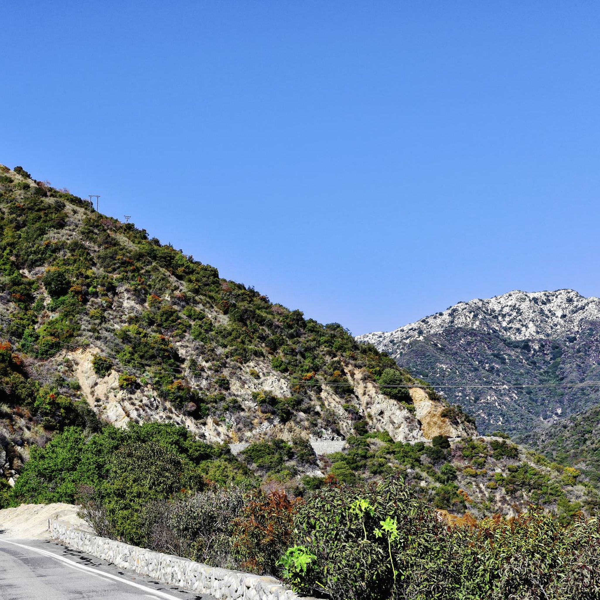
Great view from the cycle path of the San Gabriel Mountains in the distance.
0
0
This is where you leave Crystal Lake Road to get to Crystal Lake. Crystal Lake is a beautiful lake in the San Gabriel Mountains. If you want to stay the night, there are campsites on the banks of the lake.
0
0

The Crystal Lake climb begins in the Angeles National Forest, offering cyclists a moderately challenging route through some scenic landscapes. As you approach the 7-mile mark, the climb starts to reward your efforts with dramatic views of the winding switchbacks and the canyon below. The final stretch on Crystal Lake Road provides a peaceful, lightly trafficked road, ideal for cyclists to finish the climb on a well-maintained path with stunning views ahead.
0
0
Highway 39 climbs deep into Southern California’s San Gabriel Mountains, starting with a steady grade that twists through rugged terrain and offers sweeping views. After passing multiple switchbacks, a Crystal Lake turnoff, and a gated parking area around mile 12, the road softens slightly, continuing along a scenic ridgeline toward the junction with Angeles Crest Highway. A final moderate push leads you to Dawson Saddle at just under 8,000 feet, a summit raced by the pros and known as one of California’s most difficult ascents.
0
0

Syndicate Coffee in Sierra Madre serves up a blend of coffee, baked goods, and meals every day from 7:30 AM to 4 PM. This spot is for foodies, pastry lovers, and coffee enthusiasts.
0
0
Frequently Asked Questions
How many road cycling routes are available around Bradbury?
Bradbury offers a wide selection of road cycling routes, with over 40 distinct tours available. These routes cater to various skill levels, including 12 easy, 22 moderate, and 7 difficult options.
What kind of terrain can I expect on road cycling routes near Bradbury?
Road cycling around Bradbury features diverse terrain, from the significant elevation changes and winding canyon roads of the San Gabriel Mountains to more moderate paths along extensive greenway systems. You'll find routes with substantial climbs and panoramic views, as well as flatter, off-street options.
Are there road cycling routes suitable for beginners in Bradbury?
Yes, Bradbury offers several road cycling routes suitable for beginners. There are 12 easy routes available, providing gentler terrain and shorter distances. A good example of a more accessible route is the Monrovia Recreation Park loop from Monrovia, which is an easy 17-mile (27.4 km) ride.
What are some challenging road cycling routes for experienced riders?
For experienced riders seeking a challenge, Bradbury's proximity to the San Gabriel Mountains offers routes with significant elevation gain. The San Gabriel Canyon Road & Mt Baldy loop from Lario Staging Area is a difficult 65.1-mile (104.8 km) path with over 8,800 feet of elevation gain, providing panoramic mountain vistas within the Angeles National Forest. Another challenging option is the San Gabriel Canyon Road loop from Lario Staging Area, a difficult 37.6-mile (60.5 km) trail with substantial climbing.
Can I find scenic viewpoints or natural features along the road cycling routes?
Absolutely. Many routes offer stunning views of the San Gabriel Mountains and access to natural features. The San Gabriel Canyon Road, for instance, winds along the Morris and San Gabriel Reservoirs. The Santa Fe Flood Control Basin and the Santa Fe Dam Recreation Area also provide scenic paths and views of a 70-acre lake.
Are there any long-distance road cycling paths in the area?
Yes, the region features significant long-distance paths. The San Gabriel River Trail is a notable 38-mile bike path that extends from the foothills in Azusa all the way to the Pacific Ocean in Seal Beach, offering a largely off-street riding experience. The San Gabriel River Greenway also provides a moderate 19.7-mile (31.7 km) path with views of the San Gabriel Mountains.
What is the best time of year for road cycling in Bradbury?
Bradbury offers good cycling conditions for much of the year. Spring and fall generally provide the most pleasant temperatures for road cycling, avoiding the hotter summer months and potential winter rains. The clear skies often found in these seasons enhance the panoramic mountain views.
Are there options for circular road cycling routes or loops?
Yes, many road cycling routes around Bradbury are designed as loops, allowing you to start and end at the same point. Examples include the popular Newman Point Overlook – Little Dalton Debris Basin loop from Irwindale, a 28.5-mile (45.8 km) trail, and the Syndicate Coffee – Chantry Flats Trailhead loop from Monrovia.
What do other cyclists say about road cycling in Bradbury?
Road cycling in Bradbury is highly rated by the komoot community, with an average score of 4.4 stars from over 25 reviews. Cyclists often praise the diverse terrain, from challenging mountain climbs to scenic greenway rides, and the stunning backdrop of the San Gabriel Mountains.
Are there any notable attractions or points of interest near the cycling routes?
Beyond the natural beauty, you can find several points of interest. The Duarte Bike Trail is a dedicated off-street path that follows a section of the historic Pacific Electric Railway route. The Santa Fe Dam Recreation Area offers a serene environment with a lake and views, accessible via bike paths.
Where can I find parking for road cycling routes in Bradbury?
Many popular routes, especially those accessing the San Gabriel Mountains, often have designated staging areas or parking lots. For instance, routes like the San Gabriel Canyon Road loop often start from areas like the Lario Staging Area, which typically provides parking facilities. For city trails, parking may be available at adjacent parks or public lots.
Is public transport available to access road cycling trails in Bradbury?
While Bradbury is primarily accessed by car, some public transport options may connect to areas near cycling trails. It's advisable to check local transit authority websites for specific bus routes that serve the vicinity of your chosen starting points, especially for trails closer to urban centers like the Duarte Bike Trail or the San Gabriel River Trail.
Most popular routes around Bradbury
Most popular attractions around Bradbury

Get inspired with the komoot mobile app


Explore more
Browse the best Road cycling routes in other regions.
