The best running trails around Mammoth Lakes
5.0
(4)
493
runners
58
runs
Jogging around Mammoth Lakes offers a unique experience in a high-altitude setting within the Sierra Nevada mountains. The region is characterized by towering peaks, lush forests, and numerous pristine alpine lakes, providing diverse backdrops for running. Volcanic formations and dramatic geological sites also contribute to the varied terrain. This environment presents both challenging high-elevation routes and accessible options for recreational runners.
Best jogging routes around Mammoth Lakes
- The most popular jogging route is Horseshoe Lake Loop, a 3.0 miles…
Last updated: September 27, 2026
28
runners
12.1km
01:45
520m
520m
Embark on a challenging jogging adventure along the Duck Pass Trail, a difficult route spanning 7.5 miles (12.1 km) with a significant elevation gain of 1690 feet (515 metres). You…
5
runners
5.55km
00:42
100m
100m
Embark on a moderate jogging route along the Minaret Vista Trail, a 3.5-mile (5.6 km) path that takes you through the scenic Inyo National Forest. You will experience a rewarding…

6
runners
4.80km
00:31
50m
50m
Embark on the Horseshoe Lake Loop for an easy jogging experience through alpine scenery. This route offers continuous views of Horseshoe Lake as you move through shaded pine forests. You…
1
runners
12.5km
01:44
470m
470m
Prepare for a challenging jogging experience on the Lakes Basin Loop, a difficult route spanning 7.8 miles (12.5 km) with a significant elevation gain of 1547 feet (471 metres). You…
1
runners
8.11km
01:10
350m
350m
Embark on the Starkweather Lake Trail, a difficult jogging route that challenges you with 1141 feet (348 metres) of elevation gain over 5.0 miles (8.1 km). You will experience varied…
Get access to more routes and recommendations from other explorers.
Already have an account?
Our route recommendations are based on thousands of hikes, rides, and runs completed by other people on komoot.
Start today with a free account
Your next adventure awaits.
Tips from the Community

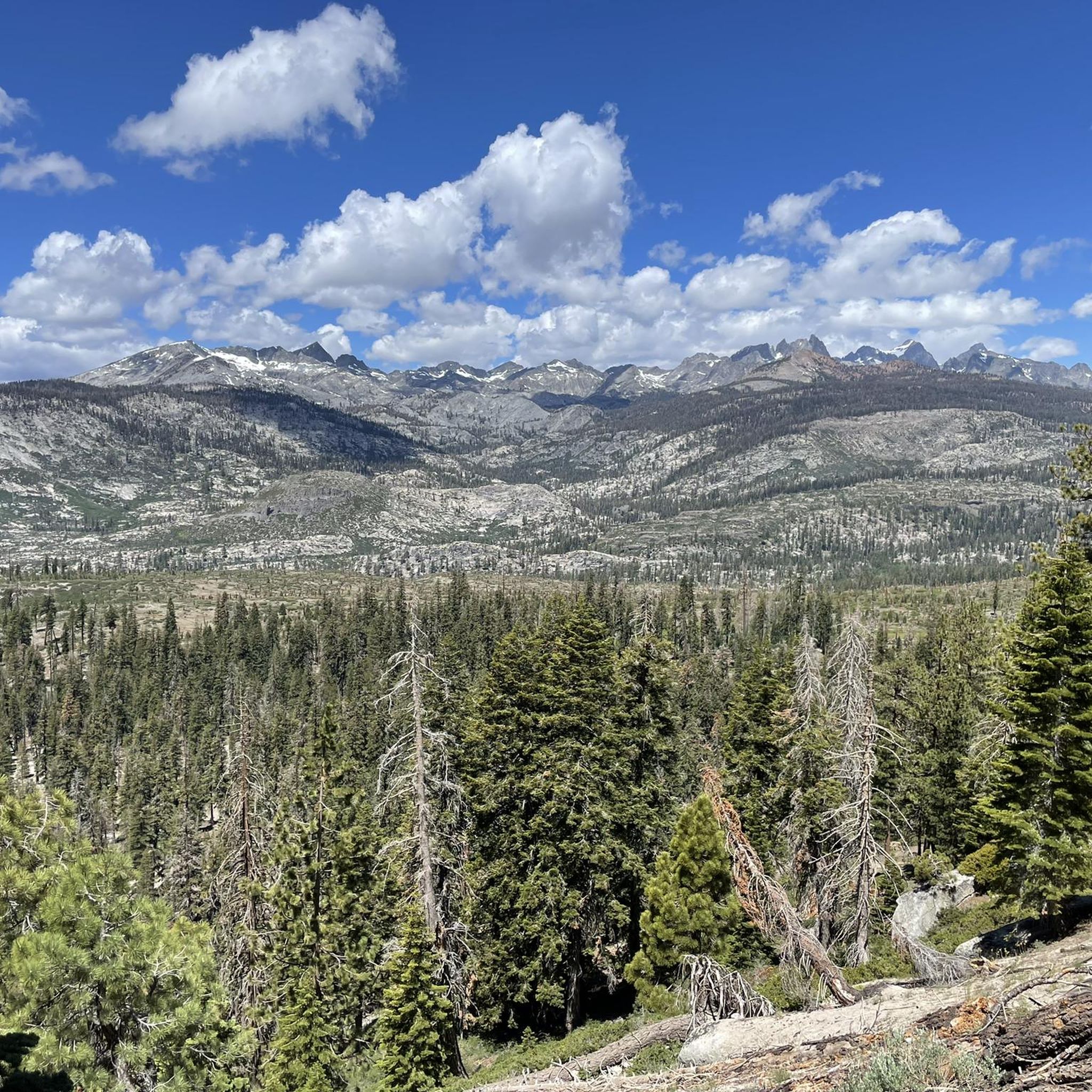
At 10,800 feet, this high mountain saddle is breathtaking, with sweeping views of Duck Lake and the surrounding Silver Divide peaks. It's the ultimate reward for the challenging ascent. Here, you can catch your breath in the crisp mountain air and enjoy the stunning Sierra Nevada vistas.
0
0

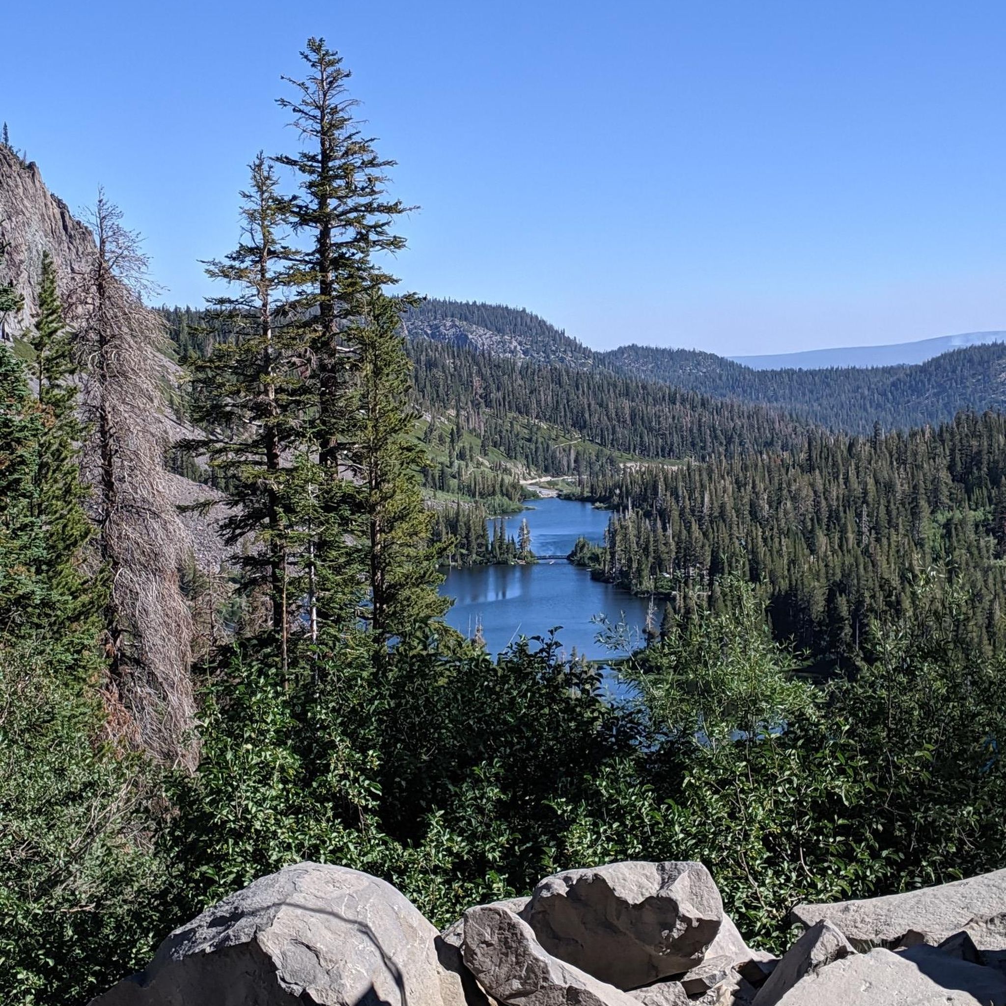
The brilliant white boulders of Crystal Crag's mountainside sweep away beneath you to reveal Lake George nestled between the peaks. You get many excellent views from the trail as you climb.
0
0

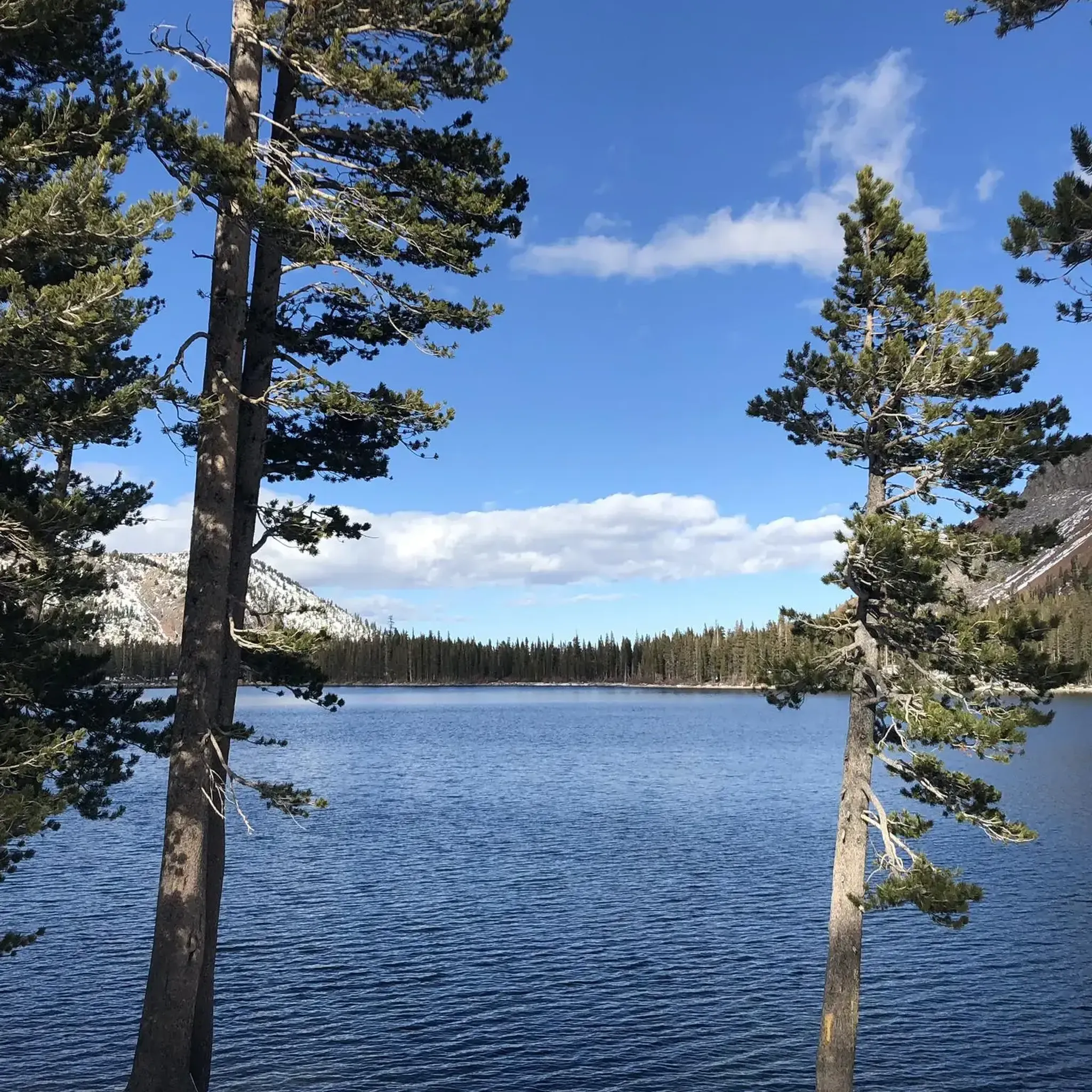
Lake Mary is nestled in front of a red basalt cliff and surrounded by forest, creating a scenic setting. In the winter, the area is blanketed in snow, making it ideal for cross-country skiing.
1
0

Minaret Vista offers a stunning view of Mammoth Lakes' iconic skyline, the Minarets, which are part of the Ritter Range. You will recognize them by the sharp, jutting spires that are outstanding. You can also spot Mount Ritter at 13,157 feet and Banner Peak at 12,945 feet (3,945 meters), the two tallest peaks in the range.
0
0

Horseshoe Lake is a popular lake in Inyo National Forest. It is a great place to take a break while enjoying the trail that runs along the banks of the lake.
0
0

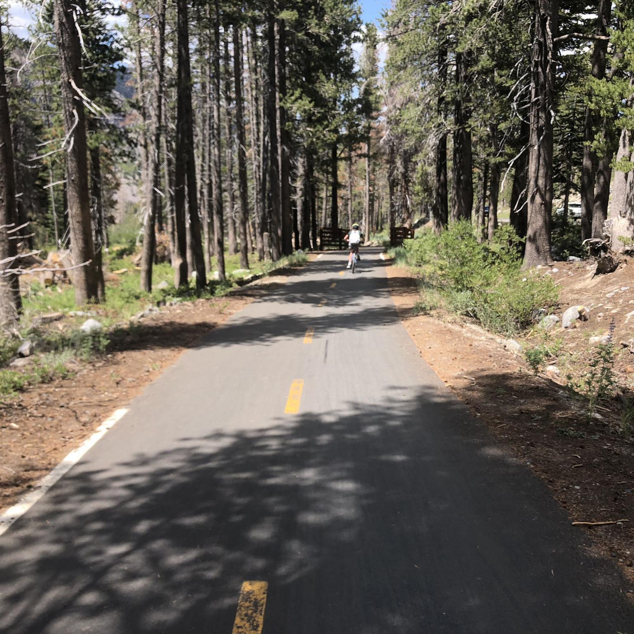
Lake Mary is the crown jewel of the Mammoth Lakes region, and a busy year-round destination. In the summer, you can ride here via the aptly named Lake Mary Road, or via the paved Lake Basin Bikepath. The road and path are not maintained during winter, but the lake is still accessible via snowshoe and cross-country ski trails
0
0
Lake Mary is the crown jewel of the Mammoth Lakes region, and a busy year-round destination. In the summer you can ride here via the aptly named Lake Mary Road, or via the paved Lake Basin Bikepath. The road and path are not maintained during winter, but the lake is still accessible via snowshoe and cross-country ski trails.
0
0

Starkweather Lake was named after a miner from the area in the 1920s. This lake is known for its rainbow trout and stunning views. The road that allows for access to this lake closes to motor vehicles in the winter.
0
0
Frequently Asked Questions
How many running trails are available in Mammoth Lakes?
Mammoth Lakes offers a wide variety of running experiences with over 49 routes. These range from easy loops perfect for a leisurely jog to challenging high-elevation trails for experienced runners.
Are there easy or beginner-friendly jogging routes in Mammoth Lakes?
Yes, Mammoth Lakes has several accessible options for beginners or those looking for a relaxed run. A great choice is the Horseshoe Lake Loop, an easy 3.0-mile (4.8 km) trail featuring unique scenery and views of the Mammoth Crest. The region research also highlights the Convict Lake Loop as another beginner-friendly option.
What are some challenging running routes for advanced runners in Mammoth Lakes?
For those seeking a challenge, Mammoth Lakes offers several difficult routes. The Lakes Basin Loop is a 7.8-mile (12.5 km) trail with significant elevation gain, offering views of McLeod Lake and Lake Mary. Another demanding option is the Starkweather Lake Trail, which is 8.1 km long and also rated difficult.
Can I find running routes with scenic views of lakes or mountains?
Absolutely! Mammoth Lakes is renowned for its stunning natural beauty. Many routes offer breathtaking views of alpine lakes and the Sierra Nevada mountains. The Minaret Vista Trail provides panoramic vistas of the iconic Minarets. You can also explore areas around picturesque lakes like Twin Lakes or Crystal Lake, which are popular for their serene settings.
Are there any running trails that pass by waterfalls or unique geological formations?
Yes, the Mammoth Lakes area is rich in natural wonders. You can find trails that lead to spectacular sights like Rainbow Falls, a stunning 101-foot cascade. The region also features fascinating volcanic formations such as Devils Postpile with its hexagonal basalt columns, and the Inyo Craters.
What do other runners enjoy most about jogging in Mammoth Lakes?
The running routes in Mammoth Lakes are highly rated by the komoot community, with an average score of 5.0 stars from over 4 reviews. Runners often praise the diverse terrain, from lush forests to high-altitude paths, and the spectacular views of the Sierra Nevada mountains and pristine alpine lakes.
Are there any long-distance running trails in the area?
For those looking for longer runs, the Duck Pass Trail is a challenging 7.5-mile (12.1 km) path that ascends past multiple lakes and wildflower-filled meadows, offering panoramic Sierra views. The Mammoth Town Loop, a seven-mile paved road, also provides a longer run with some challenging hills.
What is the best time of year for running in Mammoth Lakes?
Mammoth Lakes is an excellent destination for running, particularly from late spring through fall when most trails are clear of snow. The high-altitude setting provides a unique training ground. While winter running is possible on some trails, many higher elevation routes may be inaccessible due to snow.
Are there any circular running routes in Mammoth Lakes?
Yes, many of the popular running paths in Mammoth Lakes are circular, offering a convenient way to start and end your run at the same point. The Horseshoe Lake Loop is a prime example, providing an easy 3.0-mile loop through unique scenery. The Lake Mary Loop is another relatively flat 2.2-mile loop with breathtaking views.
What should I consider when running at high altitude in Mammoth Lakes?
Mammoth Lakes is situated at 7,880 feet above sea level, so runners should be mindful of the high altitude. It's advisable to allow time for acclimatization, stay well-hydrated, and start with shorter, less strenuous routes before attempting more challenging, high-elevation trails. The thinner air will test your lungs, even on gentler terrain.
Are there running routes suitable for families with children?
Yes, several routes are suitable for families. The Horseshoe Lake Loop is an easy, mellow dirt loop that meanders through the forest and across bridges, making it enjoyable for all ages. The Convict Lake Loop is also highlighted as a beginner-friendly, 2-mile trail perfect for a family outing.
Are there any less crowded or 'hidden gem' running routes?
While popular spots like the Lakes Basin can be busy, exploring trails slightly off the main paths can offer a more secluded experience. Routes leading to less frequented lakes or higher elevations, such as parts of the Dragon's Back Trail or Sky Meadows Trail, might provide a quieter run with equally stunning views.
Most popular routes around Mammoth Lakes
Most popular attractions around Mammoth Lakes

Get inspired with the komoot mobile app


Explore more
Browse the best Running Trails & Routes in other regions.
