The best running trails around Chino
4.8
(3)
328
runners
42
runs
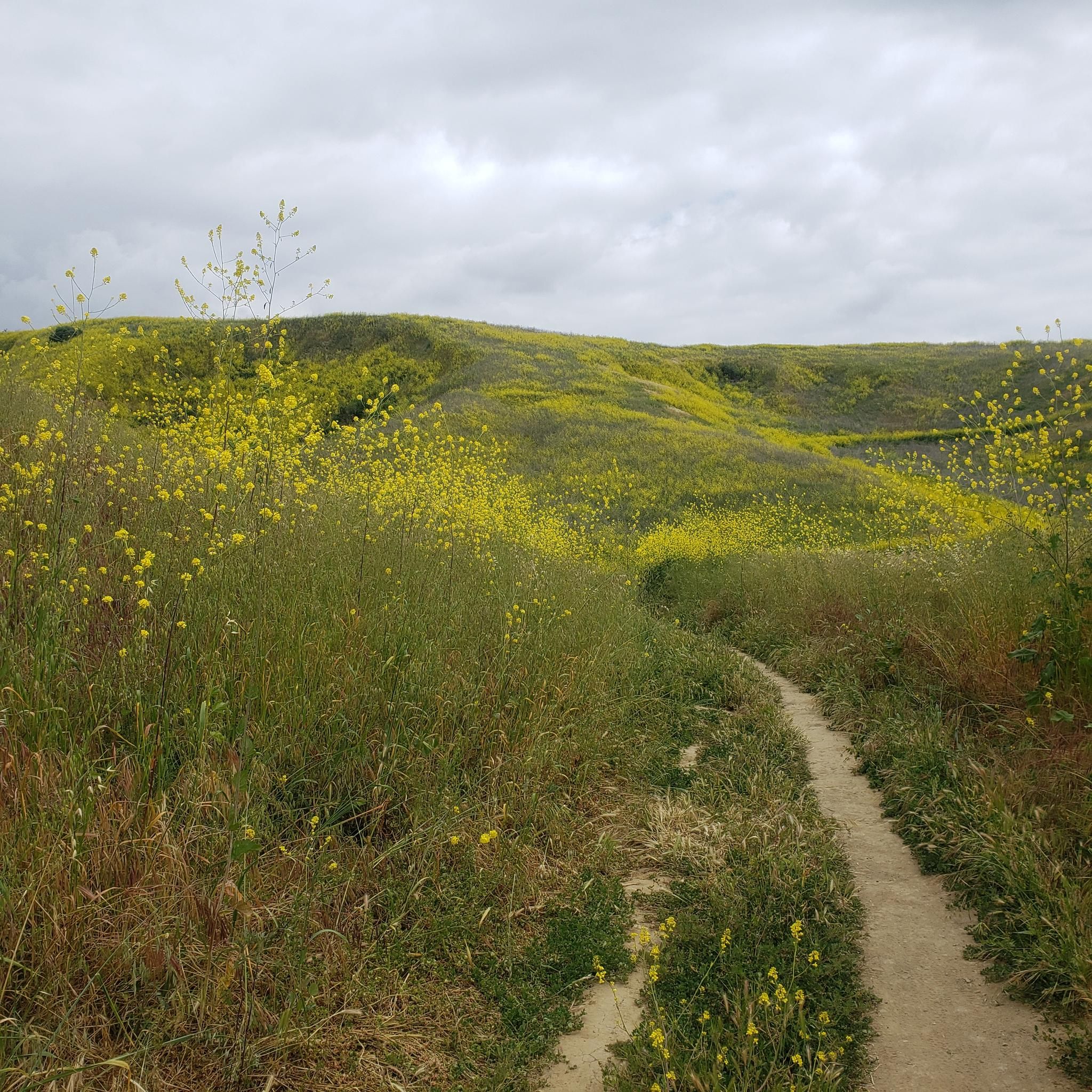
Jogging around Chino offers access to a landscape characterized by rolling hills, expansive grasslands, and diverse ecosystems. The region features significant natural open spaces like Chino Hills State Park, which provides over 90 miles of trails. These areas preserve natural landscapes, including oak woodlands and sycamore groves, with elevations ranging from 430 to 1,781 feet. This varied terrain provides a range of running experiences for different fitness levels.
Best jogging routes around Chino
- The most popular jogging route is Faultline…
Last updated: May 18, 2026
3
runners
19.6km
02:41
630m
630m
Hard run. Very good fitness required. Mostly paved surfaces. Suitable for all skill levels.
2
runners
6.94km
00:54
170m
170m
Moderate run. Good fitness required. Mostly paved surfaces. Suitable for all skill levels.

Sign up for free
8.38km
01:08
260m
260m
Moderate run. Good fitness required. Mostly paved surfaces. Suitable for all skill levels.
9
runners
3.66km
00:23
10m
10m
Easy run. Great for any fitness level. Mostly paved surfaces. Suitable for all skill levels.
7
runners
3.56km
00:22
10m
10m
Easy run. Great for any fitness level. Mostly paved surfaces. Suitable for all skill levels.
Get access to more routes and recommendations from other explorers.
Sign up for free
Already have an account?
Our route recommendations are based on thousands of hikes, rides, and runs completed by other people on komoot.
Start today with a free account
Your next adventure awaits.
Login or Signup

Tips from the Community

This is the intersection of five trails: Raptor Ridge Trail, North Ridge Trail, Bovinian Delight Trail or Telegraph Canyon Road. There are also some boards with information about the trails and a restroom.
0
0

Andersen Bump is a 482m high hilltop that rises above the city of Los Angeles in California. It provides some wonderful views of the surrounding peaks that make up the Water Canyon Natural Preserve, and on a clear day, across the city and toward the ocean, too.
0
0

This campground has 20 sites, including pull-through parking for medium-sized RVs, group camp sites, and horse camp sites. There are flush toilets, free showers, picnic benches, food hooks, and fire pits at each site. Please be sure to check local fire restrictions before making a campfire.
0
0


Take a seat, have a snack and enjoy your shady spot. After the rest you can follow with Raptor Ridge Trail, North Ridge Trail, Bovinian Delight Trail or Telegraph Canyon Road.
0
0
Andersen Bump is a 482m high hilltop that rises above the city of Los Angeles in California. It provides some wonderful views of the surrounding peaks that make up the Water Canyon Natural Preserve, and on a clear day, across the city and toward the ocean, too.
1
0

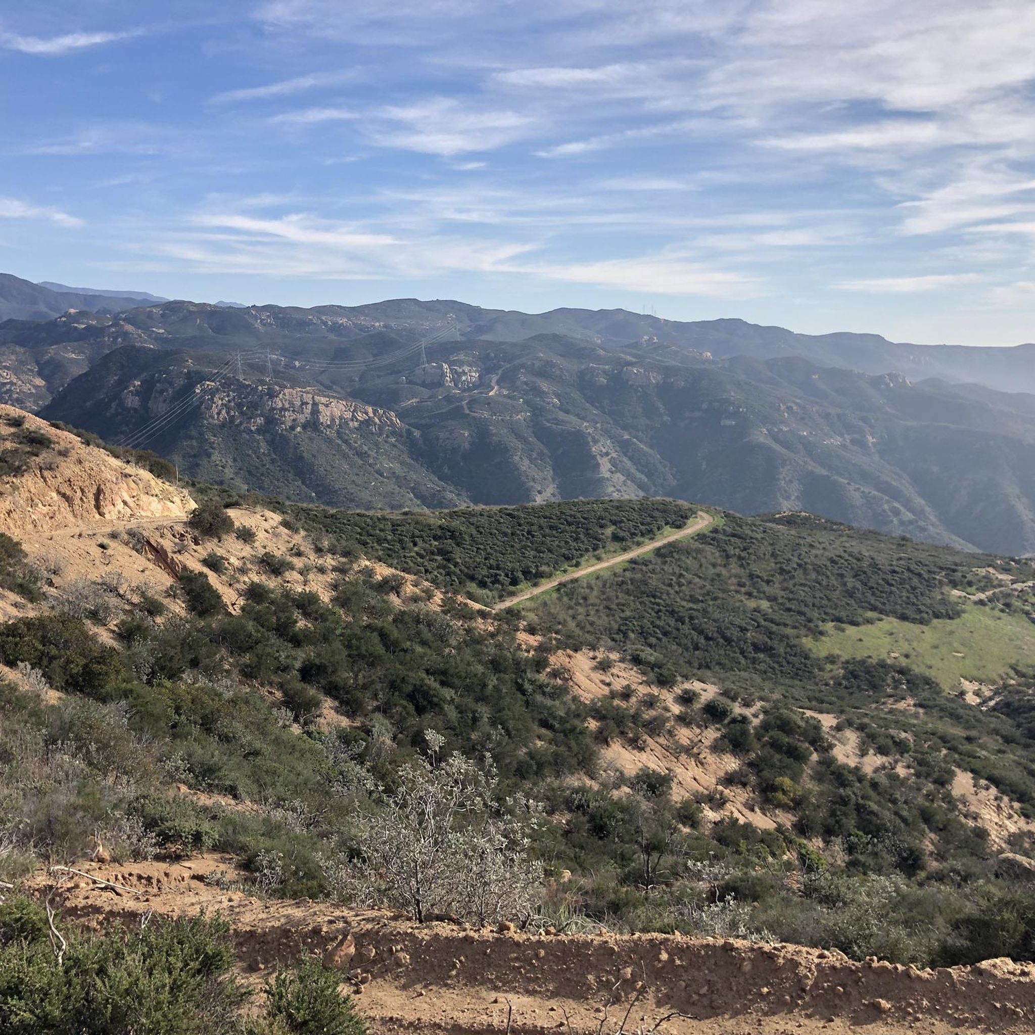
This part of Ranger Ridge Trail runs under some power lines, reminding you aren't too far from the city. The towers offer some pretty cool perspective on the distance between the rolling hills ahead of you.
0
0
This campground has 20 sites, including pull-through parking for medium-sized RVs, group camp and horse camp sites. There are flush toilets, free showers, picnic benches food hooks and fire pits at each site. Check local fire restrictions.
0
0
Frequently Asked Questions
How many running routes are available around Chino?
There are over 30 running routes available around Chino, offering a variety of experiences. This includes 5 easy routes, 23 moderate routes, and 6 difficult routes, catering to different fitness levels.
What kind of terrain can I expect on jogging routes in Chino?
Jogging routes in Chino and the surrounding Chino Hills area feature diverse terrain, including rolling hills, expansive grasslands, oak woodlands, and sycamore groves. You'll find paths ranging from flat, leisurely trails to challenging climbs with significant elevation gain, especially within Chino Hills State Park.
Are there any easy or beginner-friendly running routes in Chino?
Yes, Chino offers several easy routes perfect for beginners or those looking for a less strenuous run. For instance, the Running loop from Central Parking and the Running loop from Chino Hills are both easy options, typically under 4 km with minimal elevation changes.
Can I find challenging running trails with significant elevation in Chino?
Absolutely. For a more challenging run, consider routes like the Gilman Peak & Water Canyon Trail – Chino Hills State Park. This difficult 19.6 km path features substantial climbs and offers expansive views across the diverse landscapes of Chino Hills State Park.
Are there scenic views or natural landmarks to see while jogging in Chino?
Many jogging routes in Chino offer scenic views and natural features. Within Chino Hills State Park, you can experience rolling hills, grasslands, and seasonal streams. Highlights along or near trails include Pumpkin Rock, Sierra Peak Summit, and the Hidden Valley Viewpoint, providing picturesque backdrops for your run.
Are the running trails in Chino suitable for families?
Yes, several parks and trails in Chino are suitable for families. While Chino Hills State Park has varied terrain, local parks like Chino Creek Wetlands and Educational Park offer 1.7 miles of leisurely trails through wetlands, which can be a great option for families. Look for routes designated as 'easy' for the most family-friendly experiences.
Are dogs allowed on the jogging routes in Chino?
Generally, dogs are permitted on trails in Chino Hills State Park, but they must be on a leash no longer than six feet at all times. It's always a good idea to check specific park regulations before heading out, as rules can vary for different areas or protected habitats.
Where can I find parking for the running trails in Chino?
Parking is available at various access points for running trails. Chino Hills State Park has designated parking areas, and many local parks like Ayala Park and Chino Hills Community Park also provide parking facilities. For specific routes, check the route details on komoot for trailhead parking information.
What is the best time of year to go jogging in Chino?
The Chino area experiences a Mediterranean climate, making spring and fall ideal for jogging with milder temperatures. Summer can be hot, especially in the afternoon, so early morning or late evening runs are recommended. Winter offers cooler temperatures, which can be pleasant for running, though some seasonal streams might be more active.
Are there any circular running routes in Chino?
Yes, many of the running routes in Chino are designed as loops, allowing you to start and end at the same point. For example, the Faultline & Raptor Ridge Trail – Chino Hills State Park is a popular circular route that winds through the park's characteristic rolling hills.
What do other runners say about the jogging routes in Chino?
The jogging routes in Chino are highly rated by the komoot community, with an average score of 5.0 stars from over 3 reviews. More than 280 runners have used komoot to explore Chino's varied terrain, often praising the diverse landscapes and the range of difficulty levels available.
Are there any specific permits required to jog in Chino parks?
For Chino Hills State Park, there may be day-use fees or parking fees required. It's advisable to check the official California State Parks website for the most current information on fees and any specific permits that might be needed for certain activities or areas within the park. You can find more details on the Chino Hills State Park page.
Can I find places to eat or drink near the running trails in Chino?
While the immediate vicinity of some state park trails might be more remote, the cities of Chino and Chino Hills offer various dining options. After your run, you can find cafes, restaurants, and other amenities within a short drive from most trailheads, especially near community parks and urban areas.
Most popular attractions around Chino

Get inspired with the komoot mobile app


Explore more
Browse the best Running Trails & Routes in other regions.
