The best walks and hikes around Anaheim
4.5
(85)
1,584
hikers
29
hikes
Hiking around Anaheim offers a mix of urban park trails and routes through the rolling Anaheim Hills. The region is characterized by oak woodlands, coastal sage scrub, and paved paths along the Santa Ana River. The network of trails provides routes across varied terrain, from flat riverside walks to gentle climbs with city views.
Best hiking trails around Anaheim
- The most popular hiking route is Weir Canyon Trail loop — Anaheim Hills, a 3.4 mile (5.5 km) trail that takes about 1 hour 30 minutes to complete. This easy hike offers panoramic views over the surrounding hills.
- Another top favourite among local hiking enthusiasts is Riverdale Park to Yorba Regional Park — Santa Ana River Trail — Anaheim, a moderate 7.1 mile (11.4 km) path. The route follows the Santa Ana River, connecting multiple parks on mostly flat terrain.
- Local hiking enthusiasts also love the Oak Canyon Nature Center loop — Anaheim Hills, a 1.5 mile (2.4 km) trail leading through oak woodland and scrubland, often completed in about 40 minutes.
- Hiking around Anaheim is defined by rolling hills, riverside paths, and trails through natural preserves. The trail system provides options for different ability levels, including many easy hikes for families.
- The routes in Anaheim are highly rated by the komoot community with an average score of 4.3 stars from more than 30 reviews. More than 700 hikers have used komoot to explore Anaheim's varied terrain.
Last updated: September 27, 2026
3.0
(1)
8
hikers
16.1km
04:37
400m
380m
Hike the moderate 10.0 miles (16.1 km) Weir Canyon and Anaheim Hills Trails Loop, gaining 1322 feet (403 metres) with panoramic views.
5.0
(1)
5
hikers
5.64km
01:44
210m
180m
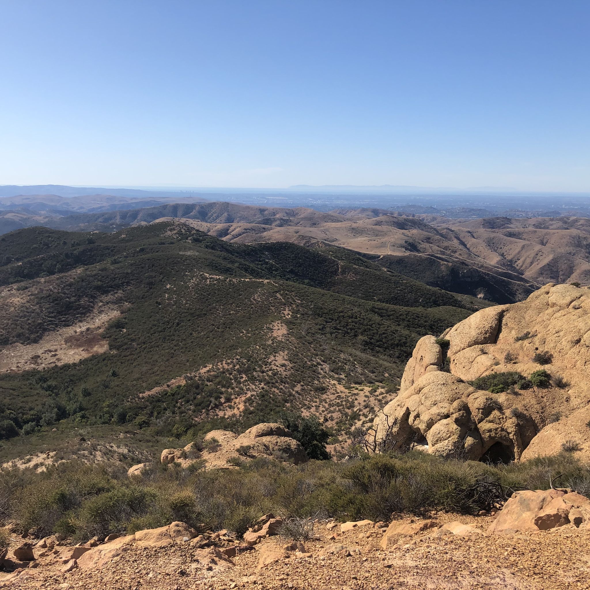
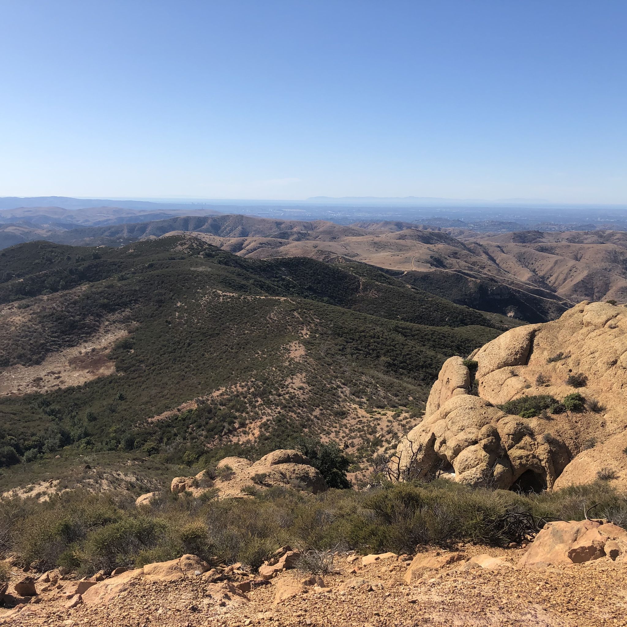
The Barham Ridge and Oak Trail to Robber's Roost offers a fantastic blend of shaded creek-side paths and rugged climbs, culminating in truly spectacular views. You'll wind through varied terrain, from the tranquil Santiago Creek Trail to the steeper sections of the Mountain Goat Trail, before reaching the iconic Robber's Roost. From this rocky outcrop, you're treated to panoramic vistas of the Villa Park Dam, Mount Baldy, and on clear days, even Catalina Island, making it a rewarding experience for its 3.5-mile (5.6 km) length.
Planning your visit to this popular Santiago Oaks Regional Park trail is straightforward. There's a vehicle entrance fee for the park, which provides convenient amenities like restrooms and picnic areas. The trail is dog-friendly, provided your furry friend stays on a leash, and it's also a multi-use path shared with mountain bikers. With an estimated duration of 1 hour and 43 minutes and 688 feet (210 metres) of elevation gain, it's an easy hike that fits well into a morning or afternoon outing.
Beyond the stunning views, the Barham Ridge and Oak Trail holds a touch of local history; Robber's Roost is rumored to have been a lookout point for the bandit Joaquín Murieta in the 1800s. You can also find a historic dam along the route, creating a picturesque pool and waterfall. Keep an eye out for diverse wildlife, including birds, rabbits, and butterflies, adding to the natural charm of this Orange County gem.

4
hikers
6.91km
02:03
210m
220m
Hike the moderate 4.3-mile Weir Canyon to Robbers Peak to Yucca Ridge to Deer Trail for panoramic views of Orange County and diverse landsca
1
hikers
8.05km
02:04
40m
30m
The Santa Ana River Trail offers a pleasant escape, winding through a mix of urban and natural settings where you can enjoy the wide river channel and even catch a View of Sierra Peak. This particular section, covering 5.0 miles (8.1 km) with a gentle 144 feet (44 metres) of elevation gain, is a moderate hike that takes about 2 hours and 4 minutes. It's a great choice for a relaxed outing, providing a taste of the diverse landscapes found along this extensive trail.
Planning your visit is straightforward, as many sections of the Santa Ana River Trail are easily accessible. Parking is typically available near trailheads, but arriving earlier in the day is always a good idea, especially on weekends. The trail is generally well-maintained and features underpasses at major road crossings, ensuring a continuous and safe journey. It's a family-friendly option, enjoyable throughout the year, though mornings are preferable during warmer months.
This segment of the Santa Ana River Trail is part of a much larger vision, aiming to connect the San Bernardino Mountains to the Pacific Ocean. Its multi-use design means you'll share the path with cyclists and runners, highlighting its role as a vital recreational corridor in Orange County. The trail's ability to transition from developed areas to more natural riverine environments offers a unique perspective on Southern California's landscape.
5.87km
01:29
20m
10m
The Santa Ana River Trail offers a pleasant, easygoing escape into nature, even with its urban surroundings. You'll find yourself on a mix of paved and natural dirt paths, often paralleling the Santa Ana River. Keep an eye out for yellow wildflowers blooming beside the paved sections, adding a splash of color to your walk, and enjoy the tranquil river views that pop up along the way.
This 3.6-mile (5.9 km) hiking route is rated easy, with a minimal 63 feet (19 metres) of elevation gain, making it a quick 1 hour and 29 minute outing suitable for most fitness levels. It's a multi-use path, so expect to share it with cyclists and equestrians. The trail system is designed with accessibility in mind, often using underpasses to ensure a continuous experience without frequent road crossings.
As part of a larger, ambitious project, the Santa Ana River Trail is set to become Southern California's longest multi-use trail, connecting three counties and 17 cities. This particular segment provides a taste of that vision, blending urban convenience with natural riverine environments. It's a great option for a casual stroll or a family-friendly outing when you're in the Anaheim area.
Get access to more routes and recommendations from other explorers.
Already have an account?
Our route recommendations are based on thousands of hikes, rides, and runs completed by other people on komoot.
Start today with a free account
Your next adventure awaits.


Tips from the Community

This view of Sierra Peak showcases one of the highest and most easily identifiable peaks in northern Orange County. It stands at 3,045 feet above sea level.
1
0

Nice wooden bridge along the Santa Ana River Trail. It takes you over the river and gives you a good view of the water.
1
0
From atop the rocky outcropping of the Roost you get spectacular sweeping views of Orange County. This is a popular sunset spot.
0
0

You get a great view up and down the Santa Ana River as you cross the truss bridge between trail segments.
0
0

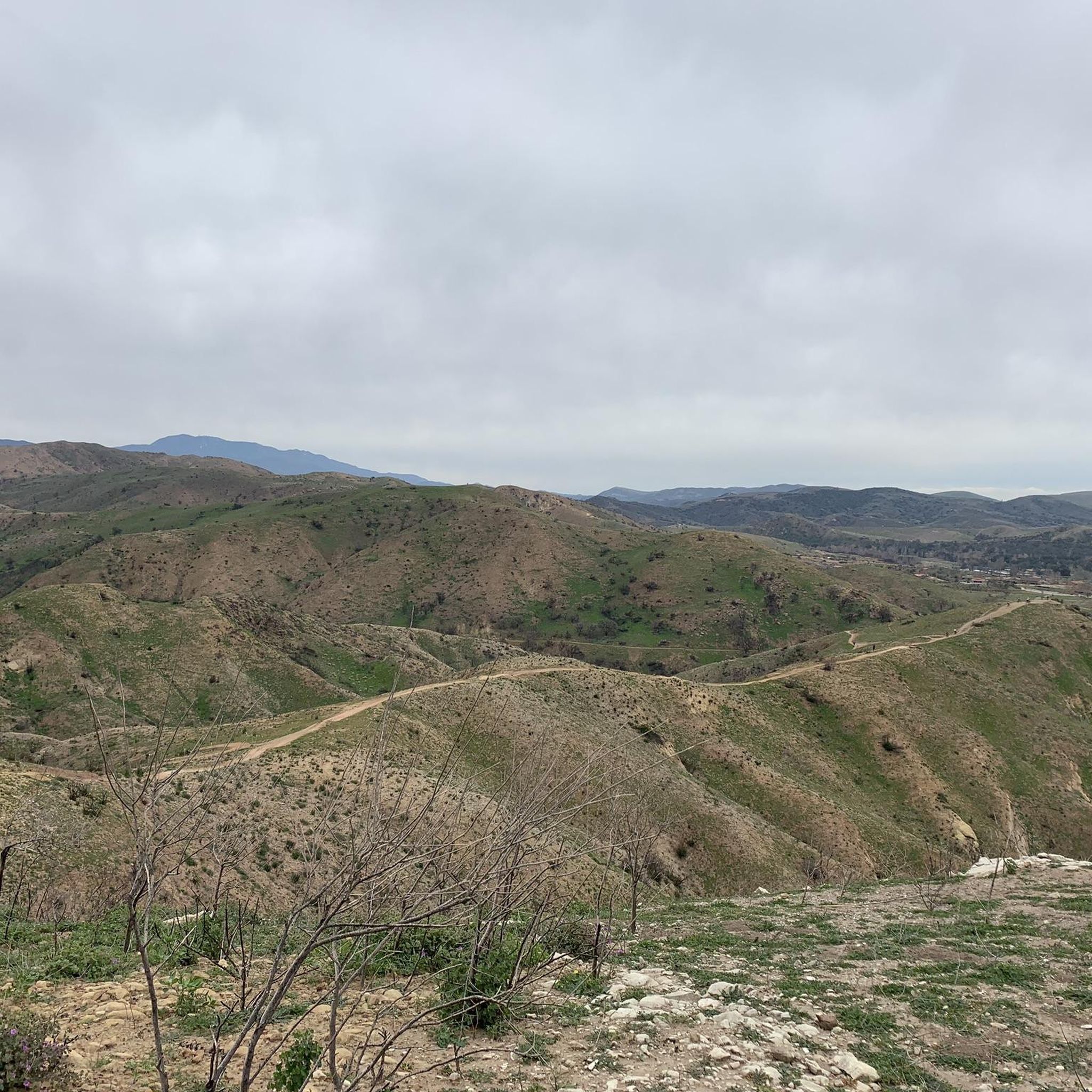
At the end of the Barham Ridge Trail, you'll find this nice viewpoint from which you can observe nature and many of the trails surrounding you from the heart of Santiago Oaks Regional Park.
1
0
Right at the northern edge of Santiago Oaks Regional Park, the 1,159-feet (329 m) elevation of Robbers Peak allows for a sweeping view of the surroundings. You'll be able to see the neighborhoods below and Walnut Canyon Reservoir a bit further in the distance.
0
0

Situated just at the edge of Santiago Oaks Regional Park, 1152-feet (329 m) Robbers Peak makes a great quick run — especially if you happen to live in one of the nearby neighborhoods.
0
0

Though the final climb is challenging, reaching the top of Robbers Peak rewards mountain bikers with a panoramic vista of Anaheim Hills' cityscape plus views spanning orange groves to the 10,000-foot Mt San Antonio on clear days.
0
0
Frequently Asked Questions
Are there easy hikes suitable for families in Anaheim?
Yes, Anaheim has several family-friendly options. The Oak Canyon Nature Center loop is a popular choice, offering a short walk through woodlands with an interpretive center on-site. The park features about four miles of trails that are great for introducing children to hiking.
Can I bring my dog on the hiking trails?
Dog policies vary by park, so it's best to check the rules for your specific destination. Many paved multi-use paths, like the Anaheim Coves Lincoln Trailhead, are dog-friendly and provide amenities like waste bags. However, most nature preserves, such as Oak Canyon Nature Center and Santiago Oaks Regional Park, do not permit dogs on trails to protect wildlife.
Are there any waterfall hikes near Anaheim?
While the immediate Anaheim area is not known for waterfalls, a short drive will take you to some great options. The trail to Black Star Canyon Falls is a well-known local favorite for those seeking a waterfall. The hike involves a flat walk followed by a more rugged creek scramble to reach the falls, which are most impressive after recent rainfall.
What are some good circular or loop trails?
The area has many enjoyable loop trails that bring you back to your starting point. For a short and easy walk, the Walnut Canyon Reservoir loop is a great option. It's a relatively flat, 1.7-mile (2.8 km) path that's perfect for a quick outing.
Which trails offer the best scenic views?
For expansive views, the trails in the Anaheim Hills are your best bet, offering panoramas of the surrounding landscape and city. Santiago Oaks Regional Park, a short drive away, is highly regarded for its trails that climb to rewarding viewpoints over the valley. On clear days, some higher trails in the region can even offer glimpses of the Pacific Ocean.
What are the most challenging hikes in the area?
While most trails directly in Anaheim are easy to moderate, you can find more strenuous hikes nearby. Santiago Oaks Regional Park offers a network of trails with significant elevation gain for a tougher workout. For a truly challenging day out, consider the backcountry trails at Crystal Cove State Park, where steep climbs lead to incredible coastal views.
What is the terrain like on the trails around Anaheim?
The terrain is quite varied. You'll find paved, flat paths like the Santa Ana River Trail, which are ideal for easy walks. In the Anaheim Hills and surrounding parks, expect dirt paths through rolling hills, oak woodlands, and coastal sage scrub, with some gentle to moderate inclines.
What do other hikers enjoy about the trails in Anaheim?
The area is highly rated by the komoot community, with an average score of 4.3 stars. Hikers often praise the accessibility of the trails and the variety of scenery, from the natural beauty of the oak woodlands to the wide-open views from the hills. The well-maintained paths are also frequently mentioned.
Are there any paved trails suitable for walking or running?
Yes, the Santa Ana River Trail is a major paved multi-use path that runs through the area, connecting several parks. The loop in Yorba Regional Park is another excellent paved option, offering a flat and scenic route for walkers and runners alike.
What kind of wildlife might I see while hiking?
The natural areas around Anaheim are home to a variety of wildlife. In parks like Oak Canyon Nature Center and Santiago Oaks Regional Park, you might spot native birds, rabbits, squirrels, and lizards. It's also not uncommon to see deer, especially during the early morning or late afternoon.
How many hiking trails are there around Anaheim?
You can find nearly 20 curated hiking routes in and around Anaheim on komoot. These range from short, easy walks in city parks to more moderate hikes in the surrounding hills, offering plenty of options for all skill levels.
Most popular routes around Anaheim
Most popular attractions around Anaheim

Get inspired with the komoot mobile app


Explore more
Browse the best Hikes in other regions.
