The best walks and hikes around Bentonville
4.8
(57)
928
hikers
57
hikes
Hikes around Bentonville explore the rolling hills and deeply dissected plateaus of the Ozark Mountains. The region's terrain is characterized by hardwood forests, limestone bluffs, and a network of trails that includes both paved city greenways and more rugged singletrack paths. This mix provides a variety of hiking experiences, from gentle walks in city parks to longer routes through the surrounding natural landscape.
Best hiking trails around Bentonville
- The most popular hiking route is Esther's Loop — Coler Mountain Bike Preserve, a 4.2 mile (6.8 km) trail that takes about 1 hour 45 minutes to complete. This is one of the popular Coler Mountain Bike Preserve hiking trails that follows a paved path through the valley.
- Another top favourite among local hiking enthusiasts is Bella Vista to Bentonville via Razorback Greenway Trail — Benton County, a moderate 10.7 mile (17.3 km) path. This route is a segment of the region's extensive paved greenway system, connecting multiple communities.
- Local hiking enthusiasts also love the Bella Vista Lake Trail — Bella Vista Park, a 3.2 mile (5.2 km) trail leading around the lake, often completed in about 1 hour 20 minutes.
- Hiking around Bentonville is defined by paved greenways, singletrack paths through hardwood forests, and routes along creek valleys. The trail system offers options for different ability levels, including many beginner friendly hikes.
- The routes in Bentonville are highly rated by the komoot community with an average score of 4.7 stars from a number of reviews. More than 300 hikers have used komoot to explore Bentonville's varied terrain.
Last updated: August 18, 2026
26
hikers
9.31km
02:30
130m
90m
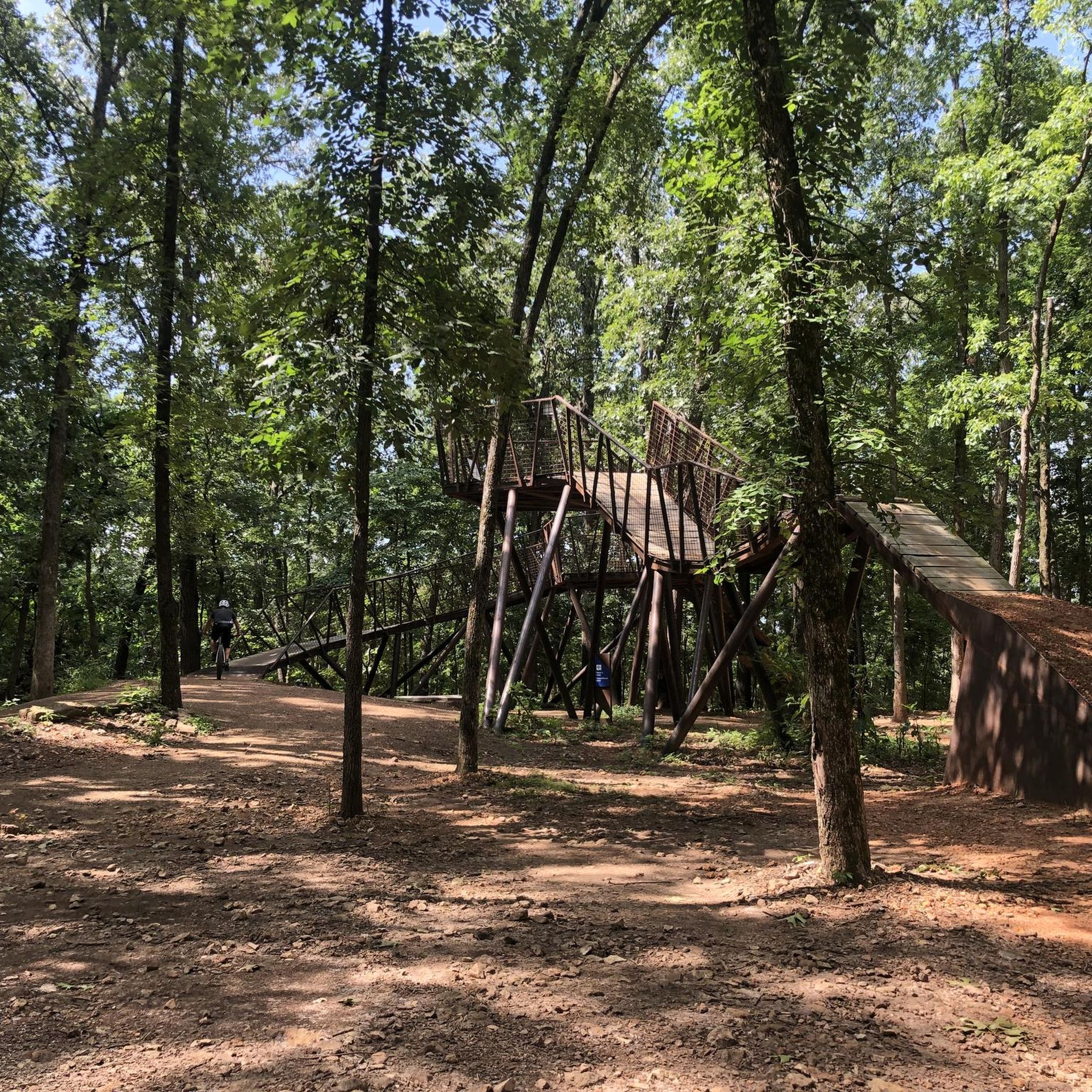
Embark on Oscar's Loop, a moderate hiking route spanning 5.8 miles (9.3 km) within the Coler Mountain Bike Preserve. You'll navigate varied natural scenery, encountering singletrack paths that can be quite rocky in places. The trail offers a steady climb of 425 feet (130 metres) and typically takes around 2 hours and 30 minutes to complete. As you hike, you'll connect to The Hub, a distinctive 20-foot steel and wood structure that serves as a central landmark and offers access to other routes. This loop provides a balanced challenge for most hikers.
Oscar's Loop is a multi-use trail, welcoming hikers, trail runners, mountain bikers, and e-bikers. Dogs are also permitted, making it a great option if you want to bring your canine companion along. Since it's part of the larger Coler Mountain Bike Preserve, you'll find it well-connected to many other routes, allowing for extended adventures if you wish. Check the preserve's official website for current conditions and any specific access rules before your visit.
This route is notable for its integration into the extensive Coler Mountain Bike Preserve, offering a unique blend of natural beauty and recreational infrastructure. The varied terrain, from smooth sections to
15
hikers
8.90km
02:19
70m
60m
Embark on the Appleblossom Trail for a moderate hike spanning 5.5 miles (8.9 km), where you will gain 217 feet (66 metres) in elevation. This well-maintained path, estimated to take around 2 hours and 19 minutes, winds through the wooded areas of the Coler Mountain Bike Preserve. You can expect a pleasant outdoor experience as you explore the natural surroundings, perhaps passing by The Homestead at Coler Preserve.
When planning your visit, you will find good access and parking facilities within the Coler Mountain Bike Preserve. While no specific warnings are noted, it is always wise to check local conditions before you head out. The preserve is well-equipped with amenities, including a Bike Wash & Repair Station, indicating a visitor-friendly environment for all.
The Appleblossom Trail offers a chance to immerse yourself in the natural beauty of the Coler Mountain Bike Preserve. You might encounter other popular routes in the area, such as Rock Salad Trail or Here's Johnny! Trail, which are also part of the preserve's network. This trail provides a great opportunity to explore the region's outdoor offerings.

Sign up for free
3
hikers
1.95km
00:32
40m
10m
Embark on an easy hike along the Sick A More trail, a 1.2-mile (1.9 km) route that takes about 31 minutes to complete. You will gain 125 feet (38 metres) in elevation as you traverse a narrow canyon. Expect to encounter rocky edges and some tricky uphill rock climbs, even though the overall difficulty is easy. The path offers beautiful scenery, winding through varied terrain that keeps the experience engaging.
This trail is generally accessible, making it easy to start your hike. You can bring your dog along, as they are permitted on the route. Parking is typically available near the Blowing Springs trail network, which provides a convenient connection to the Sick A More trail. There are no specific permits or fees required to enjoy this outdoor experience.
Located within the Little Sugar Trails network in Bella Vista, Arkansas, this route is part of a multi-use system. You might share the path with mountain bikers and trail runners, all enjoying the impressive views. While the overall route is easy, be aware that sections of the trail itself are known for their technical singletrack terrain, adding a unique challenge to this short adventure.
1
hikers
10.9km
02:54
110m
110m
The North Bentonville Trail offers a pleasant journey through natural wooded areas, often following a trickling creek. While much of the path is a wide concrete surface, you'll also encounter unpaved sections and can even connect to singletrack paths near the Slaughter Pen Trails. Keep an eye out for public art installations and the serene Crystal Bridges Overlook, providing a lovely view of the museum grounds.
This trail is highly accessible, with parking and restrooms available at multiple points along the route. It's a pet-friendly option, and you'll find amenities like benches and bike repair stations. Given its moderate difficulty, 6.8 miles (10.9 km) distance, 374 feet (114 metres) of elevation gain, and estimated 2 hours and 53 minutes duration, it's a great choice for a family-friendly hike or a leisurely stroll.
As a crucial part of the larger Razorback Regional Greenway, the North Bentonville Trail connects you to significant Bentonville attractions, including the Crystal Bridges Museum of American Art and the extensive Slaughter Pen Mountain Bike Park. Its popularity stems from its well-maintained paths, scenic views, and the ability to link up with a broader network of trails for extended adventures.
1
hikers
6.63km
01:43
10m
90m
The North Bentonville Trail offers a serene escape into natural wooded areas, winding alongside a trickling creek on a wide, paved surface. This easy 4.1-mile (6.6 km) hiking route features only 45 feet (14 metres) of elevation gain, making it a perfect choice for a leisurely 1 hour and 43 minute walk. You'll find the path incredibly smooth and accessible, with glimpses of the surrounding nature and even a Crystal Bridges Overlook providing scenic viewpoints.
Planning your visit to this family-friendly trail is straightforward, with multiple parking areas available for easy trailhead access. The route is multi-use, welcoming walkers, runners, and cyclists, and it's also dog-friendly, so feel free to bring your leashed canine companion. Amenities like benches and restrooms are conveniently placed along the way, ensuring a comfortable experience for everyone.
This trail is a key component of the extensive Razorback Regional Greenway, linking you to a broader network of paths and attractions across Northwest Arkansas. It provides direct access to the popular Bentonville Bark Park and connects to the Crystal Bridges Museum of American Art, making it one of the most popular trails in North Bentonville, Arkansas. Its gentle terrain also offers entry points to the more adventurous Slaughter Pen Mountain Bike Park, catering to a wide range of outdoor enthusiasts.
Get access to more routes and recommendations from other explorers.
Sign up for free
Already have an account?
Our route recommendations are based on thousands of hikes, rides, and runs completed by other people on komoot.
Start today with a free account
Your next adventure awaits.
Login or Signup
Tips from the Community


The Bentonville Bike Playground features a park for young and new riders with tunnels, a pumptrack, and dirt areas. This park also has parking, picnic benches, restrooms, water refill stations, and a dog park.
0
0

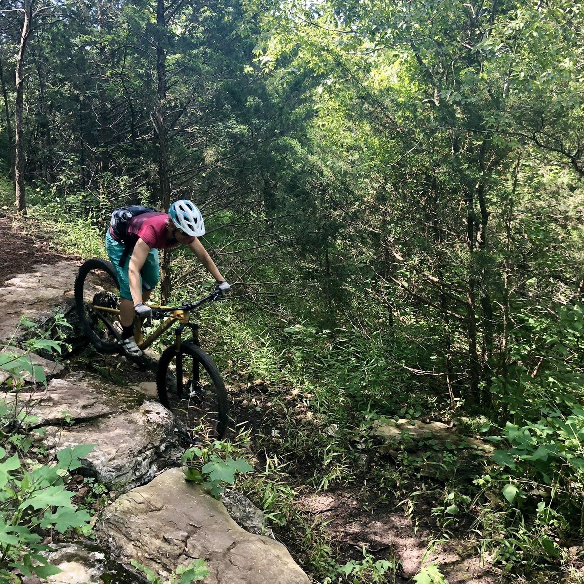
This mountain bike preserve has around 19 miles of high quality and well maintained trails of various degrees of difficulty. A paved greenway runs down the middle of it and provides multiple access points to the trails and other interesting features in the park.
0
0
The Hub Feature is a unique giant metal structure that mountain bikers use. If you're out for a hike, check this feature out and watch bikers climb and ride down this ramp. The Hub Feature is also at a junction where three trails meet.
0
0
This mountain bike preserve has around 19 miles of high quality and well maintained trails of various degrees of difficulty. A paved greenway runs down the middle of it and provides multiple access points to the trails and other interesting features in the park.
0
0
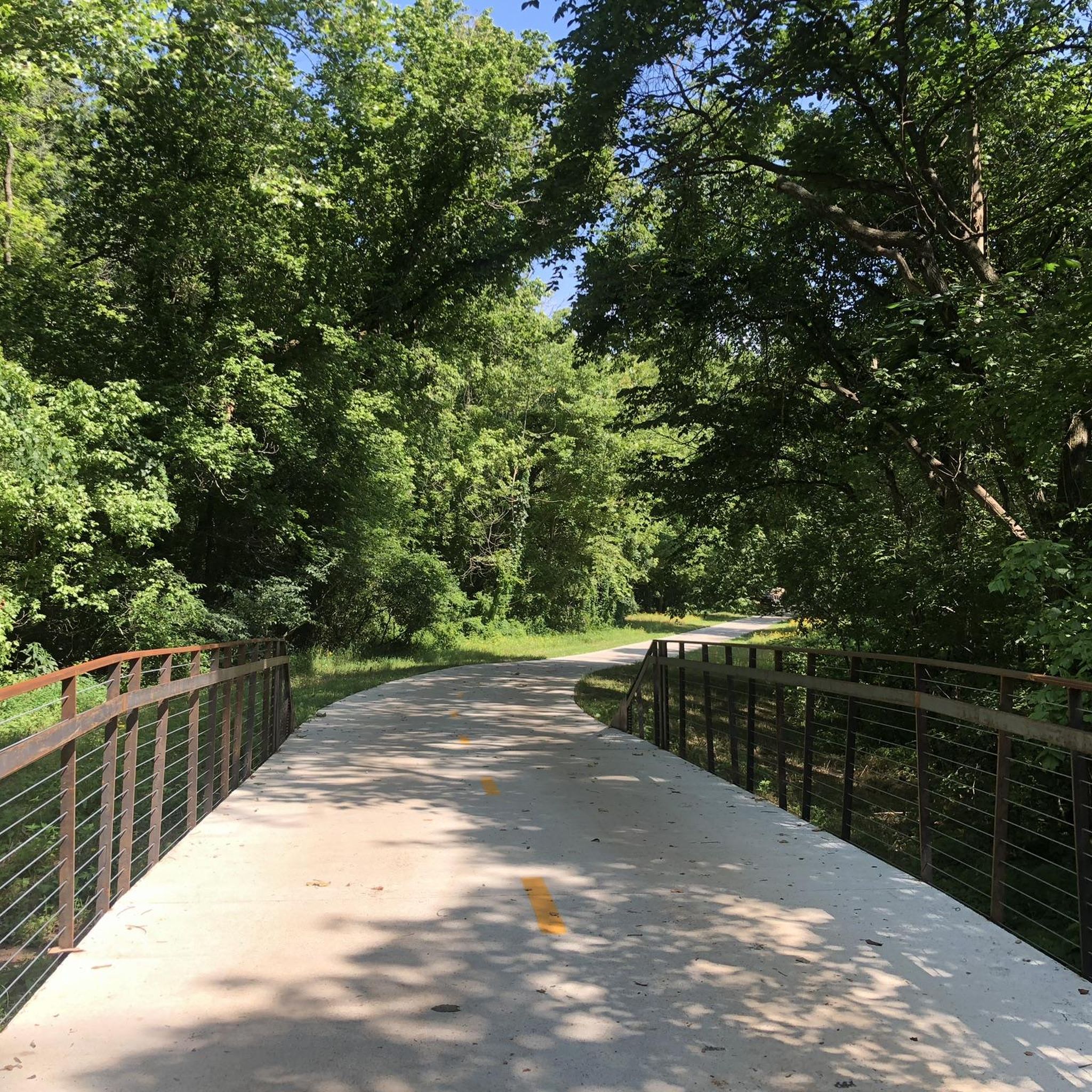
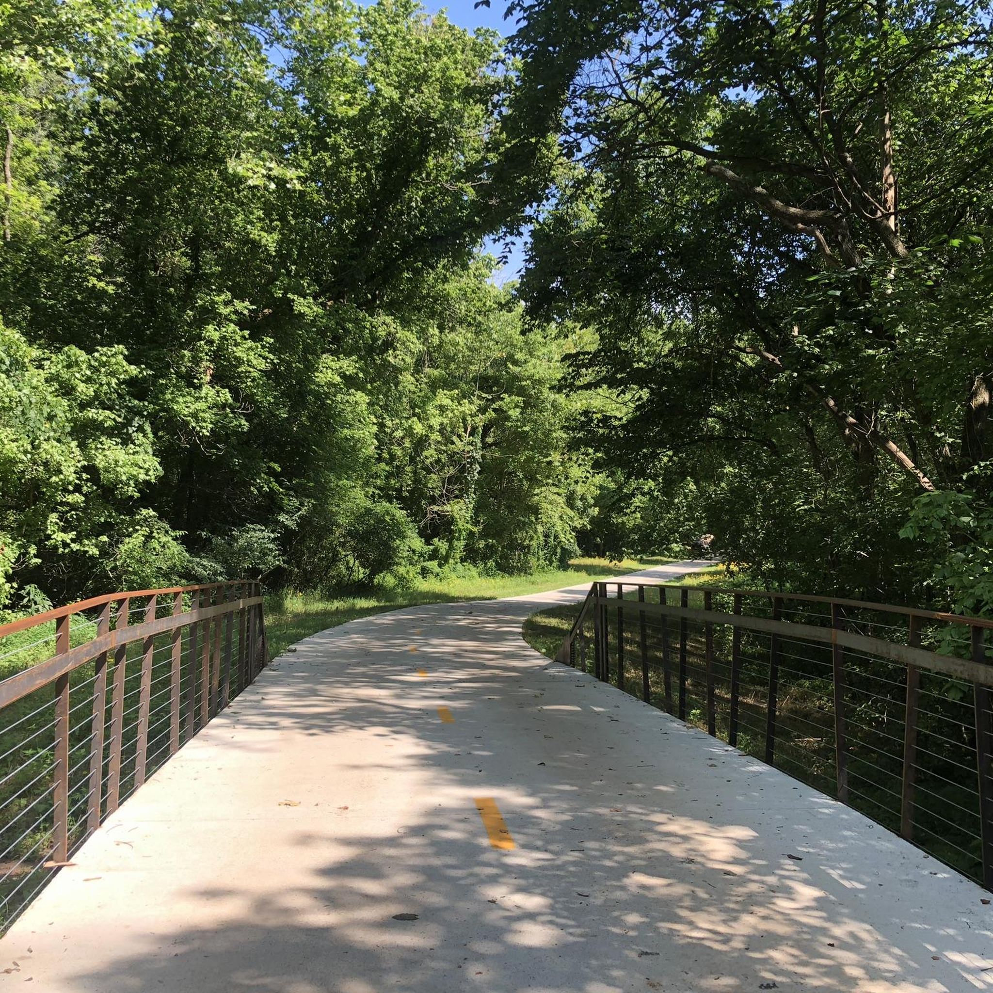
To get a view over the Crystal Bridges Museum of American Art, hop off the Razorback Regional Greenway Trail and onto the Crystal Bridges Overlooks Access Trail. It is a short detour, less than 0.1 miles, and provides great views of this architectural beauty.
0
0

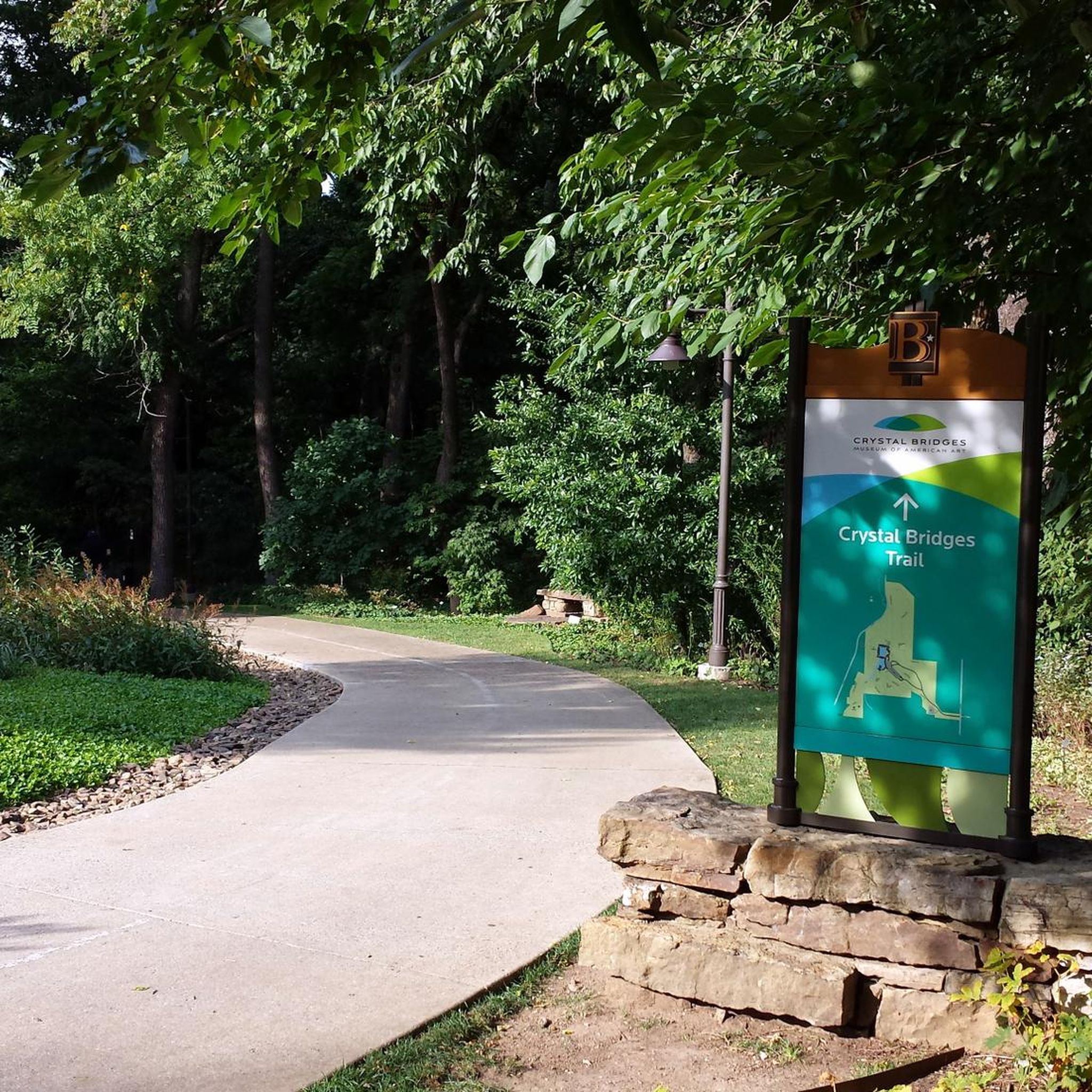
The Crystal Bridges Overlook can be accessed by running the Crystal Bridges Trail, which is a 1-mile hard-surfaced trail with a moderate slope and steep incline. This trail connects the Art Trail with downtown Bentonville.
0
0

What a great trail system! You can enjoy over 40 miles of single-track flow. Just stopp by and experience how great those trails are – even for beginners.
2
0
Frequently Asked Questions
Are there many easy, beginner-friendly hikes in the Bentonville area?
Yes, the region is well-suited for beginners. There are over 25 easy-rated hikes to choose from. Many of these are paved greenways or gentle loops within parks. For a shorter, scenic walk, consider the Oscar's Loop — Coler Mountain Bike Preserve, which is a well-regarded path through a beautiful valley.
What are some good options for family-friendly hikes?
Tanyard Creek Nature Trail is a popular choice for families. It features well-marked paths, beautiful scenery with small waterfalls, and restrooms at the trailhead. The trails at Crystal Bridges Museum of American Art also offer a unique experience, combining art, nature, and accessible paths suitable for all ages.
Can I bring my dog on the hiking trails near Bentonville?
Many trails in and around Bentonville are dog-friendly, provided your dog is kept on a leash. The North Bentonville Trail is a well-kept local favorite for dog walkers. Parks like Coler Mountain Bike Preserve and many of the trails in Hobbs State Park-Conservation Area also welcome leashed dogs. Always check specific park regulations before you go.
Where can I find a hike with a waterfall?
The Tanyard Creek Nature Trail in nearby Bella Vista is your best bet for seeing waterfalls. The trail follows a creek and features several cascades, especially after recent rainfall. For a more rugged experience with unique water features, the trails in Devil's Den State Park lead past crevices and springs, including the Devil's Icebox.
What is the best time of year to hike around Bentonville?
Spring and fall are ideal for hiking in the Ozarks. Spring offers pleasant temperatures and blooming wildflowers, while fall provides stunning autumn colors in the hardwood forests. Winter is also a great time for hiking, especially on trails like the Ozark Highlands Trail, as the bare trees offer clearer views of the surrounding landscape.
Are there any challenging hikes or long-distance trails available?
Yes, for those seeking a challenge, the Ozark Highlands Trail (OHT) offers a rugged, remote backpacking experience stretching over 200 miles through the Ozark National Forest. For a challenging day hike, the trails at Devil's Den State Park, such as the Yellow Rock Trail, provide strenuous climbs with rewarding views.
What kind of hiking is available at Hobbs State Park-Conservation Area?
Hobbs State Park, a massive conservation area, offers a diverse trail system with options for all skill levels. You can find everything from easy, family-friendly nature loops to longer, more remote backcountry trails for backpacking, like the Pigeon Roost Trail. The park's trails wind through varied terrain, including dense forests and scenic lakefront sections along Beaver Lake.
How do Coler Mountain Bike Preserve and Slaughter Pen Trail compare for hiking?
While both are famous for mountain biking, they offer different hiking experiences. Coler Mountain Bike Preserve is set in a contained valley and has about 2 miles of paved, multi-use trail that is excellent for a relaxed walk, connecting you to a coffee shop and art installations. Slaughter Pen Trail is a vast network of singletrack trails closer to downtown Bentonville; while primarily for biking, hikers can use the trails but should remain alert for fast-moving cyclists.
What makes hiking in Devil's Den State Park unique?
Devil's Den State Park is known for its remarkable geology. It contains the largest sandstone crevice area in the United States, and its trails wind through fascinating rock formations, caves, and shelters. The historic, rustic structures built by the Civilian Conservation Corps in the 1930s add to the park's unique character. It's a must-visit for anyone interested in natural history.
What do other hikers enjoy most about the trails in Bentonville?
The trails around Bentonville are highly rated by the komoot community. Hikers frequently praise the variety, from the well-maintained paved greenways like the Razorback Greenway to the scenic, natural-surface trails in places like Coler Mountain Bike Preserve. The accessibility of the trails and the beautiful Ozark scenery are also commonly highlighted.
Are there any good circular or loop hikes?
Yes, there are many excellent loop hikes. The Sunset Vista, Down Under & Sick-A-More loop in Bella Vista is a great example of a moderately easy loop through the woods. Many parks, including Coler Mountain and Hobbs State Park, are designed with multiple interconnecting loops, allowing you to easily customize the length of your hike.
Is there parking available at the main trailheads?
Most major trail systems and parks, such as Coler Mountain Bike Preserve, Hobbs State Park-Conservation Area, and Tanyard Creek Nature Trail, have designated free parking areas at their primary trailheads. These lots can fill up on weekends, so arriving earlier in the day is a good idea.
Most popular routes around Bentonville
Most popular attractions around Bentonville

Get inspired with the komoot mobile app


Explore more
Browse the best Hikes in other regions.
