The best road cycling routes around Springdale
4.3
(10)
601
riders
33
rides
If you've ever tried to plan road cycling around Springdale, you know how quickly the options can become overwhelming. With so much stunning scenery, it's hard to tell which routes are genuinely worth your time and effort, and which are just filler. That's where we come in. Our komoot community has mapped, ridden, and reviewed countless routes here, and we've distilled all that local knowledge into a curated shortlist. We're here to save you the guesswork and point you straight…
Last updated: May 28, 2026
5.0
(2)
108
riders
50.2km
02:19
280m
280m
Moderate road ride. Good fitness required. Mostly well-paved surfaces and easy to ride.
35
riders
69.8km
03:18
520m
520m
Moderate road ride. Good fitness required. Mostly well-paved surfaces and easy to ride.

Sign up for free
1.0
(1)
21
riders
Easy road ride. Great for any fitness level. Mostly well-paved surfaces and easy to ride.
3.0
(1)
17
riders
45.9km
02:07
370m
370m
Moderate road ride. Good fitness required. Mostly well-paved surfaces and easy to ride.
13
riders
Embark on a road cycling journey that blends the best of urban greenways and river-side paths with the Boardwalk along Spring Creek – Clear Creek loop. This route offers a…
Get access to more routes and recommendations from other explorers.
Sign up for free
Already have an account?
Our route recommendations are based on thousands of hikes, rides, and runs completed by other people on komoot.
Start today with a free account
Your next adventure awaits.
Login or Signup

Tips from the Community

Rabbit Foot Lodge is one of Arkansas's best examples of Adirondack-style architecture. Built in 1908 and home to J. William Fulbright from 1936 to 1941, the 3,200-square-foot chinked-log structure features pyramidal roofs, wrap-around porches, stained ceiling beams, wooden shutters, and a natural stone fireplace. This charming lodge is on the National Register of Historic Places and part of J. B. Hunt Park.
0
0

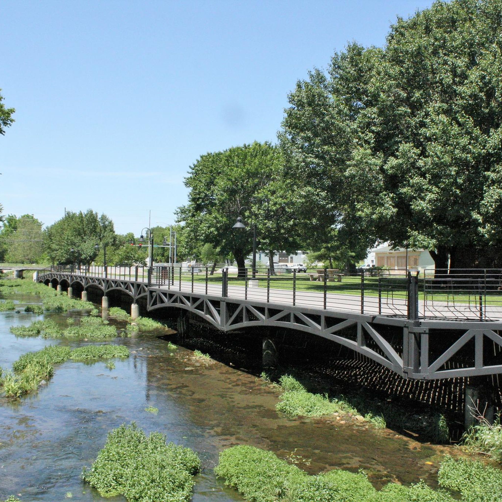
The Razorback Regional Greenway runs along a beautiful boardwalk through downtown Springdale. The path follows Spring Creek and there are also picnic tables at the side of the boardwalk. So if you need a rest, this is an ideal spot.
0
0
This beautiful multi-use path lead is part of the Northwest Arkansas Razorback Regional Greenway that is altogether almost 38 miles long and takes you to spectacular places like the Lake Fayetteville.
0
0
Make a stop on the Clear Creek bridge and admire the beauty of the rocky streambed. By the way, the multi-use trail Razorback Regional Greenway is also called Clear Creek Trail from here on and follows the course of the creek for a few miles.
0
0

This is a private lake, but the owners generously allow people to fish on it. You'll often see individuals enjoying fishing at this location, making it a picturesque spot to take a break and appreciate the water.
0
0

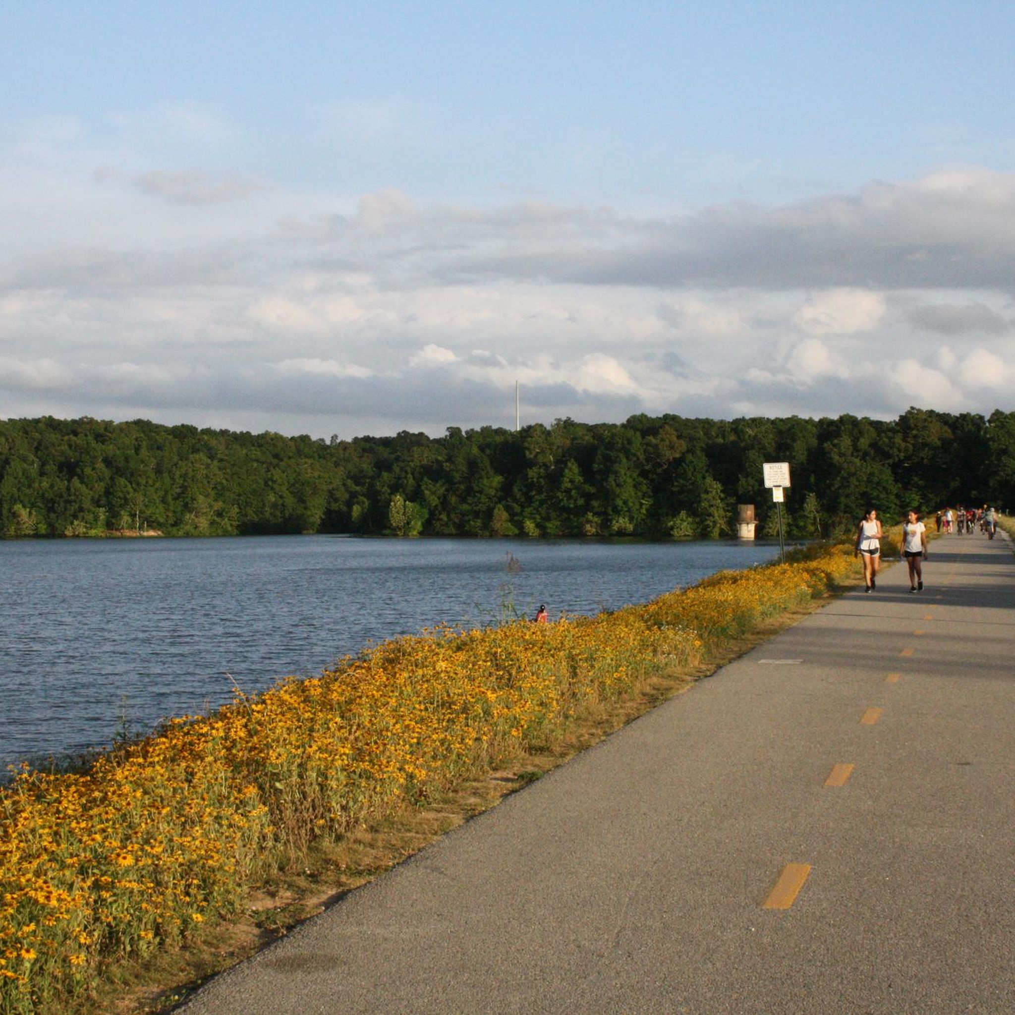
The entirety of the Razorback Regional Greenway spans over 40 miles, and most all of it is bikable with a road bike. This particular paved section meets some other paths at Lake Springdale, which is a pretty scenic reservoir.
0
0
The Razorback Regional Greenway runs along a beautiful boardwalk through downtown Springdale. The path follows Spring Creek and there are also picnic tables at the side of the boardwalk. So if you need a rest, this is an ideal spot.
4
0
Make a stop on the Clear Creek bridge and admire the beauty of the rocky streambed. By the way, the multi-use trail Razorback Regional Greenway is also called Clear Creek Trail from here on and follows the course of the creek for a few miles.
2
0
Frequently Asked Questions
How many road cycling routes are available around Springdale?
There are nearly 40 road cycling routes around Springdale, offering a variety of experiences. These include 16 easy routes and 22 moderate routes, ensuring options for different skill levels.
Are there road cycling routes suitable for beginners in Springdale?
Yes, Springdale offers several easy road cycling routes. For instance, the Boardwalk along Spring Creek – Clear Creek loop from NWACC Springdale is an easy 18.1-mile path providing a relaxed ride along local waterways. The Pa'rus Trail within Zion National Park is also a paved, multi-use trail ideal for a gentler ride, though it's shared with pedestrians.
What kind of challenges can experienced road cyclists expect in Springdale?
Experienced road cyclists can find moderate routes with varied terrain and elevation gains. Routes like the Roadbike loop from Springdale, a 29.9-mile route with over 900 feet of elevation gain, offer a good workout. For more intense climbs and sharp curves, some park roads like the East Side Route 9 or Kolob Terrace Road outside the main canyon can be explored, though they may have limited shoulders.
What are the most scenic road cycling routes in Springdale?
Springdale is nestled among stunning red rock cliffs and canyon walls, making many routes scenic. The Zion Canyon Scenic Drive, when open to cyclists (often restricted to shuttle buses during peak seasons), offers magnificent views of formations like Angels Landing and the Great White Throne. The Pa'rus Trail also provides beautiful views of the Virgin River and canyon. For a route outside the park, the Rabbit Foot Lodge – Razorback Regional Greenway loop from NWACC Springdale leads through developed greenway areas with pleasant surroundings.
Can I cycle inside Zion National Park?
Yes, cycling is permitted in Zion National Park. The Pa'rus Trail is a paved, multi-use trail accessible from the Zion Canyon Visitor Center. The iconic Zion Canyon Scenic Drive is also open to cyclists, offering a unique car-free experience during shuttle-only periods. Cyclists must be mindful of shuttle buses and pull over to allow them to pass safely. For more detailed information on park cycling regulations, you can visit the official NPS Zion website.
Are there any circular road cycling routes around Springdale?
Yes, many road cycling routes around Springdale are designed as loops. For example, the popular Roadbike loop from Springdale is a 29.9-mile circular route. Another option is the Rabbit Foot Lodge – Arbor Acres Lake loop from NWACC Springdale, which covers nearly 43.4 miles.
What landmarks or points of interest can I see along the road cycling routes?
While cycling, you'll be surrounded by the dramatic red rock landscapes and towering cliffs of the Zion area. Within Zion National Park, the Scenic Drive offers views of famous formations like Angels Landing and the Great White Throne. Outside the park, you might encounter local parks and greenway areas. For specific points of interest, you can explore highlights such as Bayyari Park or Giverny Park, which are often near cycling paths.
What do other road cyclists enjoy the most about road cycling in Springdale?
The road cycling routes in Springdale are highly rated by the komoot community, with an average score of 4.5 stars from more than 10 reviews. Reviewers often praise the stunning red rock scenery, the unique experience of cycling within Zion National Park, and the variety of routes available for different skill levels.
Is Springdale a bike-friendly town?
Yes, Springdale is designed with a strong emphasis on pedestrian and bike-friendly infrastructure. The town features a network of trails, bike lanes, and sidewalks, making it easy and enjoyable to explore on two wheels. Numerous local businesses also offer bicycle and e-bike rentals.
What is the best time of year for road cycling in Springdale?
Springdale offers excellent cycling opportunities throughout much of the year. Spring and fall generally provide the most comfortable temperatures for cycling, with vibrant colors in spring and pleasant weather in autumn. Summers can be hot, so early morning or late afternoon rides are recommended. Winter cycling is possible, but conditions can vary, and some higher elevation roads may be affected by snow or ice.
Are there any specific rules for cyclists within Zion National Park?
Yes, when cycling on the Pa'rus Trail, a speed limit of 15 mph is enforced, and cyclists must be mindful of pedestrians as it's a multi-use trail. On the Zion Canyon Scenic Drive, cyclists are required to pull over and stop to allow shuttle buses to pass safely. For comprehensive rules and safety guidelines, it's always best to check the official NPS Zion website before your ride.
Most popular routes around Springdale
Most popular attractions around Springdale

Get inspired with the komoot mobile app


Explore more
Browse the best Road cycling routes in other regions.
