The best running trails around Superior
27
runners
9
runs
Jogging around Superior offers diverse running experiences across varied landscapes. The region is characterized by its extensive Lake Superior shoreline, vast municipal and county forests, and numerous rivers. Runners can explore miles of sandy beaches, dense boreal forests, and scenic riverfront paths. The terrain includes paved paths, rooted single tracks, and gravel trails, providing options for different preferences and skill levels.
Best jogging routes around Superior
- The most popular jogging route is Picketpost Mountain Trail, a difficult 4.3 miles…
Last updated: May 27, 2026
2
runners
6.94km
01:22
580m
580m
Prepare for a challenging jogging experience on the Picketpost Mountain Trail, a difficult route spanning 4.3 miles (6.9 km) with a significant elevation gain of 1894 feet (577 metres). You…
2
runners
8.96km
01:07
110m
110m
Embark on the Legends of Superior Trail, a moderate jogging route that takes you 5.6 miles (9.0 km) through the scenic Sonoran Desert. You will experience a gradual climb of…

Sign up for free
3.02km
00:22
80m
80m
Embark on an easy jog along the Apache Tears Mine loop via Perlite Road, a 1.9-mile (3.0 km) route that guides you through the rugged Sonoran Desert. You will gain…
1
runners
11.2km
01:15
240m
240m
Lace up your jogging shoes for the Legends of Superior Trail, a moderate route that takes you through diverse Arizona landscapes. You will cover 7.0 miles (11.2 km) and gain…
26.9km
03:26
520m
520m
The Arizona Trail: Passage 17 - Alamo Canyon offers a difficult jogging experience through the Sonoran Desert. You will navigate 16.7 miles (26.9 km) of rugged terrain, gaining 1708 feet…
Get access to more routes and recommendations from other explorers.
Sign up for free
Already have an account?
Our route recommendations are based on thousands of hikes, rides, and runs completed by other people on komoot.
Start today with a free account
Your next adventure awaits.
Login or Signup
Popular around Superior
Tips from the Community

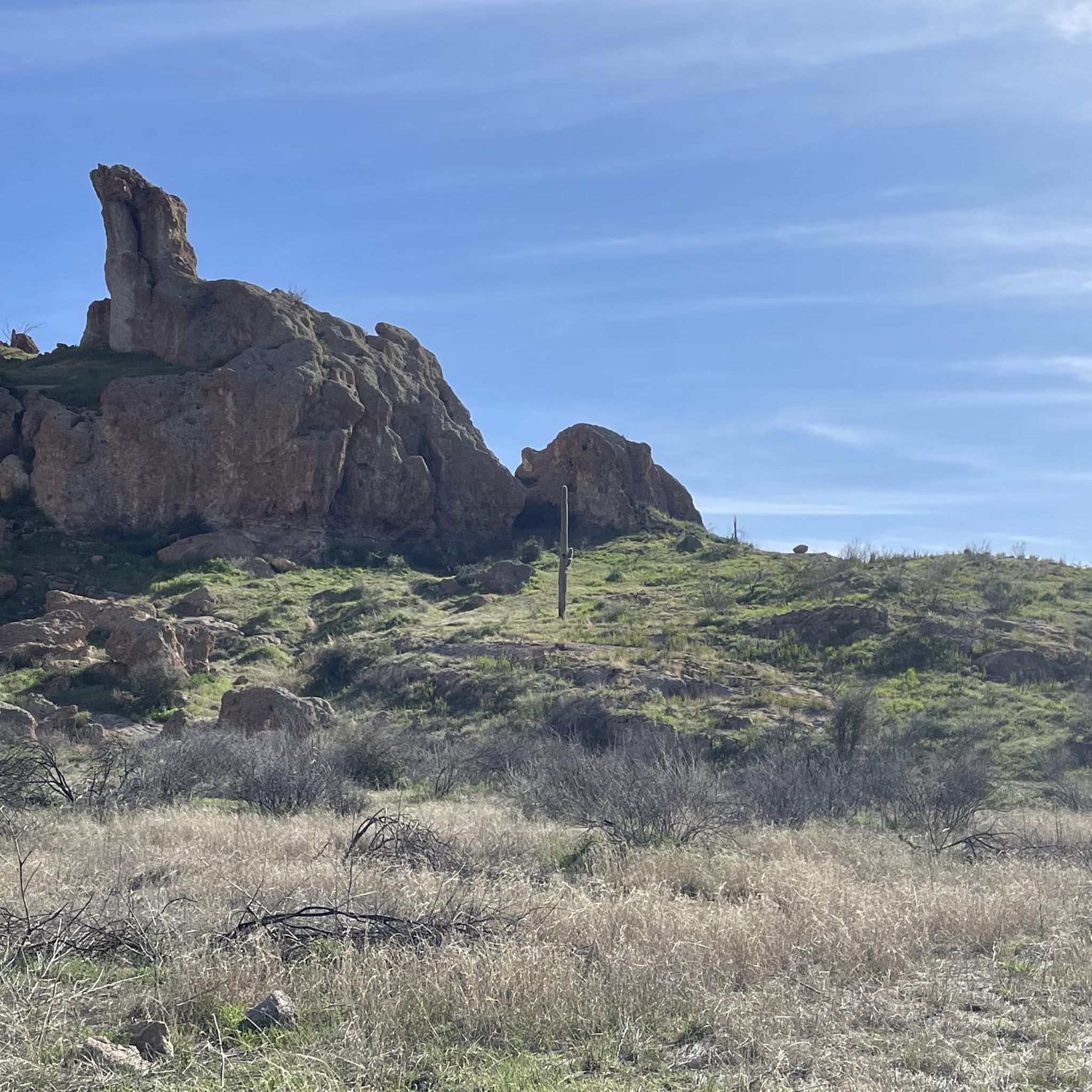
The trail through Alamo Canyon is one thing: breathtaking! To your left, the red rock walls tower up and form a unique contrast to the bright blue sky. By the way: Alamo is Spanish for cottonwood.
2
0

The Apache Tears Mine is a popular spot for visitors and families. The path to the area is easy, and you can extract black rocks from the cave walls. The rocks are called Apache Tears because according to legend, Apache warriors rode their horses off a cliff rather than die at the hands of the US cavalry.
0
0
The Picketpost Loop Trail is actually a combination of a few trails circling around Picketpost Mountain. The L.O.S.T. Trail #221 is a winding canyon trail that passes by canyon walls, free-range cows, and open meadow. There isn't a lot of shade on the trail, so make sure to bring plenty of water.
0
0

Picketpost Mountain is a 4,375-foot mountain in the southern part of Tonto National Forest. The climb to the top is steep and rocky, but the summit is totally worth the trek. There are views in all directions along with a bench, mailbox, and summit registry on the summit.
0
0
The Apache Tears Mine has been called one of the most unique hikes on the planet. You have the opportunity to "mine" obsidian from the walls of cliffs and caves. The rocks are considered Apache tears in memory of the Apache members that died when the US cavalry took over the area.
0
0
Picketpost Mountain is a 4,375-foot mountain in the southern part of Tonto National Forest. The climb to the top is steep and rocky, but the summit is totally worth the trek. There are views in all directions along with a bench, mailbox, and summit registry on the summit.
0
0
There are few sources of water on this low section of the Arizona Trail. With a bit of luck there were water gallons in the supply box at Forest Road 4, which could only be reached by good off-road vehicles. Therefore, a rainwater collector was installed in 2019 halfway between the Gila River and Picketpost Trailhead and the supply box at FR 4 was removed.
6
0
Frequently Asked Questions
How many running routes are available around Superior?
Komoot offers a diverse selection of over 9 running routes around Superior. These routes cater to various preferences, including easy, moderate, and challenging options, ensuring there's something for every runner.
Are there any easy or family-friendly jogging paths in Superior?
Yes, for an easy and quick run, consider the Apache Tears Mine loop via Perlite Road. This 1.9-mile route is suitable for a leisurely jog and can be completed in about 22 minutes. The region also features paved paths like the Osaugie Trail, which offers a flat and accessible surface along Superior Bay, ideal for families.
Where can I find long-distance running trails near Superior?
For longer runs, the region offers extensive options. The Legends of Superior Trail has segments that provide a balanced workout over 5.6 miles. Additionally, state trails like the Willard Munger State Trail and the Gandy Dancer Trail (Northern Section) offer extended scenic routes through forests and hills, connecting to areas beyond Superior.
Are there any running routes with scenic viewpoints of Lake Superior?
Absolutely. The Lake Superior shoreline provides numerous picturesque jogging opportunities. Wisconsin Point offers miles of sandy beaches with stunning views of the lake and a historic lighthouse. The paved Osaugie Trail also traces nearly eight miles along the Lake Superior shore, providing continuous scenic vistas.
Can I find challenging running routes with significant elevation gain in Superior?
Yes, for experienced runners seeking a challenge, the Picketpost Mountain Trail is an excellent choice. This difficult 4.3-mile route features significant elevation gain, making it a strenuous option that takes approximately 1 hour 22 minutes to complete.
Are there any waterfalls or natural monuments to see along the jogging routes?
Yes, the region is rich in natural beauty. While jogging, you might explore areas near Pattison State Park, home to Big Manitou Falls, Wisconsin's highest waterfall. Amnicon Falls State Park also features a series of captivating waterfalls. For specific natural monuments, consider routes that pass by Apache Tears Mine or offer views of Picket Post Mountain.
What kind of terrain can I expect on running trails in Superior?
Superior's running trails offer a wide variety of terrain. You can find paved paths, rooted single tracks, and gravel trails. This diversity accommodates different preferences and skill levels, from flat, easy surfaces to more challenging routes with elevation changes through forests and along shorelines.
Are there any dog-friendly running trails in the Superior area?
Many trails in the Superior Municipal Forest and Douglas County Forest are generally dog-friendly, provided dogs are kept on a leash. The Douglas County Wildlife Area, also known as the 'Bird Sanctuary,' offers miles of trails through varied habitats that are great for running with your canine companion.
What do other runners enjoy most about jogging in Superior?
Runners frequently praise the diverse terrain and scenic beauty of Superior's routes. The komoot community highlights the variety, from challenging mountain paths to moderate forest routes and easier loops, ensuring options for all ability levels. The chance to observe diverse wildlife also enhances the outdoor running experience.
Are there any loop running routes available in Superior?
Yes, loop routes are available for those who prefer to start and end at the same point. The Apache Tears Mine loop via Perlite Road is a notable example, offering a convenient circular path through varied terrain.
What are some notable natural areas or forests to explore while running in Superior?
Superior offers access to vast natural areas. The Superior Municipal Forest, the third-largest forest within a U.S. city, provides numerous trails like the Pokegama Trail and Millennium Trail. The broader Douglas County Forest also spans over 272,000 acres, offering extensive public land for running through diverse habitats.
Are there any running routes that pass by lakes or rivers?
Yes, the region is bordered by Saint Louis, Superior, and Allouez bays, and framed by the Nemadji and Saint Louis rivers. The Brule River State Forest encompasses the entire 44-mile Bois Brule River, offering scenic routes. You can also find routes near Ayer Lake, providing beautiful waterside running experiences.
Most popular routes around Superior
Most popular attractions around Superior

Get inspired with the komoot mobile app


Explore more
Browse the best Running Trails & Routes in other regions.
