The best walks and hikes around Casa Grande
15
hikers
8
hikes
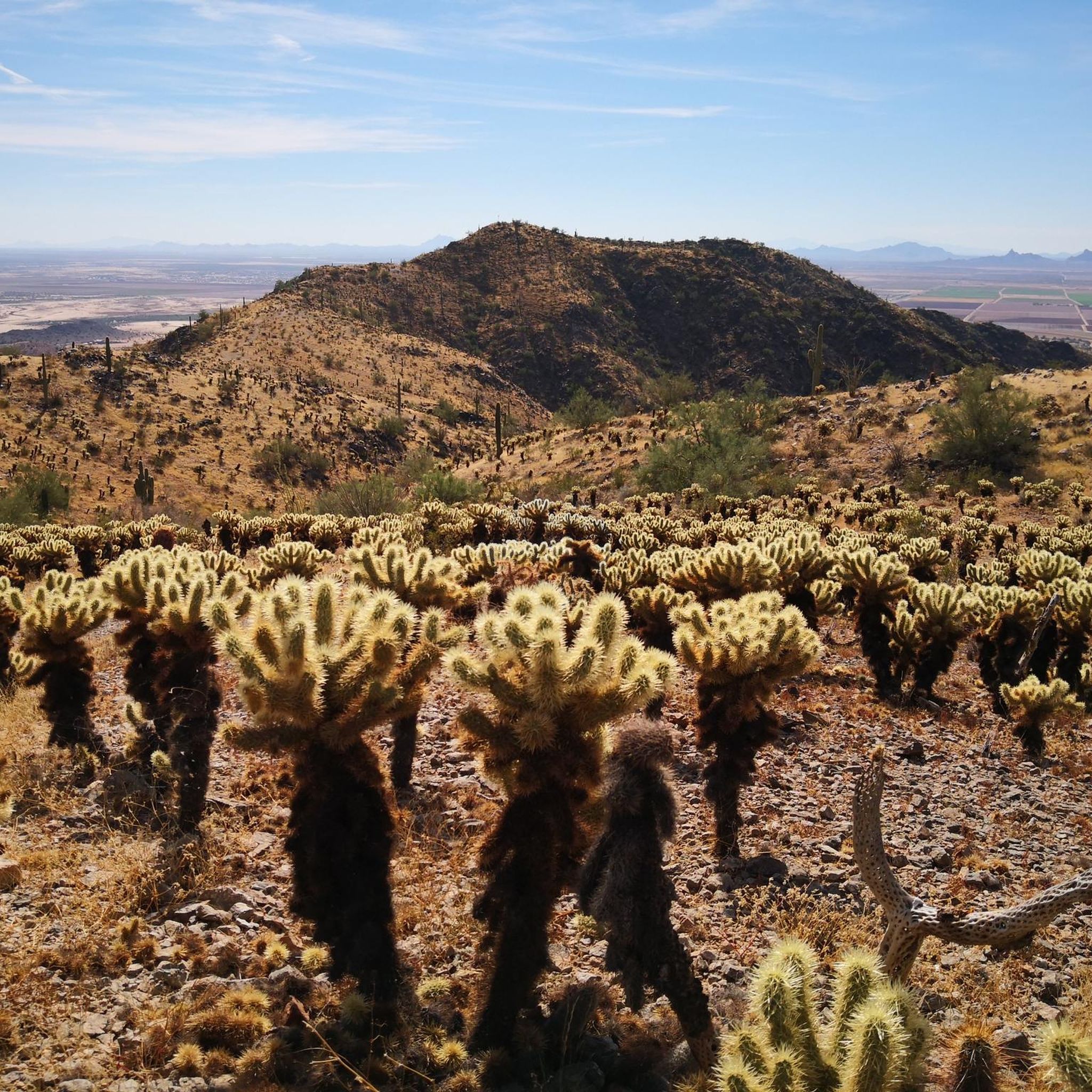
Hiking around Casa Grande offers routes through the Sonoran Desert, characterized by saguaro cacti and diverse desert flora. The region features low mountain ranges, including Casa Grande Mountain, providing elevation and varied terrain. Trails wind through cholla-fleeced foothills and stony clefts, offering views across surrounding valleys. This landscape defines a desert hiking experience.
Best hiking trails around Casa Grande
- The most popular hiking route is Spine Trail to Ridge Trail Loop, a 7.2 miles (11.5 km) trail that takes…
Last updated: September 28, 2026
1
hikers
11.5km
03:15
240m
240m
Hike the Spine Trail to Ridge Trail Loop in Casa Grande Mountain Park, a moderate 7.2-mile route with Sonoran Desert views.
2.35km
00:42
80m
70m
An easy 1.5-mile hike in Casa Grande Mountain Park, offering desert views and a quick outdoor escape.

1.63km
00:38
190m
0m
Hike the easy Radio Tower Trail in Casa Grande Mountain Park, Arizona, for expansive views and a 607-foot climb over 1.0 mile.
2.15km
00:34
20m
20m
Easy 1.3-mile hike through the Sonoran Desert near Casa Grande, featuring saguaro cacti and family-friendly terrain.
5
hikers
5.52km
01:49
260m
260m
Hike the easy 3.4-mile Bolt Trail in Casa Grande Mountain Park, gaining 838 feet for desert views and the High Point of Casa Grande Mountain
Get access to more routes and recommendations from other explorers.
Already have an account?
Our route recommendations are based on thousands of hikes, rides, and runs completed by other people on komoot.
Tips from the Community

Great view from the Casa Grande Mountain Park over the surrounding valley. The trail to get up to the viewpoint is moderately challenging and crosses multiple paths, so make sure you have enough water and a GPS or map.
0
0
At 2,350 feet, this is the high point of the Casa Grande Mountains. There is a great view into the Table Top Wilderness in the distance. The trail to the top is not too challenging, so it is definitely worth the effort to get the views.
1
1

from the parking lot "Hanna Road Trailhead" in about 45 minutes.
0
0
West car park from Casa Grande Mountain
0
0
Frequently Asked Questions
Are there any easy, family-friendly hikes in Casa Grande?
Yes, the area is well-suited for families and beginners. Most trails in Casa Grande Mountain Park are rated as easy. A great option is the Casa Grande Mountain Park loop, which is a relatively flat 3.6-mile (5.8 km) walk through the desert landscape, perfect for a relaxed outing.
Can I bring my dog on the hiking trails?
Dogs are generally welcome on trails in Casa Grande Mountain Park, but they must be kept on a leash at all times. Remember that the desert can be extremely hot for pets, so always carry extra water for your dog and check the ground temperature to protect their paws.
What kind of wildlife and plants might I see while hiking?
The trails around Casa Grande are in the Sonoran Desert, so you can expect to see iconic saguaro cacti, ironwood trees, and various desert shrubs. In spring, the area can be covered in wildflowers. Wildlife includes desert birds, lizards, and jackrabbits. While less common, be aware of rattlesnakes and stay on marked paths.
Are there any challenging hikes for more experienced hikers?
While most local trails are easy, those seeking a challenge can drive to nearby Picacho Peak State Park. It's famous for its steep trails, like the Hunter Trail, which uses steel cables to assist hikers on the ascent to the summit and offers incredible 360-degree views.
What should I pack for a hike in the Casa Grande area?
For any desert hike, sun protection is essential. Bring a wide-brimmed hat, sunglasses, and sunscreen. Carry more water than you think you'll need, at least one liter per hour of hiking. Sturdy hiking shoes are recommended due to rocky and uneven terrain. Also, pack some salty snacks to help with hydration.
Where is the best place to park for hiking in Casa Grande Mountain Park?
There are several trailheads for the park. The Hanna Road Trailhead is a popular and highly-regarded starting point for accessing the park's main trails. Another good option is the Arica Road Trailhead, which provides access to the western side of the trail system.
Are there any circular walks or loop trails available?
Yes, there are several loop trails. For a shorter walk, consider the Parking lot loop from Mission Royale, which is about 2.1 miles (3.4 km). It's a great way to experience the desert scenery without having to backtrack.
Are there any waterfalls on the trails near Casa Grande?
No, the hiking trails around Casa Grande are in a dry desert environment. You will not find any permanent waterfalls. The landscape's beauty comes from its unique desert flora, rugged mountains, and expansive views.
What are the best trails for scenic views?
For great panoramic views of the surrounding valley, the Casa Grande Mountain Lookout loop from Mission Royale is an excellent choice. This 3.5-mile (5.6 km) trail takes you to a viewpoint that showcases the vast Sonoran Desert landscape.
What is the best time of year to go hiking in Casa Grande?
The best seasons for hiking are from late fall to early spring (October through April). Temperatures are mild and pleasant. Summer months (May through September) are extremely hot and hiking is not recommended during the middle of the day. If you visit in the spring, you may be treated to a beautiful wildflower bloom.
Are there any historical sites to see while hiking?
The nearby Ironwood Forest National Monument contains over 200 recorded Hohokam-period archaeological sites, including petroglyphs. While not a hiking destination, the Casa Grande Ruins National Monument in Coolidge is also a significant cultural site preserving an ancient Sonoran Desert farming community.
How long does it take to hike to the highest point of Casa Grande Mountain?
The hike to the high point of the Casa Grande Mountains typically starts from the Hanna Road Trailhead. The route is approximately 3.4 miles (5.5 km) long and takes most people about 1 hour and 50 minutes to complete the round trip.
Most popular routes around Casa Grande

Get inspired with the komoot mobile app


Explore more
Browse the best Hikes in other regions.
