The best walks and hikes in Allegheny National Forest
4.8
(37)
342
hikers
32
hikes
Hiking in Allegheny National Forest offers a diverse landscape characterized by dense woodlands, varied elevations, and numerous creeks and rivers. The region features rolling hills and valleys, providing a mix of terrain for different hiking experiences. Trails often traverse forested areas, leading to overlooks and along waterways. The elevation changes, as seen in routes with over 200 meters of ascent, contribute to the varied nature of the paths.
Best hiking trails in Allegheny National Forest
- The most popular hiking route is Minister Creek Trail — Allegheny National Forest, a 5.6 miles (9.1 km) trail that takes 2 hours 41 minutes to complete. This moderate route winds through dense forest and alongside Minister Creek.
- Another top favourite among local hikers is Rimrock Overlook — Allegheny National Forest, an easy 2.7 miles (4.3 km) path. This trail offers scenic views from prominent rock formations.
- Local hikers also love the Rimrock Trail Loop — Allegheny National Forest, a 9.1 miles (14.7 km) trail leading through forested terrain with overlooks, often completed in about 4 hours 12 minutes.
- Hiking in Allegheny National Forest is defined by dense woodlands, rolling hills, and scenic overlooks. The network offers options for different ability levels, from easy walks to more challenging moderate routes.
- The routes in Allegheny National Forest are highly rated by the komoot community with an average score of 4.7 stars from over 24 reviews. More than 218 hikers have used komoot to explore Allegheny National Forest's varied terrain.
Last updated: October 11, 2026
5.0
(1)
4
hikers
20.9km
06:51
330m
330m
Embark on the Hickory Creek Trail for a challenging hike through dense wilderness. This difficult 13.0 miles (20.9 km) route will take you through northern hardwoods like black cherry and oak, with rich undergrowth of flowers, ferns, and mosses, especially noticeable in the Fern Fields. You will gain 1092 feet (333 metres) in elevation, and the journey typically takes around 6 hours and 51 minutes to complete, offering varied terrain from rolling hills to rough, rocky sections.
Planning your visit requires careful preparation, as the trail features minimal signage and faded blazes. You should be ready to navigate using a map, compass, or GPS, given the primitive nature of the route. Parking is generally available at the trailheads, but it is always wise to check local conditions before you head out.
The Hickory Creek Trail offers a true wilderness experience within the Allegheny National Forest. As you hike, keep an eye out for local wildlife such as bear, deer, and turkey. The route provides scenic views over the valleys carved by East Hickory Creek, making it a notable option for those seeking a deep immersion in nature.
7
hikers
14.1km
04:01
310m
320m
The Tracy Ridge Outer Loop plunges you into the heart of the Allegheny National Forest, offering a challenging hike through dense woodlands of oak, beech, and black cherry, with beautiful hemlock groves along stream beds. You'll navigate varied terrain, including steep slopes and rock ledges, especially near the Allegheny Reservoir and the scenic Johnnycake Run. This trail provides a remote, wild feel, perfect for those seeking an escape into nature.
This moderate 8.8-mile (14.1 km) loop involves 1032 feet (315 metres) of elevation gain and typically takes about 4 hours. The trail usually begins at the Tracy Ridge Campground, but note that the campground closes for winter, requiring alternative parking. If you plan to hike during late fall or spring, wearing bright colors is recommended due to active hunting seasons in the area.
Much of the Tracy Ridge Outer Loop, about ten miles, coincides with the North Country National Scenic Trail, adding to its significance. Keep an eye out for abundant wildlife, including deer, squirrels, grouse, and turkey, with black bears and coyotes also present. The trail's elevation changes dramatically, from ridgetop views at 2,245 feet down to 1,328 feet at the Allegheny Reservoir's water level, offering diverse ecological zones.

3
hikers
4.99km
01:25
110m
110m
Embark on the Jakes Rocks Trail, an easy hiking route that winds through towering trees and unique "rock city" formations. You will encounter massive sandstone boulders, impressive cliffs, and deep crevices as you explore. This scenic path covers 3.1 miles (5.0 km) with a gentle elevation gain of 373 feet (114 metres), making it a pleasant journey that typically takes around 1 hour and 24 minutes to complete. From the prominent Jakes Rocks Overlook, you can enjoy sweeping panoramic views of the Allegheny Reservoir and the impressive Kinzua Dam.
When planning your visit, you will find parking readily available at various access points to the larger 35-mile trail network. The Jakes Rocks Trail system is designed for multiple users, including hikers, so you might share sections with others. While the path leading to the main Jakes Rocks Overlook was once paved, be aware that some sections may now be uneven due to its age. Consider visiting in spring to see blooming wildflowers or in fall for spectacular autumn colors.
This trail offers a fantastic opportunity to immerse yourself in the natural beauty of the Allegheny National Forest. The distinctive "rock city" formations are a highlight, showcasing unique geological features that set this area apart. It's a great way to experience the region's diverse landscape and enjoy a straightforward outdoor adventure, providing a memorable connection to the forest's ancient character.
4
hikers
34.0km
09:47
830m
840m
The Finger Lakes / North Country Trail offers a deep dive into New York's varied natural beauty, winding through everything from dense upland forests and tranquil wooded glens to wide-open pastures. You'll traverse natural treads and boardwalks, encountering scenic waterfalls, historic old vineyards, and even expansive views of Seneca Lake. Keep an eye out for wildlife, and be prepared for a journey that feels both wild and well-maintained, thanks to dedicated volunteer efforts.
Planning your visit to this trail is straightforward, as it's accessible year-round for hiking, snowshoeing, and running. If you're bringing your dog, they're welcome on a leash, but remember that hunting is permitted in some areas, so stay alert. For longer trips, some sections even offer Adirondack-style shelters on a first-come, first-served basis, adding a rustic charm to your overnight plans.
What makes this route truly unique is its dual identity: it's a significant segment of both the Finger Lakes Trail system and the much larger North Country National Scenic Trail. This means you're hiking a critical connection within a national network, passing through state parks, forests, and the Finger Lakes National Forest—New York's only national forest. This difficult 21.1-mile (34.0 km) hike, with its 2738 feet (834 metres) of elevation gain and estimated 9 hours and 47 minutes duration, is a rewarding challenge for experienced hikers.
5.0
(1)
2
hikers
5.12km
01:33
170m
180m
The North Country Trail: Sugar Run to Handsome Lake offers a tranquil journey through the Allegheny National Forest, guiding you through a diverse hardwood forest filled with black cherry and oak trees. You'll enjoy pleasant walking along old logging railroad grades, with picturesque views along Hammond Run and Hemlock Run, and the chance to spot unique rock outcroppings. It's an easy 3.2-mile (5.1 km) hike, making it a great option for a relaxing forest immersion.
Planning your visit to this section of the North Country Trail is straightforward, though a few tips can enhance your trip. The trail is generally easy, but be aware that areas around Hammond Run can be wet, so waterproof footwear is recommended. If you're considering a winter hike, prepare for muddy and icy conditions, and bring crampons and hiking poles. Parking is usually available at the Sugar Run trailhead.
This segment is part of the much larger North Country National Scenic Trail, offering a quiet connection with nature away from more crowded paths. The area is rich in wildlife, with opportunities to spot deer, bobcats, and various bird species. For those interested in an overnight adventure, Handsome Lake Campground is a remote camping area accessible by boat or hike-in, though remember to bring your own water supply.
Get access to more routes and recommendations from other explorers.
Already have an account?
Our route recommendations are based on thousands of hikes, rides, and runs completed by other people on komoot.
Start today with a free account
Your next adventure awaits.





Tips from the Community

Listen to the sounds of the burbling water as you take a break.
0
0
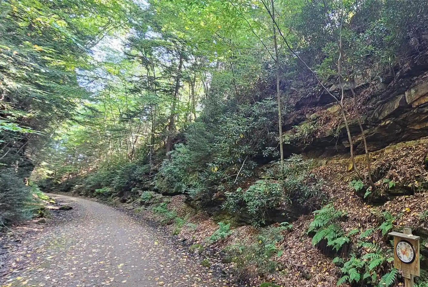
The trail meanders through many rock formations here.
0
0
You may or may not have to take off shoes here, depending on the status of the "bridge".
0
0
Frequently Asked Questions
How many hiking trails are available in Allegheny National Forest?
Allegheny National Forest offers a variety of hiking experiences with over 17 distinct trails. These routes cater to different skill levels, from easy walks to more challenging hikes.
What kind of terrain can I expect when hiking in Allegheny National Forest?
Hiking in Allegheny National Forest features a diverse landscape of dense woodlands, rolling hills, and valleys. Trails often traverse forested areas and follow waterways, with elevation changes that contribute to varied paths. You can expect a mix of terrain, from gentle slopes to more significant ascents.
Are there easy hiking trails suitable for beginners or families?
Yes, Allegheny National Forest has several easy trails. For instance, Rimrock Overlook — Allegheny National Forest is an easy 2.7-mile (4.3 km) path offering scenic views from prominent rock formations. There are 6 easy routes in total, making it a great place for less experienced hikers or families.
Are there more challenging or longer hikes available in the forest?
For those seeking a challenge, Allegheny National Forest offers more difficult routes. The Hickory Creek Trail is a difficult 13-mile (20.9 km) hike that provides a more strenuous experience. In total, there are 2 difficult routes for experienced hikers.
What natural features or landmarks can I see while hiking in Allegheny National Forest?
The forest is home to several notable natural features. You can visit the scenic Rimrock Overlook or the Minister Valley Overlook for expansive views. For those interested in waterfalls, Hector Falls is a highlight worth exploring.
Are there any trails that offer scenic viewpoints?
Absolutely. The Rimrock Overlook — Allegheny National Forest trail is specifically known for its scenic views from prominent rock formations. Additionally, the Rimrock Overlook itself and the Minister Valley Overlook are popular spots for panoramic vistas.
What do other hikers say about the trails in Allegheny National Forest?
The trails in Allegheny National Forest are highly regarded by the komoot community, holding an average rating of 4.7 out of 5 stars from over 24 reviews. More than 218 hikers have used komoot to explore the varied terrain, often praising the dense woodlands and scenic overlooks.
Are there any loop trails for a circular hiking experience?
Yes, Allegheny National Forest offers several excellent loop trails. The Rimrock Trail Loop — Allegheny National Forest is a popular 9.1-mile (14.7 km) option, and the Morrison Trail Loop — Allegheny National Forest is another moderate 5.1-mile (8.3 km) loop that provides a great circular hiking experience.
Can I find trails that follow along creeks or rivers?
Many trails in Allegheny National Forest traverse forested areas and often lead along waterways. The Minister Creek Trail — Allegheny National Forest is a prime example, winding through dense forest and directly alongside Minister Creek, offering a refreshing waterside experience.
What is the typical duration for a hike in Allegheny National Forest?
Hiking durations vary significantly based on the trail's length and difficulty. For example, an easy trail like Rimrock Overlook — Allegheny National Forest can be completed in about 1 hour 19 minutes, while a moderate route such as Minister Creek Trail — Allegheny National Forest typically takes around 2 hours 41 minutes. Longer, more difficult trails will naturally require more time.
Most popular attractions in Allegheny National Forest

Get inspired with the komoot mobile app


Explore more
Browse the best Hikes in other regions.
