The best walks and hikes in Shasta-Trinity National Forest
4.6
(65)
966
hikers
53
hikes
Hiking in Shasta-Trinity National Forest offers diverse terrain across a vast landscape in northern California. The region features extensive forests, numerous lakes, and significant elevation changes, providing varied hiking experiences. Trails often lead through wooded areas, past waterfalls, and to scenic viewpoints overlooking natural features. The forest environment supports a range of outdoor activities for different skill levels.
Best hiking trails in Shasta-Trinity National Forest
- The most popular hiking route is McCloud Waterfalls Trail, a 3.9 miles (6.2 km) trail that takes 1 hour 42 minutes to complete. This easy route features multiple waterfalls along the river.
- Another top favourite among local hikers is Castle Lake Trail, a difficult 3.0 miles (4.8 km) path. This trail ascends to a scenic alpine lake with notable elevation gain.
- Local hikers also love the Canyon Creek Lakes Trail — Trinity Alps Wilderness, a 15.5 miles (24.9 km) trail leading through wilderness areas and past multiple lakes, often completed in about 7 hours 34 minutes.
- Hiking in Shasta-Trinity National Forest is defined by dense forests, scenic lakes, and impressive waterfalls. The network offers options for easy walks, moderate excursions, and challenging multi-hour treks.
- The routes in Shasta-Trinity National Forest are highly rated by the komoot community with an average score of 4.7 stars from more than 30 reviews. More than 600 hikers have used komoot to explore Shasta-Trinity National Forest's varied terrain.
Last updated: September 27, 2026
19
hikers
5.86km
03:51
1,060m
10m
Embark on the challenging Mount Shasta via Avalanche Gulch Route, a difficult hike that promises a true mountaineering experience. You will begin your ascent through sparse forest, gradually transitioning as the landscape opens up. The trail leads you to Horse Camp, a significant landmark featuring a historic stone lodge, before continuing upwards onto expansive, glaciated slopes. This demanding route covers 3.6 miles (5.9 km) and involves a substantial elevation gain of 3467 feet (1057 metres). Plan for a duration of approximately 3 hours and 50 minutes to complete this strenuous journey.
When planning your visit, be aware that this route is best attempted during late spring or early summer when snow conditions are more stable, though ice axes and crampons are often still necessary. Always check current weather forecasts and avalanche conditions before heading out, as mountain weather can change rapidly. Access to the trailhead typically involves driving, and you should confirm parking availability and any potential fees or permit requirements for the area. Starting early in the day is crucial to allow ample time for the ascent and descent, especially given the route's difficulty and exposure.
Mount Shasta is a prominent stratovolcano and a significant landmark in Northern California, known for its spiritual importance and unique geological features. The Avalanche Gulch route is one of the most popular ways to reach its summit, offering a classic high-altitude climbing experience. This area is part of the Shasta-Trinity National Forest, home to diverse ecosystems and wildlife, making it a remarkable natural environment to explore. The mountain's glaciated slopes and alpine environment provide a stark contrast to the lower forested sections, showcasing the region's dramatic ecological transitions.
6
hikers
4.58km
01:33
0m
650m
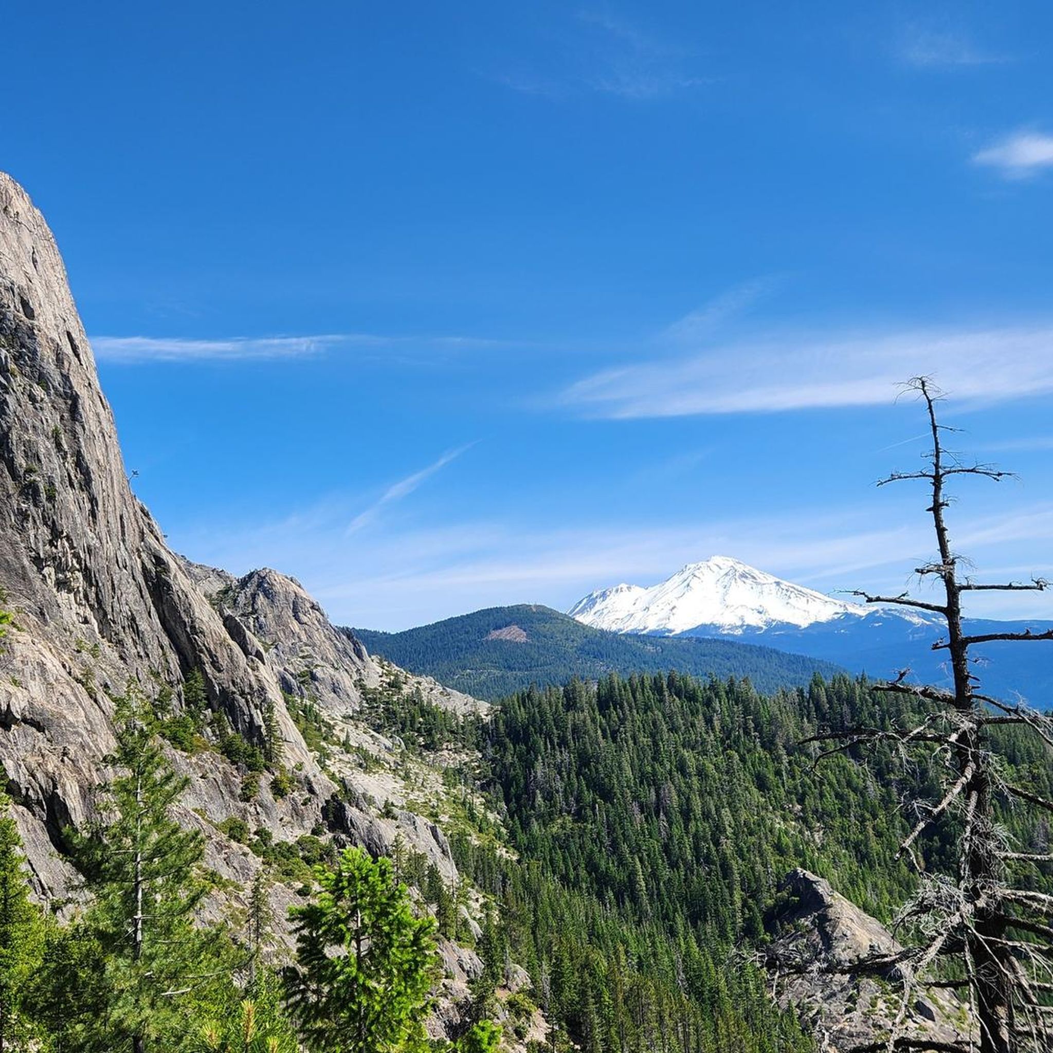
Embark on an easy hike along the Crags Trail to Castle Dome, a route that takes you through serene pine forests before revealing spectacular panoramic views. This trail covers 2.8 miles (4.6 km) with no elevation gain, making it a straightforward option that you can complete in about 1 hour and 33 minutes. As you hike, you will see the dramatic granite spires and domes of the Castle Crags, including the prominent Castle Dome itself, and catch glimpses of Mount Shasta in the distance.
To begin your adventure, the trailhead is conveniently located right off Interstate 5, ensuring easy access for a day trip. While the route is rated easy, it is always a good idea to carry plenty of water, especially if you are hiking during warmer months. There are no specific permits or fees mentioned for this trail, allowing for a spontaneous outing.
This trail offers a unique experience, often compared to a

4
hikers
19.9km
07:22
1,700m
570m
Embark on the Four Lakes and Siligo Peak Loop, a challenging hike through the Trinity Alps Wilderness. This difficult 12.3-mile (19.9 km) route demands a significant effort, climbing 5583 feet (1702 metres) over an estimated 7 hours and 22 minutes. As you traverse diverse alpine terrain, you will encounter four distinct lakes: Deer, Summit, Diamond, and Luella, each set within its own natural basin. The trail offers continuous, sweeping vistas of the surrounding Trinity Alps, culminating in panoramic views from Siligo Peak where you might even spot Mount Shasta on a clear day.
Given its substantial distance and elevation gain, many hikers choose to complete this loop as a multi-day backpacking trip. If you plan to stay overnight, remember that self-issued permits are required, so make sure to secure one before you begin. Be aware that the higher elevations along the route can lead to a shorter access window later in the season, so plan your visit accordingly to avoid early snow or difficult conditions.
This loop is celebrated for its remarkable concentration of natural features and viewpoints, making it a standout experience in the region. The journey through the Trinity Alps reveals a rich tapestry of alpine ecosystems, from the serene lake shores to the rugged peaks. It is a prime example of the wilderness's raw beauty, offering a deep immersion into a pristine mountain environment.
4
hikers
758m
00:13
0m
40m
The Middle Falls of the McCloud River Trail offers an easy hike through a lush forest canopy, where Douglas-fir and ponderosa pine provide ample shade. You will follow the constant sound of the spring-fed McCloud River, leading you directly to the impressive Middle McCloud Falls. This short route is only 0.5 miles (0.8 km) long with no elevation gain, making it an easy 12-minute walk perfect for a quick natural escape.
Planning your visit to the Middle Falls is straightforward, as individual parking lots are available right at the waterfall. You will find convenient facilities on site, including picnic tables for a relaxing break and vault toilets. Pets are welcome to join you on this trail, provided they are kept on a leash, making it a great option for families and dog owners.
The highlight of this trail is the spectacular Middle McCloud Falls, which cascades approximately 50 feet high and spans 80-100 feet wide over a broad basalt ledge. As you observe the falls, you can also spot unique geological features like columnar basalt along the river, a clear testament to the area's volcanic history.
2
hikers
4.17km
01:28
330m
20m
Embark on the Burstarse Falls via Pacific Crest Trail, a moderate hiking route that covers 2.6 miles (4.2 km) with a significant elevation gain of 1073 feet (327 metres). You can expect to complete this journey in about 1 hour and 28 minutes. The trail begins with a strenuous climb on the Dog Trail, offering expansive views of the Trinity Alps before connecting you to the renowned Pacific Crest Trail, winding through a diverse mixed forest.
When planning your visit, be aware that the initial Dog Trail section is dog-friendly, allowing you to bypass areas where pets are restricted. To reach the impressive 50-foot Burstarse Falls, you will need to navigate faint use-trails along Burstarse Creek, which can be slippery and may require some scrambling. The best time to experience the falls at their peak is during waterfall season, even if higher elevations still have snow.
This route is nestled within the Shasta-Trinity National Forest and is particularly notable for its dramatic waterfall, which plunges from a granite drainage. As you approach the falls, you will also be treated to increasingly prominent views of the striking granite spires of the Castle Crags, adding to the unique geological appeal of this area.
Get access to more routes and recommendations from other explorers.
Already have an account?
Our route recommendations are based on thousands of hikes, rides, and runs completed by other people on komoot.
Start today with a free account
Your next adventure awaits.
Popular around Shasta-Trinity National Forest



Other adventures in Shasta-Trinity National Forest


Tips from the Community

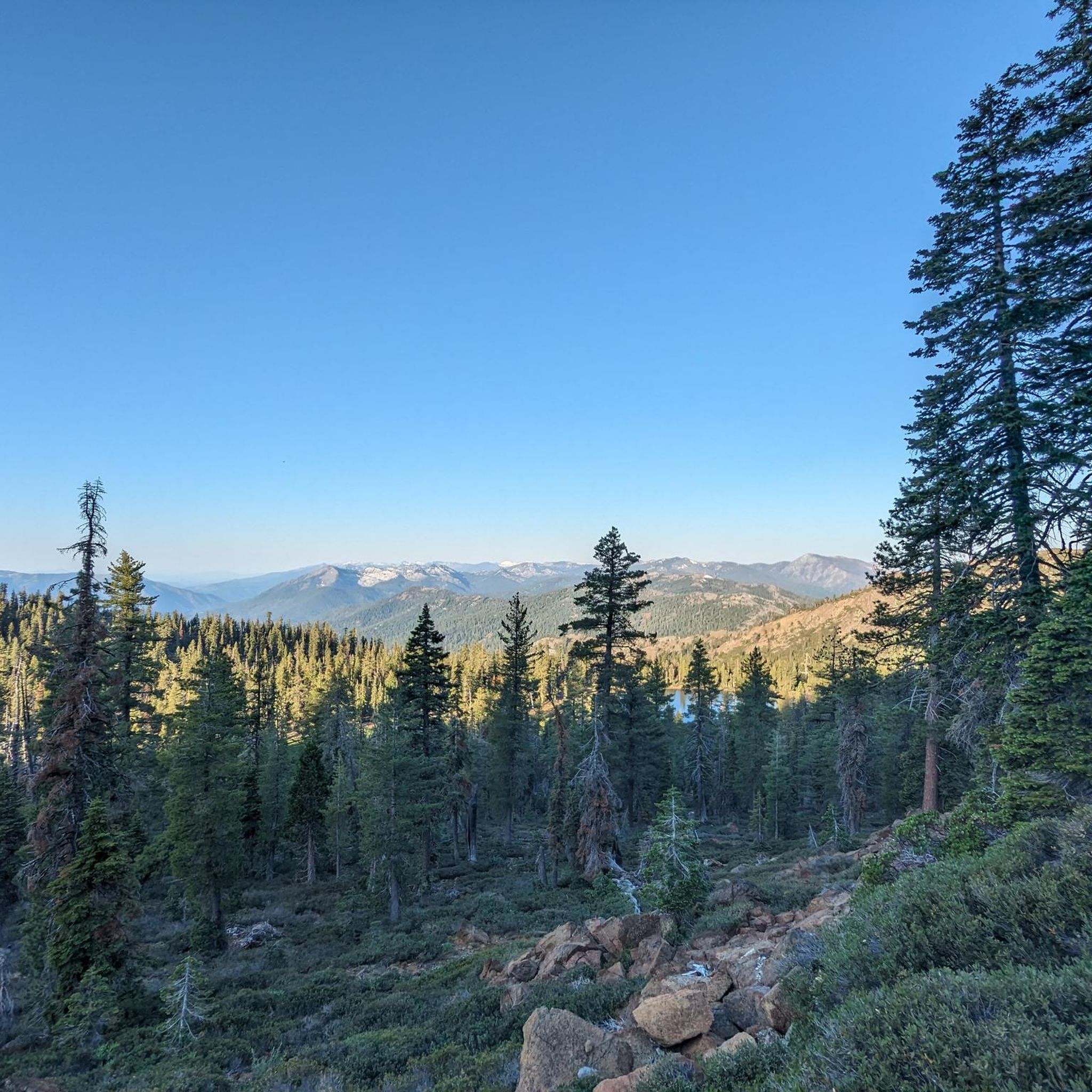
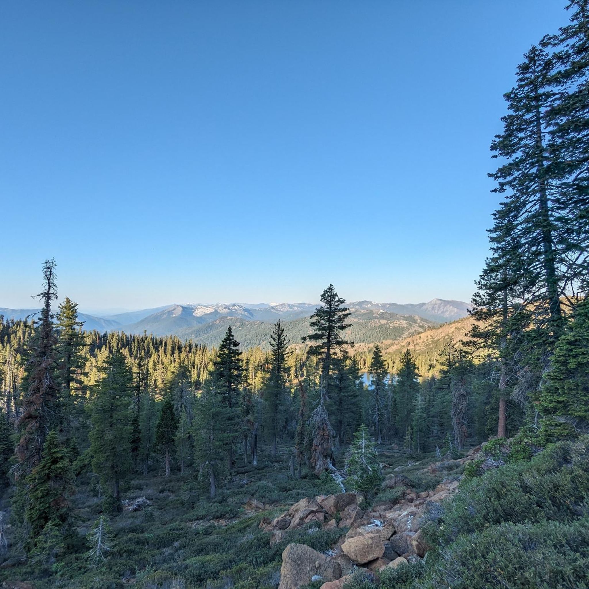
This is the smallest of the alpine lakes on the Four Lakes Loop. From here you get views of the upper Stuart Fork Valley toward Morris Meadow.
0
0
This is the largest of the four beautiful alpine lakes beneath Siligo Peak. The route to the summit picks up near where the trail from Summit Lake rejoins the Four Lakes Loop.
0
0
Looking back out on the valley, the mountains are a staggering two-tone of orange and white rock.
0
0

While this is the ultimate gateway to Mount Shasta's winter activities, it is also widely used in the summer since it serves as a starting point for five of the nine hiking trails on Mount Shasta. It provides access to Horse Camp, Hidden Valley, and Green Butte Ridge.
1
0
One of the hidden gems of the Castle Crags, accidentally skipped by many who are hiking the PCT. To reach them you will need to scramble a bit following the stream upwards from the PCT. You will first encounter a "smaller" 25 feet fall but if you continue scrambling along the faint trail, you will reach the gorgeous 50-foot free fall.
0
0

This almost flat area is about half-way up the slope to Helen Lake. Some hikers prefer to camp here rather than at Helen Lake if it's busy or very cold. It makes the summit day a little longer, but it reduces the distance hiking uphill with a heavy load.
1
0

The end of the Crags Trail is marked by a sign on a tree, but you probably won't notice because you will be too busy marveling at the granite spires and views of Mt Shasta. Take time to explore the top as there is much to see here but watch for steep dropoffs.
0
0
Frequently Asked Questions
What types of hiking trails can I expect in Shasta-Trinity National Forest?
Shasta-Trinity National Forest offers a wide variety of hiking experiences, ranging from easy walks along rivers to challenging ascents to alpine lakes. The terrain is diverse, featuring dense forests, numerous lakes, and significant elevation changes. You'll find paths leading through wooded areas, past impressive waterfalls, and to scenic viewpoints.
How many hiking routes are available in Shasta-Trinity National Forest?
There are over 35 hiking routes available in Shasta-Trinity National Forest, catering to various skill levels. This includes 4 easy routes, 18 moderate routes, and 14 difficult routes, ensuring options for everyone from casual walkers to experienced trekkers.
Are there any family-friendly hiking trails in Shasta-Trinity National Forest?
Yes, Shasta-Trinity National Forest has several easy trails suitable for families. An excellent option is the McCloud Waterfalls Trail, which is 3.9 miles (6.2 km) long and features multiple waterfalls along the river, making it an engaging walk for all ages.
Can I bring my dog on the hiking trails in Shasta-Trinity National Forest?
While many trails in Shasta-Trinity National Forest are dog-friendly, it's always best to check specific trail regulations before heading out. Generally, dogs are welcome on leash, but some wilderness areas or sensitive habitats may have restrictions. Always practice Leave No Trace principles and clean up after your pet.
What are some notable natural features or landmarks to see while hiking?
Shasta-Trinity National Forest is rich in natural beauty. You can explore stunning waterfalls like Middle McCloud Falls and Faery Falls. For those seeking panoramic views, the region also boasts impressive peaks such as Mt Shasta summit and Black Butte Summit.
Are there any trails that lead to lakes or offer water features?
Absolutely. The forest is known for its numerous lakes and rivers. The Castle Lake Trail ascends to a beautiful alpine lake, offering a rewarding destination. Additionally, the Canyon Creek Lakes Trail — Trinity Alps Wilderness leads past multiple pristine lakes within a rugged wilderness setting.
What is the best time of year to go hiking in Shasta-Trinity National Forest?
The best time to hike in Shasta-Trinity National Forest generally depends on the elevation and specific trail. Lower elevation trails are often accessible from spring through fall. For higher elevation trails and alpine areas, late spring to early fall (June to October) typically offers the most favorable conditions, with less snow and milder temperatures.
Do I need a permit for hiking in Shasta-Trinity National Forest?
Most day hikes in Shasta-Trinity National Forest do not require a permit. However, some wilderness areas, overnight trips, or specific activities might require permits. It's always advisable to check with the local ranger station for the most current regulations regarding permits and any fire restrictions before your visit.
What do other hikers say about the trails in Shasta-Trinity National Forest?
The trails in Shasta-Trinity National Forest are highly rated by the komoot community, with an average score of 4.7 stars from over 30 reviews. Hikers often praise the diverse scenery, the impressive waterfalls, and the sense of wilderness found on many routes. Over 600 hikers have used komoot to explore the varied terrain here.
Are there any challenging trails for experienced hikers?
Yes, for experienced hikers seeking a challenge, Shasta-Trinity National Forest offers several difficult routes. The Castle Lake Trail involves a significant ascent to an alpine lake, while the Canyon Creek Lakes Trail — Trinity Alps Wilderness is a longer, strenuous trek through a remote wilderness area.
Where can I find parking for trailheads in Shasta-Trinity National Forest?
Most popular trailheads in Shasta-Trinity National Forest have designated parking areas. These can range from paved lots to gravel pull-offs. It's recommended to arrive early during peak seasons to secure a spot, especially for well-known trails. Always check specific trail information for details on parking availability and any potential fees.
Are there any trails with significant elevation gain for a good workout?
Yes, many trails in Shasta-Trinity National Forest offer substantial elevation gain. For instance, the Castle Lake Trail features over 200 meters of ascent in just 3 miles, providing a challenging climb to a scenic reward. The Canyon Creek Lakes Trail — Trinity Alps Wilderness involves over 845 meters of elevation gain over its 15.5-mile length.
Most popular routes in Shasta-Trinity National Forest
Most popular attractions in Shasta-Trinity National Forest

Get inspired with the komoot mobile app


Explore more
Browse the best Hikes in other regions.
