The best walks and hikes in Nebraska National Forest
4.7
(63)
627
hikers
35
hikes
Hiking in Nebraska National Forest offers diverse landscapes across its nearly 1.1 million acres, encompassing national forests and grasslands. The region features the Pine Ridge area with its sharp ridges, steep canyons, and sandstone buttes, alongside the unique Sandhills prairie ecosystem characterized by rolling, grass-covered sand dunes. Hikers can also explore the "otherworldly" desert landscape of Toadstool Geologic Park, known for its mushroom-shaped hoodoos. This varied terrain provides a range of experiences from Ponderosa pine forests to expansive grasslands.
Best hiking trails in Nebraska National Forest
- The most popular hiking route is Blackhills Overlook Trail — Chadron State Park, a 3.9 miles (6.2 km) trail that takes 1 hour 44 minutes to complete. This easy route provides expansive views of the surrounding Pine Ridge and grasslands.
- Another top favourite among local hikers is Toadstool, High Plains, and Bison loop — Oglala National Grassland, a moderate 5.1 miles (8.2 km) path. This trail leads through an "otherworldly" desert landscape filled with mushroom-shaped hoodoos.
- Local hikers also love the Soldier Creek loop — Soldier Creek Wilderness, a 10.1 miles (16.3 km) trail leading through a federally designated wilderness area, often completed in about 4 hours 25 minutes.
- Hiking in Nebraska National Forest is defined by unique Sandhills prairie, dramatic sandstone buttes, and Ponderosa pine forests. The network offers options for different ability levels, from easy walks to more rugged experiences.
- The routes in Nebraska National Forest are highly rated by the komoot community with an average score of 4.7 stars from over 60 reviews. More than 700 hikers have used komoot to explore Nebraska National Forest's varied terrain.
Last updated: June 25, 2026
5.0
(1)
1
hikers
2.78km
00:43
20m
0m
Embark on the Great Plains Trail for an easy hike through the unique badlands and buttes of Toadstool Geological Park. This 1.7-mile (2.8 km) loop offers a distinctive landscape, often described as moon-like, with its unusual rock formations sculpted by natural erosion. You will gain a gentle 80 feet (24 metres) in elevation, making it a perfect route for a quick outdoor escape. Expect to spend around 43 minutes exploring these fascinating geological features, providing a pleasant experience for all skill levels.
Planning your visit to the Great Plains Trail is straightforward, as the route is easily accessible within Toadstool Geological Park. You will find parking generally available either at the main park entrance or conveniently close to the campground, making your start simple. Before heading out, it's always a good idea to check local park information for any specific access details. This includes looking into potential seasonal considerations that might affect your trip, ensuring a smooth and enjoyable hike.
The Great Plains Trail stands out for its remarkable geological setting, showcasing the unique badlands and buttes that are characteristic of Toadstool Geological Park. The landscape here is truly special, with its unusual rock formations shaped over time by erosion, creating a terrain often compared to a moonscape. This area is considered a hidden gem for nature lovers, offering a chance to witness fascinating geological features up close.
11.8km
03:07
150m
30m
Embark on the Sheep Mountain Table Road, a moderate hiking route that guides you through a unique and remote section of Badlands National Park. Over 7.3 miles (11.8 km), you will ascend 483 feet (147 metres) in elevation, typically completing the journey in about 3 hours and 6 minutes. The trail offers expansive panoramic views of the Badlands' signature eroded cliffs, deep canyons, and multi-colored rock formations from an elevated plateau, providing a distinct visual experience compared to other areas of the park.
When planning your visit, be aware that while the initial stretch is a wide gravel road, the path becomes rougher and unpaved as you climb the table. You might encounter ruts and washouts, making the terrain more challenging. The National Park Service suggests parking at an overlook on top of the table and hiking the final 2.5 miles to its end. Consider your vehicle's clearance carefully, as a high-clearance vehicle is recommended for accessing certain parts of the road.
This route stands out for its authentic backcountry feel and the sweeping vistas of surrounding grasslands that complement the Badlands' dramatic geology. The elevated plateau provides a vantage point unlike any other in the park, allowing you to appreciate the vastness and distinct character of this southwestern edge. It's an ideal choice if you are seeking a less-traveled path with remarkable natural scenery.

Sign up for free
2
hikers
8.22km
02:11
80m
80m
Hike the Toadstool, High Plains, and Bison loop in Oglala National Grassland to explore unique toadstool formations and vast badlands.
4.5
(2)
3
hikers
6.24km
01:44
120m
120m
Hike the easy 3.9-mile Blackhills Overlook Trail in Chadron State Park, offering Pine Ridge views and chalk bluffs.
4.0
(1)
1
hikers
9.24km
01:57
90m
90m
Hike the easy 5.7-mile Scott Lookout National Recreation Trail through the unique man-made Nebraska National Forest to the historic Scott Lo
Get access to more routes and recommendations from other explorers.
Sign up for free
Already have an account?
Our route recommendations are based on thousands of hikes, rides, and runs completed by other people on komoot.
Start today with a free account
Your next adventure awaits.
Login or Signup
Popular around Nebraska National Forest
Tips from the Community

From here you can make your way to Cedar Butte. There are no official trails in the southern section of Badlands National Park but you can find your way along by following in other's footsteps. Just be careful as the landscape changes rapidly and what worked for the last hiker may not work for you.
0
0

The campground has six sites with fire pits, picnic tables, and restrooms, but no drinking water. There are three main trails you can walk from here, including a 3 mile hike to the Hudson-Meng Education and Research Center. The Toadstool Trail has informational kiosks, and you can download a brochure from the forest service website. You may have to pay a $3 entry fee for day use.
0
0
As you follow the trail along the river bed between the Toadstool Trail and Orella Road (Forest Road 918), the path may become muddy and the trail signposts will disappear. Keep going! The trail is well worth it and provides a great deal of variety from the other trails in the grassland.
0
0
As you follow Orella Road (Forest Road 918) to connect the Bison Trail and trail along the river bed, at the point where you will summit the road you will find 360 degree views of the grasslands and buttes.
0
0
From the campground trailhead you can hike up the the Blackhills Overlook, Outrider Trailhead off the highway to the north, or south into Chadron State Park.
0
0
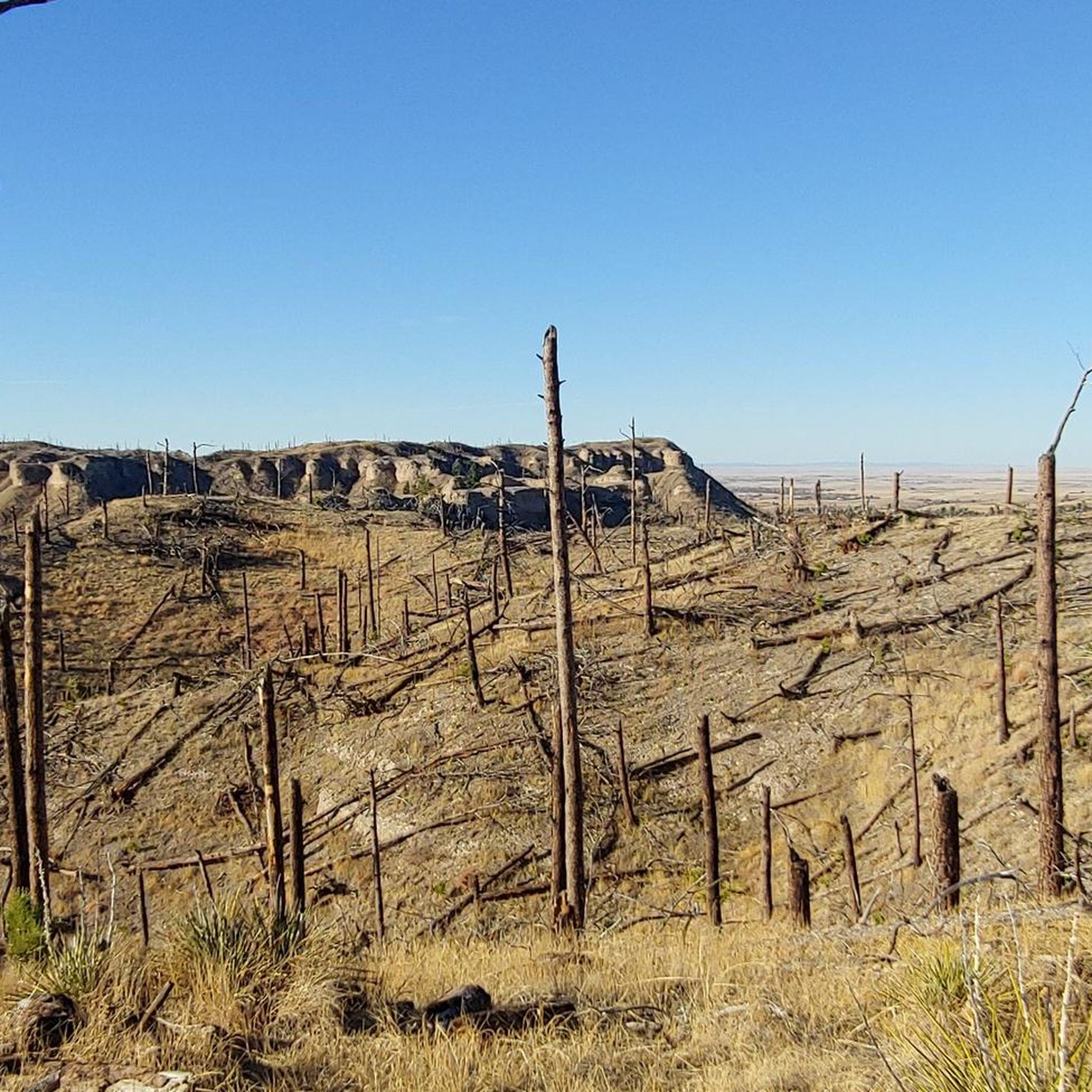
From the overlook you can see Pine Ridge, Chadron State Park, and the Black Hills. You can also see the effects of the 1973 Dead Horse Fire and a more recent fore from 2012. Part of the region was replanted in 2018.
0
0
The Halsey portion of Nebraska National Forest is the largest hand-planted forest in the world. It is surrounded by the Nebraska Sandhills, one of the largest remaining contiguous prairies and a refuge for many different types of wildlife. The Scott Lookout Lower is the most popular hike, but you will also find many miles of OHV / ATV trails.
0
0
The lookout tower was renovated in 2011. After ascending the steps you will get a view of the nearby forest and grasslands. Google maps currently lists the tower as "permanently closed" — the tower is, in fact, open. The national forest website has updates on openings and closures.
0
0
Frequently Asked Questions
How many hiking trails are available in Nebraska National Forest?
Nebraska National Forest offers around 30 hiking routes, catering to various skill levels. You'll find a good mix of easy, moderate, and a few more challenging trails to explore across its diverse landscapes.
What kind of terrain can I expect when hiking in Nebraska National Forest?
The terrain is incredibly diverse. You can hike through the unique Sandhills prairie with its rolling, grass-covered dunes, experience the sharp ridges, steep canyons, and Ponderosa pine forests of the Pine Ridge region, or explore the 'otherworldly' badlands formations at Toadstool Geologic Park.
Are there any easy hiking trails suitable for beginners or families?
Yes, there are plenty of easy options. For expansive views of the Pine Ridge and grasslands, consider the Blackhills Overlook Trail — Chadron State Park. Another accessible choice is the Scott Lookout National Recreation Trail — Nebraska State Forest, Halsey, which offers a pleasant walk through the unique Sandhills landscape.
What are some notable natural features or landmarks to see while hiking?
You can explore the distinctive mushroom-shaped hoodoos at Toadstool Geologic Park, where you might even spot ancient fossils. The Pine Ridge region offers dramatic sandstone buttes and views, including from the Black Hills Overlook. The Scenic (partly ghost town) is also a unique point of interest nearby.
Are there any loop trails in Nebraska National Forest?
Yes, loop trails are available. A popular moderate option is the Toadstool, High Plains, and Bison loop — Oglala National Grassland, which takes you through the unique badlands formations. For a longer, more rugged experience, the Soldier Creek loop — Soldier Creek Wilderness is another excellent choice.
What do other hikers enjoy most about hiking in Nebraska National Forest?
The area is highly rated by the komoot community, with an average score of 4.7 stars from over 60 reviews. Hikers often praise the unique and diverse landscapes, from the Sandhills to the Pine Ridge, and the opportunity to explore geological wonders like Toadstool Geologic Park.
Are there any specific areas for wildlife viewing?
Yes, the diverse ecosystems of Nebraska National Forest provide opportunities for wildlife viewing. Areas like Limestone Butte are known for this. The Oglala National Grassland, particularly around the Toadstool area, is also home to prairie dogs, and you might spot bison on the Toadstool, High Plains, and Bison loop.
Can I find trails that offer scenic viewpoints?
Absolutely. The Pine Ridge region is known for its dramatic views. The Blackhills Overlook Trail — Chadron State Park provides expansive vistas of the surrounding Pine Ridge, grasslands, and even the distant Black Hills of South Dakota.
What is the best time of year to go hiking in Nebraska National Forest?
While specific seasonal weather can vary, spring and fall generally offer the most pleasant hiking conditions with milder temperatures and beautiful scenery. Summer can be warm, especially in exposed areas like the badlands, while winter hiking is possible but requires preparation for colder conditions.
Are there any facilities or campgrounds available near the trails?
Yes, there are facilities available. For instance, the Toadstool Geological Park Campground offers a place to stay near the unique geological formations and trails in that area.
Are there any challenging hikes for experienced hikers?
Yes, for those seeking a more rugged experience, the federally designated Soldier Creek Wilderness offers challenging trails. The Soldier Creek loop — Soldier Creek Wilderness is a moderate to challenging 10.1-mile route that takes you through this unique area.
Most popular routes in Nebraska National Forest
Most popular attractions in Nebraska National Forest

Get inspired with the komoot mobile app


Explore more
Browse the best Hikes in other regions.
