The best MTB trails in Sierra De San Miguelito
4.7
(19)
89
riders
9
rides
Mountain biking in Sierra De San Miguelito offers diverse landscapes within a protected natural area in San Luis Potosí. The region is characterized by temperate pine and oak forests, alongside xerophilous scrubland, providing varied terrain for mountain bike routes. Riders can expect dirt roads, flowing paths, and sections with natural obstacles like stones and roots, often featuring significant elevation changes. Natural viewpoints and intriguing rock formations add to the scenic appeal of the trails.
Best mountain bike trails in Sierra…
Last updated: July 7, 2026
4.0
(2)
8
riders
8.80km
00:32
60m
60m
Easy mountain bike ride. Great for any fitness level. Suitable for all skill levels.
5
riders
Moderate mountain bike ride. Good fitness required. Advanced riding skills necessary.

Sign up for free
6
riders
Moderate mountain bike ride. Good fitness required. Advanced riding skills necessary.
5.0
(5)
18
riders
12.9km
00:50
90m
90m
Easy mountain bike ride. Great for any fitness level. Suitable for all skill levels.
5.0
(4)
22
riders
32.3km
02:24
380m
380m
Moderate mountain bike ride. Good fitness required. Advanced riding skills necessary.
Get access to more routes and recommendations from other explorers.
Sign up for free
Already have an account?
Our route recommendations are based on thousands of hikes, rides, and runs completed by other people on komoot.
Start today with a free account
Your next adventure awaits.
Login or Signup
Popular around Sierra De San Miguelito

Tips from the Community

sanctuary of determination towards Escalerillas
0
0
Frequently Asked Questions
How many mountain bike trails are available in Sierra De San Miguelito?
Sierra De San Miguelito offers a good selection of mountain bike trails, with 9 routes currently available on komoot. These range in difficulty from easy to moderate, catering to various skill levels.
What kind of terrain can I expect on mountain bike trails in Sierra De San Miguelito?
You can expect diverse terrain, including dirt roads, flowing paths, and sections with natural obstacles like stones and roots. The trails often traverse temperate pine and oak forests, as well as xerophilous scrubland, providing varied landscapes and significant elevation changes.
Are there any easy mountain bike trails suitable for beginners or families?
Yes, there are several easy trails. A great option for a more relaxed ride is the Rapas God loop from Parque Tangamanga. This 8.8 km (5.5 miles) route offers flowing paths through varied vegetation with minimal elevation gain, making it suitable for beginners or a family outing.
Are there mountain bike trails with scenic viewpoints in Sierra De San Miguelito?
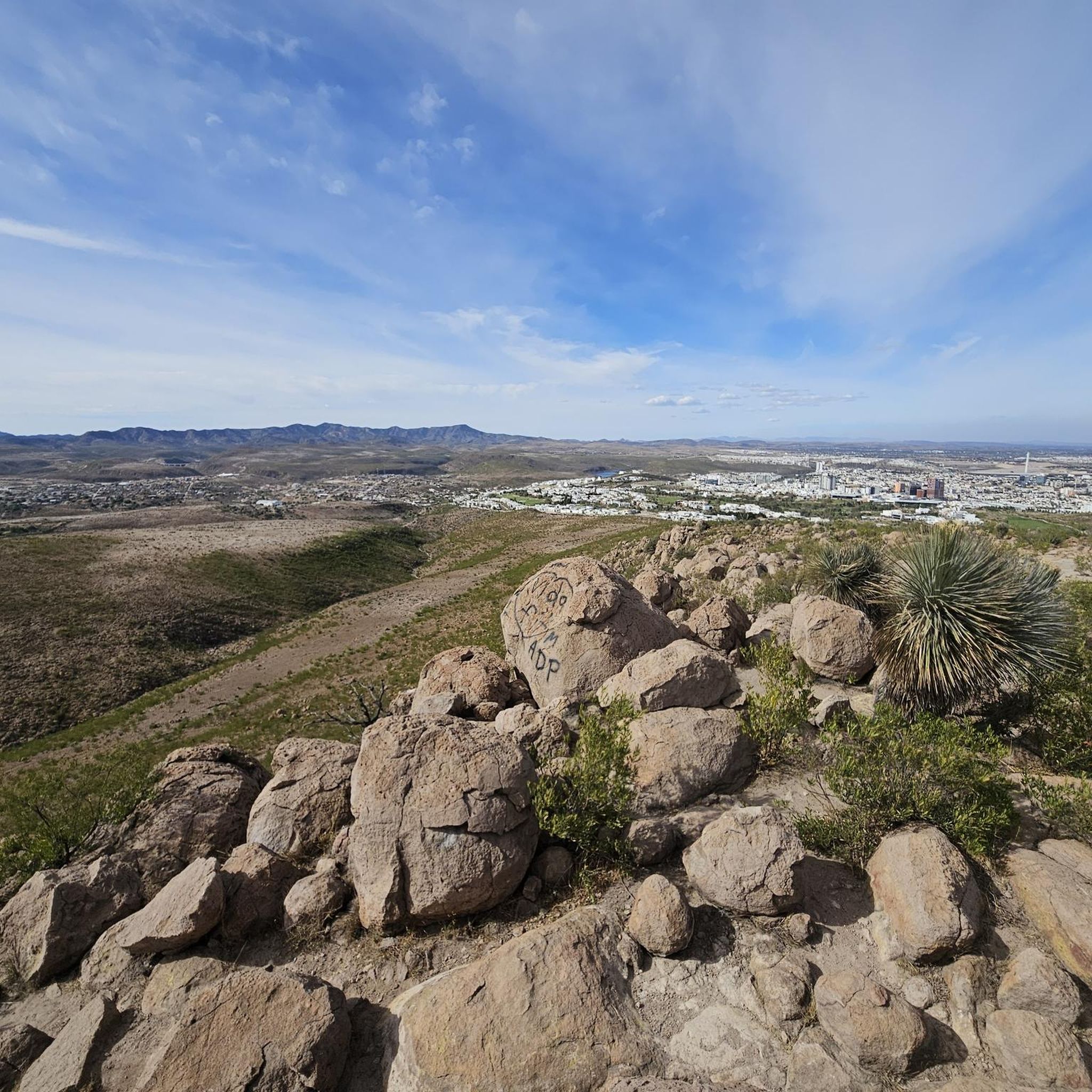
Absolutely. The Sierra de San Miguelito is known for its natural viewpoints and intriguing rock formations. Many trails offer picturesque scenery, allowing you to enjoy panoramic views of the diverse landscapes, including forests and scrubland. For example, the Presa San Antonio – Presa San Carlos loop offers panoramic views as it traverses dirt roads with significant elevation changes.
What is the best time of year for mountain biking in Sierra De San Miguelito?
While the region can be enjoyed year-round, the best time for mountain biking in Sierra De San Miguelito generally depends on local weather patterns. It's advisable to check the forecast for comfortable temperatures and dry conditions, as some trails may become challenging after heavy rains. The varied vegetation, including pine and oak forests, provides shade, making it pleasant even on warmer days.
Can I bring my dog on the mountain bike trails in Sierra De San Miguelito?
Sierra de San Miguelito is a protected natural area. While many outdoor activities are encouraged, specific regulations regarding dogs on trails can vary. It's always best to check with local authorities or park management for the most current rules on bringing pets to ensure compliance with conservation efforts and the safety of wildlife.
Are there any circular mountain bike routes in Sierra De San Miguelito?
Yes, many of the mountain bike routes in Sierra De San Miguelito are designed as loops, offering a convenient way to explore the area without retracing your steps. An example is the Rapas God loop from Instituto Tecnológico de Estudios Superiores de Monterrey, which is a longer moderate route leading through diverse forests and open scrubland.
What do other mountain bikers enjoy most about mountain biking in Sierra De San Miguelito?
The komoot community highly rates the mountain biking experience in Sierra De San Miguelito, with an average score of 4.7 stars from over 18 reviews. Riders often praise the diverse landscapes, the mix of flowing paths and challenging sections, and the natural beauty of the pine and oak forests and xerophilous scrubland.
Are there any natural attractions or landmarks to see along the mountain bike trails?
The Sierra de San Miguelito is rich in natural features. Beyond the scenic viewpoints and rock formations, the area is known for its hydrological importance, with an extensive network of intermittent streams. You might also encounter natural wonders like the Cueva de Briones, a cave with a perennial spring, or the La Cantera Dam and its associated waterfall, which are notable natural attractions within the range.
What are the typical distances and durations for mountain bike trails in this region?
Trail distances vary significantly, from shorter loops like the Rapas God loop from Parque Tangamanga at 8.8 km (5.5 miles) taking about 30 minutes, to longer, more challenging routes such as the Loma Capulines – View of Presa San José loop from Monte Oscuro, which is 32.3 km (20.1 miles) and can take over 2 hours.
Is parking or public transport available near the mountain bike trailheads?
The city of San Luis Potosí is practically on the periphery of some parts of the protected area, making it relatively accessible. While specific parking details for each trailhead may vary, access points are generally manageable. For public transport, you would likely need to research local bus routes or taxi services from San Luis Potosí to get closer to the trail starting points.
Most popular routes in Sierra De San Miguelito

Get inspired with the komoot mobile app


