The best road cycling routes in Nevado De Toluca
91
riders
5
rides
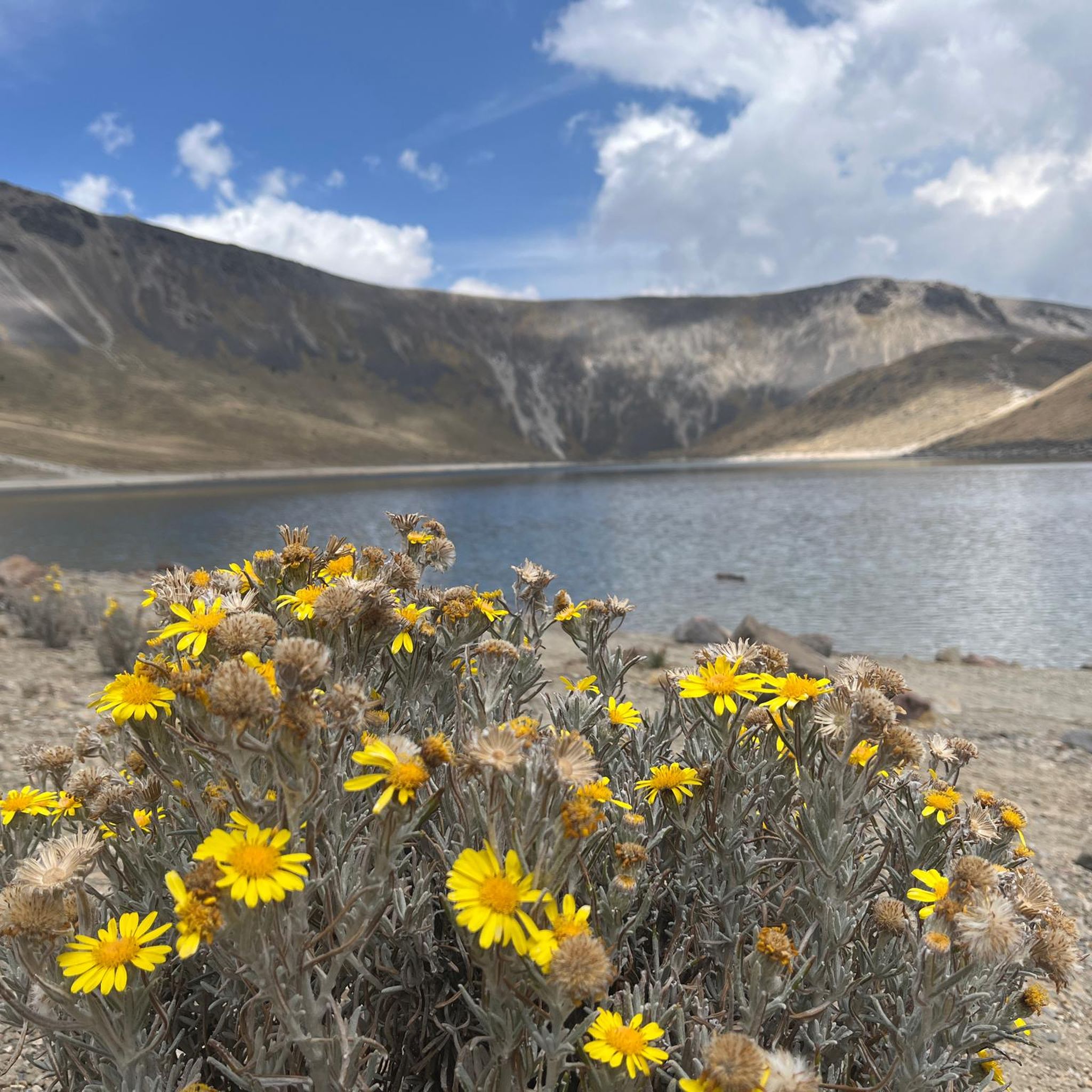
Road cycling in Nevado De Toluca is characterized by its high-altitude volcanic landscapes and challenging terrain. The region features the Xinantécatl volcano, Mexico's fourth-highest peak, surrounded by impressive rocky formations and diverse ecosystems. Fir and pine forests at lower elevations transition to expansive alpine meadows higher up, presenting significant elevation gains for cyclists. The high altitude means even moderate grades can be challenging due to thinner air.
Best road cycling routes in Nevado De Toluca
- The most popular road cycling route is El Mapa loop from San Juan de las Huertas, a 79.8 miles (128.4 km) trail that takes 7 hours 38 minutes to complete. This difficult route features significant elevation gain through volcanic landscapes.
- Another top favourite among local road cyclists is Joquicingo de León Guzmán loop from Tenango de Arista, a difficult 43.7 miles (70.4 km) path. This route offers challenging climbs through diverse ecosystems.
- Local road cyclists also love the El Mapa loop from Mesa de Jaimes, an 83.4 miles (134.2 km) trail leading through high-altitude terrain, often completed in about 7 hours 31 minutes.
- Road cycling in Nevado De Toluca is defined by volcanic peaks, high-altitude ascents, and fir and pine forests. The network offers options for various fitness levels, though many routes present significant challenges.
- The guide includes highly-rated routes that showcase the best of the region's landscape. More than 90 road cyclists have used komoot to explore Nevado De Toluca's varied terrain.
Last updated: May 20, 2026
15
riders
128km
07:38
2,980m
2,980m
Hard road ride. Very good fitness required. Mostly well-paved surfaces and easy to ride.
9
riders
70.4km
03:45
1,360m
1,360m
Hard road ride. Very good fitness required. Mostly well-paved surfaces and easy to ride.

Sign up for free
58
riders
134km
07:31
3,040m
3,040m
Hard road ride. Very good fitness required. Mostly well-paved surfaces and easy to ride.
7
riders
94.2km
05:25
2,240m
2,240m
Hard road ride. Very good fitness required. Mostly well-paved surfaces and easy to ride.
2
riders
130km
07:15
2,630m
2,630m
Hard road ride. Very good fitness required. Mostly well-paved surfaces and easy to ride.
Our route recommendations are based on thousands of hikes, rides, and runs completed by other people on komoot.
Start today with a free account
Your next adventure awaits.
Login or Signup
Popular around Nevado De Toluca
Tips from the Community

Frequently Asked Questions
How challenging are the road cycling routes in Nevado de Toluca?
Road cycling in Nevado de Toluca is known for its significant challenge due to high-altitude volcanic landscapes and considerable elevation gains. All routes listed in this guide are rated as difficult, requiring good to very good fitness. Even moderate grades can feel strenuous because of the thinner air at these elevations.
What kind of elevation gain can I expect on these routes?
The routes in Nevado de Toluca feature substantial elevation gains. For example, the El Mapa loop from San Juan de las Huertas involves an ascent of nearly 3,000 meters, while the El Mapa loop from Mesa de Jaimes (the longer version) has over 3,000 meters of climbing. Prepare for demanding ascents throughout the region.
Are the road cycling routes fully paved?
While many routes start on paved roads, especially the initial 20 kilometers from Toluca, the final 14 kilometers leading to the volcano's crater are dirt roads. Cyclists should be prepared for varied terrain, including both paved and unpaved sections, particularly when heading towards higher elevations.
When is the best time of year for road cycling in Nevado de Toluca?
The region transitions through diverse ecosystems, and during winter months, the peaks become snow-capped. For road cycling, it's generally best to visit outside of peak winter to avoid snow and ice, which can make higher elevation roads impassable or extremely challenging. Always check local weather conditions before planning your ride.
What landmarks or viewpoints can I see along the road cycling routes?
Nevado de Toluca offers breathtaking natural and man-made landmarks. You can aim for the Nevado de Toluca Summit for panoramic views, or explore the unique Mosaic Map of Estado de México. The stunning crater lakes, Laguna del Sol and Laguna de la Luna, are also significant natural features within the volcano's crater.
Are there any family-friendly or beginner road cycling options?
Given the high altitude, significant elevation gains, and the fact that all routes in this guide are rated as difficult, Nevado de Toluca is generally not recommended for beginner road cyclists or young families seeking easy rides. The terrain and thin air present a considerable challenge.
Can I bring my dog on the road cycling routes?
While the region is popular for outdoor activities, specific regulations regarding dogs on road cycling routes, especially within the national park, can vary. It's advisable to check with local park authorities for the most current rules on pet access to ensure a smooth trip.
Where can I find parking near the road cycling routes?
Parking is available at various access points to the Nevado de Toluca National Park. The top parking area is located at 4,135 meters, offering a starting point for rides towards the crater. Specific parking availability can vary, so it's good to plan your starting point in advance.
What do other road cyclists enjoy most about road cycling in Nevado de Toluca?
Road cyclists frequently praise the region's unique high-altitude volcanic landscapes and the rewarding challenge of the climbs. The diverse ecosystems, from fir and pine forests to alpine meadows, and the stunning views of the crater lakes, make for a memorable and physically demanding experience.
Are there any cafes or accommodation options near the road cycling routes?
While the immediate high-altitude areas are more remote, you can find cafes, restaurants, and accommodation in the towns and villages surrounding the Nevado de Toluca National Park, such as Toluca or Tenango de Arista. These serve as good bases for exploring the cycling routes.
What is the highest point I can reach by road bike in Nevado de Toluca?
The paved road ascends for 21 kilometers from the main entrance (Las Raíces) towards the volcano's summit. While the final 14 kilometers to the crater are dirt roads, the top parking area is at 4,135 meters, offering access to very high elevations for road cyclists.
Are there any circular road cycling routes available?
Yes, many of the popular routes in Nevado de Toluca are circular. Examples include the Joquicingo de León Guzmán loop from Tenango de Arista and the Hacienda Pipiol – Santa María loop from Mesa de Jaimes, allowing you to start and end at the same point.
Most popular attractions in Nevado De Toluca

Get inspired with the komoot mobile app


Explore more
Browse the best Road cycling routes in other regions.
