The best road cycling routes around Keijärvi
4.3
(48)
1,669
riders
53
rides
Road cycling around Keijärvi, located in the Pirkanmaa region of Finland, features diverse landscapes with a mix of paved surfaces and varied elevation. The area is characterized by numerous lakes, including Keijärvi and Julkujärvi, and notable esker areas like Ylöjärvenharju. These natural features contribute to a range of road cycling experiences, from easier rides to more challenging routes with elevation gains.
Best road cycling routes around Keijärvi
- The most popular road cycling route is Pikku Lehmijärvi – Lemmakkalanjärvi loop from…
Last updated: May 21, 2026
5.0
(1)
13
riders
31.2km
01:19
220m
220m
Moderate road ride. Great for any fitness level. Some segments of this route may be unpaved and difficult to ride.
10
riders
37.4km
01:34
250m
250m
Moderate road ride. Great for any fitness level. Some segments of this route may be unpaved and difficult to ride.

Sign up for free
7
riders
62.9km
02:35
410m
410m
Moderate road ride. Good fitness required. Mostly well-paved surfaces and easy to ride.
4
riders
18.0km
00:51
120m
120m
Moderate road ride. Great for any fitness level. Some segments of this route may be unpaved and difficult to ride.
5.0
(1)
34
riders
Moderate road ride. Good fitness required. Some segments of this route may be unpaved and difficult to ride.
Get access to more routes and recommendations from other explorers.
Sign up for free
Already have an account?
Our route recommendations are based on thousands of hikes, rides, and runs completed by other people on komoot.
Start today with a free account
Your next adventure awaits.
Login or Signup


Tips from the Community

Hämeenkyrö is a Finnish municipality of about 10,300 inhabitants, located in the Pirkanmaa region. It is strategically located just 36 kilometers west of Tampere (about 30 minutes by car) along the national road 3. The municipality is known for its strong cultural identity, its natural landscapes, and its commitment to environmental sustainability.
0
0

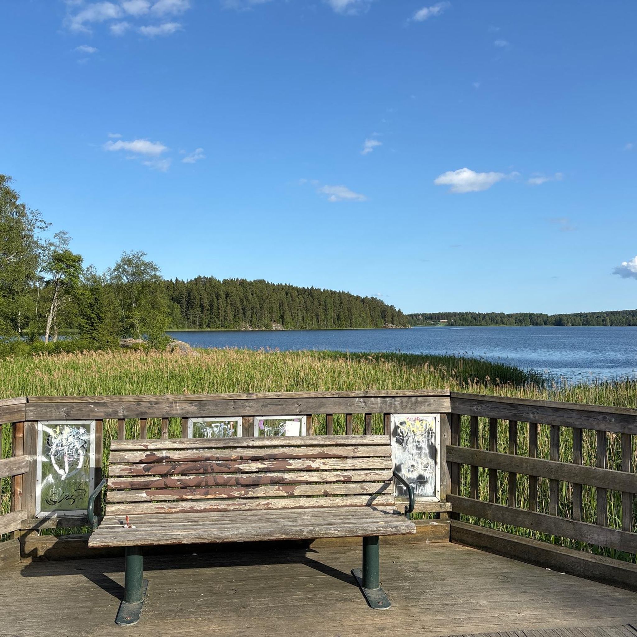
scenic road with views of Lake Vesijärvi from high above, not too busy, a descent followed by a climb in either direction (bonus trivia: half of the lap for the traditional road race Rosendahl GP)
0
0


Hämeenkyrö is a peaceful municipality in the Pirkanmaa region, about 36 km from Tampere. Known for its scenic landscapes of lakes, forests, and rolling countryside, it’s a great spot for outdoor activities. The area is also famous as the birthplace of Nobel Prize-winning author Frans Eemil Sillanpää. Though small, Hämeenkyrö offers a blend of natural beauty and cultural heritage.
0
0

Hämeenkyrö is a rural municipality located near the urban area, only 30 minutes west of Tampere.
1
0
okay bike path running alongside the motorway, great views of the lake
0
0

Beautiful wooden church built in 1850. Open during the summer 11-17.
0
0
Frequently Asked Questions
How many road cycling routes are available around Keijärvi?
The Keijärvi area offers a wide selection of road cycling routes, with over 50 tours available on komoot. These routes cater to various preferences, from easy rides to more challenging excursions.
What are the typical difficulty levels for road cycling routes in Keijärvi?
Road cycling routes around Keijärvi feature a range of difficulty levels. You'll find 12 easy routes, 40 moderate routes, and 3 difficult routes, ensuring options for all fitness levels. For example, the Pikku Lehmijärvi – Lemmakkalanjärvi loop from Ylöjärvi is a moderate route with diverse scenery and some elevation changes.
Are there any easy road cycling routes suitable for beginners or families?
Yes, Keijärvi offers several easy road cycling routes perfect for beginners or families. The View of the Forest loop from Hietasmäki is an easy 28.9-mile (46.5 km) trail through forested areas. The Ylöjärvi Church loop from Haavisto is also noted as an easier ride, great for any fitness level, with mostly paved surfaces.
What kind of landscapes and natural features can I expect to see while road cycling around Keijärvi?
Road cycling around Keijärvi offers diverse landscapes characterized by picturesque lakes like Keijärvi and Julkujärvi, notable esker areas such as Ylöjärvenharju, and extensive forests. You can also find scenic viewpoints and natural trails, providing a beautiful backdrop for your ride.
Are there road cycling routes with scenic lake views?
Absolutely! The region is known for its numerous lakes. The Bench With Lake View loop from Pukkisaari is a popular moderate route featuring scenic lake views and primarily paved surfaces. The Julkujärvi Lake – Scenic Road with Lake Views loop from Valkeekiven lehto also offers stunning vistas.
What is the best time of year for road cycling in Keijärvi?
The most popular months for cycling in the Pirkanmaa region, where Keijärvi is located, are July and August. During these months, the weather is generally favorable, making it ideal for exploring the area's road cycling routes.
Are there road cycling routes that form a loop?
Yes, many of the road cycling routes around Keijärvi are designed as loops, offering convenient starting and ending points. Examples include the Pikku Lehmijärvi – Lemmakkalanjärvi loop from Ylöjärvi and the Bench With Lake View loop from Pukkisaari.
What do other cyclists say about road cycling in Keijärvi?
The road cycling routes in Keijärvi are highly rated by the komoot community, with an average score of 4.3 stars from over 50 reviews. Cyclists often praise the varied terrain, picturesque lakes, and well-maintained paved surfaces that make for an enjoyable riding experience.
Are there any longer road cycling routes for experienced riders?
For experienced riders seeking longer distances, routes like the Lakeside Pathway – Pyynikki Observation Tower loop from Mastosvuoren luonnonsuojelualue cover over 30 miles (50 km) and include significant elevation changes. The Puuvuori Tree Mountain – Julkujärvi Lake loop from Pappilanniemi also requires good fitness and offers varying durations.
Are there any specific attractions or points of interest worth visiting near the cycling routes?
Beyond the beautiful lakes, the area offers several points of interest. You can explore the Ylöjärvenharju Esker, which features nature trails like the Pikku-Ahvenisto Nature Trail. Murto Beach by Lake Keijärvi is a great spot for relaxation, and the environmental art project Tree Mountain in Ylöjärvi is also notable. For more information on nature and exercise in the region, you can visit visitylojarvi.fi.
Is parking available near the starting points of road cycling routes?
While specific parking details for each route vary, many routes originate from locations like Pappilanniemi, Valkeekiven lehto, Haavisto, and Pukkisaari, which typically offer parking facilities for outdoor enthusiasts. It's advisable to check the specific route details on komoot for precise parking information.
What are the typical distances and durations for road cycling routes in the area?
The routes around Keijärvi vary in length and duration. For instance, the Nahkatehtaanrinne loop from Ylöjärvi is about 11.2 miles (18 km) and takes around 50 minutes, while the Lakeside Pathway – Pyynikki Observation Tower loop from Mastosvuoren luonnonsuojelualue is over 30 miles (50 km) and can take more than 2 hours.
Are there any challenging routes with significant elevation gain?
Yes, for cyclists looking for a challenge, some routes feature notable elevation gains. The Lakeside Pathway – Pyynikki Observation Tower loop from Mastosvuoren luonnonsuojelualue has an elevation gain of approximately 390 meters. The Julkujärvi Lake – Scenic Road with Lake Views loop from Valkeekiven lehto is also described as a hard ride requiring very good fitness.
Most popular routes around Keijärvi

Get inspired with the komoot mobile app


Explore more
Browse the best Road cycling routes in other regions.
