The best mountain hikes around Gletschersee Obersulzbachtal
4.7
(72)
1,390
hikers
20
hikes
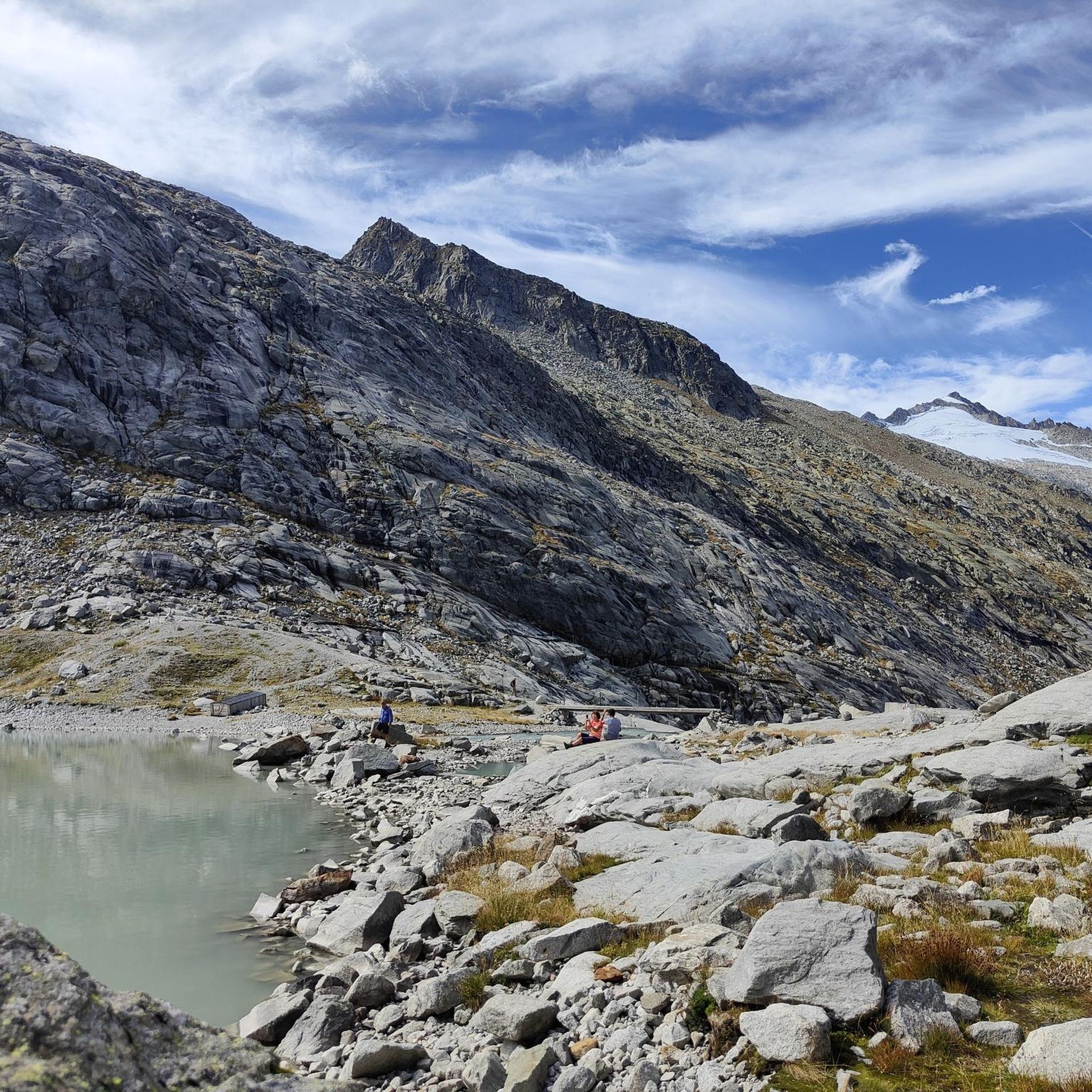
Mountaineering routes around Gletschersee Obersulzbachtal are situated in a high alpine environment, characterized by prominent peaks, glacial formations, and deep valleys. The region features challenging rock and ice terrain, with routes often leading to exposed ridges and summits. Glacial lakes and moraines are common landscape elements, reflecting the area's geological history.
Best mountaineering routes around Gletschersee Obersulzbachtal
- The most popular mountaineering route is Großvenediger Summit Ridge – Großvenediger Summit loop from Kürsingerhütte, an 8.3 miles (13.3 km) trail that…
Last updated: September 1, 2026
4.9
(27)
697
hikers
13.4km
09:03
1,120m
1,100m
Hard mountaineering route. Very good fitness required. Sure-footedness, sturdy shoes and alpine experience required.
4
hikers
9.47km
07:13
910m
900m
Hard mountaineering route. Very good fitness required. Sure-footedness, sturdy shoes and alpine experience required.

Sign up for free
5.0
(1)
6
hikers
4.40km
03:32
480m
490m
Hard mountaineering route. Good fitness required. Sure-footedness, sturdy shoes and alpine experience required.
5.0
(1)
141
hikers
Hard mountaineering route. Good fitness required. Sure-footedness, sturdy shoes and alpine experience required.
25
hikers
11.3km
07:17
1,260m
1,260m
Hard mountaineering route. Very good fitness required. Sure-footedness, sturdy shoes and alpine experience required.
Get access to more routes and recommendations from other explorers.
Sign up for free
Already have an account?
Our route recommendations are based on thousands of hikes, rides, and runs completed by other people on komoot.
Start today with a free account
Your next adventure awaits.
Login or Signup
Popular around Gletschersee Obersulzbachtal
Tips from the Community

From the hut, the summit of the Großvenediger is already visible and gifts you anticipation and excitement for the coming day or the already successfully completed summit tour.
0
0
The summit of the Großvenediger is at 3,666 meters, a broad firn ridge that suddenly opens up after a picture-perfect summit ridge. The cross stands silver in the light and marks the goal of an easy high-altitude tour that nevertheless reaches a remarkable height. Even if it's often busy at the top, there's still enough space to let your gaze wander for a few minutes: to the three-thousanders of the Venediger Group, across to the Zillertal peaks, far out into the Salzburger Land.
0
0
A picture-book summit ridge: the track is mostly well-trodden, the gradient moderate. The ridge stretches upwards as a narrow, clear line, with wide snow flanks to the left and right. Shortly before the summit, the ridge widens, and the cross stands silvery in the light. A point where the gaze wanders over the surrounding three-thousand-meter peaks and is rewarded for the journey.
0
0

Beautiful view of the Großvenediger
0
0

Great summit ridge with a beautiful view. Caution is advised, but with appropriate snow conditions, you can even walk it with splitboards up to just below the cross.
0
0

The summit is at an impressive height of 3,657 metres. Legend has it that you can see as far as Venice from the summit.
2
0

Take a quick breather here. Then just boulders 😉
0
0

Frequently Asked Questions
What level of experience is required for mountaineering in Gletschersee Obersulzbachtal?
The mountaineering routes in Gletschersee Obersulzbachtal are primarily designed for experienced mountaineers. The region features challenging rock and ice terrain, often leading to exposed ridges and summits. Out of 20 available routes, 18 are classified as difficult, with only 2 being moderate. There are no easy routes available.
Are there any family-friendly mountaineering options in Gletschersee Obersulzbachtal?
Given the high alpine environment and the prevalence of difficult routes, Gletschersee Obersulzbachtal is not typically recommended for family-friendly mountaineering with young children or beginners. The terrain often involves challenging rock and ice sections, making it more suitable for experienced individuals.
What is the best time of year for mountaineering around Gletschersee Obersulzbachtal?
The best time for mountaineering in this high alpine region is generally during the summer months, from late June to early September, when snowmelt allows for better access and more stable weather conditions. However, conditions can change rapidly, so always check local forecasts and avalanche warnings before heading out.
Are there any circular mountaineering routes in the Gletschersee Obersulzbachtal area?
Yes, there are several circular routes available for mountaineering in the region. For example, you could consider the View of the Großer Geiger loop from Kürsingerhütte, which offers stunning views in a high alpine setting. Another option is the Upper Obersulzbachtal loop from Materialseilbahnstation Kürsingerhütte.
Where can I park when planning a mountaineering trip to Gletschersee Obersulzbachtal?
Access to the high alpine areas like Gletschersee Obersulzbachtal often involves parking at designated trailheads or valley stations. For routes starting from Kürsingerhütte, you would typically park at the Materialseilbahnstation Kürsingerhütte in the Obersulzbachtal, which serves as a common starting point for many tours in the area.
What kind of views and natural features can I expect to see along the mountaineering routes?
Mountaineering in Gletschersee Obersulzbachtal offers breathtaking high alpine scenery. You'll encounter prominent peaks, impressive glacial formations, and deep valleys. Glacial lakes and moraines are common landscape elements, reflecting the area's geological history. Routes often provide panoramic views of iconic peaks like the Großer Geiger and the Großvenediger.
Are there any huts or places to get refreshments along the mountaineering trails?
Yes, in high alpine regions like Gletschersee Obersulzbachtal, mountain huts often serve as important bases for mountaineers, offering shelter, food, and refreshments. The Kürsingerhütte, for instance, is a prominent starting point and refuge for many tours, including the View of the Großer Geiger – Kürsingersteig Via Ferrata loop from Kürsingerhütte.
What do other mountaineers say about their experiences in Gletschersee Obersulzbachtal?
The mountaineering routes in Gletschersee Obersulzbachtal are highly rated by the komoot community, with an average score of 4.7 stars from over 60 reviews. Mountaineers often praise the challenging nature of the routes, the stunning high alpine scenery, and the rewarding summit views, particularly on tours like the Großvenediger Summit Ridge – Großvenediger Summit loop from Kürsingerhütte.
Are there any less crowded mountaineering routes in Gletschersee Obersulzbachtal?
While the region is popular among experienced mountaineers, some routes might see less traffic than the most prominent summit ascents. Exploring routes that venture slightly off the main paths or are longer in duration, such as the Upper Obersulzbachtal – Keeskogel Summit loop from Materialseilbahnstation Kürsingerhütte, could offer a more solitary experience.
How long do mountaineering routes in Gletschersee Obersulzbachtal typically take to complete?
The duration of mountaineering routes in Gletschersee Obersulzbachtal varies significantly based on difficulty, distance, and elevation gain. Shorter, challenging routes like the View of the Großer Geiger loop from Kürsingerhütte can take around 3.5 hours, while more extensive summit tours, such as the Großvenediger Summit Ridge – Großvenediger Summit loop from Kürsingerhütte, can require over 9 hours to complete.
Are permits or guides required for mountaineering in this area?
Gletschersee Obersulzbachtal is located within the Hohe Tauern National Park. While general access is usually permitted, certain high alpine routes, glacier crossings, or climbing activities might require specific permits or the accompaniment of a certified mountain guide, especially for those unfamiliar with the terrain or glacier travel. It is always advisable to check with local park authorities or mountain guide associations for the latest regulations before your trip.
Most popular routes around Gletschersee Obersulzbachtal

Get inspired with the komoot mobile app


Explore more
Browse the best Mountain Hikes & Routes in other regions.
