The best cycling routes around Region of Windsor and West Hants Municipality
45
riders
7
rides
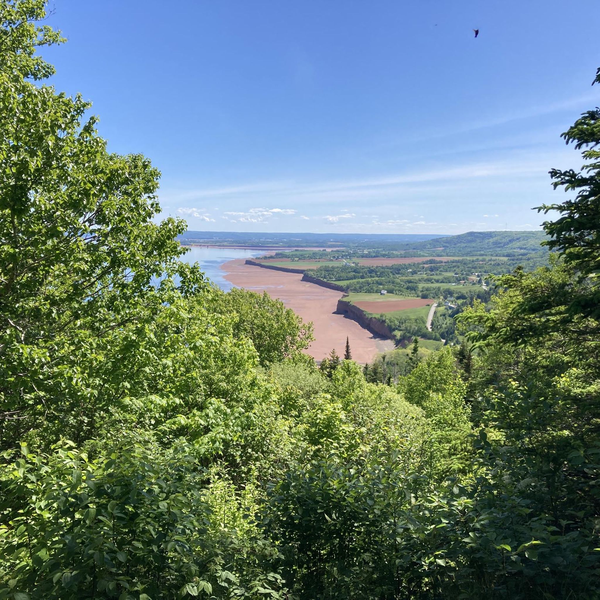
Touring cycling around Region of Windsor and West Hants Municipality features diverse landscapes, including views along the Avon River and the Minas Basin, known for its high tides. The terrain includes extensive shorelines, tidal riverbanks, and 30 kilometers of dykes protecting fertile land. Inland, cyclists encounter rolling hills, forested areas, and various lakes and rivers. The region also incorporates sections of Nova Scotia's Blue Route, providing dedicated cycling infrastructure.
Best touring cycling routes around Region of Windsor and West Hants Municipality
- The most popular touring cycling route is The Guzzle Lookoff loop from Grand Pre, an easy 11.5 miles (18.5 km) trail that takes 1 hour 28 minutes to complete, offering views of the Guzzle Lookoff.
- Another top favourite among local touring cyclists is Lake Pisiquid loop from Garlands Crossing, an easy 15.1 miles (24.3 km) path. This route circles Lake Pisiquid, providing waterside scenery.
- Local touring cyclists also love the Lake Pisiquid loop from Falmouth, a 15.7 miles (25.3 km) trail leading through varied terrain around Lake Pisiquid, often completed in about 1 hour 34 minutes.
- Touring cycling around Region of Windsor and West Hants Municipality is defined by Avon River views, dyke paths, and lake loops. The network offers options for different ability levels, from easy loops to moderate routes.
- The guide includes highly-rated routes that showcase the best of the region's landscape. More than 40 touring cyclists have used komoot to explore Region of Windsor and West Hants Municipality's varied terrain.
Last updated: July 13, 2026
8
riders
18.3km
01:27
40m
40m
Easy bike ride. Great for any fitness level. Mostly paved surfaces. Suitable for all skill levels.
4
riders
24.3km
01:28
150m
150m
Easy bike ride. Great for any fitness level. Mostly paved surfaces. Suitable for all skill levels.

Sign up for free
4
riders
25.3km
01:34
160m
160m
Moderate bike ride. Good fitness required. Mostly paved surfaces. Suitable for all skill levels.
3
riders
27.5km
01:42
210m
210m
Moderate bike ride. Good fitness required. Mostly paved surfaces. Suitable for all skill levels.
3
riders
30.5km
01:55
250m
250m
Moderate bike ride. Good fitness required. Mostly paved surfaces. Suitable for all skill levels.
Get access to more routes and recommendations from other explorers.
Sign up for free
Already have an account?
Our route recommendations are based on thousands of hikes, rides, and runs completed by other people on komoot.
Start today with a free account
Your next adventure awaits.
Login or Signup
Popular around Region of Windsor and West Hants Municipality

Tips from the Community

A beautiful statue with a pretty church surrounded by a pleasant park. The church houses a somewhat pathetic but fascinating exhibition on the deportation of the Acadians.
0
0

A fabulous spot on the end of the Guzzle to see wildlife, great for fishing and can watch the tide roll in
0
0
Frequently Asked Questions
What kind of terrain can I expect on touring cycling routes in the Region of Windsor and West Hants Municipality?
The region offers a diverse landscape for touring cyclists. You'll find beautiful views along the Avon River, extensive shorelines and tidal riverbanks leading to the Minas Basin (known for the world's highest tides), and 30 kilometers of dykes protecting fertile land. Inland, the terrain features rolling hills, forested areas, and various lakes and rivers. Some routes, like the The Guzzle Lookoff loop from Grand Pre, offer scenic lookouts.
Are there easy touring cycling routes suitable for beginners or families?
Yes, the Region of Windsor and West Hants Municipality has several easy touring cycling routes. For instance, the Lake Pisiquid loop from Garlands Crossing is an easy 15.1-mile (24.3 km) path that circles Lake Pisiquid, providing pleasant waterside scenery. There are 3 easy routes in total, making them great options for a relaxed ride.
Can I find circular touring cycling routes in the Region of Windsor and West Hants Municipality?
Many of the touring cycling routes in the area are designed as loops, offering convenient circular journeys. Examples include the popular Lake Pisiquid loop from Falmouth, which covers 15.7 miles (25.3 km) through varied terrain, and the The Guzzle Lookoff loop from Grand Pre.
What natural features or landmarks can I see while cycling in the Region of Windsor and West Hants Municipality?
Cyclists can enjoy a variety of natural attractions. Routes often provide views of the Avon River and the dynamic Minas Basin. You might also encounter the region's extensive dyke systems, forested areas, and wetlands like Meadow Pond, which is home to various waterfowl. The The Guzzle Lookoff loop from Grand Pre specifically offers views of the Guzzle Lookoff.
Are there any longer or more challenging touring cycling routes for experienced riders?
While many routes are easy to moderate, some offer a bit more distance and elevation. For example, the Lake Pisiquid loop from Windsor is a moderate 30.5-mile (49 km) route with over 250 meters of elevation gain, providing a more extended cycling experience. There are 3 moderate routes and 1 difficult route available for those seeking a greater challenge.
Is it possible to spot wildlife along the touring cycling routes?
Yes, the diverse natural environment of the Region of Windsor and West Hants Municipality provides opportunities for wildlife spotting. Areas around lakes, rivers, and wetlands like Meadow Pond are particularly good for observing waterfowl and other aquatic species. Cycling through forested areas may also offer glimpses of local fauna.
Are there dedicated cycling paths or infrastructure in the region?
The region is actively developing its cycling infrastructure. It is part of Nova Scotia's 'Blue Route,' a province-wide project. A notable 12km section of this route, featuring newly paved shoulders, connects Hantsport to the Windsor town line along Trunk Highway 1, providing a dedicated and scenic ride for cyclists.
What are the typical distances of touring cycling routes in the Region of Windsor and West Hants Municipality?
The touring cycling routes in the area vary in length to suit different preferences. You can find routes ranging from approximately 11.5 miles (18.5 km) for shorter, easier rides, such as The Guzzle Lookoff loop from Grand Pre, up to 19 miles (30.5 km) for longer, moderate loops like the Lake Pisiquid loop from Windsor.
Are there any parks or open spaces accessible from the cycling routes?
The West Hants Regional Municipality boasts 73 parks and open space land parcels, covering 492.5 acres. Many of these are easily accessible and can be incorporated into or found near cycling routes. Notable examples include the Tregothic Trail, Riverview Trail, Falmouth Mini Park, Causeway Trail, and Windsor Waterside Park, offering additional recreational opportunities.
What other outdoor activities are available in the Region of Windsor and West Hants Municipality besides cycling?
Beyond cycling, the region offers a wide array of outdoor activities. Visitors can explore numerous hiking trails, visit farms like Castle Frederick Farms which have their own trails, or engage in water-based activities such as swimming, canoeing, kayaking, fishing, or boating on the many lakes and rivers. For winter sports, Ski Martock offers downhill skiing, and OnTree Fun & Adventure Park provides high ropes and zip-lining.
What is the best time of year for touring cycling in the Region of Windsor and West Hants Municipality?
The region's diverse landscapes are enjoyable across multiple seasons. Spring and fall offer pleasant temperatures and beautiful scenery, with autumn foliage being particularly vibrant. Summer provides warmer weather ideal for combining cycling with water activities. While specific winter conditions vary, many trails may still be accessible for cycling, depending on snow and ice.
Most popular routes around Region of Windsor and West Hants Municipality
Most popular attractions around Region of Windsor and West Hants Municipality

Get inspired with the komoot mobile app


Explore more
Browse the best Cycling routes in other regions.
