The best road cycling routes around Rannasee
4.6
(94)
1,641
riders
113
rides
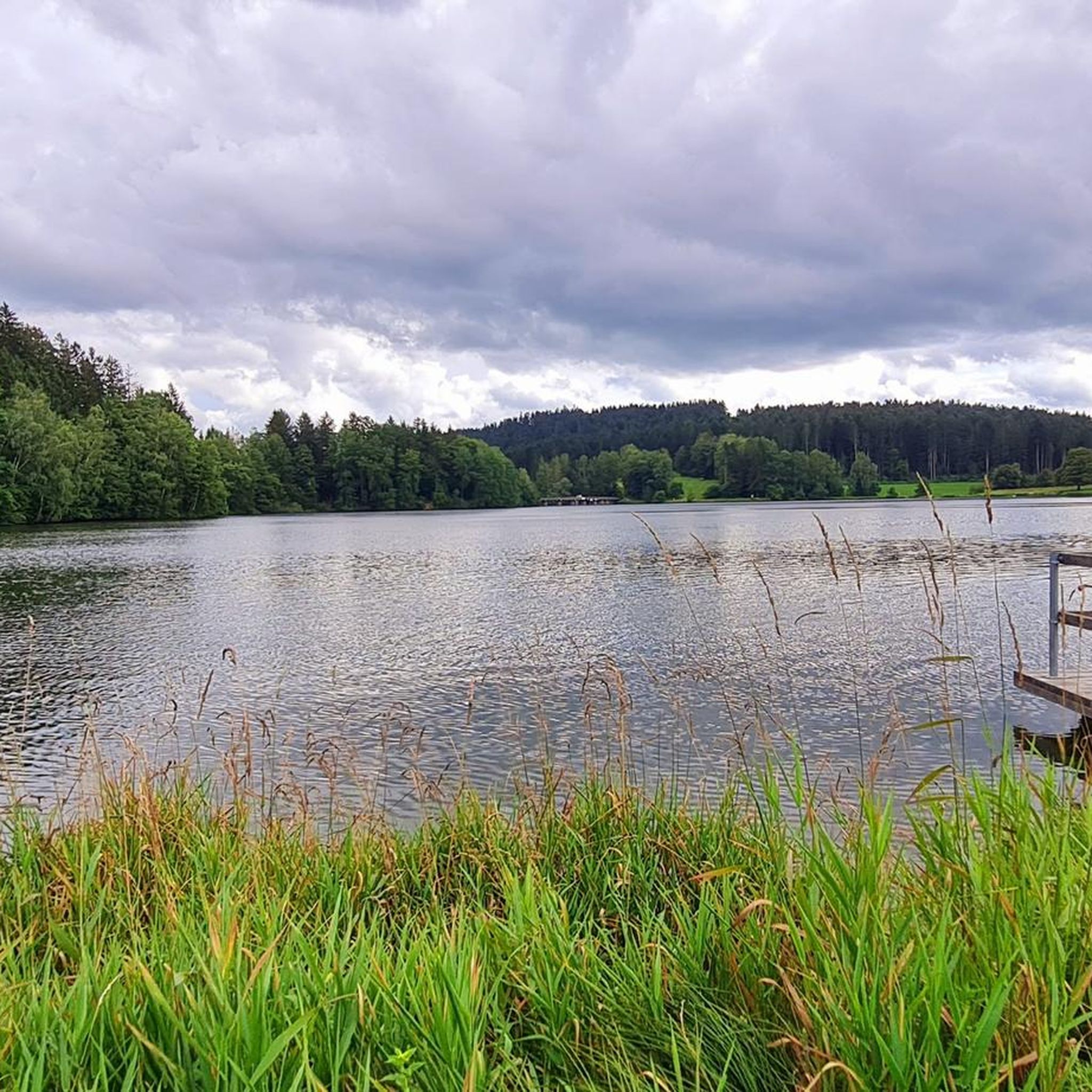
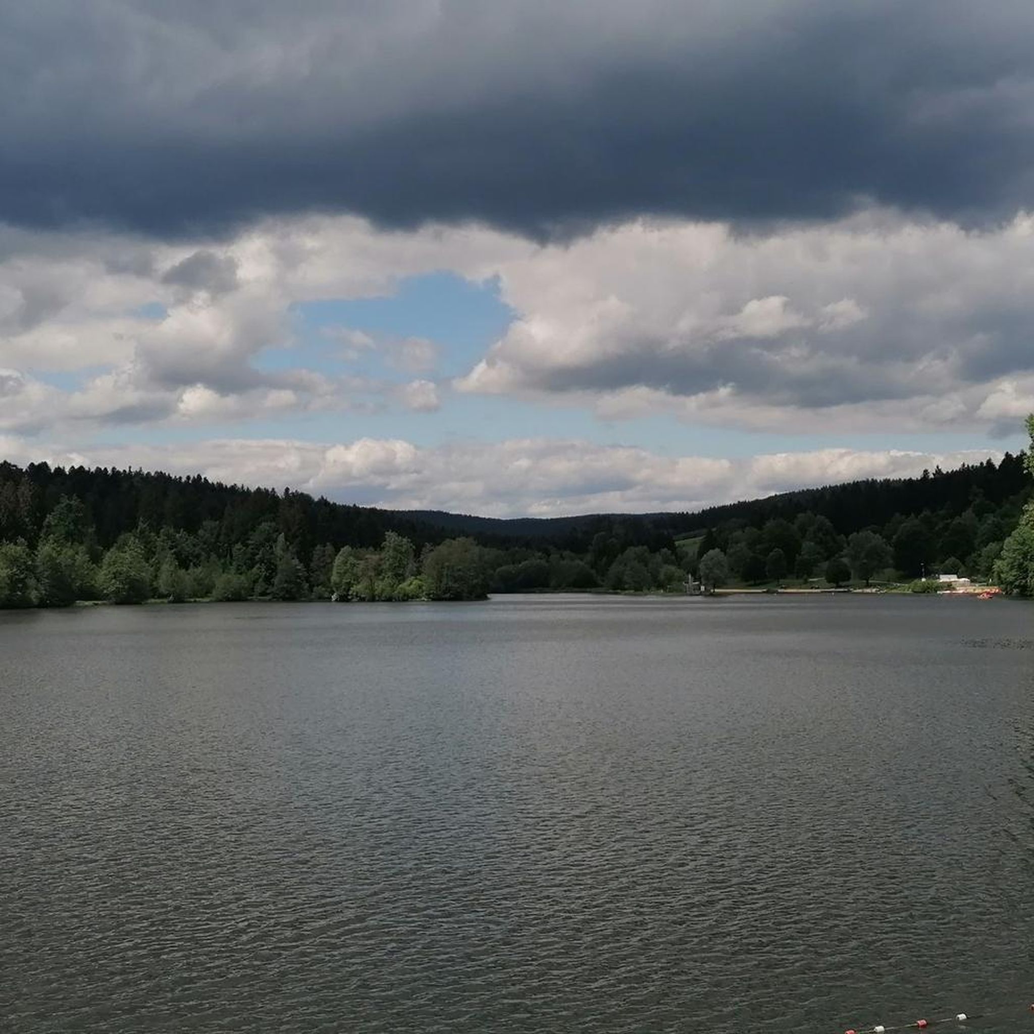
Road cycling routes around Rannasee are characterized by a diverse landscape of serene waters, dense forests, and the verdant Ranna Valley. The region, centered around the artificial Rannasee lake, offers paths that wind through pine and oak woodlands. Cyclists can expect routes with moderate elevation changes, providing varied terrain and views, particularly near the Germany-Austria border.
Best road cycling routes around Rannasee
- The most popular road cycling route is Mistlberg Hairpin – Border crossing DE/AUT loop from Oberkappel, a…
Last updated: June 29, 2026
5.0
(2)
9
riders
48.1km
02:39
930m
930m
Hard road ride. Very good fitness required. Some segments of this route may be unpaved and difficult to ride.
6
riders
35.7km
02:10
830m
830m
Moderate road ride. Good fitness required. Mostly well-paved surfaces and easy to ride.

Sign up for free
7
riders
25.7km
01:29
440m
440m
Moderate road ride. Good fitness required. Mostly well-paved surfaces and easy to ride.
7
riders
64.1km
03:24
1,180m
1,180m
Hard road ride. Very good fitness required. Mostly well-paved surfaces and easy to ride.
6
riders
23.0km
01:14
450m
450m
Moderate road ride. Good fitness required. Mostly well-paved surfaces and easy to ride.
Get access to more routes and recommendations from other explorers.
Sign up for free
Already have an account?
Our route recommendations are based on thousands of hikes, rides, and runs completed by other people on komoot.
Start today with a free account
Your next adventure awaits.
Login or Signup

Tips from the Community

a graceful church on the village square of Neustift
0
0
The beautiful village fountain, decorated with an eagle, is located in the village square.
0
0
This old linden avenue by the castle is very handsome, but today it houses a florist who will surely fulfill every wish.
0
0


Nestled between rolling hills and the Bohemian Forest lies Julbach, with its striking neo-Romanesque St. Anne's Church a prominent landmark visible from afar. A mild climate, walnut and plum trees, expansive meadows, and tranquil forests make it the perfect place to stop. www.julbach.at
0
0
If you're looking for a truly hearty break on your tour, stop by the Meraner Kutscherstadl. Their Kutscherpfandl (a traditional Austrian dish) is just the thing to revive your legs – and a cold beer will help you unwind. The perfect stop before you continue your journey. https://www.muehlviertel.at/essen-trinken/gastronomie/oesterreich-gastronomie/detail/430000349/meraner-kutscherstadl-gasthof-cafe-pub.html
0
0
Just beyond the state border, a gentle forest clearing opens up. A lovely spot to pause briefly, take a photo of this small natural amphitheater with slender spruce trees reaching straight up into the sky.
0
0

Caution cyclists! There are 90 steps to climb. Not feasible for everyone with the heavy e-bikes.
5
0
Frequently Asked Questions
How many road cycling routes are available around Rannasee?
There are over 100 road cycling routes in the Rannasee region, offering a wide range of options for different skill levels. The komoot community has explored more than 117 routes in this area.
What kind of terrain can I expect on road cycling routes near Rannasee?
The Rannasee region offers a diverse landscape for road cyclists. You can expect paths winding through dense forests of pines and oaks, along the verdant Ranna Valley, and with views of the serene Rannasee itself. While some routes offer gentle lake loops, many involve moderate elevation changes, providing varied terrain and scenic vistas, especially near the German-Austrian border.
Are there road cycling routes suitable for beginners or those looking for an easier ride?
Yes, the Rannasee area provides options for all abilities. While many routes feature moderate to difficult climbs, there are 4 routes specifically categorized as easy. These typically offer less elevation gain and might include flatter sections around the lake or through valleys.
What are some notable landmarks or natural features I can see while road cycling in the Rannasee area?
Road cycling routes around Rannasee often pass by several interesting points. You can cycle near the artificial Rannasee, the largest bathing lake in the Bavarian Forest, and the impressive Rannasee Dam, which marks the Germany-Austria border. The region also features the biodiverse Ranna Valley and dense forests. Keep an eye out for the unique 'Liebesinsel' (Love Island) in the middle of Rannasee.
What do other road cyclists enjoy most about road cycling in Rannasee?
The road cycling routes in Rannasee are highly rated by the komoot community, with an average score of 4.5 stars from over 200 reviews. Cyclists often praise the diverse landscape, the mix of serene lake views, dense forests, and the challenge of moderate elevation changes. The unique experience of crossing the German-Austrian border on routes like Mistlberg Hairpin – Border crossing DE/AUT loop from Oberkappel is also a highlight.
Are there any circular road cycling routes around Rannasee?
Yes, many of the road cycling routes in the Rannasee region are designed as loops, allowing you to start and end at the same point. Examples include the challenging Mistlberg Hairpin – Border crossing DE/AUT loop from Oberkappel and the scenic Rauna Dam – Ranna Reservoir Dam loop from Oberkappel.
Can I find routes that offer panoramic views?
Absolutely. Routes with significant elevation gain often reward cyclists with panoramic views. For instance, the Ameisberg Ascent – Ameisberg Tower loop from Oberkappel includes a notable ascent towards the Ameisberg Tower, which is known for offering expansive vistas of the surrounding landscape.
What is the best time of year for road cycling around Rannasee?
The spring and summer months are ideal for road cycling in Rannasee. During this time, the forest floors are adorned with wildflowers, enhancing the natural beauty of the routes. The weather is generally more favorable for outdoor activities, allowing you to fully enjoy the diverse landscapes.
Are there options for longer, more challenging road cycling tours?
Yes, for experienced road cyclists seeking a challenge, there are 43 difficult routes available. These routes often feature significant elevation gains and longer distances. An example is the Obernzell on the Danube – Danube Cycle Path loop from Oberkappel, which covers over 64 kilometers and includes substantial climbing.
Where can I park my car when going road cycling in Rannasee?
While specific parking locations for each route are best checked on the individual tour pages, the Rannasee area, being a popular recreational destination, generally offers parking facilities. Look for designated parking areas near the lake or trailheads, especially in towns like Oberkappel, which is a common starting point for many routes.
Is public transport available to reach the Rannasee area with a bicycle?
Public transport options to Rannasee with bicycle carriage can be limited and vary by season and operator. It's advisable to check local bus or train services in the Bavarian Forest region for their specific policies regarding bicycle transport before planning your trip.
Are there any permits required for road cycling around Rannasee?
Generally, no special permits are required for road cycling on public roads and designated cycling paths around Rannasee. However, always respect local regulations and private property signs, especially when venturing into more remote areas or nature reserves.
Most popular routes around Rannasee
Most popular attractions around Rannasee

Get inspired with the komoot mobile app


Explore more
Browse the best Road cycling routes in other regions.
