The best road cycling routes around vod. n. Veľká Domaša
116
riders
6
rides
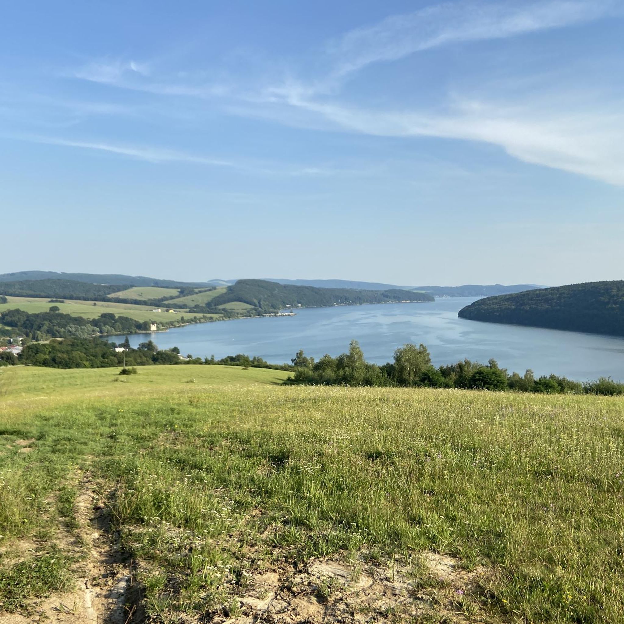
Road cycling routes around vod. n. Veľká Domaša feature a landscape shaped by the Veľká Domaša reservoir, offering routes that often follow the shoreline or venture into the surrounding terrain. The region is characterized by rolling hills and forested areas, with elevations generally remaining below 200 meters. Road cyclists can expect varied surfaces and gradients, providing a mix of flat sections and moderate climbs.
Best road cycling routes around vod. n. Veľká Domaša
- The most popular road cycling route is…
Last updated: May 25, 2026
35
riders
66.7km
03:08
780m
790m
Moderate road ride. Good fitness required. Some segments of this route may be unpaved and difficult to ride.
22
riders
70.2km
02:54
440m
440m
Moderate road ride. Good fitness required. Mostly well-paved surfaces and easy to ride.

Sign up for free
9
riders
46.5km
02:08
470m
470m
Moderate road ride. Good fitness required. Some segments of this route may be unpaved and difficult to ride.
5
riders
36.7km
01:52
330m
330m
Moderate road ride. Good fitness required. Some segments of this route may be unpaved and difficult to ride.
39
riders
87.7km
04:07
910m
910m
Hard road ride. Very good fitness required. Some segments of this route may be unpaved and difficult to ride.
Our route recommendations are based on thousands of hikes, rides, and runs completed by other people on komoot.
Start today with a free account
Your next adventure awaits.
Login or Signup
Popular around vod. n. Veľká Domaša
Frequently Asked Questions
Are there easy road cycling routes suitable for beginners around Veľká Domaša?
The road cycling routes around Veľká Domaša are generally categorized as moderate to difficult. There are currently no routes specifically listed as easy. Cyclists should be prepared for rolling hills and varied terrain.
What is the typical duration for road cycling routes in the Veľká Domaša region?
Route durations vary depending on the specific path and your pace. For example, the Roadbike loop from Šandal can be completed in about 1 hour 52 minutes, while the longer Malá Domaša loop from Stropkov typically takes around 4 hours 7 minutes.
Where can I find parking for road cycling routes around Veľká Domaša?
While specific parking areas are not detailed for each route, many routes, such as the Malá Domaša loop from Domaša, odbočka k hrádzi, often start from accessible points near the reservoir or local villages, where public parking might be available. It's advisable to check local amenities in starting towns like Domaša or Stropkov.
Are there any family-friendly road cycling options in the Veľká Domaša area?
Given that most routes are moderate to difficult, with significant elevation gains, they may not be suitable for young children or families seeking very easy, flat rides. These routes are generally better suited for experienced road cyclists.
What is the best season for road biking around Veľká Domaša?
The region's landscape, characterized by rolling hills and forested areas, is enjoyable throughout the warmer months. Spring and autumn offer pleasant temperatures and scenic views, with autumn potentially bringing vibrant foliage. Always check local weather conditions before heading out.
Are there any circular road cycling routes available?
Yes, many of the routes around Veľká Domaša are designed as loops. Examples include the popular Malá Domaša loop from 'Srdce' - fotopoint and the Malá Domaša – Park Čaklov loop from Giglovce, allowing you to start and finish in the same location.
What kind of terrain can I expect on road cycling routes in Veľká Domaša?
The terrain around Veľká Domaša features a mix of lakeside paths, rolling hills, and forested sections. You can expect varied surfaces and gradients, providing a balance of flatter sections and moderate climbs, with elevations generally remaining below 200 meters.
What do other road cyclists enjoy most about cycling in Veľká Domaša?
Over 100 road cyclists have explored the Veľká Domaša region using komoot. They often appreciate the varied terrain, which includes scenic lakeside views and challenging climbs through forested hills, offering a diverse and engaging cycling experience.
Are there any cafes or refreshment stops along the road cycling routes?
While specific cafes are not listed for each route, the routes often pass through or near local villages and towns surrounding the reservoir. It's common to find small shops or cafes in these settlements, especially in larger starting points like Domaša or Stropkov. It's always a good idea to carry sufficient water and snacks.
What are some of the longer road cycling routes for advanced riders?
For advanced riders seeking longer distances and more elevation, routes like the Malá Domaša loop from Stropkov, which covers 87.7 km with significant climbing, offer a challenging experience. Another option is the Malá Domaša – Park Čaklov loop from Giglovce, at 76 km.
How many road cycling routes are available in the Veľká Domaša region?
There are several road cycling routes available, with this guide featuring 6 distinct routes. These range from moderate to difficult, offering various distances and challenges for cyclists.
Most popular routes around vod. n. Veľká Domaša

Get inspired with the komoot mobile app


