The best walks and hikes around Saint-Sixte
4.9
(10)
150
hikers
7
hikes
Hiking around Saint-Sixte offers a variety of trails through diverse natural settings. The region features routes that traverse forests and open landscapes, with some paths providing views of river valleys. Elevation changes are generally modest, making many trails accessible for various fitness levels. The area's geology includes unique formations, and the presence of national parks contributes to its natural appeal for outdoor activities.
Best hiking trails around Saint-Sixte
- The most popular hiking route is Sentier La Serpentine – Plaisance National…
Last updated: August 8, 2026
2
hikers
15.5km
03:57
50m
50m
Moderate hike. Good fitness required. Easily-accessible paths. Suitable for all skill levels.
5.0
(1)
43
hikers
6.43km
01:38
20m
20m
Easy hike. Great for any fitness level. Easily-accessible paths. Suitable for all skill levels.

Sign up for free
4.7
(3)
37
hikers
4.70km
01:26
160m
160m
Easy hike. Great for any fitness level. Easily-accessible paths. Suitable for all skill levels.
8
hikers
16.7km
04:15
50m
50m
Moderate hike. Good fitness required. Easily-accessible paths. Suitable for all skill levels.
5.0
(1)
7
hikers
3.06km
00:47
10m
10m
Easy hike. Great for any fitness level. Easily-accessible paths. Suitable for all skill levels.
Get access to more routes and recommendations from other explorers.
Sign up for free
Already have an account?
Our route recommendations are based on thousands of hikes, rides, and runs completed by other people on komoot.
Start today with a free account
Your next adventure awaits.
Login or Signup
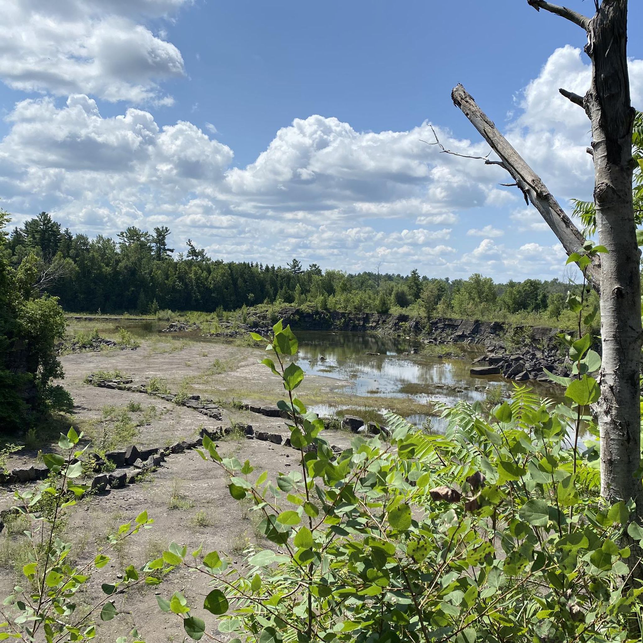
Tips from the Community

The small peepholes with silhouettes of clichéd Canadian motifs are particularly beautiful. The rock face, however, isn't visible; you're probably standing on top of it.
1
0

At this vantage point, the mighty Ottawa River is more reminiscent of a lake.
0
0
Numerous bird species call this area their home.
0
0

Frequently Asked Questions
How many hiking trails are available in the Saint-Sixte area?
There are 7 hiking routes documented in the Saint-Sixte area on komoot. These include 5 easy trails and 2 moderate trails, offering options for various fitness levels.
What kind of landscapes can I expect to see while hiking around Saint-Sixte?
The Saint-Sixte region offers diverse landscapes. Depending on the specific area, you might encounter alpine scenery with views of the Mont Blanc massif, dense forests, meadows, and small alpine lakes. Other parts feature unique geological formations like basaltic organs and waterfalls. Many trails also provide views of river valleys and lead through shaded forests.
Are there any easy hiking trails suitable for beginners or families in Saint-Sixte?
Yes, Saint-Sixte has several easy trails. For example, the La Serpentine Trail loop from Plaisance is an easy 6.4 km path that takes about 1 hour 38 minutes. Another accessible option is the La Serpentine Trail loop from La Zizanie-des-Marais, which is 3.1 km and can be completed in under an hour.
What are some moderate hiking options for those looking for a bit more challenge?
For a moderate challenge, consider the Sentier La Serpentine – Plaisance National Park. This route is 15.5 km long and typically takes around 3 hours 56 minutes to complete, exploring varied terrain within the national park.
Are there any circular hiking routes in Saint-Sixte?
Yes, many of the trails in Saint-Sixte are designed as loops. Examples include the La Serpentine Trail loop from Plaisance and the Belvédère loop from Refuge de l'Érable, both offering convenient circular paths.
What do other hikers say about the trails in Saint-Sixte?
The hiking trails in Saint-Sixte are highly regarded by the komoot community, boasting an average rating of 4.9 out of 5 stars from over 10 reviews. Hikers often praise the varied terrain, the peaceful forested paths, and the scenic river valley views.
Are there any notable natural attractions or landmarks to see while hiking in the region?
Yes, the region offers several interesting natural and historical features. Depending on your chosen trail, you might encounter unique geological formations like the basaltic organs of Puy de Chavanne or the Ligeay waterfalls. In other areas, you can find small alpine lakes or enjoy panoramic views from spots like the Chapelle Saint-Sixte, which also features a botanical trail.
Is Saint-Sixte suitable for dog-friendly hiking?
While specific dog regulations can vary by trail or protected area, many natural paths in regions like Saint-Sixte are generally accessible for dogs, especially if kept on a leash. It's always recommended to check local signage or park rules for any specific restrictions before heading out with your pet.
What is the best time of year to go hiking in Saint-Sixte?
The best time to hike in Saint-Sixte largely depends on the specific trails and your preferences. Spring and autumn offer pleasant temperatures and vibrant scenery, with blooming flowers or colorful foliage. Summer provides warmer weather, ideal for higher altitude trails or those near water. Winter hiking is possible on some routes, especially lower elevation ones, but requires appropriate gear and caution for potential snow or ice.
Are there any protected natural areas near Saint-Sixte that offer hiking opportunities?
Yes, for example, the Parc Naturel Régional des Bauges, located near Saint-Sixt (a similar-sounding area in the French Alps), is a protected area known for its rich biodiversity and offers signposted itineraries for exploring its natural beauty. The Plaisance National Park is also mentioned as a location for some of the trails in Saint-Sixte.
Can I find trails that offer views of the Mont Blanc massif from Saint-Sixte?
If you are hiking in the Saint-Sixt area, which is in the French Alps, you can find trails that offer breathtaking panoramas, including views of the majestic Mont Blanc massif, particularly from routes like those around the Col de la Forclaz.
Are there any trails that follow canals or river valleys in the Saint-Sixte region?
Yes, the region's geography includes river valleys such as the Durance and Garonne. Additionally, the Canal des Deux Mers and the Garonne Lateral Canal offer pleasant routes that are suitable for walks, providing a different kind of scenic experience.

Get inspired with the komoot mobile app


Explore more
Browse the best Hikes in other regions.
