The best running trails around Albufeira da Apartadura
4.8
(8)
505
runners
55
runs
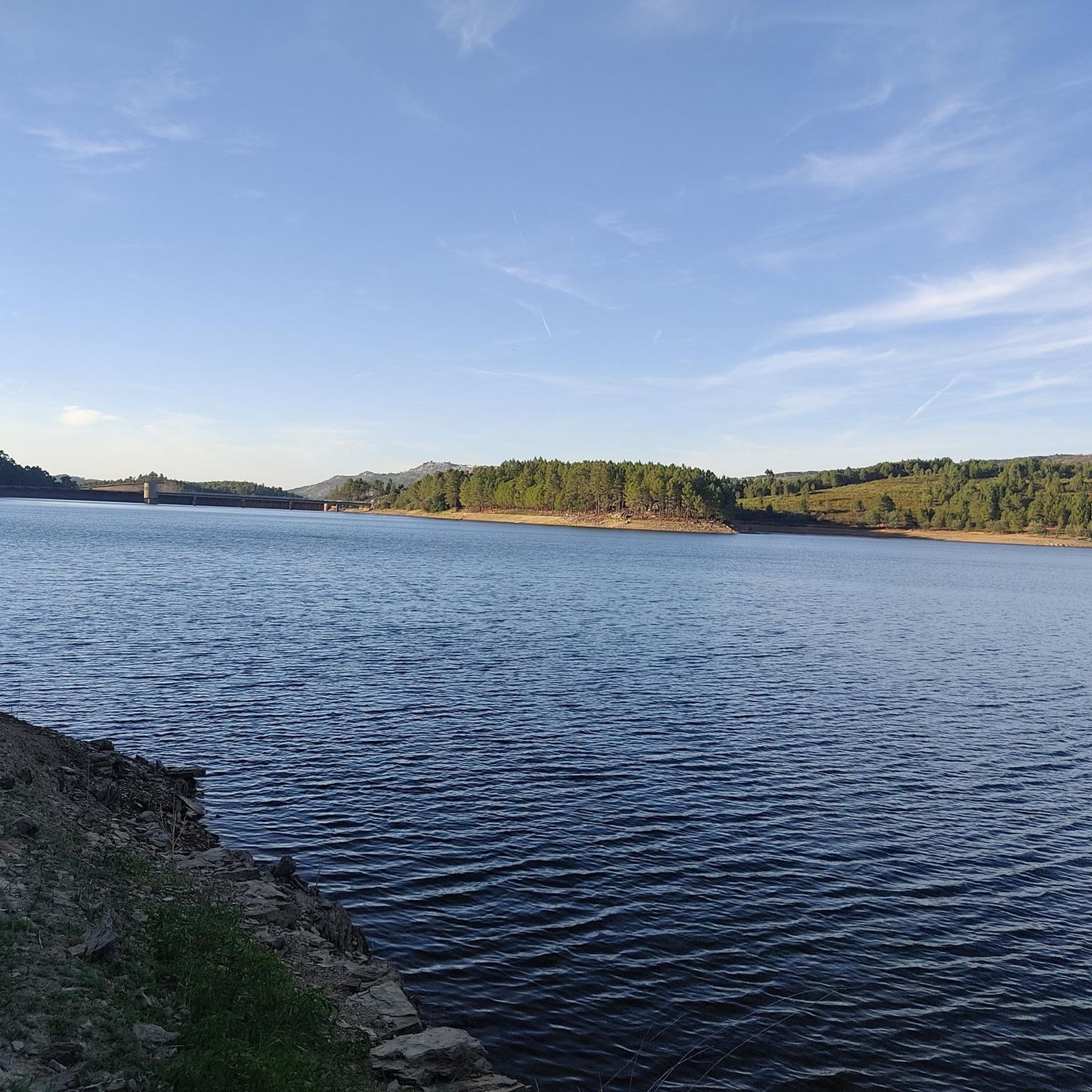
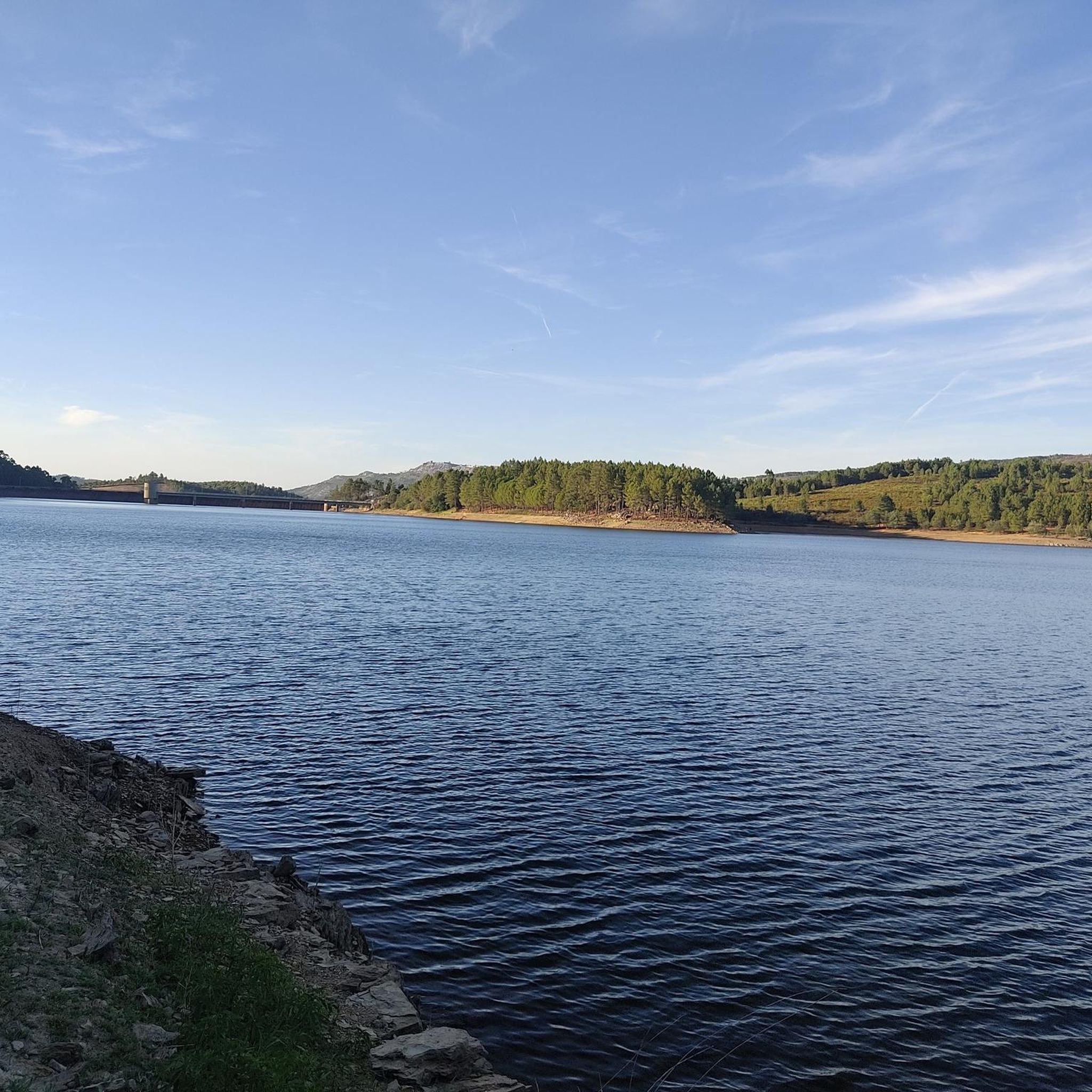
Jogging routes around Albufeira da Apartadura are primarily situated within the Serra de São Mamede Natural Park, offering a diverse natural environment. The region features the Apartadura Reservoir as a central landmark, providing scenic paths. Terrain includes rolling hills, forested areas with cork oaks, and paths that traverse varied geological formations of schist and granite.
Best jogging routes around Albufeira da Apartadura
- The most popular jogging route is Apartadura Reservoir loop from Serra de São Mamede Nature Park, a…
Last updated: November 2, 2026
3
runners
5.85km
00:42
100m
100m
Moderate run. Good fitness required. Mostly paved surfaces.
4.5
(2)
18
runners
19.3km
02:33
550m
550m
Hard run. Very good fitness required. Mostly paved surfaces.

7
runners
73.5km
09:45
2,420m
2,420m
Hard run. Very good fitness required. Mostly paved surfaces.
6
runners
12.7km
01:39
410m
410m
Hard run. Very good fitness required. Mostly paved surfaces.
5.0
(1)
3
runners
Hard run. Very good fitness required. Mostly paved surfaces.
Get access to more routes and recommendations from other explorers.
Already have an account?
Our route recommendations are based on thousands of hikes, rides, and runs completed by other people on komoot.
Start today with a free account
Your next adventure awaits.
Tips from the Community

For those planning to hike in the Alegrete area, the main reference route is the PR3 PTG – Percurso de Alegrete. This circular route offers a complete immersion in the Serra de São Mamede Natural Park, combining the medieval heritage of the village with montado landscapes and water lines. The Main Route (PR3 PTG) The PR3 PTG - Percurso de Alegrete is about 11.4 km long and is classified as medium/low difficulty. The recommended starting and ending point is near Fonte Nova, although many hikers start their journey in the village of Alegrete itself to explore the historic center right away. Castle and Village: The Castle of Alegrete is the (literal) highlight of the hike. Situated at about 500 meters above sea level, it offers a panoramic view of the Alentejo border region. Don't miss the Clock Tower (Torre do Relógio). Nature and Biodiversity: The trail crosses areas of cork oak montado, pine forests, and riparian areas. It is an excellent place for bird watching (such as the robin or the titmouse) and, near the water lines, you can find rare vegetation like the royal fern. Religious Heritage: During your passage through the village, you can also visit the small Chapel of Mercy (Capela da Misericórdia), which is part of the local historical complex. Practical Hiking Tips Time of Year: Avoid the months of July and August due to the extreme temperatures in the Alentejo. Autumn and spring are ideal for the colors of the vegetation and mild temperatures. In winter, be careful with the ground, which can become quite slippery on cobblestones and rocky trails. Equipment: Use footwear with good grip (the ascents and descents to the castle and river have sections of loose stones). Bring enough water, as outside the village, refueling points are scarce. Safety and Respect: Always follow the official signage (yellow and red marks).
0
0
Hiking to Serra de São Mamede (1027 m), the highest point in continental Portugal south of the Tagus, offers a unique experience that combines the hardness of quartzite with the freshness of lush vegetation in the Serra de São Mamede Natural Park. The ascent rewards hikers with panoramic views that extend to the Estrela and deep into Spanish territory. For a safe and rewarding hike on this peak in Portalegre, consider the following advice: Route Planning: There are several trails leading to the summit, with the Serra de São Mamede Walking Route (PR1 PTG) being one of the most popular. The path is often rocky and steep, requiring footwear with good traction and ankle support. Water and Energy Management: The physical exertion and sun exposure, especially in the higher, unprotected areas, require you to carry sufficient water (at least 1.5L) and energy snacks. There are no reliable supply points during the ascent. Pay Attention to the Weather: The weather in the mountains can change rapidly. Even if it is sunny in the city, the summit may be shrouded in fog or strong winds. Always check the local forecast before setting off and bring a windbreaker or warm clothing. Sun Protection: Due to the altitude and sparser vegetation on the summit, UV radiation is more intense. Use sunscreen and a hat, even on cloudy days.
1
0
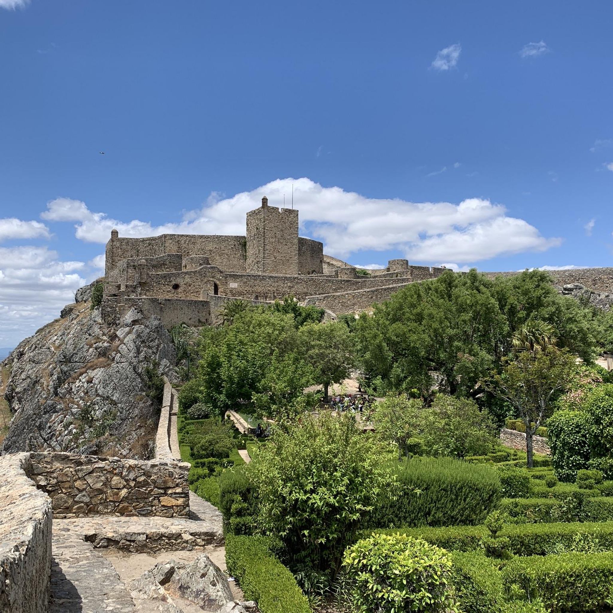
The castle was founded by King D. Dinis in 1290, with the aim of defending the Alentejo border. Originally, it had an imposing structure with a double ring of walls, twelve towers and eight gates. Over the centuries, it lost part of its structure to the growth of the city, but it remains a National Monument. The Keep is the best-preserved part of the original complex. Inside, there is a museum that you can visit.
3
0

The current pillory dates from the years immediately following the granting of the New Charter by King Manuel in 1512 and reflects his Manueline, albeit very rustic, style. The monument stands in front of the 16th-century district jail building and next to the clock tower, also from the 16th century, in the square that bears his name. It stands on a base with four octagonal steps and consists of an octagonal shaft set directly into the upper step, formed by five drums with mortar joints.
4
0
An old stone-paved road leads from Portagem through cork oak forests up to Marvão. A strenuous journey in summer.
3
0
The fortified town of Marvão, 12 kilometers from Quinta do Pomarinho, is also known as the "Eagle's Nest." It boasts a spectacular location on a granite cliff, atop one of the peaks of the Serra de São de Mamede mountain range. Completely walled, Marvão is situated in the Alto Alentejo region, near the Spanish border, which was once controlled from the village. The town of Marvão owes its name to Ibn Maruane, an Arab military leader who sought refuge here in the 11th century. He hid on Mount Ammaia and built a castle there, in the most remote and inaccessible spot he could find. Years later, the castle was transformed into a medieval fortress. Its location made it a strategic defensive position, nestled among hills with slopes to the north, south, and west, accessible only on foot from the village. For many years, Marvão was a municipality heavily and significantly involved in numerous military conflicts in the region. Today, Marvão is a rather sleepy town, but one where you can enjoy wonderful walks. More information can be found here: https://www.feriasemportugal.com/marvao
4
0
The Igreja de Santiago - Marvão was one of the two parish churches of Marvão in 1321. Both belonged to the Order of Malta and were under the jurisdiction of the priory of Crato. The structure and decorative elements preserve the regional Gothic typology with its sober lines and the strong contrast between dark granite and white masonry. Currently, 1€ is requested for its renovation. The visit is well worth the small contribution.
1
0

Castelo do Alegrete is an imposing medieval fortress located on a rocky outcrop near the village of Alegrete, Portugal. Dating back to at least the 13th century (with probably older origins), it played a key role in defending the border with Spain. It features a large quadrilateral wall with cubic towers. Although part of the castle is in ruins, it still retains elements such as parapets, gates and arrow slits. It offers spectacular views of the surrounding landscape and is an important national monument, a testimony to the defensive history of the region.
0
0
Frequently Asked Questions
What kind of terrain can I expect on running routes around Albufeira da Apartadura?
The running routes in Albufeira da Apartadura, primarily within the Serra de São Mamede Natural Park, offer diverse terrain. You'll find paths around the scenic Apartadura Reservoir, through cork oak forests providing shade, and over rolling hills. The region features varied geological formations of schist and granite, ensuring a dynamic running experience.
Are there running routes suitable for beginners in Albufeira da Apartadura?
Yes, there are options for various fitness levels. While many routes are moderate to difficult, you can find easier paths. For instance, the Apartadura Reservoir loop from Serra de São Mamede Nature Park is a moderate 5.8 km route that takes about 43 minutes, offering a good introduction to the area's beauty.
How many running routes are available in the Albufeira da Apartadura area?
Komoot offers a wide selection of running routes around Albufeira da Apartadura, with over 50 distinct tours available. These range from short, moderate loops to challenging long-distance runs through the natural park.
What do other runners say about the trails in Albufeira da Apartadura?
The running routes in Albufeira da Apartadura are highly regarded by the komoot community, boasting an average rating of 4.9 stars. Runners frequently praise the tranquil environment, picturesque views of the reservoir, and the varied natural landscapes of the Serra de São Mamede Natural Park.
Are there any long-distance running challenges in the region?
Absolutely. For experienced runners seeking a significant challenge, routes like the São Mamede Trail – Portalegre Castle loop from Quinta da Dourada offer an extensive 62.9 km journey through varied landscapes, typically taking nearly 8 hours to complete.
Can I find circular running routes around the Apartadura Reservoir?
Yes, the Apartadura Reservoir is a central feature for many running routes. A popular option is the Apartadura Reservoir loop from Serra de São Mamede Nature Park, which provides a scenic, moderate 5.8 km circuit around the reservoir.
What natural features or landmarks can I see while running in Albufeira da Apartadura?
While running, you'll primarily experience the natural beauty of the Serra de São Mamede Natural Park. Key features include the serene Apartadura Reservoir, extensive cork oak forests, and the distinctive schist and granite rock formations characteristic of the region. The routes offer picturesque views and a tranquil environment.
Is the Albufeira da Apartadura region suitable for family-friendly running or jogging?
The area offers a range of routes, and while specific 'family-friendly' designations aren't always explicit, the presence of moderate, shorter loops like the Apartadura Reservoir loop can be suitable for families looking for a less strenuous outing. Always check the distance and elevation profile to ensure it matches your family's ability.
Are there any particularly challenging running routes for experienced athletes?
For those seeking a more demanding run, the region offers several difficult routes. The Apartadura Reservoir – São Mamede Trail loop from São Mamede is a challenging 19.2 km path with significant elevation changes, perfect for pushing your limits within the natural park.
What is the best time of year to go running in Albufeira da Apartadura?
The Serra de São Mamede Natural Park offers diverse landscapes that can be enjoyed year-round. However, for comfortable running, spring and autumn generally provide milder temperatures. Summer can be hot, so early morning or late afternoon runs are advisable, utilizing the shade provided by cork oak forests. Winter offers cooler, crisp conditions, though some paths might be wetter.
Are there any routes that take me through historic areas or past castles?
Yes, some routes extend to nearby historic locations. For example, the Marvão Walled Town and Castle – Historic Village of Marvão loop from Marvão is a challenging 9.8 km route that allows you to combine your run with exploring the historic village and its impressive castle.
Most popular routes around Albufeira da Apartadura

Get inspired with the komoot mobile app


Explore more
Browse the best Running Trails & Routes in other regions.
