The best walks and hikes around North Frontenac
4.4
(52)
439
hikers
26
hikes
Hiking around North Frontenac offers diverse experiences across the rugged Canadian Shield topography, characterized by ancient exposed rock, dense forests, and numerous pristine lakes. The region features varied terrain, including steep limestone hillsides and significant elevation changes, providing a range of challenges for hikers. Extensive trail systems wind through these natural landscapes, often following old logging and Crown access roads. This area is known for its ecological significance, including Areas of Natural and Scientific Interest.
Best hiking trails around North Frontenac
- The most popular hiking route is Eagle's Nest Trail, a 1.8 miles (2.9 km) trail that takes 53 minutes to complete. This moderate path leads to the Eagle's Nest Lookout and Turtle Pond.
- Another top favourite among local hikers is Eagle's Nest Lookout – Turtle Pond loop from Otter Pond, a moderate 5.8 miles (9.4 km) path. This route features an elevation gain of over 670 feet (200 meters) through varied terrain.
- Local hikers also love the Manitou Mountain Lookout – Eagle's Nest Lookout loop from McNeeleys Bay, a 7.7 miles (12.4 km) trail leading through forested areas and offering multiple lookout points, often completed in about 3 hours 33 minutes.
- Hiking around North Frontenac is defined by Canadian Shield topography, pristine lakes, and diverse forests. The network offers options for different ability levels, from shorter walks to longer, more challenging routes with significant elevation changes.
- The routes in North Frontenac are highly rated by the komoot community with an average score of 4.6 stars from over 30 reviews. More than 300 hikers have used komoot to explore North Frontenac's varied terrain.
Last updated: November 9, 2026
4.6
(11)
74
hikers
2.91km
00:54
50m
50m
3.0
(2)
37
hikers
9.50km
02:47
210m
210m
Moderate hike. Good fitness required. Mostly walkable paths. Sure-footedness required.

5.0
(2)
31
hikers
4.24km
01:08
50m
50m
Easy hike. Easily walkable paths.
4.0
(3)
28
hikers
2.69km
00:44
40m
40m
Easy hike. Easily walkable paths.
3
hikers
2.79km
00:44
20m
20m
Easy hike. Easily walkable paths.
Get access to more routes and recommendations from other explorers.
Already have an account?
Our route recommendations are based on thousands of hikes, rides, and runs completed by other people on komoot.
Start today with a free account
Your next adventure awaits.
Popular around North Frontenac
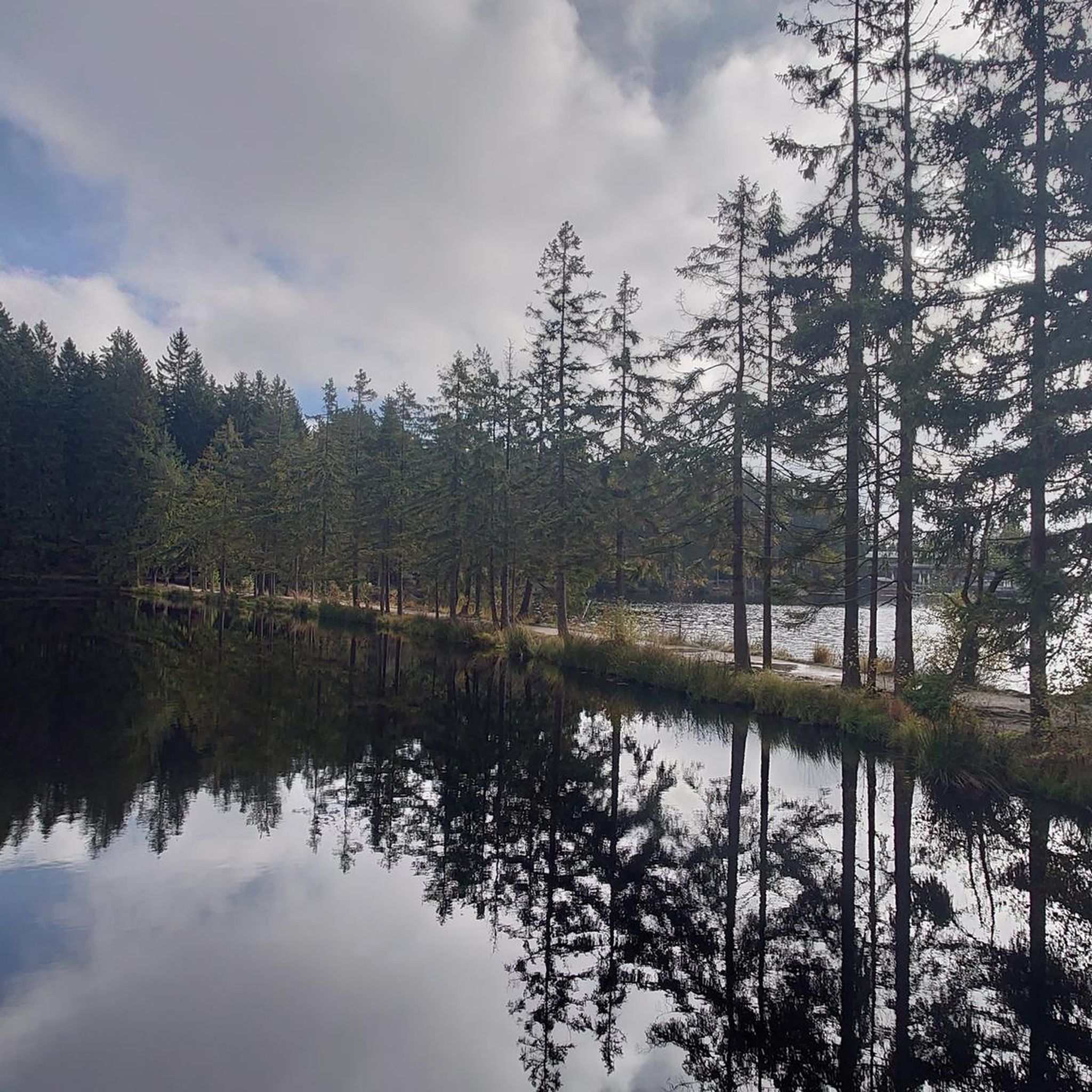
Tips from the Community

The Narrows is a shallow channel between upper and lower Mazinaw Lake and sits below the towering Mazinaw Rock. There is a popular trail that traces the shoreline of the lake from the nearby campground, making this point easy to access.
0
0
Forming the heart of Bon Echo Provincial Park, Mazinaw Lake is divided in two by "The Narrows" a shallow channel that separates the two lake basins. Drawing its name from the Algonquian word Mazinaabikinigan-zaaga'igan, meaning "painted-image lake" a moniker that honours Mazinaw Rock, a massive 100-metre cliff that rises directly from the water and features over 260 Indigenous pictographs, the largest such collection in Canada. You can launch a canoe or kayak onto the lake to inspect the historic artwork up close from the water, or take in the sheer cliff face and surrounding pine forests from elevated shoreline lookouts along the park's walking trails.
0
0
Bon Echo is best known for Mazinaw Rock, a sheer cliff rising above Lake Mazinaw and covered with well over 200 Indigenous pictographs. The area around the lake is quiet and scenic, with easy access to beaches, canoe routes, and short walking trails that lead to viewpoints, sheltered coves, and other smaller lakes within the park boundary. Bon Echo offers hiking, kayaking, camping, fishing, swimming, and rock climbing which has made it a popular destination for outdoor lovers across Canada.
0
0
This beach sits at the northern edge of Lower Mazinaw Lake and where Bon Echo Creek meets the lake. It's a nice stretch of sand where families can relax by the water. You'll find a buoyed area for swimming, picnic tables, toilets, water taps, and showers nearby.
0
0

Mazinaw Heights road provides access to the beautiful High Pines Trail, a short loop through tall pines, hemlock groves and forest ponds. On bright days, the gaps in the trees create a lovely, warm glow and it's a wonderfully serene place for an amble.
0
0
The High Pines Trail is a pleasant loop that's easily accessible from Highway 41 and Bon Echo Provincial Park's campsites by Mazinaw Lake. Tall pines, groves of hemlock and serene forest ponds characterise the loop, which can be walked in under and hour.
0
0
This trail loops around Bon Echo Provincial Park. It passes through lush forest and right by three different lakes. The trail can be quite buggy, so be sure to bring your bug spray, or plan your visit in the colder months when bugs aren't a problem.
1
0
Bon Echo is best known for Mazinaw Rock, a sheer cliff rising above Lake Mazinaw and covered with well over 200 Indigenous pictographs. The area around the lake is quiet and scenic, with easy access to beaches, canoe routes, and short walking trails that lead to viewpoints, sheltered coves, and other smaller lakes within the park boundary. Bon Echo offers hiking, kayaking, camping, fishing, swimming, and rock climbing which has made it a popular destination for outdoor lovers across Canada.
0
0
Frequently Asked Questions
How many hiking trails are available in North Frontenac?
North Frontenac offers over 20 hiking routes, catering to various skill levels. Most of these, 18 to be exact, are considered moderate, while 4 are easier options for a more relaxed experience.
What kind of terrain can I expect on hikes in North Frontenac?
The region is characterized by the rugged Canadian Shield topography, featuring ancient exposed rock, dense forests, and pristine lakes. You'll encounter varied terrain, including steep limestone hillsides and significant elevation changes, offering a diverse hiking experience.
Are there any family-friendly hiking options in North Frontenac?
Yes, North Frontenac has several easier trails suitable for families. For instance, the Eagle's Nest Trail is a moderate 2.9 km path that leads to the scenic Eagle's Nest Lookout and Turtle Pond, making it a great option for a shorter outing.
What are some notable natural features or landmarks to see while hiking?
North Frontenac is rich in natural beauty. You can explore areas like the Schooner-Fortune Lake ANSI, known for its unique ecological significance. Many trails lead to scenic viewpoints, such as the Eagle's Nest Lookout, or wind past pristine bodies of water like Turtle Pond. The region's Canadian Shield landscape itself is a major attraction.
Are there any circular hiking routes in North Frontenac?
Yes, there are several excellent loop trails. A popular choice is the Eagle's Nest Lookout – Turtle Pond loop from Otter Pond, a moderate 9.4 km path with over 200 meters of elevation gain. Another option is the Red Arrow Rock Lookout loop from McNeeleys Bay, which is a moderate 6.8 km route.
What do other hikers say about the trails in North Frontenac?
The trails in North Frontenac are highly rated by the komoot community, with an average score of 4.6 stars from over 30 reviews. Hikers often praise the diverse terrain, the beauty of the pristine lakes, and the well-maintained network of paths that offer options for various ability levels.
Are there any challenging hikes for experienced trekkers?
While most trails are moderate, routes like the Manitou Mountain Lookout – Eagle's Nest Lookout loop from McNeeleys Bay offer a longer, more strenuous experience. This 12.4 km trail features significant elevation changes through forested areas and multiple lookout points, making it a good challenge.
Can I find places to eat or stay near the hiking trails?
Yes, there are amenities available. For instance, you can find places like Sophie's Burger & Arden C4 Country Convenience for food, and Black Donald Tent and RV Park for accommodation options, which are listed as nearby attractions.
What is the best time of year to go hiking in North Frontenac?
North Frontenac offers beautiful hiking experiences throughout the warmer months. The fall foliage season is particularly spectacular, with the K&P Trail offering stunning views. Spring and summer provide lush greenery and opportunities to enjoy the many lakes.
Are there any trails that follow old railway lines or historical routes?
Yes, sections of the K&P Rail Trail traverse North Frontenac. This trail, which follows an old railway line, offers opportunities for both hiking and cycling, with some sections providing advanced hiking experiences and spectacular views.
What makes North Frontenac unique for hiking compared to other regions?
North Frontenac stands out due to its distinct Canadian Shield topography, featuring ancient exposed rock and soil, and an abundance of pristine lakes. It's also home to unique ecological areas, including two of the five Areas of Natural and Scientific Interest (ANSIs) in the Madawaska Highlands, and is recognized as a Dark Sky Preserve, offering exceptional stargazing opportunities.
Most popular routes around North Frontenac
Most popular attractions around North Frontenac

Get inspired with the komoot mobile app


Explore more
Browse the best Hikes in other regions.
