The best walks and hikes around Dokkfløyvatnet
4.7
(38)
199
hikers
22
hikes
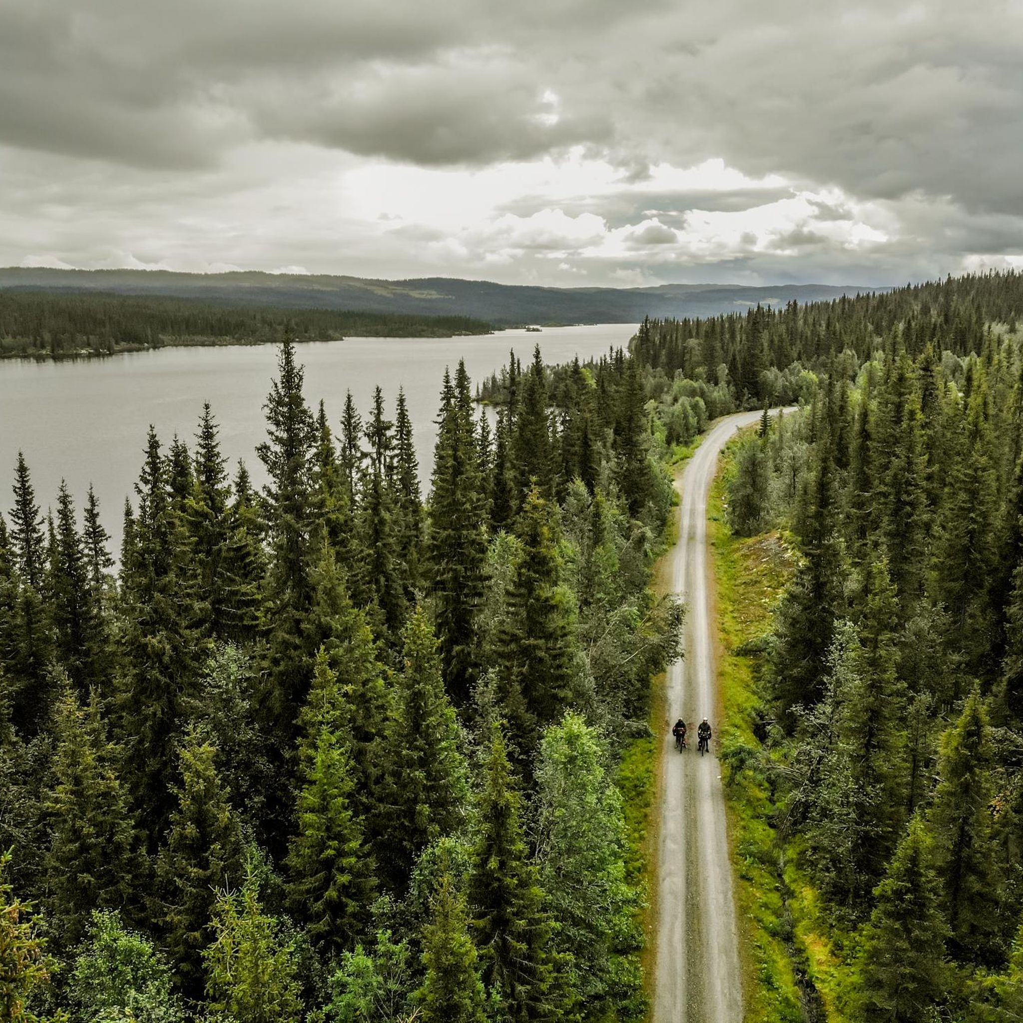
Hiking around Dokkfløyvatnet offers trails through Norway's inland mountainous regions, characterized by forests, open terrain, and views typical of a higher elevation lake. Situated at 735 meters (2,411 feet), the Dokkfløyvatnet area features varied terrain suitable for hiking, from gentle paths to more challenging ascents. The landscape is also notable for its historical significance, with evidence of ancient human activity, including Stone Age settlements and moose traps, adding a unique dimension to the outdoor experience.
Best hiking trails around Dokkfløyvatnet
…Last updated: June 26, 2026
1
hikers
35.3km
10:06
840m
840m
Hard hike. Very good fitness required. Easily-accessible paths. Suitable for all skill levels.
4.9
(8)
21
hikers
11.6km
03:30
350m
360m
Moderate hike. Good fitness required. Easily-accessible paths. Suitable for all skill levels.

Sign up for free
5.0
(2)
12
hikers
6.41km
01:45
100m
100m
Easy hike. Great for any fitness level. Easily-accessible paths. Suitable for all skill levels.
5.0
(2)
12
hikers
6.47km
01:46
90m
100m
Easy hike. Great for any fitness level. Easily-accessible paths. Suitable for all skill levels.
4.0
(2)
8
hikers
9.51km
02:32
100m
110m
Moderate hike. Good fitness required. Easily-accessible paths. Suitable for all skill levels.
Get access to more routes and recommendations from other explorers.
Sign up for free
Already have an account?
Our route recommendations are based on thousands of hikes, rides, and runs completed by other people on komoot.
Start today with a free account
Your next adventure awaits.
Login or Signup
Popular around Dokkfløyvatnet
Tips from the Community

Part of Langsua National Park, this is a lovely stretch. The track takes you gradually up through peaceful woodland towards Obleikhaugen. It forms part of the epic SignaTUR Omveien, a long-distance trail between Lillehammer and Sognefjord that opened in 2022.
0
0
Opened in 2015, Vestfjellhytta is nestled in the Gausdal Vestfjell and is a great base camp for the region's reserves and national parks. In total, there are 18 beds across its two bedrooms and loft. There are numerous good fishing lakes in the surrounding countryside, though you'll need a licence for the area.
0
0
Renovated in 2021, Kittilbua is a charming, self-service log cabin surrounded by lush coniferous forest. It features on both the Omveien and Jotunheimstien long-distance hiking routes and is an ideal base camp for exploring Langsua National Park's nature reserves.
0
0

DNT Kittilbua is a very cozy, easily accessible bivouac surrounded by lush coniferous forest. Quiet is assured!
2
0


beautiful small circular route through typical moorland
3
3
At first, wooden planks make it easier to walk across the moor
3
3

Above all, it is conveniently located and easily accessible.
0
0
Frequently Asked Questions
How many hiking trails are available around Dokkfløyvatnet?
There are over 20 hiking trails around Dokkfløyvatnet, offering a variety of experiences for different skill levels. The komoot community has explored these routes extensively, with more than 200 hikers using komoot to navigate the area.
What kind of terrain can I expect on hikes around Dokkfløyvatnet?
The terrain around Dokkfløyvatnet is characteristic of Norway's inland mountainous regions, featuring a blend of forests, open areas, and views typical of a higher elevation lake. You'll find varied paths, from gentle forest trails to more challenging ascents with significant elevation changes, suitable for easy, moderate, and difficult ability levels.
Are there any family-friendly hiking options near Dokkfløyvatnet?
Yes, Dokkfløyvatnet offers several family-friendly hiking options. For an easier walk, consider the Holshaugen loop from Jomyrkroken, which is 4.0 miles (6.5 km) and leads through forested areas, typically taking about 1 hour 45 minutes. Another easy option is the DNT Kittilbua – Bog Iron Ore Extraction Site loop from Jomyrkroken, a 3.8-mile (3.8 km) trail that offers a glimpse into the region's historical significance.
Are dogs allowed on the hiking trails around Dokkfløyvatnet?
While specific regulations for dogs on every trail are not detailed, generally, dogs are welcome on hiking trails in Norway, especially if kept on a leash. The varied terrain and open spaces around Dokkfløyvatnet make it a suitable area for hiking with dogs, provided they are well-behaved and you follow local guidelines for nature protection.
What historical landmarks or natural features can I see while hiking?
The Dokkfløyvatnet area is rich in history. You can explore a landscape steeped in thousands of years of human activity, including evidence of Stone Age settlements, ancient moose traps, and iron mining facilities. While specific named landmarks on trails are not listed, the entire region offers a unique blend of natural beauty and historical intrigue, making every hike a journey through time. The DNT Kittilbua – Bog Iron Ore Extraction Site loop from Jomyrkroken specifically highlights an ancient iron ore extraction site.
Are there any circular hiking routes around Dokkfløyvatnet?
Yes, there are several circular hiking routes available. A popular moderate option is the Ormtjernkampen – Omtjernet Picnic Area loop from Holsfossen, which is 7.2 miles (11.6 km) and offers views of the mountainous landscape. For an easier loop, consider the Holshaugen loop from Jomyrkroken, a 4.0-mile (6.5 km) trail through forested areas. Another moderate loop is the Dokklia loop from Holsfossen, covering 9.5 miles (9.5 km).
What is the best time of year to hike around Dokkfløyvatnet?
The best time to hike around Dokkfløyvatnet is typically during the warmer months, from late spring to early autumn (May to September), when the trails are clear of snow and the weather is most favorable. This period allows for comfortable exploration of the forests, open terrain, and lake views. Always check local weather conditions before heading out.
What do other hikers enjoy most about hiking in Dokkfløyvatnet?
The Dokkfløyvatnet area is highly rated by the komoot community, with an average score of 4.7 stars from over 30 reviews. Hikers often praise the blend of serene lake environments, varied mountainous terrain, and the unique historical context, including ancient human activity. The well-maintained paths and diverse options for all skill levels are also frequently highlighted.
Are there options for winter hiking around Dokkfløyvatnet?
While the region is known for its natural beauty, specific groomed winter hiking trails are not detailed. However, the broader area of Gausdal and proximity to Langsua National Park suggest that winter activities like cross-country skiing or snowshoeing might be possible on suitable terrain, depending on snow conditions. Always exercise caution and be prepared for winter conditions if attempting to hike in colder months.
Is there parking available at the trailheads around Dokkfløyvatnet?
While specific parking locations for every trailhead are not detailed, areas like Holsfossen and Jomyrkroken are mentioned as starting points for several routes, implying that parking facilities are likely available nearby. It's advisable to check local signage or specific route descriptions for detailed parking information before your hike.
Are there any cafes or restaurants near the hiking trails?
The Dokkfløyvatnet area is primarily a natural and historical landscape. While specific cafes or restaurants directly adjacent to trailheads are not mentioned, you may find options in nearby towns within the Gausdal and Nordre Land municipalities. It's recommended to bring your own provisions for your hike and check for dining options in the surrounding communities.
What is the longest hike available in the Dokkfløyvatnet area?
The longest hike listed in the area is The Detour Signature Trail (Day 3), a challenging 21.9-mile (35.3 km) route. This difficult trail traverses varied terrain with significant elevation changes and typically takes around 10 hours 5 minutes to complete.
Most popular routes around Dokkfløyvatnet

Get inspired with the komoot mobile app


Explore more
Browse the best Hikes in other regions.
