The best road cycling routes around Sault Ste. Marie
5.0
(3)
32
riders
4
rides
Road cycling routes around Sault Ste. Marie navigate a landscape shaped by the St. Marys River and its tributaries, including the Root River and Goulais River. The terrain features gentle elevation changes, river valleys, and areas near the historic lock gates. This region offers a mix of urban-adjacent paths and more expansive routes through natural settings.
Best road cycling routes around Sault Ste. Marie
- The most popular road cycling route is Across the lock gates loop from Greyhound station,…
Last updated: July 2, 2026
5.0
(2)
16
riders
23.5km
01:09
110m
110m
Easy road ride. Great for any fitness level. Mostly well-paved surfaces and easy to ride.
5.0
(1)
7
riders
77.5km
03:24
690m
690m
If you're seeking a rewarding road cycling adventure near Sault Ste. Marie, the Root River – Goulais River loop offers a fantastic journey through Algoma Country's diverse landscapes. This moderate…

Sign up for free
4
riders
27.1km
01:07
140m
140m
The Roadbike loop from Korah Collegiate and Vocational School offers a wonderfully accessible road cycling experience in Sault Ste. Marie. You'll enjoy well-paved surfaces throughout this easy 16.8-mile (27.1 km)…
5
riders
60.4km
02:37
480m
480m
The Root River loop from Greyhound station offers a delightful road cycling adventure through Minnesota's scenic Bluff Country. You'll pedal along a well-maintained paved trail, tracing the Root River's course…
Our route recommendations are based on thousands of hikes, rides, and runs completed by other people on komoot.
Start today with a free account
Your next adventure awaits.
Login or Signup

Other adventures around Sault Ste. Marie

Tips from the Community

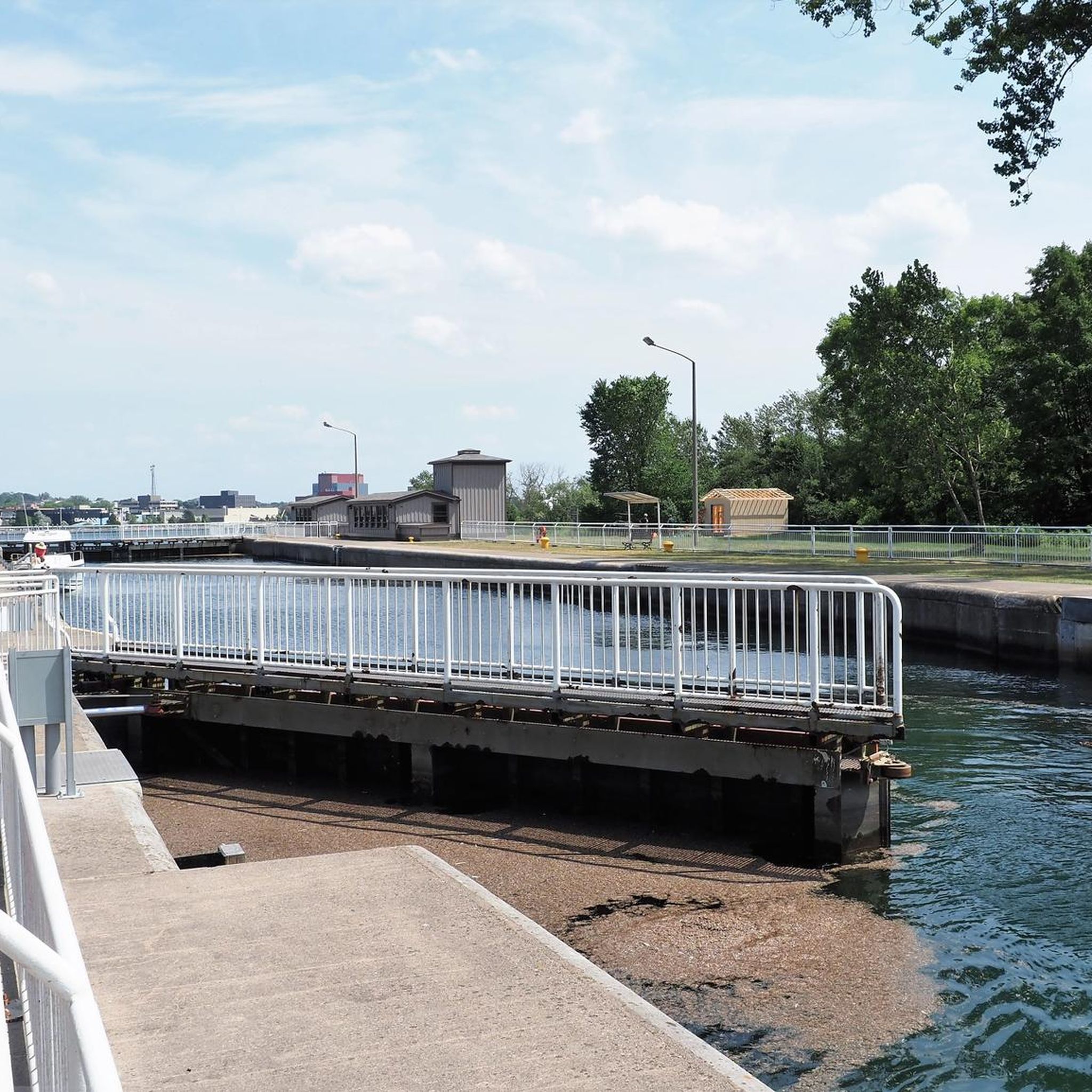
Your way to South St. Mary's Island takes you through one of the lock gates. The Visitor Center is located right next to the lock, where you can find out more about the island and its walking trails.
1
0
Frequently Asked Questions
What kind of terrain can I expect on road cycling routes around Sault Ste. Marie?
Road cycling routes in Sault Ste. Marie feature a landscape shaped by the St. Marys River and its tributaries, including the Root River and Goulais River. You'll encounter gentle elevation changes, river valleys, and areas near the historic lock gates, offering a mix of urban-adjacent paths and natural settings.
Are there easy road cycling routes suitable for beginners or families in Sault Ste. Marie?
Yes, Sault Ste. Marie offers easy road cycling options. For instance, the Across the lock gates loop from Greyhound station is an easy 14.4-mile (23.2 km) route, and the Roadbike loop from Korah Collegiate and Vocational School is another easy 16.8-mile (27.1 km) path with moderate elevation gains, suitable for a relaxed ride.
What are the typical distances for road cycling routes in the Sault Ste. Marie area?
Route distances vary, catering to different preferences. You can find shorter routes like the 14.4-mile (23.2 km) Across the lock gates loop from Greyhound station, or longer, more challenging rides such as the 48.1-mile (77.5 km) Root River – Goulais River loop from Greyhound station.
Are there more challenging or advanced road cycling routes available?
For those seeking a more challenging ride, Sault Ste. Marie offers moderate routes. The Root River – Goulais River loop from Greyhound station is a 48.1-mile (77.5 km) route through river valleys and rural landscapes, and the Root River loop from Greyhound station covers 60.4 miles (97.2 km) with significant elevation changes.
What kind of scenery can I expect while road cycling in Sault Ste. Marie?
The routes offer diverse scenery, from views of the St. Marys River and its lock system to expansive rural landscapes along river valleys like the Root River and Goulais River. You'll experience a blend of urban edges and natural areas.
Are the road cycling routes in Sault Ste. Marie typically loop trails?
Yes, many of the popular road cycling routes in Sault Ste. Marie are designed as loops, allowing you to start and end your ride at the same location. Examples include the Across the lock gates loop from Greyhound station and the Beaver Falls – Goulais River loop from Island Lake.
What do other road cyclists say about the routes in Sault Ste. Marie?
The road cycling routes in Sault Ste. Marie are highly rated by the komoot community, with an average score of 5.0 stars. Cyclists often praise the varied terrain, from riverine landscapes to gentle hills, and the options available for both easy and more challenging rides.
When is the best time of year for road cycling in Sault Ste. Marie?
While specific data isn't provided, Sault Ste. Marie experiences distinct seasons. Generally, late spring through early autumn (May to October) offers the most favorable weather for road cycling, with milder temperatures and less precipitation. Always check local weather forecasts before heading out.
Are there any routes that pass by notable landmarks or points of interest?
Routes like the Across the lock gates loop from Greyhound station offer views of the St. Marys River and its lock system, which is a significant historical and engineering landmark in the region. Other routes explore the natural beauty of the Root and Goulais River valleys.
How many road cycling routes are available in Sault Ste. Marie?
There are at least 5 distinct road cycling routes detailed for the Sault Ste. Marie area, ranging in difficulty from easy to moderate, providing options for various skill levels and preferences.
Are there any routes that explore both urban and natural areas?
Yes, the road cycling network in Sault Ste. Marie is designed to offer a mix. Routes often navigate urban-adjacent paths, providing access to city amenities, before transitioning into more expansive natural settings along river valleys and rural landscapes.
Most popular attractions around Sault Ste. Marie

Get inspired with the komoot mobile app


Explore more
Browse the best Road cycling routes in other regions.
