The best walks and hikes around Byglandsfjorden
4.5
(497)
1,640
hikers
14
hikes
Hiking around Byglandsfjorden offers a diverse range of experiences within Agder county, Norway. The region is characterized by the 34-kilometer-long Byglandsfjorden itself, surrounded by extensive woodlands and varied terrain. Hikers can find routes ranging from leisurely paths through forests and meadows to challenging ascents leading to panoramic viewpoints. The landscape includes hills, higher peaks, and natural features like the Lauvåsen Nature Reserve and Birkelandsskogen Forest.
Best hiking trails around Byglandsfjorden
- The most popular hiking route is Round trip to Ørnenapen, a 2.4 miles (3.9 km) trail that takes 1 hour 58 minutes to complete. This moderate route offers views of the surrounding landscape.
- Another top favourite among local hikers is Arabianspitz 792 m – Årdalsnuten Summit loop from Neset, a moderate 5.2 miles (8.3 km) path. This trail features significant elevation gain, leading to summit views.
- Local hikers also love the Årdalsnuten Summit – View of Byglandsfjord loop from Neset, a 5.0 miles (8.0 km) trail leading through varied terrain to viewpoints, often completed in about 3 hours 45 minutes.
- Hiking around Byglandsfjorden is defined by its crystal-clear fjord, dense woodlands, and numerous viewpoints from hills and peaks. The network offers options for different ability levels, from easy strolls to more demanding ascents.
- The routes in Byglandsfjorden are highly rated by the komoot community with an average score of 4.4 stars from over 400 reviews. More than 1,500 hikers have used komoot to explore Byglandsfjorden's varied terrain.
Last updated: July 7, 2026
4.7
(49)
183
hikers
3.91km
01:58
310m
310m
Moderate hike. Good fitness required. Mostly accessible paths. Sure-footedness required.
4.2
(9)
35
hikers
8.17km
03:20
430m
430m
Moderate hike. Good fitness required. Mostly accessible paths. Sure-footedness required.

Sign up for free
4.7
(57)
217
hikers
7.99km
03:45
530m
530m
Moderate hike. Good fitness required. Mostly accessible paths. Sure-footedness required.
3.8
(26)
61
hikers
13.0km
05:05
650m
650m
Hard hike. Very good fitness required. Mostly accessible paths. Sure-footedness required.
4.7
(18)
67
hikers
4.34km
01:15
110m
110m
Easy hike. Great for any fitness level. Easily-accessible paths. Suitable for all skill levels.
Get access to more routes and recommendations from other explorers.
Sign up for free
Already have an account?
Our route recommendations are based on thousands of hikes, rides, and runs completed by other people on komoot.
Start today with a free account
Your next adventure awaits.
Login or Signup
Popular around Byglandsfjorden
Tips from the Community

It couldn't be more beautiful: the path leads you through a wonderful forest, where an even more stunning view awaits you around every bend.
0
0
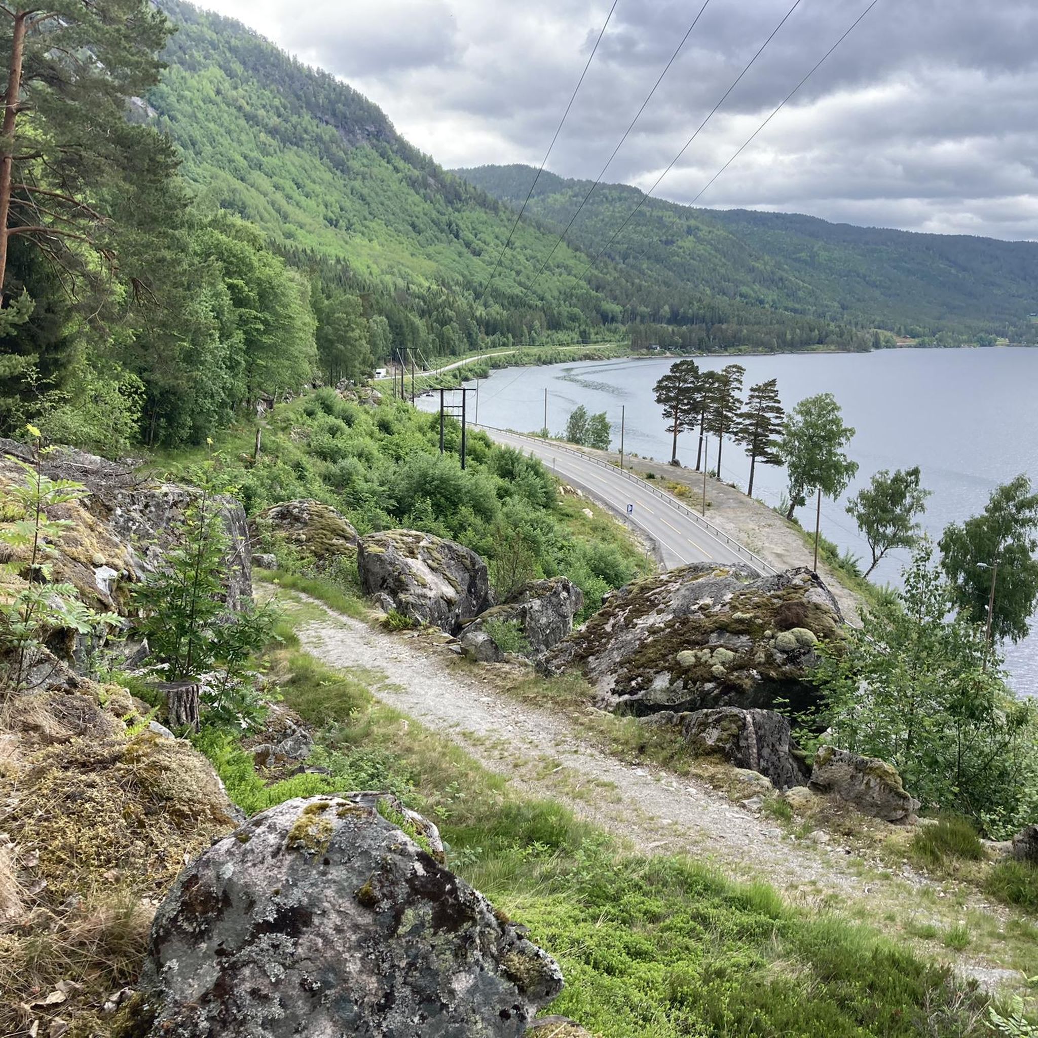
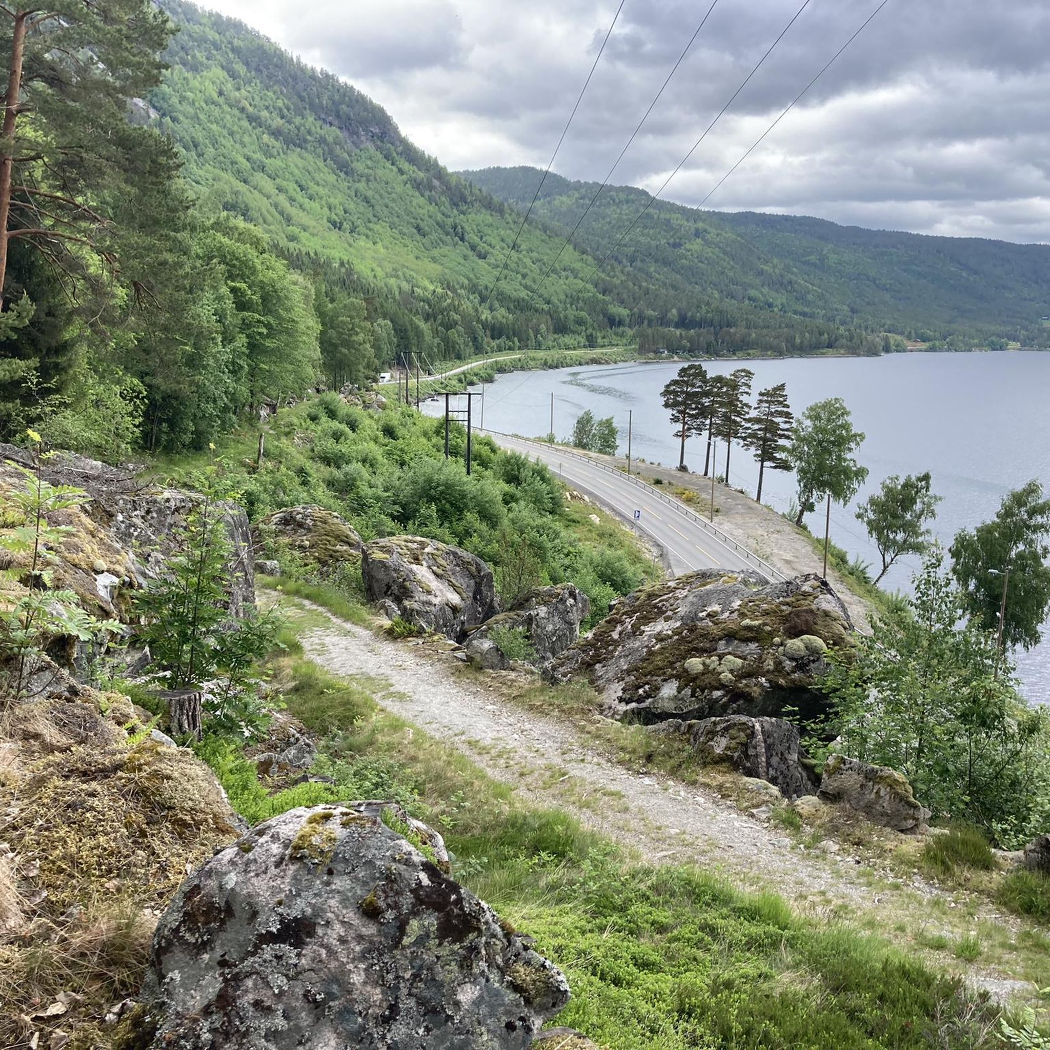
From here, you have a great view of the Byglandsfjord near Lauvdal. It is a long, narrow freshwater lake in southern Norway known for its calm waters and scenic forested surroundings. It is part of the Setesdal valley and is popular for fishing, boating, and quiet nature experiences.
1
0
Along the hiking trail, you will constantly enjoy magnificent views of the Byglandsfjord.
1
0


The start of this walk is no longer Neset camping. Due to roadworks the beginning of the trail was destroyed. You can start the walk now a bit more south, in the turn.
0
0

Beautiful views of the lake
1
0
Small parking lot, but parking is also possible on the campsite
0
0
Great view of the lake
0
0
Frequently Asked Questions
What kind of hiking terrain can I expect around Byglandsfjorden?
Byglandsfjorden offers a diverse range of hiking experiences. You'll find everything from leisurely paths through lush forests and open meadows to more challenging routes across rugged terrain and steep inclines. The landscape includes hills, higher peaks, and trails that lead to stunning viewpoints overlooking the fjord.
Are there any easy hiking trails suitable for beginners in Byglandsfjorden?
Yes, Byglandsfjorden has trails suitable for beginners. Out of the 15 available routes, 3 are classified as easy, offering gentle paths through scenic areas. These are perfect for those new to hiking or looking for a relaxed stroll.
What are some notable natural features or viewpoints to look for while hiking?
The region is rich in natural beauty. You can explore the Lauvåsen Nature Reserve with its well-marked paths, or the Birkelandsskogen Forest which leads to stunning fjord views. For panoramic vistas, consider trails leading to Hovden Mountain or the Kongens Utsikt Trail. The highest peak, Årdalsknaben, also offers breathtaking views from its summit. Don't miss the View of Fånefjorden, a popular viewpoint.
Are there any circular hiking routes in Byglandsfjorden?
Yes, many of the trails around Byglandsfjorden are designed as circular routes, allowing you to start and end at the same point. For example, the Round trip to Ørnenapen is a moderate 3.9 km loop offering great views.
What historical sites or attractions can I visit near the hiking trails?
Byglandsfjorden has a rich history. You can visit the Evje Old Train Station and Library, which dates back to 1895 and showcases the area's past as a transportation hub. During the summer, you might also catch a ride on the historic wood-fired steamboat, SS Bjoren, which operates on Byglandsfjorden.
Are there opportunities for foraging or wildlife observation in the woodlands?
Absolutely. The extensive woodlands surrounding Byglandsfjorden are home to Europe's southernmost wild reindeer herd, offering unique wildlife observation opportunities. In late summer, these forests are also excellent for picking wild mushrooms and berries.
What do other hikers say about the trails in Byglandsfjorden?
The hiking routes in Byglandsfjorden are highly rated by the komoot community, with an average score of 4.4 stars from over 460 reviews. Hikers often praise the crystal-clear fjord views, dense woodlands, and the variety of trails suitable for different ability levels.
Where can I find parking for the hiking trailheads?
Several trailheads in Byglandsfjorden offer dedicated parking. For instance, you can find parking at Ørnenapen Trailhead Parking and Tjovhola Trailhead Parking, making access to the trails convenient.
Are there any challenging hikes for experienced trekkers?
Yes, for experienced trekkers seeking a challenge, Byglandsfjorden offers more demanding routes. One such trail is the View of Byglandsfjord – Årdalsnuten Summit loop from Neset, which is classified as difficult and features significant elevation gain over its 13.4 km distance.
Can I combine hiking with other outdoor activities like swimming or boating?
Definitely! The 34-kilometer-long Byglandsfjorden itself is a central feature, offering crystal-clear waters ideal for swimming, boating, and fishing. Many fine-grained sand beaches along the fjord provide perfect spots to relax after a hike or enjoy water activities.
What is Årdalsknapen and can I hike to it?
Årdalsknapen is the highest peak in the Byglandsfjorden area, standing at 762 meters above sea level. It offers breathtaking views from its summit. You can hike to it via routes like the Arabianspitz 792 m – Årdalsnuten Summit loop from Neset, which is a moderate 8.3 km path leading to summit views.
Are there any huts along the hiking routes for rest or overnight stays?
Yes, many hiking routes in Byglandsfjorden feature charming huts. These provide a welcome respite, basic amenities, and some even offer opportunities for overnight stays, allowing for a deeper immersion in nature and longer hiking adventures.
Most popular attractions around Byglandsfjorden

Get inspired with the komoot mobile app


Explore more
Browse the best Hikes in other regions.
