Attractions and Places To See around Area A (Malaspina/Toba) - Top 20
Best attractions and places to see around Area A (Malaspina/Toba) are found in a region known for its rugged natural beauty and opportunities for wilderness exploration. This area encompasses the scenic Toba Inlet, a deep fjord with snow-capped peaks and numerous waterfalls, and Malaspina Provincial Park, which protects coastal forests and shorelines. The region is also part of the traditional territory of the Klahoose First Nation, offering cultural insights and unique wildlife viewing experiences. It provides a blend of natural features and points of interest for adventurers and nature enthusiasts.
Best attractions and places to see around Area A (Malaspina/Toba)
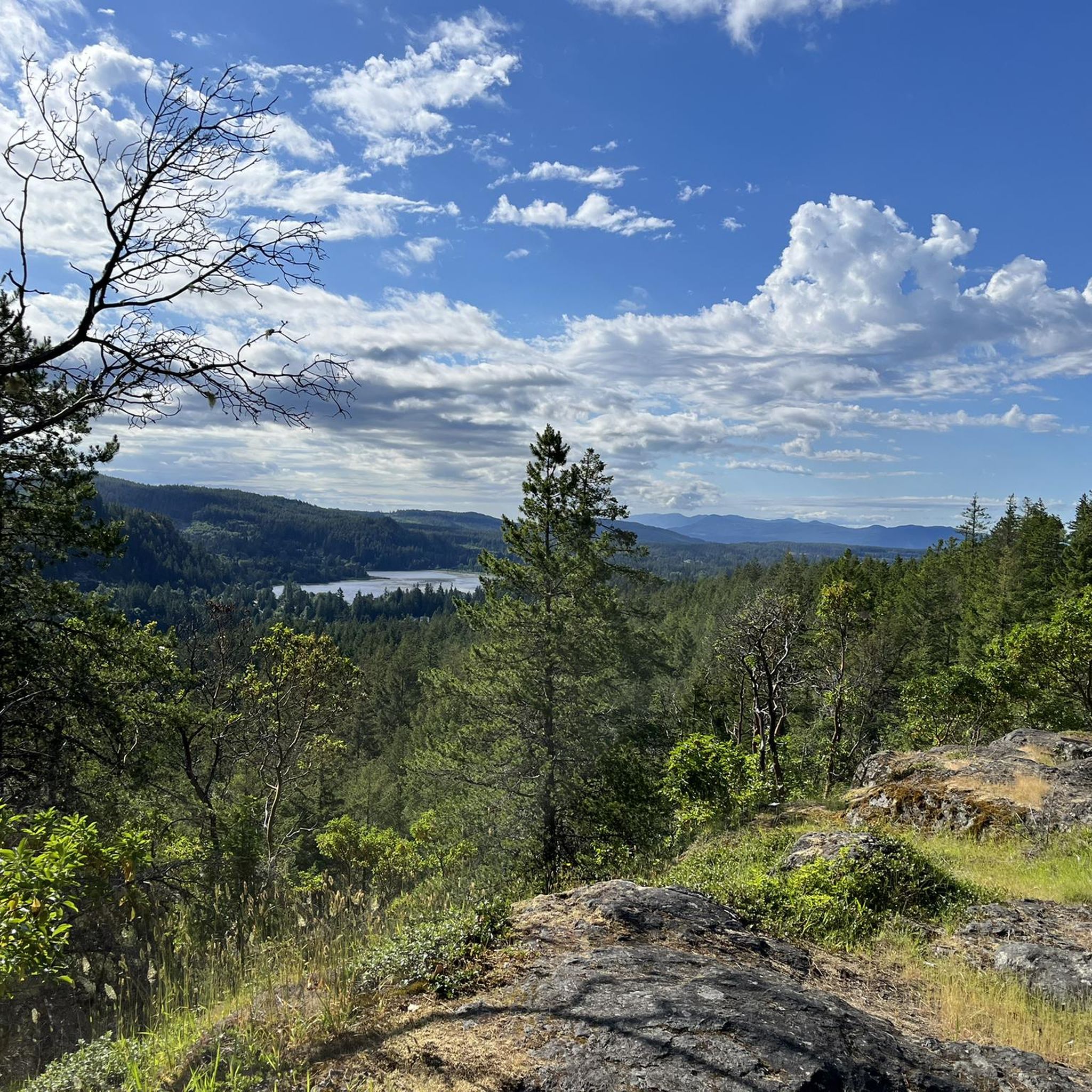
- The most popular attractions is Manzanita Bluffs and Shelter, a hut that offers views over Savary Island and Vancouver Island. This location includes a cabin, a bear box, picnic tables, and a fireplace.
- Another must-see spot is Wednesday Lake, a calm lake known for its clear, drinkable water and abundant nature. It is a suitable place to rest, with beavers often visible in the evenings.
- Visitors also love Anthony Island Campsite, a facilities highlight located on an island. This campsite is noted for opportunities to swim with Common Loons and offers a unique natural experience.
- Area A (Malaspina/Toba) is known for its natural features, cultural sites, and diverse outdoor activities. Visitors can explore fjords, coastal forests, and lakes, alongside opportunities for wildlife viewing, kayaking, and hiking.
- The attractions around Area A (Malaspina/Toba) are appreciated by the komoot community, with 5 upvotes and 7 photos shared by users.
Last updated: July 8, 2026
Manzanita Bluffs and Shelter
Highlight • Mountain Hut
Translated by Google •
Tip by

Fiddlehead Landing Hut
Highlight • Mountain Hut
Tip by

Sign up now to discover places like this
Get recommendations on the best single tracks, peaks, & plenty of other exciting outdoor places.
Sign up for free
Tin Hat Hut
Highlight • Mountain Hut
Tip by
Wednesday Lake
Highlight • Lake
Translated by Google •
Tip by
Willingdon Beach spur trail junction
Highlight • Beach
Tip by

Sign up for free to discover even more attractions around Area A (Malaspina/Toba).
Sign up for free
Already have an account?
Start today with a free account
Your next adventure awaits.
Login or Signup
Popular around Area A (Malaspina/Toba)
Tips from the Community

Tin Hat Hut sits at the halfway point of the Sunshine Coast Trail on the summit of Tin Hat Mountain, with 360-degree views of Powell Lake, the Coast Mountain range, the Strait of Georgia, and Vancouver Island to the west. The hut, built by volunteers in 2011, sleeps 10 and includes a pellet stove, an outhouse, picnic tables, and a fire pit. It’s free to stay on a first-come, first-served basis with no permits required, making it a great overnight destination whether you are doing a day hike or a longer section of the trail.
0
0
Fiddlehead Landing is a remote lakeside access point on Powell Lake along the Sunshine Coast Trail, located near the site of the former Fiddlehead Farm and an old orchard on the shoreline. Just uphill, Fiddlehead Hut is a small backcountry shelter perched above Powell Lake, offering simple overnight accommodation and views of the lake in a quiet, forested setting. This site functions as a backcountry trailhead and staging area, with direct access by water taxi from Powell Lake Marina (Contact Justin Behan, who transports hikers to and from the landing at 604-483-6527). Alternatively, land access is via the Fiddlehead Trail as part of a longer, more strenuous backcountry approach.
0
0

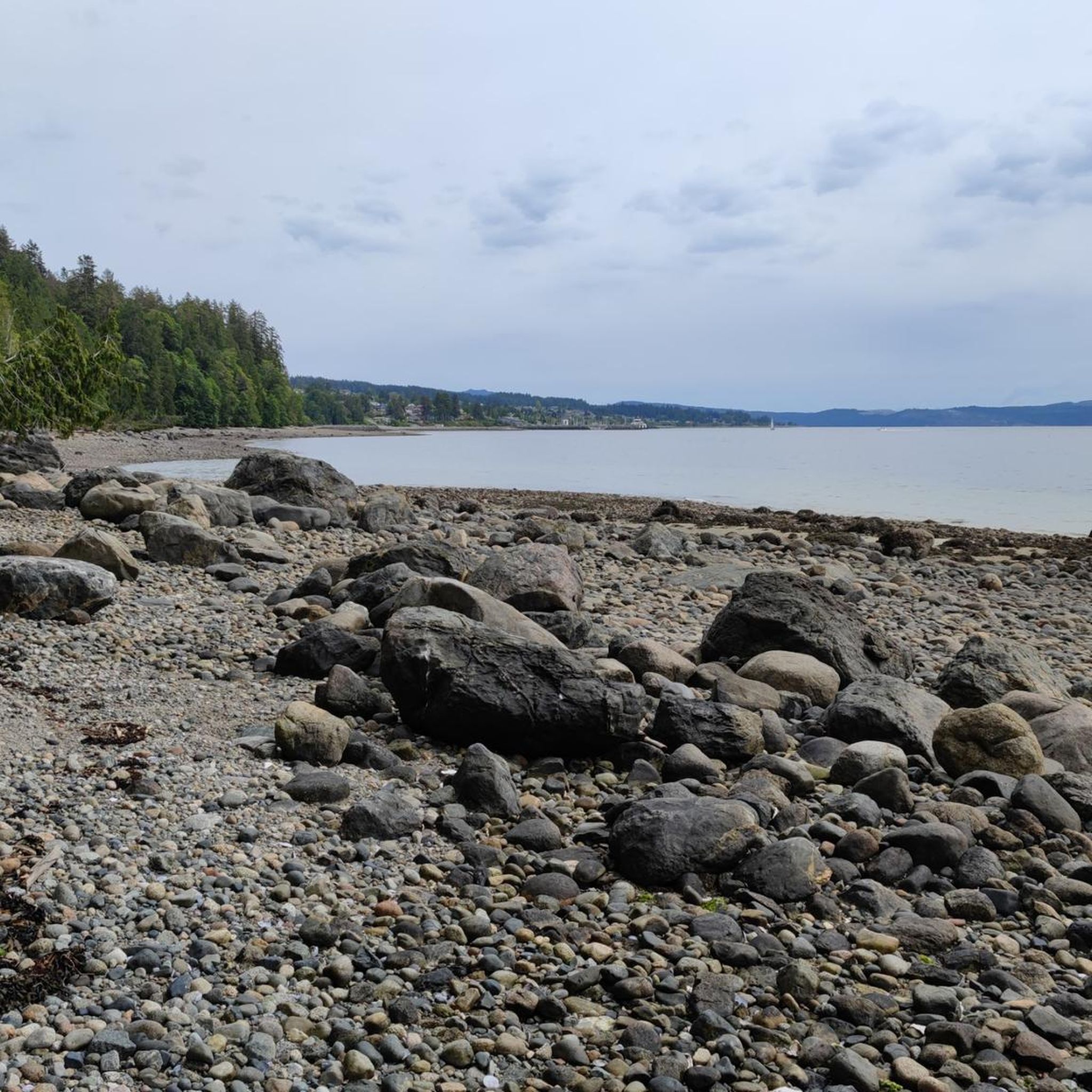
As you walk along the shoreline, you can enjoy a wide, sandy beach that is great for swimming or searching for colorful shells during low tide. The water here is usually calm, making it a safe and fun place for you to relax under the sun.
0
0

The halfway point of the Sunshine Coast Trail, the Tin Hat Hut is an epic 360-degree mountain-top lookout that provides the quintessential view of the rugged mountains, valleys, and lakes that define the qathet back country experience. This hut, built by qPAWS in 2011, is a fully winterized cabin with a pellet stove. Tin Hat Mountain is named for the tin hats that were worn by loggers who were pioneers in the area, and the mountain itself was once home to a fire lookout station, because of the expansive view it provides of all the surrounding forested areas and views of 32 lakes.” https://sunshinecoasttrail.com/plan-your-hike/hut-to-hut/tin-hat/ When we slept there it was very crowded: it is said that the cabin offers place for 10 persons. However we have been 12. You have to carry your own water up the mountain as there is no creek.
0
0
Open shelter with enclosed sleeping loft Amenities: Outhouse, picnic tables, fire pit, swimming dock We experienced the place not as nice as it was recommended. Nearby are neighbours who seem not to like hikers near their property (signs, big dogs) The Hut is placed in between. To sleep at Tin Hat cabin was by far the better choice.
0
0
Stunning view over Savary Island and Vancouver Island. There is a Cabin, a Bear-Box, Picnic Tables and a fire place. Please inform yourself if it is allowed to make a fire. Often it is forbidden during summertime beacuse of the wildfire risk. I highly recommend the Book by Eagle Walz about the Sunshine Coast Trail
0
0
Clear drinkable water - beavers in the evening. Perfect spot to rest. A toilet is located 50m north on the SCT
0
0

Take the Willingdon Beach Trail and head down to the beach once you see an old trail leading down there right at the trailhead/end
0
0
Frequently Asked Questions
What natural features can I explore in Area A (Malaspina/Toba)?
Area A is rich in natural beauty. You can explore the dramatic Toba Inlet, a deep fjord with snow-capped peaks and numerous waterfalls, especially impressive in early summer. The region also features coastal forests and shorelines within Malaspina Provincial Park, and serene lakes like Wednesday Lake, known for its clear water and abundant wildlife.
Are there opportunities for wildlife viewing in Area A (Malaspina/Toba)?
Yes, Area A offers excellent wildlife viewing. In Toba Inlet, visitors can witness grizzly bears, particularly during the salmon runs from late summer through fall, often from Klahoose First Nation viewing platforms. The Malaspina Strait is home to marine mammals such as humpback whales, orcas, seals, and sea lions. You might also spot black bears, Roosevelt elk, and various bird species like Common Loons, especially around campsites like Anthony Island Campsite.
What kind of hiking trails are available in Area A (Malaspina/Toba)?
The region offers diverse hiking opportunities. Malaspina Provincial Park features sections of the Sunshine Coast Trail, a long-distance route. You can find trails ranging from easy to moderate, such as those around Inland Lake Provincial Park or the hiking routes around Area A. For a more challenging experience, the mountainous terrain of the Tahumming Range in Toba Inlet provides rugged options. Hikers can also reach viewpoints like Tin Hat Hut, offering 360-degree mountain-top views.
What are some family-friendly outdoor activities in Area A (Malaspina/Toba)?
Families can enjoy various outdoor activities. Exploring the calm waters of Wednesday Lake, where beavers are often visible in the evenings, is a peaceful option. Easy hikes, such as those listed in the easy hikes guide for Area A, are suitable for all ages. Camping at sites like Anthony Island Campsite or Big Tla'amin Lake Campsite offers a chance to connect with nature, with opportunities for swimming in the lakes.
What cultural sites or experiences are available in Area A (Malaspina/Toba)?
Toba Inlet is within the traditional territory of the Klahoose First Nation. Visitors can learn about their rich cultural heritage. The Klahoose Nation also operates special bear viewing platforms in Toba Inlet, offering a unique opportunity to safely observe grizzly bears in their natural habitat, which is a significant cultural and ecological experience.
What is the best time to visit Area A (Malaspina/Toba) for outdoor activities?
The best time to visit largely depends on your interests. Early summer is ideal for witnessing the numerous cascading waterfalls in Toba Inlet as the snow melts. Late summer through fall is prime for grizzly bear viewing during the salmon runs. Generally, the warmer months offer the best conditions for kayaking, boating, and hiking, though some huts like Tin Hat Hut are fully winterized for year-round use.
Are there any viewpoints or scenic lookouts in the area?
Yes, the region boasts several stunning viewpoints. Manzanita Bluffs and Shelter offers breathtaking views over Savary Island and Vancouver Island. For panoramic vistas, the Tin Hat Hut provides an epic 360-degree mountain-top lookout of the rugged mountains, valleys, and lakes.
What water activities can I do in Area A (Malaspina/Toba)?
The fjords and inlets, including Toba Inlet and the adjacent Desolation Sound, are perfect for kayaking and boating. You can embark on multi-day expeditions, explore waterfalls, and discover secluded beaches. Fishing is also popular, with major salmon runs in Toba Inlet's rivers and streams, as well as opportunities to catch rainbow trout, cod, and prawns.
Where can I find accommodation in Area A (Malaspina/Toba)?
While specific accommodation options are limited within the most remote parts of Area A, the Toba Wildernest Resort offers accommodation with incredible views and serves as a potential base for exploring Toba Inlet. For campers, sites like Anthony Island Campsite and Big Tla'amin Lake Campsite provide rustic options, often requiring tents and bear-safe food storage.
Are there cycling routes available near the attractions in Area A (Malaspina/Toba)?
Yes, there are several cycling routes in the vicinity. You can find options ranging from easy to difficult, such as the 'Bike loop from Inland Lake Campground' or the more challenging 'Totem Pole Viewpoint loop from Powell River'. For more details and route options, refer to the cycling guide for Area A.
What should I know about accessibility and getting around in Area A (Malaspina/Toba)?
Many parts of Area A, particularly Toba Inlet, are remote and inaccessible by car, preserving their wild character. Access is primarily by boat or kayak. Malaspina Provincial Park also has marine access from Desolation Sound. Okeover Inlet offers vehicle access campsites at Okeover Arm Park. Planning for remote travel and potential boat charters is essential for exploring the deeper fjords.
Most popular routes around Area A (Malaspina/Toba)

Get inspired with the komoot mobile app


Explore more
Still not found the Highlight you’re looking for? See guides of the top attractions in other regions:
