Attractions and Places To See around Area C (Lois Lake/Saltery Bay) - Top 20
Best attractions and places to see around Area C (Lois Lake/Saltery Bay) include a diverse range of natural features and points of interest. This region, encompassing Lois Lake and Saltery Bay, offers landscapes from expansive lakes to coastal shorelines. Visitors can explore significant landmarks, engage in various outdoor activities, and discover unique cultural sites. The area provides opportunities for hiking, paddling, and experiencing the natural environment.
Best attractions and places to see around Area C (Lois Lake/Saltery Bay)
- The most…
Last updated: September 1, 2026
Fiddlehead Landing Hut
Highlight • Mountain Hut
Tip by

Tin Hat Hut
Highlight • Mountain Hut
Tip by
Sign up now to discover places like this
Get recommendations on the best single tracks, peaks, & plenty of other exciting outdoor places.
Sign up for free
Anthony Island Campsite
Highlight • Rest Area
Tip by

Inland Lake
Highlight • Lake
Tip by
Willingdon Beach spur trail junction
Highlight • Beach
Tip by

Sign up for free to discover even more attractions around Area C (Lois Lake/Saltery Bay).
Sign up for free
Already have an account?
Start today with a free account
Your next adventure awaits.
Login or Signup
Popular around Area C (Lois Lake/Saltery Bay)
Tips from the Community

Tin Hat Hut sits at the halfway point of the Sunshine Coast Trail on the summit of Tin Hat Mountain, with 360-degree views of Powell Lake, the Coast Mountain range, the Strait of Georgia, and Vancouver Island to the west. The hut, built by volunteers in 2011, sleeps 10 and includes a pellet stove, an outhouse, picnic tables, and a fire pit. It’s free to stay on a first-come, first-served basis with no permits required, making it a great overnight destination whether you are doing a day hike or a longer section of the trail.
0
0
Fiddlehead Landing is a remote lakeside access point on Powell Lake along the Sunshine Coast Trail, located near the site of the former Fiddlehead Farm and an old orchard on the shoreline. Just uphill, Fiddlehead Hut is a small backcountry shelter perched above Powell Lake, offering simple overnight accommodation and views of the lake in a quiet, forested setting. This site functions as a backcountry trailhead and staging area, with direct access by water taxi from Powell Lake Marina (Contact Justin Behan, who transports hikers to and from the landing at 604-483-6527). Alternatively, land access is via the Fiddlehead Trail as part of a longer, more strenuous backcountry approach.
0
0

As you walk along the shoreline, you can enjoy a wide, sandy beach that is great for swimming or searching for colorful shells during low tide. The water here is usually calm, making it a safe and fun place for you to relax under the sun.
0
0

The halfway point of the Sunshine Coast Trail, the Tin Hat Hut is an epic 360-degree mountain-top lookout that provides the quintessential view of the rugged mountains, valleys, and lakes that define the qathet back country experience. This hut, built by qPAWS in 2011, is a fully winterized cabin with a pellet stove. Tin Hat Mountain is named for the tin hats that were worn by loggers who were pioneers in the area, and the mountain itself was once home to a fire lookout station, because of the expansive view it provides of all the surrounding forested areas and views of 32 lakes.” https://sunshinecoasttrail.com/plan-your-hike/hut-to-hut/tin-hat/ When we slept there it was very crowded: it is said that the cabin offers place for 10 persons. However we have been 12. You have to carry your own water up the mountain as there is no creek.
0
0
Open shelter with enclosed sleeping loft Amenities: Outhouse, picnic tables, fire pit, swimming dock We experienced the place not as nice as it was recommended. Nearby are neighbours who seem not to like hikers near their property (signs, big dogs) The Hut is placed in between. To sleep at Tin Hat cabin was by far the better choice.
0
0
Anthony Island is a marvellous place where we had the most fascinating swim with Common Loons in the water, who were giving us a concert. I can absolutely recommend this campsite. Although the old hut looks more welcoming for mice than hikers, you can sleep in your tent. Food has to be lifted in the trees. There is also a toilet. Check out the Common Loon sounds before you come here - it is a very soul touching sound which might be confusable with a wolf if you’re alone at night:)
0
0
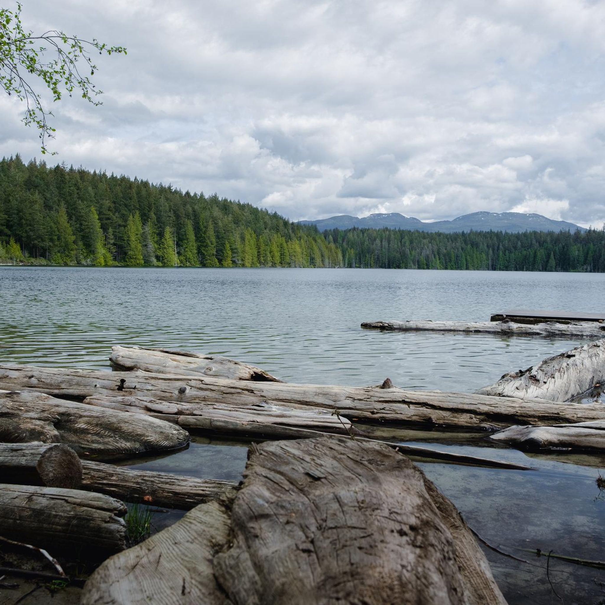
The best lake for swimming. Especially at Anthony Island. The whole lake is accessible for persons in wheelchairs as the Powell River Parks and Wilderness Society (PAWS) has build a flat path around the lake.
0
0

Take the Willingdon Beach Trail and head down to the beach once you see an old trail leading down there right at the trailhead/end
0
0
Frequently Asked Questions
What are some popular natural attractions in Area C (Lois Lake/Saltery Bay)?
Area C offers a variety of natural attractions. You can enjoy the expansive views from Tin Hat Hut on Tin Hat Mountain, which provides a 360-degree mountain-top lookout over 32 lakes. Lois Lake is ideal for paddle sports and swimming, featuring a unique 'drowned forest' along its shoreline. Saltery Bay Provincial Park offers a scenic shoreline with rocky tide-pools and lush forests, including Mermaid Cove for swimming and diving.
Are there any unique cultural or historical sites to visit in the region?
Yes, the region is home to the renowned Sunshine Coast Trail (SCT), a 180 km hut-to-hut hiking trail. You can also explore the Powell Forest Canoe Route, an 80 km paddle route connecting 12 lakes. For divers, Saltery Bay features the 'Emerald Princess', Canada's first underwater statue, located in 60 feet of water offshore from Saltery Bay Provincial Park.
What outdoor activities are popular around Area C (Lois Lake/Saltery Bay)?
The region is a hub for outdoor activities. Popular options include hiking on the Sunshine Coast Trail or more moderate routes like Lang Creek Trail, paddling on Lois Lake or the Powell Forest Canoe Route, and swimming in clear waters at Lois Lake, Rainy Day Lake, Gorge Falls, and Mermaid Cove. Fishing, diving in Saltery Bay, and mountain biking on trails like the Elephant Bay Loop are also highly enjoyed.
Where can I go swimming in Area C?
There are several excellent spots for swimming. Lois Lake offers clear waters for a refreshing dip. Rainy Day Lake, accessible from the Rainy Day Lake Shelter, is surrounded by dense forest and has clear water. Gorge Falls features several large, icy cold pools, including a deep, narrow swimming hole. Mermaid Cove within Saltery Bay Provincial Park is also known for its cool, clear waters.
Are there family-friendly attractions or activities in Area C?
Many natural attractions are suitable for families. Swimming in Lois Lake or Rainy Day Lake can be a fun activity. Exploring the tide-pools at Saltery Bay Provincial Park offers an engaging experience for children. The easy hiking routes mentioned in the hiking guide, such as the Stillwater Bluffs Trail or Mermaid Cove viewpoint, are also great for families.
What kind of views can I expect to see in Area C?
The region offers diverse and magnificent views. From Tin Hat Hut, you'll get a 360-degree mountain-top lookout over surrounding forested areas and 32 lakes. Fairview Bay Hut provides serene spots with magnificent ocean views. The Sunshine Coast Trail itself offers varied terrain from rocky mountaintops to old-growth forests and coastal shorelines, ensuring a wide range of scenic vistas.
Are there opportunities for camping near the attractions?
Yes, camping is available at several locations. Lois Lake offers camping facilities. Anthony Island Campsite is a remarkable place for camping, known for opportunities to swim and observe Common Loons. Khartoum Lake, Nanton Lake, and Dodd Lake also provide additional camping opportunities. The Sunshine Coast Trail features 15 unique huts, many of which can serve as overnight camps.
What are some recommended hiking trails in Area C?
Area C is renowned for its hiking. The Sunshine Coast Trail (SCT) is a major highlight, offering diverse terrain and hut-to-hut experiences. For specific routes, you can explore trails around Tin Hat Hut, or consider more moderate options like the Lang Creek Trail. For a comprehensive list of hiking routes, refer to the Hiking around Area C (Lois Lake/Saltery Bay) guide.
Can I go cycling or mountain biking in the area?
Absolutely! The Upper Sunshine Coast area, including routes near Saltery Bay, offers some of the best mountain biking trails in the province, such as the Elephant Bay Loop. For general cycling, you can find various routes, including the Totem Pole Viewpoint loop from Powell River. More details on cycling routes are available in the Cycling around Area C (Lois Lake/Saltery Bay) guide.
What do visitors enjoy most about the attractions in Area C?
Visitors particularly appreciate the stunning natural beauty and the variety of outdoor activities. Many enjoy the unique experience of swimming with Common Loons at Anthony Island Campsite. The serene ocean views and sandy beach at Fairview Bay Hut are also highly praised, especially for swimming and finding oysters seasonally. The clear waters of Rainy Day Lake for swimming are another community favorite.
Are there any specific facilities available at the huts and shelters?
Yes, the huts and shelters along the Sunshine Coast Trail offer various amenities. For example, Rainy Day Lake Shelter provides an outhouse, picnic tables, a fire pit, a sleeping loft, and swimming docks. Fairview Bay Hut is a fully enclosed shelter with an outhouse, picnic tables, a fire pit, a sleeping loft, a beach, and a covered porch. Tin Hat Hut is a fully winterized cabin with a pellet stove.
What is the best time to visit Area C (Lois Lake/Saltery Bay) for outdoor activities?
The region is generally enjoyable for outdoor activities from spring through fall. The summer months are ideal for swimming, paddling, and enjoying the beaches. Hiking is popular throughout the warmer seasons, with the Sunshine Coast Trail offering diverse experiences. Always check local weather conditions before planning your visit, especially for mountain excursions.
Most popular routes around Area C (Lois Lake/Saltery Bay)

Get inspired with the komoot mobile app


Explore more
Still not found the Highlight you’re looking for? See guides of the top attractions in other regions:
