The best walks and hikes in San Luis Obispo County
4.7
(176)
3,531
hikers
266
hikes
Hiking in San Luis Obispo County offers diverse terrain, from rugged coastlines and sandy beaches to rolling hills and distinctive volcanic peaks. The region is characterized by its unique geological features, including the Nine Sisters, a chain of ancient volcanic hills, and extensive oak woodlands. Coastal bluffs and varied ecosystems provide a wide range of natural environments for outdoor exploration. Trails traverse oak woodlands, chaparral, and expansive grasslands, offering varied scenic experiences.
Best hiking trails in San Luis Obispo County
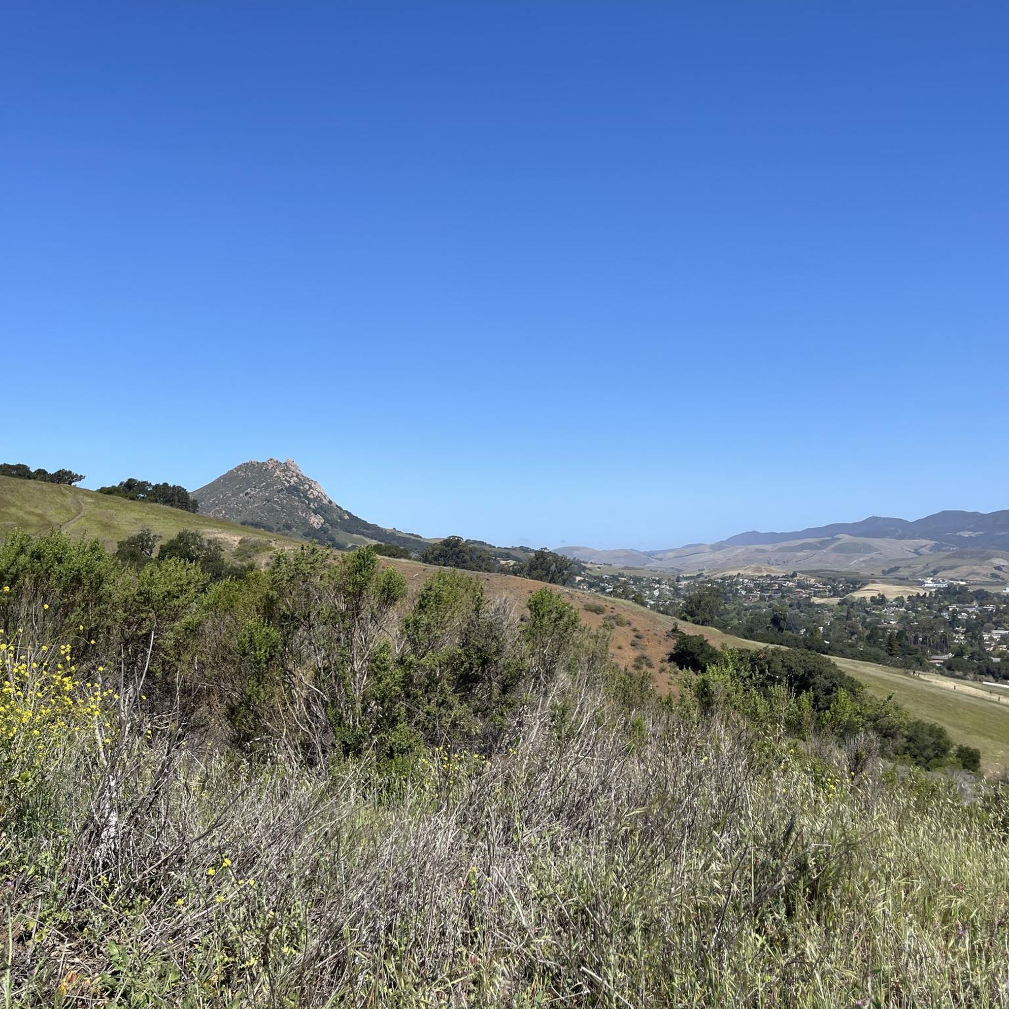
- The most popular hiking route is Bishop Peak Trail from Patricia Drive, a 3.8 miles (6.1 km) trail that takes 2 hours 0 minutes to complete. This moderate route ascends one of the iconic volcanic peaks, offering panoramic views of the surrounding landscape.
- Another top favourite among local hikers is High Road to Panhandle to Discovery Trail, a moderate 4.3 miles (6.9 km) path. This trail provides coastal views and winds through varied terrain near Pismo Beach, often completed in about 2 hours 6 minutes.
- Local hikers also love the Montaña de Oro Bluff Trail, a 9.0 miles (14.5 km) trail leading through rugged coastal bluffs, often completed in about 3 hours 57 minutes.
- Hiking in San Luis Obispo County is defined by volcanic hills, rugged coastlines, and oak woodlands. The extensive network of trails offers options for various ability levels, from easy coastal walks to more challenging hill climbs.
- The routes in San Luis Obispo County are highly rated by the komoot community with an average score of 4.7 stars from over 140 reviews. More than 3100 hikers have used komoot to explore San Luis Obispo County's varied terrain.
Last updated: August 31, 2026
5.0
(3)
55
hikers
14.5km
03:57
210m
190m
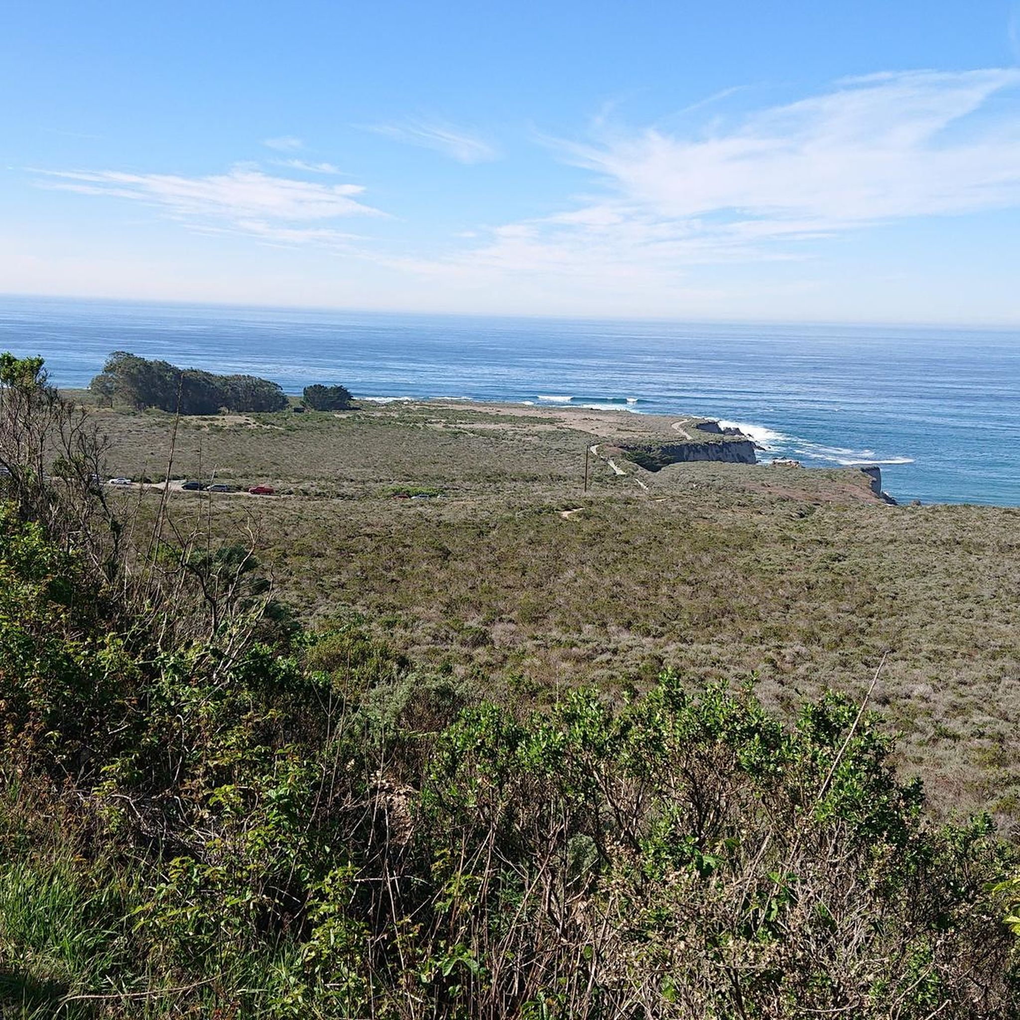
The Montaña de Oro Bluff Trail offers an incredibly scenic journey along California's central coast, where you'll find yourself walking a mostly flat, wide gravel path directly alongside dramatic coastal bluffs. Expect continuous, expansive views of the Pacific Ocean, with rugged cliffs and unique rock formations like those near Spooner's Cove. On clear days, you might even spot Morro Rock in the distance, making this a truly memorable experience.
Planning your visit is straightforward, as the trail has numerous access points within Montaña de Oro State Park, allowing you to tailor your hike's length. The trail is generally easy and suitable for many, with minimal elevation gain. Consider visiting in spring to witness the hillsides burst with golden wildflowers, enhancing the already stunning coastal panorama.
This trail stands out as one of the top-rated hikes along Highway 1, celebrated for its accessibility and exceptional coastal views. It's a moderate 9.0-mile (14.5 km) hiking route with 699 feet (213 metres) of elevation gain, typically taking around 3 hours and 56 minutes. The Montaña de Oro Bluff Trail is a perfect choice for families and those looking for a high-reward, low-effort coastal adventure.
3.0
(1)
45
hikers
6.62km
01:42
20m
30m
Embark on an easy 4.1-mile (6.6 km) hike along the Bob Jones City to the Sea Bike Trail, a route that takes about 1 hour and 41 minutes to complete. You will experience a gentle ascent of just 79 feet (24 metres) as you follow the San Luis Obispo Creek. The path winds through lush woodlands and shaded sycamore groves, offering a refreshing atmosphere. Keep an eye out for the old railroad bridge and apple orchards as you make your way towards the coast. Eventually, the trail opens up to expansive views of the Avila Beach estuary, a prime spot for birdwatching, before you reach the Pacific Ocean.
This trail is celebrated for its accessibility, making it suitable for all ages and fitness levels. The paved, all-weather surface is ADA friendly and perfect for strollers, ensuring a smooth journey for everyone. Dogs are welcome to join you on your hike, provided they remain on a leash. You will also find convenient amenities along the way, including access to food and refreshments, making your visit comfortable and enjoyable.
The Bob Jones City to the Sea Bike Trail is a multi-use pathway that beautifully connects the city to the sea, offering a unique blend of natural and historical sights. The Avila Beach estuary, which you will encounter along the route, is a significant ecological area known for its diverse birdlife. This trail stands out as an accessible and scenic option for anyone looking to enjoy the outdoors and experience the transition from inland greenery to coastal views.

Sign up for free
4.7
(3)
38
hikers
3.50km
00:54
20m
30m
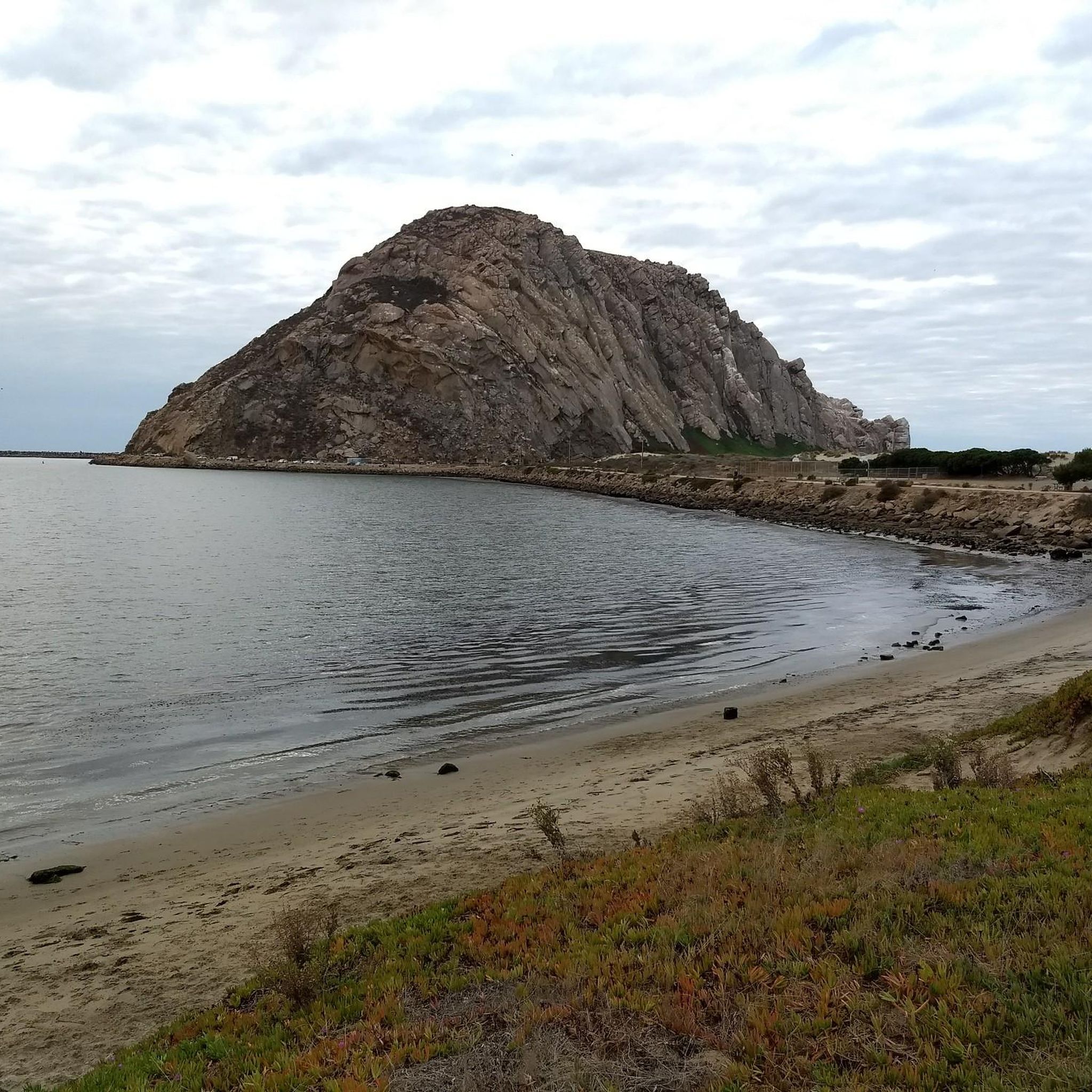
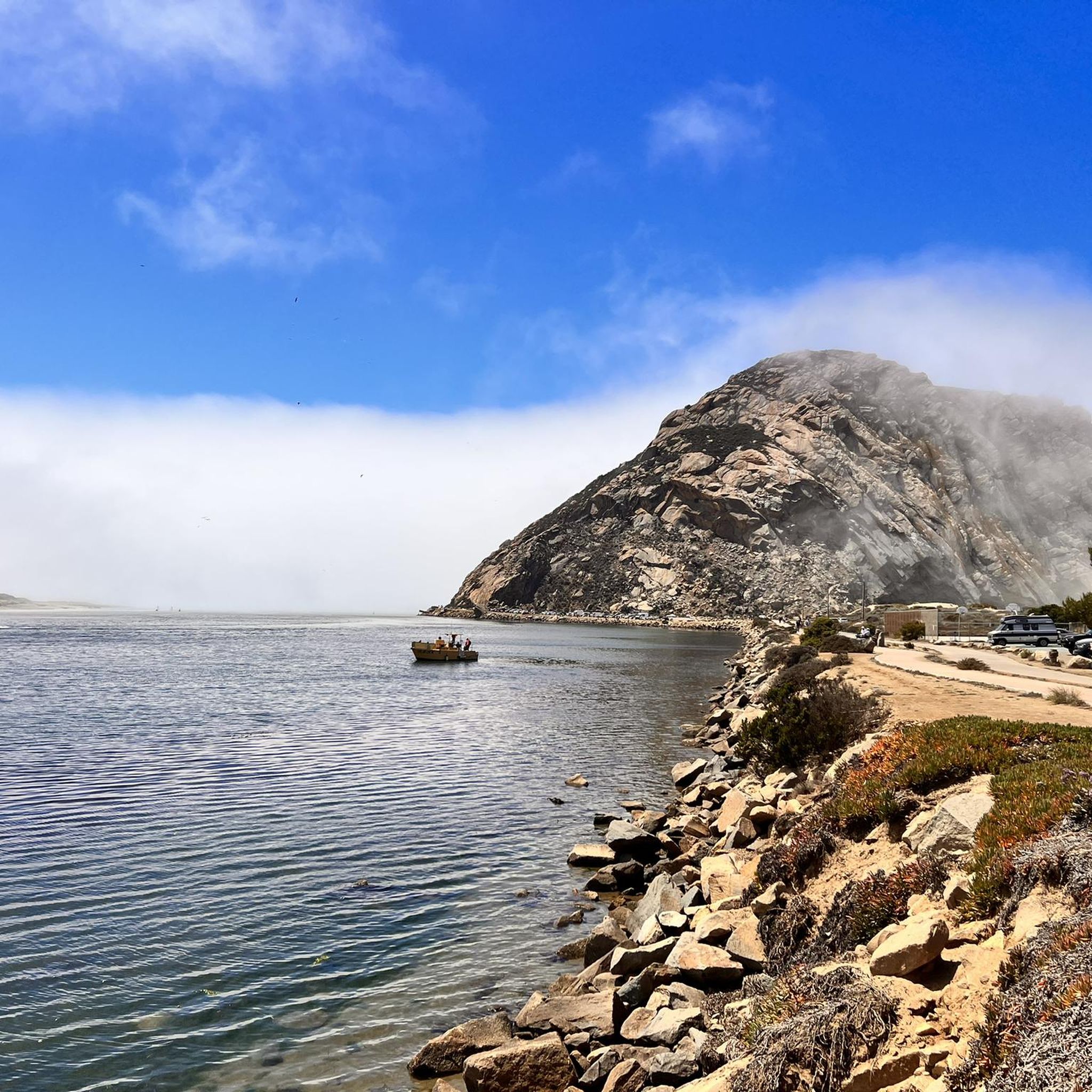
The Morro Bay Harbor and Estuary trail offers a delightful and accessible stroll through a vibrant coastal ecosystem. You'll wander along a path that transitions from smooth pavement to natural sandy stretches and wooden boardwalks, all while enjoying continuous views of the iconic Morro Rock and the bustling harbor. This easy 2.2-mile (3.5 km) route is a fantastic spot for wildlife enthusiasts, with frequent sightings of sea otters, harbor seals, and a diverse array of migratory birds, making it a truly engaging experience for all ages.
Planning your visit is straightforward for this popular Morro Bay route. The trail is predominantly flat, with only 53 feet (16 metres) of elevation gain, and takes about 54 minutes to complete, making it ideal for a leisurely outing. While parking is available, arriving early is recommended, especially during peak times, to secure a spot. Consider an early morning start to catch the estuary at sunrise, offering particularly stunning photographic opportunities.
This trail is a highlight of the Morro Bay National Estuary, a critical habitat and a vital stop on the Pacific Flyway for countless bird species. Its inclusive design, featuring wheelchair-accessible sections for the first 0.8 miles, ensures that a wide range of visitors can enjoy the natural beauty and exceptional wildlife viewing opportunities. It's a perfect choice for those seeking a relaxing outdoor adventure with high scenic payoff.
5.0
(1)
17
hikers
8.46km
02:38
370m
220m
Embark on the Black Hill Loop, a moderate hiking route that takes you through varied landscapes and offers rewarding views. This 5.3-mile (8.5 km) journey involves a steady climb of 1230 feet (375 metres), typically completed in about 2 hours and 37 minutes. As you hike, you will experience diverse terrain, from shaded groves of old oak trees draped with Spanish moss to fragrant eucalyptus fields. The trail culminates at the summit of Black Hill, where you are treated to expansive 360-degree panoramic views of the coast, the iconic Morro Rock, and the Morro Bay Estuary.
Planning your visit to the Black Hill Loop is straightforward, as the trail is generally accessible for hikers. You can begin your adventure conveniently from the Exercise Trailhead. This route is considered family-friendly, making it a good option for a day out with companions of varying skill levels. There are no specific warnings regarding snow conditions, road closures, or permits for this trail, allowing for flexible planning.
This trail offers a unique opportunity to ascend one of the ancient volcanic plugs known as the "Nine Sisters." The area is a haven for migrating bird species, so keep an eye out for local wildlife as you traverse the path. The diverse ecosystem, from the old oak groves to the eucalyptus fields, provides a rich natural experience that sets this hike apart in the Morro Bay State Park region.
11
hikers
6.99km
02:06
220m
220m
The High Road to Panhandle to Discovery Trail offers a diverse and engaging hiking experience, winding through coastal oak trees and open grassy hillsides. You'll find yourself on flowing, switchback singletrack, especially on the Panhandle section, as you climb to a ridge. Keep an eye out for the Octopus Oak Viewpoint, which provides expansive coastal views, and the Adam Hill Memorial Bench, a great spot to take in Shell Beach and Pismo Beach. This moderate 4.3-mile (7.0 km) route, with 726 feet (221 metres) of elevation gain, takes about 2 hours and 5 minutes.
Planning your visit? This trail is a fantastic way to experience the Pismo Preserve. Spring is an excellent time to visit for the wildflowers, while fall and winter offer cooler temperatures and the chance for whale-watching from the viewpoints. The trail is open to hikers, mountain bikers, and equestrians, making it a versatile choice for outdoor enthusiasts. Check the Pismo Preserve trail map for specific access points and parking information.
What makes this trail notable is its ability to combine a solid workout with stunning panoramic ocean views and rolling hills. It's a true highlight of the Pismo Preserve, providing numerous spots to take in vistas of Avila Beach and the sparkling bay. The mix of unpaved and natural paths, with a small asphalt section, keeps the terrain interesting throughout your hike.
8
hikers
6.27km
01:59
250m
250m
Embark on the Froom Creek, Old Prospector, and Pond Loop, an easy hiking route that guides you through diverse landscapes. You will cover 3.9 miles (6.3 km) with an elevation gain of 827 feet (252 metres), typically taking about 1 hour and 58 minutes to complete. As you hike, you will experience coastal chaparral and wind through a canyon, crossing several footbridges along Froom Creek where you can find temporary shade under oak trees. The trail offers a pleasant mix of open terrain and sheltered sections, providing a varied and engaging experience.
When planning your visit, you will find the trail generally accessible, making it a convenient option for a quick outdoor escape. Dogs are permitted on the route, so feel free to bring your furry companion along. Parking is usually available near the trailhead, ensuring a smooth start to your adventure. Be mindful that poison oak is present in various areas along the route, so it is wise to stay on the marked path and be aware of your surroundings.
This loop provides a unique glimpse into the region's natural and historical elements. You will traverse sections that resemble old mining roads, hinting at the area's past. The trail also ascends to offer broad views of San Luis Obispo's prominent Morros, including Bishop Peak and Cerro San Luis, providing excellent photo opportunities. Additionally, you can observe an old reservoir on the Pond Loop segment, a remnant of a past mining operation that adds a touch of historical context to your hike.
5
hikers
5.36km
01:30
110m
110m
The San Simeon Creek Trail offers a delightful immersion into a surprisingly diverse landscape, guiding you through five distinct plant communities in a single outing. You'll traverse everything from riparian woodlands and grasslands to coastal scrub, with parts of the path featuring boardwalks and others soft, mulched ground. Keep an eye out for mule deer in the creek bed and various bird species as you enjoy the panoramic views of the Santa Lucia Mountain range and the Pacific Ocean.
This easy 3.3-mile (5.4 km) hike, with its modest 372 feet (113 metres) of elevation gain, is perfect for a relaxed 1 hour and 30 minutes stroll. You can easily access the trail from multiple points, including the San Simeon Creek Campground and Washburn Day Use Area. It's a family-friendly and dog-friendly route, making it an excellent choice for a casual outing with your leashed companion.
What truly sets this trail apart is its exceptional ecological richness, passing directly through the San Simeon Natural Preserve, a vital wintering site for monarch butterflies. Beyond its natural wonders, you'll also encounter the remains of an old homestead, adding a touch of historical intrigue to your journey. Informative panels along the way provide fascinating details about the local flora and fauna, enriching your understanding of this unique coastal environment.
5.0
(1)
7
hikers
7.26km
02:36
460m
330m
Embark on the Ontario Ridge Trail for a moderate hike that rewards you with expansive views of the Pacific Ocean and rugged coastline. This 4.5-mile (7.3 km) route involves a significant climb, gaining 1518 feet (463 metres) as you traverse terrain often surrounded by coastal sage. You can expect to spend around 2 hours and 36 minutes on the trail, enjoying panoramic vistas that stretch from San Luis Obispo Bay to Pismo Beach. Keep an eye out for the unique swing near the T-Mobile towers at the ridge's summit, a popular spot to take in the scenery.
When planning your visit, be aware that parking at the trailhead can be limited, particularly if you aim to start near Pirate's Cove. Arriving early is a good idea to secure a spot. You have the option to access the trail from two main points: the Shell Beach trailhead or Cave Landing in Avila Beach. If you enjoy hiking with your dog, you will be pleased to know that the route is dog-friendly.
The Ontario Ridge Trail is well-known for its sweeping coastal views, offering a challenging yet rewarding outdoor experience. As you ascend, you will pass through areas of coastal sage, leading to various viewpoints. These spots provide clear sightlines to landmarks like Pirate's Cove and Avila Valley, making the effort worthwhile for the visual payoff.
6
hikers
14.4km
04:06
330m
330m
Embark on the Islay Creek Hazard Peak Loop Trail for a moderate hiking experience that spans 9.0 miles (14.4 km) and involves a total elevation gain of 1072 feet (327 metres). You can expect to complete this loop in about 4 hours and 6 minutes, enjoying diverse scenery along the way. As you ascend, you will be treated to expansive ocean views, culminating in panoramic 360-degree vistas from Hazard Peak, where you can clearly see Morro Rock and Morro Bay.
When planning your visit, be aware that this trail involves significant elevation changes, so you should be prepared for a good workout. Dogs are generally not permitted on this route, so make arrangements for your pets before heading out. You will also share the path with mountain bikers, so stay alert and aware of your surroundings, especially when navigating blind turns.
This loop takes you through Montaña de Oro State Park, offering more than just coastal views. After the peak, the trail descends into the secluded interior of Islay Creek Canyon, where you will find areas covered by sycamore trees and views of thousand-foot peaks. You might even discover a small waterfall along the Islay Creek section, surrounded by coastal sage and eucalyptus trees, adding to the unique natural environment of the area.
6
hikers
3.13km
01:06
290m
0m
Embark on the Cerro San Luis Loop, a challenging hike that covers 1.9 miles (3.1 km) with a significant elevation gain of 959 feet (292 metres). You can expect to complete this difficult route in about 1 hour and 6 minutes. The trail offers varied terrain, from smooth fire roads to rocky single tracks as you approach the summit. Look out for oak trees and vibrant wildflowers in spring, and enjoy the unique experience of walking through natural tunnels formed by vegetation.
When planning your visit, remember that much of the route has little shade. It is best to hike during cooler times of the day, especially if you are visiting in warmer months. The trail is easily accessible from downtown San Luis Obispo and remains open throughout the year. If you have a canine companion, leashed dogs are welcome to join you on this popular route.
From the Cerro San Luis Summit, you will be rewarded with panoramic views of the Central Coast, the city of San Luis Obispo, and other prominent peaks like Bishop Peak. This trail provides a rewarding experience for hikers seeking a strenuous workout with scenic payoffs. It is a notable local landmark, offering a quick escape into nature right near the city.
Get access to more routes and recommendations from other explorers.
Sign up for free
Already have an account?
Our route recommendations are based on thousands of hikes, rides, and runs completed by other people on komoot.
Start today with a free account
Your next adventure awaits.
Login or Signup
Popular around San Luis Obispo County




Other adventures in San Luis Obispo County


Tips from the Community

San Simeon Natural Preserve, part of the historic Hearst San Simeon State Park established in 1932, spans hundreds of coastal acres featuring wetlands, beaches, and wonderful sea views.
0
0


A sculpture by Elizabeth MacQueen commemorating families waiting for loved ones lost at sea.
0
0

A nice viewpoint and rest stop to get your breath back and look down over the expansive coastal views towards Spindrift and Spyglass.
1
0

The Adam Hill Memorial Bench is on the corner of a switchback on Turtle Trail. This area is great for a break on this multi-use trail and a good opportunity to soak up the view of Shell Beach and Pismo Beach. Often in the morning there is a marine layer, but the afternoons usually clear up for a sunny view over the ocean.
0
0

Hazard Peak stands at 1,076 feet, making it one of the highest peaks in the area. Don't be misled by the name; it was named after Alexander Hazard, the previous landowner, and not because of any hazardous conditions. The views of the ocean and dunes from here are truly spectacular.
0
0

Standing at 1,292 feet the summit of Cerro San Luis offers panoramic views of Bishop Peak and the rest of the SLO area. One of the Nine Sisters of volcanic peaks that run between Morro Bay and San Luis Obispo.
0
0

It is a pebbly beach with interesting rock formations where you can spend a nice day in the tide pools or exploring the caves.
0
0
Frequently Asked Questions
How many hiking trails are available in San Luis Obispo County?
San Luis Obispo County offers a wide variety of hiking experiences, with over 190 routes recorded on komoot. These trails range from easy coastal walks to more challenging climbs up volcanic peaks.
What types of terrain can I expect on hikes in San Luis Obispo County?
The region boasts incredibly diverse terrain, from rugged coastlines and sandy beaches to rolling hills, oak woodlands, and distinctive volcanic peaks known as the Nine Sisters. You'll find trails winding through lush greenery, chaparral, and coastal bluffs, offering varied landscapes for every hiker.
Are there any easy, family-friendly hikes in the area?
Yes, San Luis Obispo County has many easy trails suitable for families. For instance, the Morro Bay via Embarcadero — Morro Bay State Park route is an easy 5 km walk with minimal elevation gain. Another great option is the Spooner Cove & Bluff Trail loop — Montaña De Oro State Park, which offers scenic coastal views on a relatively flat path.
What are some notable natural features or landmarks to see while hiking?
San Luis Obispo County is rich in natural landmarks. You can explore the iconic volcanic peaks like Bishop Peak and Cerro San Luis Summit, which offer panoramic views. The coastline features stunning spots like Moonstone Beach and the Elephant Seal Vista Point. Don't miss the unique Monarch Butterfly Grove - Pismo Beach during migration season.
When is the best time of year to go hiking in San Luis Obispo County?
With an average of 315 days of sunshine per year, San Luis Obispo County is an excellent hiking destination year-round. Spring is particularly beautiful, as many trails, like those around Bishop Peak, are adorned with golden wildflowers. The mild climate makes it enjoyable even in winter, especially for coastal walks.
Are there any challenging hikes for experienced trekkers?
Yes, for those seeking a challenge, trails like the Cerro Alto loop — Los Padres National Forest offer significant elevation gain and rewarding views. The Reservoir Canyon Trail loop also provides a substantial climb through oak and eucalyptus groves to a 360-degree panoramic summit.
What do other hikers enjoy most about hiking in San Luis Obispo County?
The area is highly rated by the komoot community, with an average score of 4.7 stars from over 130 reviews. Hikers frequently praise the diverse landscapes, from dramatic coastal bluffs to scenic volcanic peaks, and the well-maintained trails that cater to all skill levels.
Are there any circular hiking routes in San Luis Obispo County?
Yes, many trails in the county are designed as loops, offering varied scenery without retracing your steps. Examples include the Bluff Trail & Valencia Peak Trail loop — Montaña De Oro State Park and the Felsman Loop Trail — Ferrini Ranch Open Space, both popular choices for a complete hiking experience.
Can I bring my dog on the hiking trails in San Luis Obispo County?
Many trails in San Luis Obispo County are dog-friendly, but regulations can vary by park or reserve. It's always best to check specific trail rules before heading out. Generally, dogs are welcome on leash in many open spaces and state parks, but some sensitive natural areas or specific trails may have restrictions.
Are there trails with ocean views?
Absolutely! San Luis Obispo County's coastline offers numerous trails with stunning ocean vistas. The Discovery Trail & Lone Oak Loop — Pismo Beach provides excellent coastal views. Montaña de Oro State Park is particularly renowned for its dramatic ridgelines and coastal scenery, with trails like the Bluff Trail offering exquisite rocky shoreline access.
Is public transport available to reach trailheads?
While some trailheads near urban centers might be accessible by local bus services, many of the more remote or scenic hiking spots in San Luis Obispo County are best reached by car. It's advisable to check local transit schedules and routes for specific trailheads if you plan to use public transport.
Are there any trails that lead to a summit with panoramic views?
Yes, several trails in the region lead to summits offering breathtaking panoramic views. The Bishop Peak Trail from Patricia Drive ascends one of the iconic volcanic peaks, providing sweeping views of the surrounding landscape. Similarly, the Ocean to Valencia Peak loop — Montana de Oro State Park culminates in spectacular 360-degree vistas of the coastline.
Most popular routes in San Luis Obispo County
Most popular attractions in San Luis Obispo County

Get inspired with the komoot mobile app


Didn’t find what you were looking for?
Check out more Hikes throughout San Luis Obispo County below and find the perfect route in your destination.
Explore more
Browse the best Hikes in other regions.
