The best road cycling routes around Frøylandsvatnet
4.5
(35)
2,221
riders
56
rides
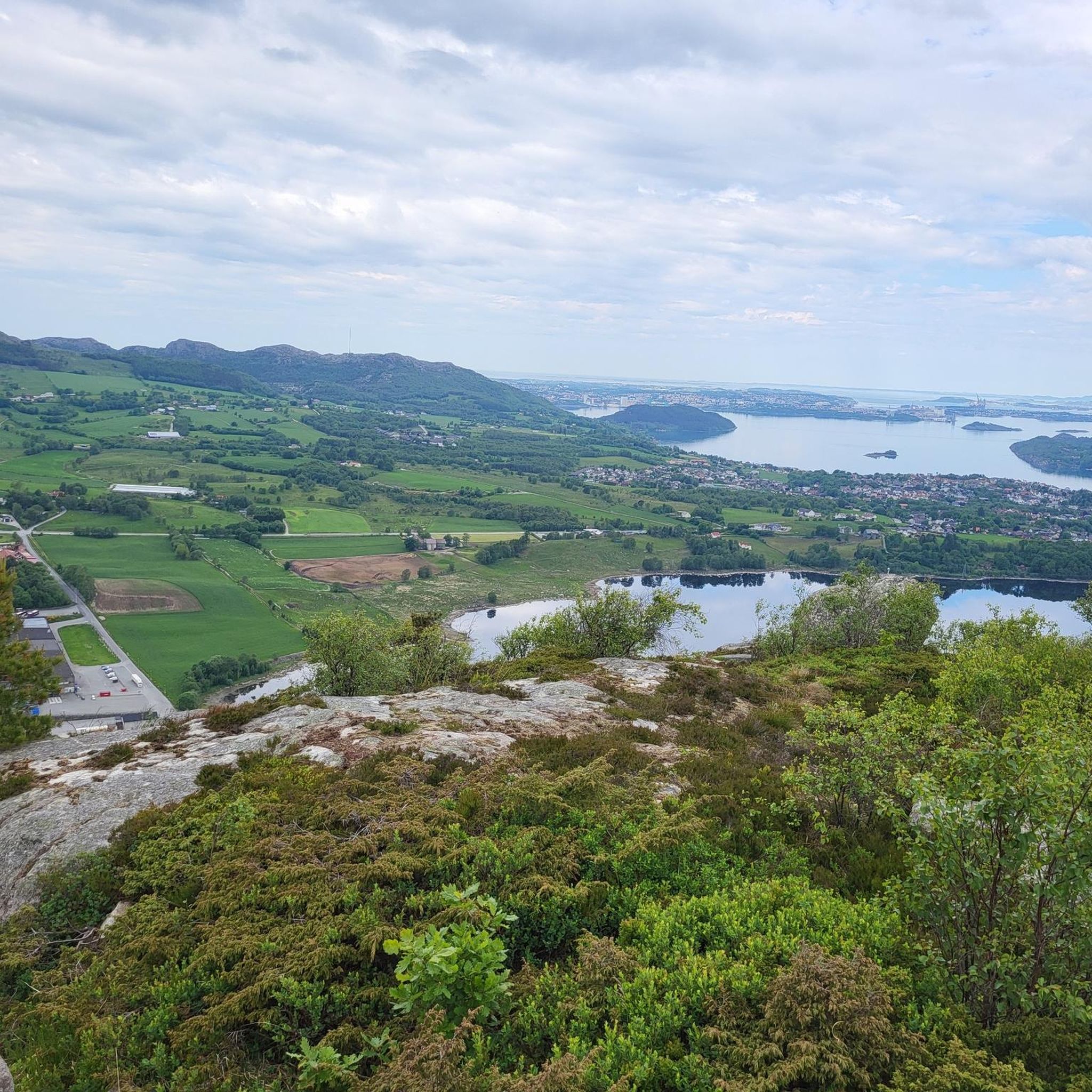
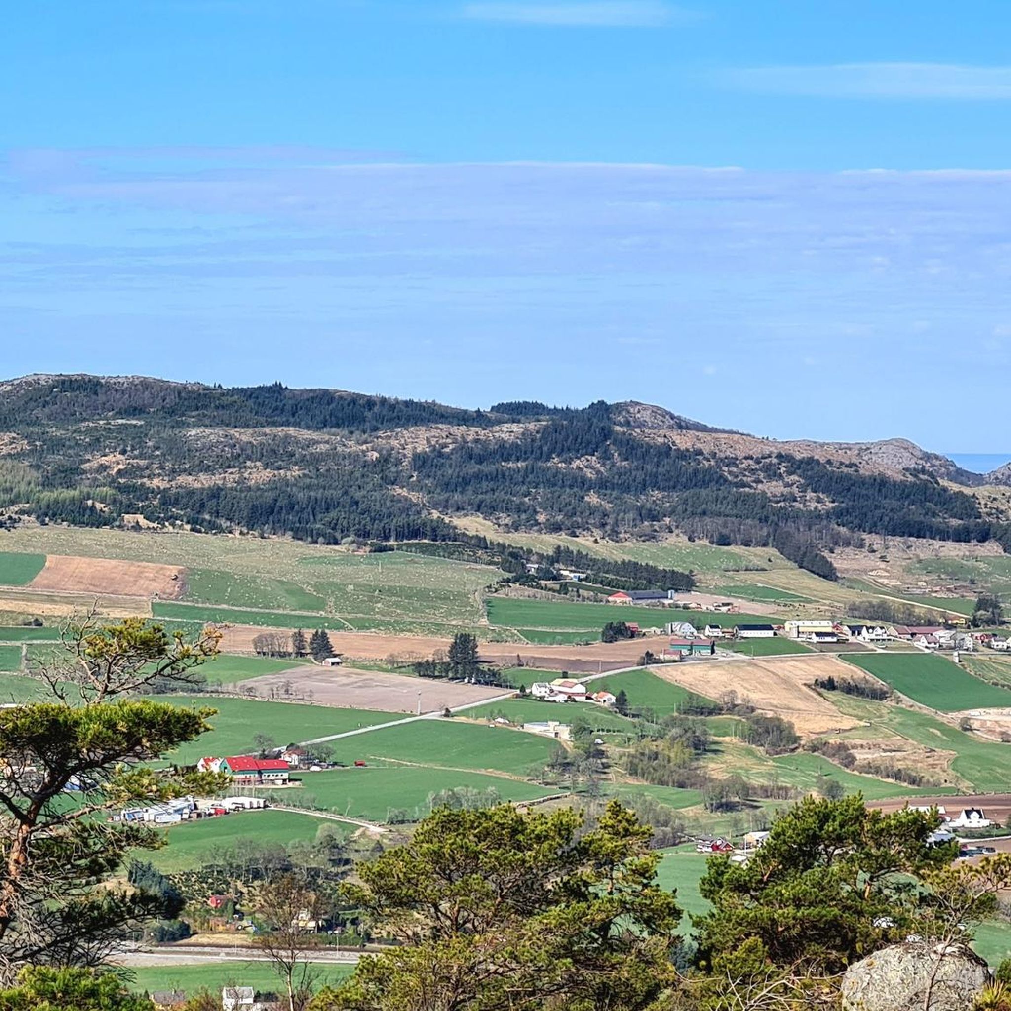
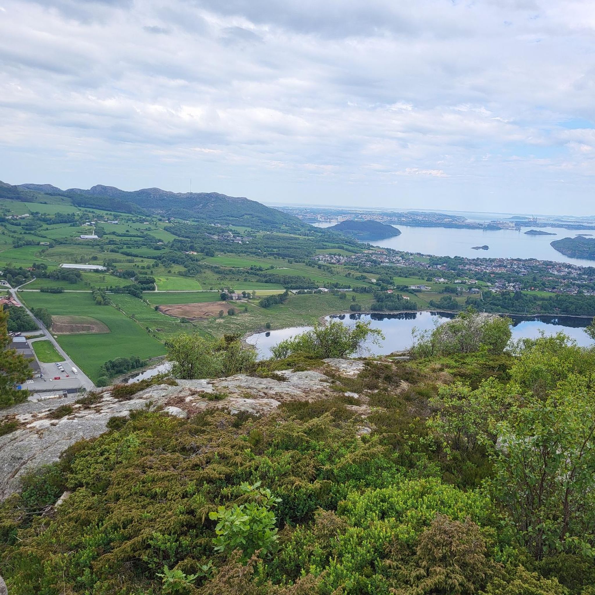
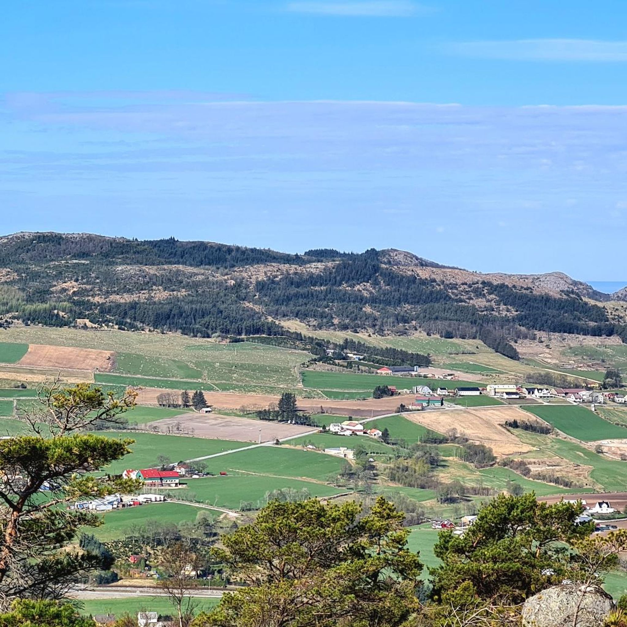
Road cycling around Frøylandsvatnet offers varied terrain, combining open grazing lands with denser spruce forests. The region provides a dynamic visual experience for cyclists, with mostly well-paved surfaces suitable for different fitness levels. The landscape features a harmonious blend of agricultural areas and natural beauty, making it accessible for enjoyable cycling.
Best road cycling routes around Frøylandsvatnet
- The most popular road cycling route is Ferry Terminal at Hjelmeland – View of Jøsenfjorden loop from Frøylandsvatnet, a 26.1 miles (42.1…
Last updated: June 29, 2026
5.0
(1)
8
riders
Moderate road ride. Good fitness required. Mostly well-paved surfaces and easy to ride.
3
riders
34.8km
01:36
190m
190m
Easy road ride. Great for any fitness level. Mostly well-paved surfaces and easy to ride.

Sign up for free
33
riders
38.3km
01:38
220m
220m
Easy road ride. Great for any fitness level. Mostly well-paved surfaces and easy to ride.
30
riders
22.5km
01:01
160m
160m
Moderate road ride. Great for any fitness level. Some segments of this route may be unpaved and difficult to ride.
11
riders
36.1km
01:45
250m
250m
Moderate road ride. Great for any fitness level. Some segments of this route may be unpaved and difficult to ride.
Get access to more routes and recommendations from other explorers.
Sign up for free
Already have an account?
Our route recommendations are based on thousands of hikes, rides, and runs completed by other people on komoot.
Start today with a free account
Your next adventure awaits.
Login or Signup
Tips from the Community

Planetstien turns your hike through Sandvedparken into a journey through the solar system. Stretching along the Storåna river, this 1:1 billion scale model starts with the Sun near Sandnes center and ends with Pluto towards Ganddal. It is a flat, easy gravel path suitable for cycling and walking. As you travel the green corridor, you pass sculptures representing each planet at their relative distances.
0
0

What a wonderful church! Unfortunately, it was closed, but a visit here is a must!
0
0
Beautiful shallow water can be found here… perfect for families with small children.
0
0

Ferry from Lauvvik to Oanes. Small ferry but runs all 1/2 hour.
0
0

Be careful with the sand on the bike path
0
0

This road is practically perfect, with smooth tarmac and views of water and mountains on all sides. Cycling heaven.
1
0
A busy little harbour with a few good coffee stop options nearby. A great place to start or end a ride around Sandnes.
0
0
Sola beach is a well-known, extensive sandy beach located near Stavanger Airport, characteristic of the Jæren coastline.
0
0
Frequently Asked Questions
How many road cycling routes are available around Frøylandsvatnet?
There are over 50 road cycling routes around Frøylandsvatnet listed on komoot, offering a wide range of options for different skill levels and preferences.
Are there road cycling routes suitable for beginners or families around Frøylandsvatnet?
Yes, Frøylandsvatnet offers several easy road cycling routes perfect for beginners and families. The general description of paths around the lake suggests accessible and enjoyable cycling opportunities. For example, the Solastranden Beach – Sola Beach loop from Hana kirke is an easy 35.1 km path that provides coastal scenery.
What kind of terrain can I expect on road cycling routes in the Frøylandsvatnet area?
Road cycling around Frøylandsvatnet features a diverse landscape. You'll experience a mix of open agricultural areas, typical of Jæren, and denser spruce forests. The routes generally have well-paved surfaces, providing a dynamic visual experience as you ride.
What are some notable landmarks or natural features to look out for while cycling around Frøylandsvatnet?
A significant landmark is the Midgardsormen, a distinctive wooden bridge that gracefully winds its way across the lake, offering a unique photo opportunity. You can also explore Sandtangen at the southern end of Frøylandsvatnet, a wooded recreational area with picnic spots. Additionally, Njåskogen, a pleasant forest between Bryne and Kvernaland, offers well-lit paths.
Where can I park my car when planning a road cycling trip around Frøylandsvatnet?
The lake is easily accessible with convenient parking options. You can find parking at Bryne, near Sandtangen by the Time Town Hall, and also at Kleppe, accessible from Klepp station.
Is it possible to reach the Frøylandsvatnet cycling routes using public transport?
Yes, public transport is a viable option. The path along Frøylandsvatnet runs close to the railway for part of the route, making it convenient to access starting points from stations like Klepp.
What is the best season for road cycling around Frøylandsvatnet?
While specific details on seasons are not provided, the region's varied terrain and well-paved surfaces suggest that spring through autumn would be ideal for road cycling, offering pleasant weather and vibrant scenery. Winter conditions might present challenges due to snow or ice.
Are there any cafes or places to stop for refreshments along the road cycling paths?
While specific cafes directly on the paths are not detailed, the recreational area of Sandtangen near Bryne offers picnic spots, and both Bryne and Kleppe, which are starting points for routes, would have amenities like cafes and shops.
What do other road cyclists enjoy most about cycling in Frøylandsvatnet?
The area is highly rated by the komoot community, with an average score of 4.5 stars from over 20 reviews. Cyclists often praise the varied terrain, which combines open agricultural areas with lush forests, and the overall dynamic visual experience. The accessibility and well-paved surfaces are also frequently highlighted.
Are there any longer or more challenging road cycling routes for experienced riders?
Yes, for more experienced riders, there are moderate and difficult routes available. For instance, the Ferry Terminal at Hjelmeland – View of Jøsenfjorden loop from Frøylandsvatnet is a moderate 42.1 km trail with significant elevation gain, offering scenic views including the Jøsenfjorden.
Can I find circular road cycling routes around Frøylandsvatnet?
Many of the road cycling routes in the area are designed as loops, allowing you to start and end at the same point. This makes planning your ride convenient. An example of a loop route is the Idlandskogen loop from Mariero, a moderate 22.5 km trail.
How does road cycling around Frøylandsvatnet compare to other areas in Jæren?
Frøylandsvatnet offers a unique blend within Jæren, combining the open grazing lands characteristic of the region with denser spruce forests. This provides a more varied and dynamic visual experience compared to some purely coastal or agricultural routes found elsewhere in Jæren, while still benefiting from the generally well-paved surfaces of the broader area.
Most popular routes around Frøylandsvatnet

Get inspired with the komoot mobile app


Explore more
Browse the best Road cycling routes in other regions.
