The best walks and hikes in Crittenden County
4.1
(5)
184
hikers
38
hikes
Hiking in Crittenden County offers opportunities to explore the unique landscape of the Mississippi River Delta region. The area is characterized by fertile bottomlands, bottomland hardwood forests, and cypress/willow swamps. While generally flat, the county provides natural settings for walks and wildlife observation, particularly within the Wapanocca National Wildlife Refuge. This distinct ecological experience includes waterways, wetlands, and flatlands.
Best hiking trails in Crittenden County
- The most popular hiking route is Big River Crossing, a 2.5 miles (4.0 km)…
Last updated: May 12, 2026
1
hikers
9.82km
02:29
10m
10m
Hike the Ducks Unlimited Park Loop for Mississippi River views, the Memphis skyline, and a seasonal sunflower field on a paved trail.
22
hikers
3.96km
01:01
20m
20m
Embark on an easy hiking adventure across the Big River Crossing, a unique route that spans 2.5 miles (4.0 km) and offers sweeping views of the Mississippi River. As you…

Sign up for free
3
hikers
3.79km
00:59
20m
20m
Embark on an easy hike along the Memphis Riverwalk, a paved route offering continuous panoramic views of the Mississippi River and the Memphis skyline. This trail covers 2.4 miles (3.8…
2.28km
00:36
10m
10m
Embark on the Mississippi River Model Walk, an easy 1.4-mile (2.3 km) route that offers a unique perspective on one of America's great rivers. This interpretive stroll, taking about 35…
29
hikers
5.23km
01:21
30m
30m
Easy hike. Great for any fitness level. Easily-accessible paths. Suitable for all skill levels.
4.5
(2)
25
hikers
Moderate hike. Good fitness required. Easily-accessible paths. Suitable for all skill levels.
4.0
(1)
14
hikers
Moderate hike. Good fitness required. Easily-accessible paths. Suitable for all skill levels.
11
hikers
1.14km
00:18
10m
10m
Easy hike. Great for any fitness level. Easily-accessible paths. Suitable for all skill levels.
3.0
(1)
9
hikers
Moderate hike. Good fitness required. Easily-accessible paths. Suitable for all skill levels.
4
hikers
Moderate hike. Good fitness required. Easily-accessible paths. Suitable for all skill levels.
Get access to more routes and recommendations from other explorers.
Sign up for free
Already have an account?
Our route recommendations are based on thousands of hikes, rides, and runs completed by other people on komoot.
Start today with a free account
Your next adventure awaits.
Login or Signup




Tips from the Community

From the edge of Mud Island River Park, downtown Memphis feels like a living postcard. The Mississippi widens in front of you, mirroring the steel arcs of the Hernando de Soto Bridge and the glassy prow of the Bass Pro Pyramid. To the south, the Beale Street Landing roof hints at the city’s musical heart, while office towers and the FedExForum rise behind a fringe of riverside trees. At dusk, river tugs glow and the skyline turns gold, violet, and finally neon.
0
0
Installed in 2019, the 50-foot-long, 10-foot-tall “MEMPHIS” sign sprawls across the south lawn of Mud Island River Park off the Mississippi River. Commissioned for the city’s bicentennial “New Century of Soul” celebration and funded by Memphis River Parks Partnership with sponsors, the multicoloured block letters form a photo backdrop visible from downtown and the I-40 bridge. Designers finished both sides, so the sculpture reads correctly from land and river, and it is repainted for events.
0
0


Ashburn-Coppock Park is a small linear park with paved trails that are popular for commuting, biking, running, and walking. The intertwining paths in the area are well marked and offer the option for creating small loops. Tom Lee Park is a much larger park to the north, and it connects to the main trail in Ashburn-Coppock Park.
0
0
This small park is located on the banks of the Mississippi River and was created in remembrance of those involved in the Yellow Fever Epidemic of 1878. The park connects to a paved path that follows the Mississippi River Trail bike route and connects to some of the nearby parks to the north.
0
0
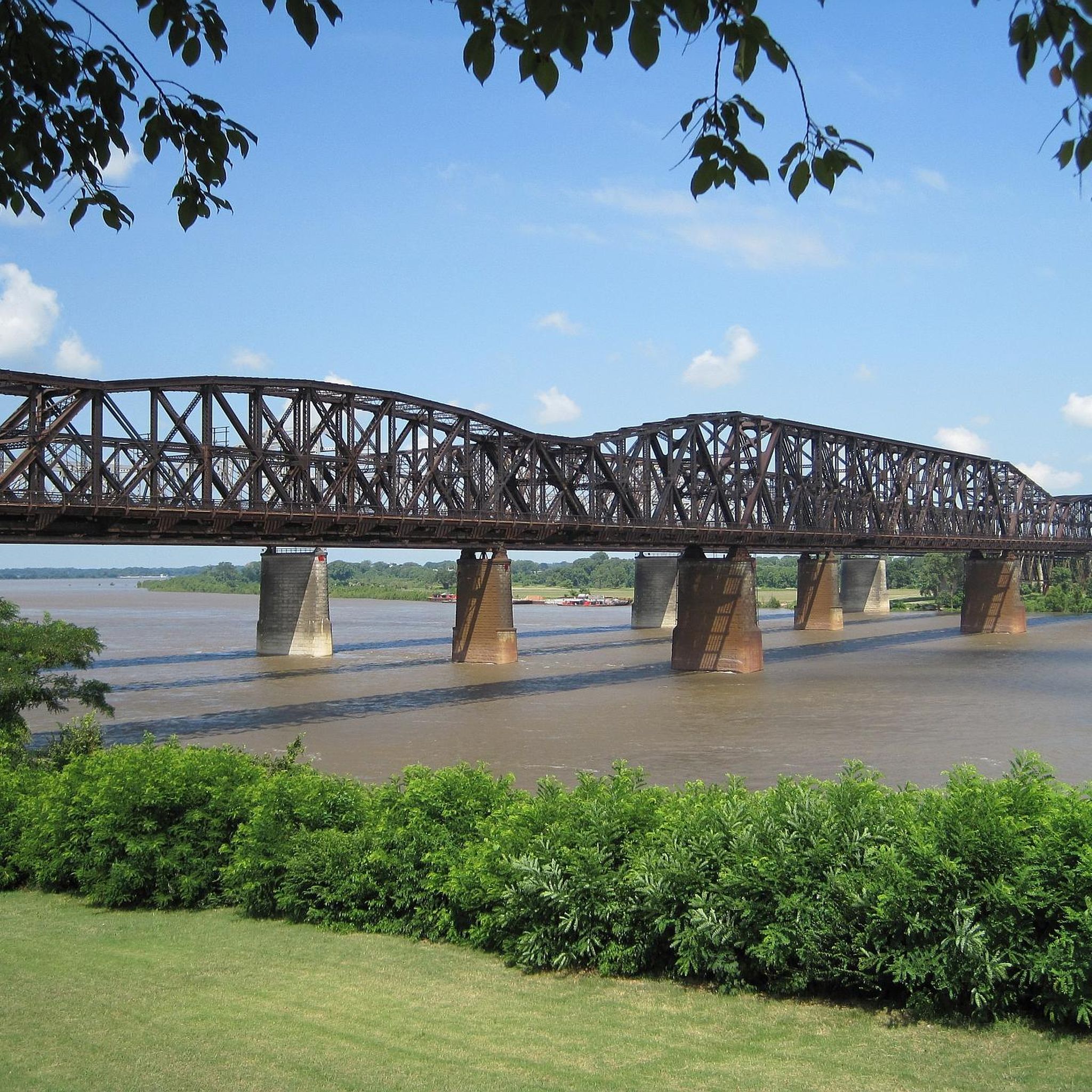
The Big River Crossing is named in reference to crossing the Mississippi River on the longest pedestrian bridge. The bridge is actually named Harahan Bridge and helps connect the city of Memphis to the state of Arkansas and the Ducks Unlimited area. You get terrific views of the river from up on the bridge.
0
0
Mud Island Park is home to the Mississippi River Museum, Wolf River Harbor, and the Mud Island Park Amphitheater. There are a handful of intertwining paved paths in the park and a bunch of different viewpoints with informational placards spread throughout the property.
0
0
The Mississippi River Walk is a popular path circling around the Mud Island Park property and offering views of the Mississippi River. This paved trail is a great place for everyone in the family. It is flat and features numerous informational signs along the side of the trail.
0
0
Frequently Asked Questions
What kind of hiking terrain can I expect in Crittenden County?
Crittenden County is characterized by the unique landscape of the Mississippi River Delta. You'll find fertile bottomlands, areas of bottomland hardwood forest, and cypress/willow swamps. The terrain is generally flat, offering easy nature walks focused on ecological diversity rather than elevation changes. While not mountainous, Pecan Ridge is a notable topographical point of interest.
How many hiking trails are available in Crittenden County?
There are over 25 hiking routes available in Crittenden County and the immediate surrounding area. These range from easy nature walks to slightly more moderate paths, providing diverse options for exploring the region's unique landscape.
Are there any easy hiking trails suitable for beginners or casual walkers?
Yes, the majority of trails in Crittenden County are considered easy, with 22 out of 26 routes falling into this category. These paths are perfect for beginners or those looking for a relaxed stroll. An example is the Mississippi River Greenbelt Park Path — Memphis, Tennessee, which follows the riverbank.
What are the best places for wildlife viewing and nature walks?
The Wapanocca National Wildlife Refuge is a prime location for nature walks and wildlife viewing in Crittenden County. Its diverse habitats, including bottomland hardwood forests and cypress/willow swamps, make it a vital stopover for migratory birds, offering excellent opportunities for birdwatching and nature photography.
Are there any trails that offer scenic views?
Many trails along the Mississippi River offer scenic views of the river and city skyline. For instance, the Big River Crossing via Harahan Bridge — Memphis, Tennessee provides expansive river views as you cross. Other paths, like the Riverline Loop from Memphis Martyrs Park — Memphis, Tennessee, also offer pleasant riverfront perspectives.
What do other hikers say about the trails in Crittenden County?
The trails in Crittenden County are highly regarded by the komoot community, with an average rating of 3.9 stars. Hikers often praise the unique riverfront paths, the tranquility of the bottomland hardwood forests, and the opportunities for wildlife observation.
Are there any moderate hiking options for those seeking a bit more challenge?
Yes, while most trails are easy, there are a few moderate options available. For example, the Big River Crossing – Memphis Martyrs Park loop from Harahan Bridge offers a longer distance and slightly more varied terrain, providing a good option for those looking for a longer day hike.
Can I find circular hiking routes in Crittenden County?
Yes, several routes in the area are designed as loops, allowing you to start and end at the same point. An example is the Mississippi River Walk loop — Mud Island Park, which offers a pleasant circular experience along the river.
What kind of natural features can I explore while hiking?
Crittenden County's natural features include fertile bottomlands, remnants of bottomland hardwood forests, and cypress/willow swamps, particularly within the Wapanocca National Wildlife Refuge. These areas provide unique ecosystems to explore, rich in flora and fauna, especially migratory birds.
Are there any trails that are particularly long for extended walks?
For those seeking longer walks, routes like the Mississippi River Walk – Fire Museum of Memphis loop from Memphis Central Station offer a substantial distance, allowing for an extended exploration of the riverfront and urban parklands.
What is the best time of year to go hiking in Crittenden County?
The best time to visit Crittenden County for hiking is generally during the spring and fall. These seasons offer milder temperatures, making for more comfortable walks, and are ideal for birdwatching, especially during the migratory periods at Wapanocca National Wildlife Refuge.
Most popular routes in Crittenden County

Get inspired with the komoot mobile app


Didn’t find what you were looking for?
Check out more Hikes throughout Crittenden County below and find the perfect route in your destination.
Explore more
Browse the best Hikes in other regions.
