The best cycling routes in Twin Falls County
5.0
(2)
18
riders
4
rides
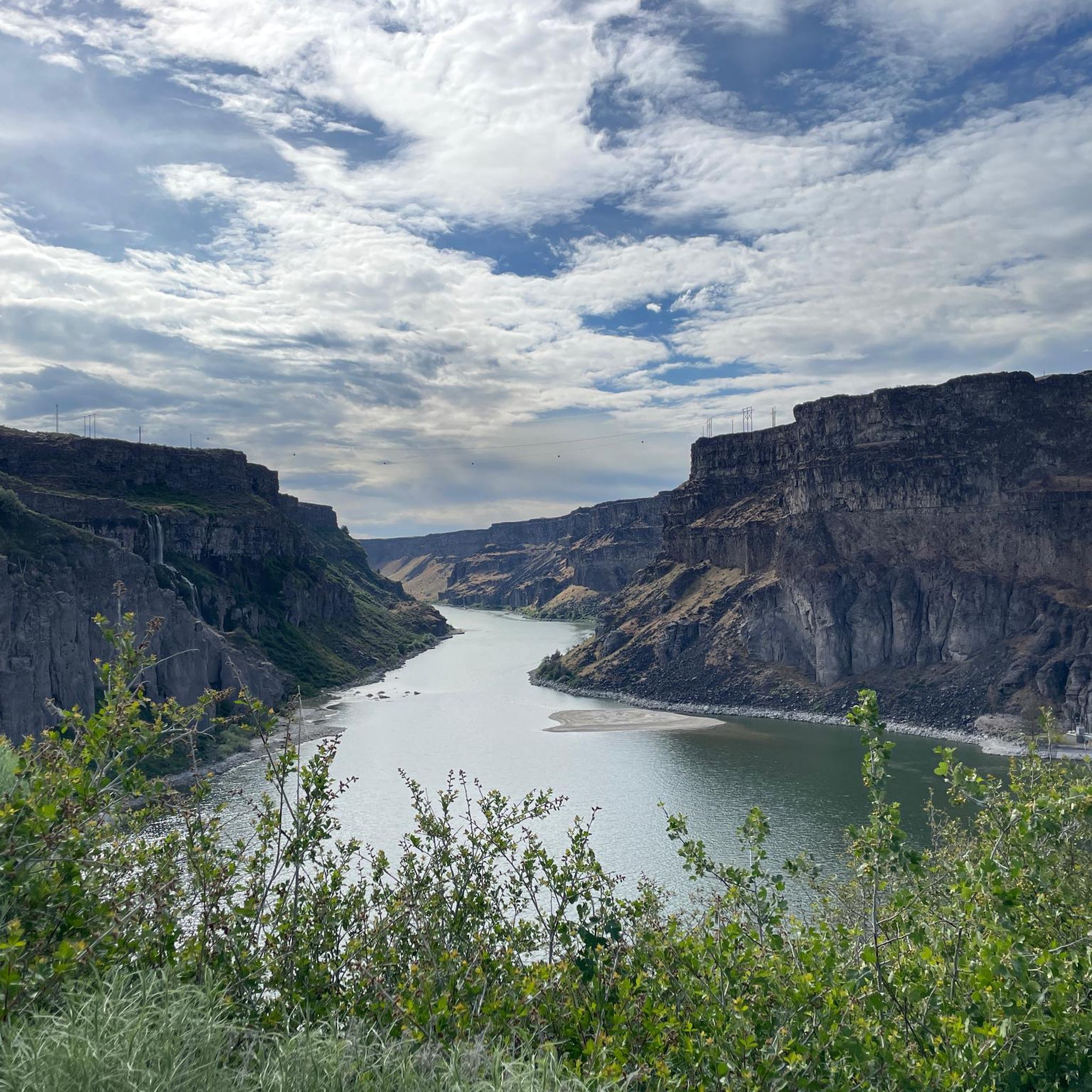
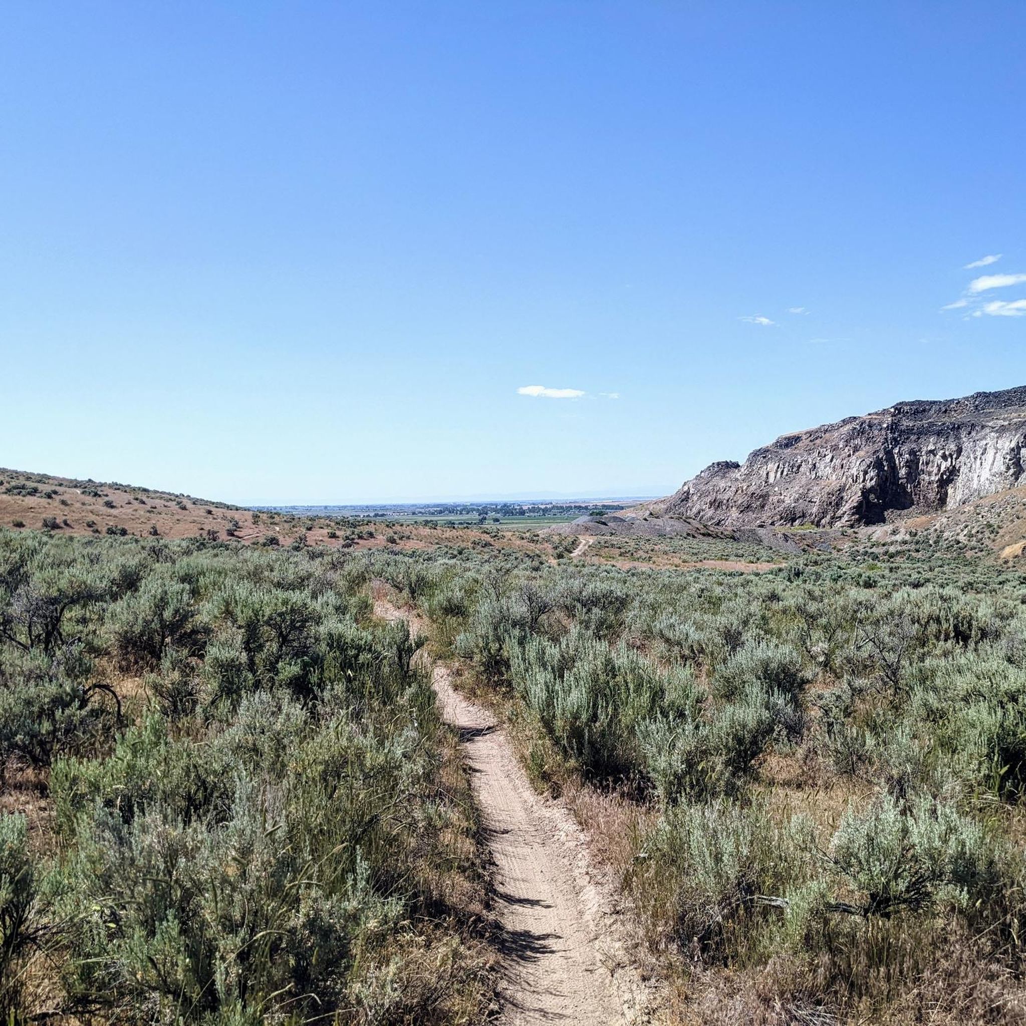
Touring cycling in Twin Falls County offers routes along the Snake River Canyon, featuring diverse terrain. The region is characterized by its dramatic canyon rim trails, river views, and scenic waterfalls. Cyclists can expect a mix of paved paths and some unpaved sections, with elevation changes typical of river valleys. The landscape includes features like the Perrine Bridge and Shoshone Falls, providing distinct points of interest for touring cyclists.
Best touring cycling routes in Twin Falls County
- The most popular touring cycling route is Auger Falls Trailhead – Alpheus Creek Bridge loop from Auger Falls Park, a 7.4 miles (11.9 km) trail that takes about 47 minutes to complete. This easy route explores the area around Auger Falls and Alpheus Creek.
- Another top favourite among local touring cyclists is Snake River - Canyon Rim Trail – Bluegill Lake loop from Canyon Ridge High School, a moderate 19.9 miles (32.0 km) path. This route offers expansive views along the Snake River Canyon and passes by Bluegill Lake.
- Local touring cyclists also love the Snake River - Canyon Rim Trail – Perrine Bridge - Twin Falls loop from Twin Falls Idaho Temple, a 10.2 miles (16.5 km) trail leading through the Snake River Canyon, often completed in about 1 hour 7 minutes. This route provides views of the iconic Perrine Bridge and Twin Falls.
- Touring cycling in Twin Falls County is defined by canyon rim trails, riverfront paths, and scenic viewpoints along the Snake River. The network offers options for both easy touring bike trails and more moderate routes.
- The routes in Twin Falls County are highly rated by the komoot community with an average score of 5.0 stars from over 2 reviews. More than 27 touring cyclists have used komoot to explore Twin Falls County's varied terrain.
Last updated: August 18, 2026
5
riders
Moderate bike ride. Good fitness required. Mostly paved surfaces. Suitable for all skill levels.
2
riders
Easy bike ride. Great for any fitness level. Mostly paved surfaces. Suitable for all skill levels.

Sign up for free
3
riders
Moderate bike ride. Good fitness required. Mostly paved surfaces. Suitable for all skill levels.
Our route recommendations are based on thousands of hikes, rides, and runs completed by other people on komoot.
Start today with a free account
Your next adventure awaits.
Login or Signup
Other adventures in Twin Falls County

Tips from the Community

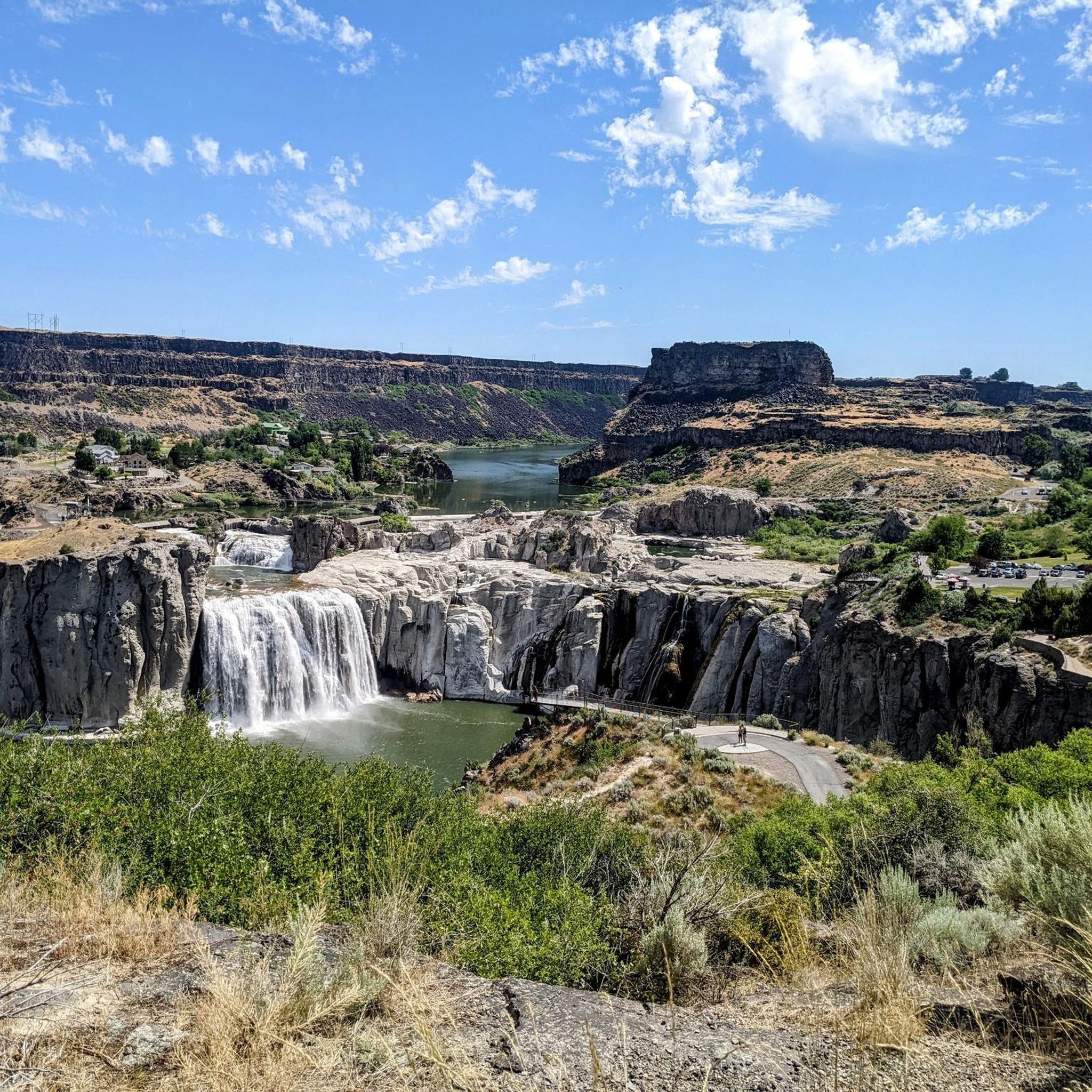
A boardwalk brings the trail here out above the edge of the rim to an elevated overlook of the impressive waterfalls, often dubbed "the Niagara of the West".
0
0

The railroad bridge over the Snake River near Twin Falls was built in 1914. It was part of the Oregon Short Line Railroad and played a key role in connecting the region by rail during the early 20th century.
0
0
You can find a picnic area near the Shoshone Falls viewpoint.
0
0
Often referred to as the Niagara of the West, Shoshone Falls is a must-see attraction in Twin Falls, Idaho. At 212 feet tall and 900 foot wide, Shoshone Falls is one of the largest natural waterfalls in the United States surpassing the height of the famous Niagara Falls. Shoshone Falls is located on the Snake River as it carves its way through a deep basalt Canyon on its way to the Columbia River. Shoshone Falls is open year-round with the exceptions of temporary closures due to poor road conditions. The park hours are from dawn to dusk. Access by bike or on foot is free. Cars pay a $5.00 fee at Shoshone Falls Park and Dierkes Lake per vehicle. The fee is in effect from March 1st through September 30th.
2
0

Fit for all ages. Dog walkers should know there is a set of metal grate steps your pooch may have trouble with.
0
0

In the summer of 2024, they will unfortunately only have half as much water, but they are still impressive. Admission per vehicle $5.00 (2024)
0
0

There is a parking lot here with space for around ten cars. The trail leads you down along the Snake River, and is a perfect moderate out-and-back on dirt paths with great scenery.
1
0
From here you can hike along the rim of the canyon to Shoshone Falls. The trail passes by Perrine Coulee Falls, the Perrine Memorial Bridge, and the spur trail into the canyon where you can hike alongside Pillar Falls.
0
0
Frequently Asked Questions
Are there easy touring cycling routes in Twin Falls County?
Yes, Twin Falls County offers several easy touring cycling routes. For instance, the Auger Falls Trailhead – Alpheus Creek Bridge loop from Auger Falls Park is an easy 7.4-mile (11.9 km) path that explores the area around Auger Falls and Alpheus Creek. Another easy option is the Perrine Bridge - Twin Falls loop from The Church of Jesus Christ of Latter-day Saints, which is 8.9 miles (14.3 km) long.
What are some longer touring cycling routes in Twin Falls County?
For those looking for a longer ride, the Snake River - Canyon Rim Trail – Bluegill Lake loop from Canyon Ridge High School covers 19.9 miles (32.0 km) and offers expansive views along the Snake River Canyon. Another moderate option is the Shoshone Falls – Snake River - Canyon Rim Trail loop from Six Robblees Truck & Trailer Parts, which is 16.5 miles (26.6 km) long.
Can I find circular touring cycling routes in Twin Falls County?
Many of the touring cycling routes in Twin Falls County are designed as loops. Examples include the Auger Falls Trailhead – Alpheus Creek Bridge loop from Auger Falls Park, the Snake River - Canyon Rim Trail – Bluegill Lake loop from Canyon Ridge High School, and the Shoshone Falls – Snake River - Canyon Rim Trail loop from Six Robblees Truck & Trailer Parts.
What natural attractions can I see while touring cycling in Twin Falls County?
The region is known for its dramatic natural features. You can cycle past the impressive Shoshone Falls, often called the 'Niagara of the West,' and enjoy views from the Shoshone Falls Overlook — Centennial Trail. The Snake River Viewpoint offers panoramic vistas of the canyon, and you can also see the historic Evel Knievel Snake River Canyon Jump Site.
Are there any landmarks or points of interest along the touring cycling routes?
Yes, several routes offer views of iconic landmarks. The Snake River - Canyon Rim Trail – Perrine Bridge - Twin Falls loop from Twin Falls Idaho Temple provides excellent views of the iconic Perrine Bridge, a popular spot for base jumping. Many routes also follow the scenic Snake River Canyon Rim Trail.
What is the best time of year for touring cycling in Twin Falls County?
The spring and fall months generally offer the most pleasant conditions for touring cycling in Twin Falls County, with milder temperatures. Summer can be warm, especially in the canyon, while winter can bring colder temperatures and potential snow, making some routes less accessible.
Are there family-friendly touring cycling routes in Twin Falls County?
Routes classified as 'easy' are generally suitable for families. The Auger Falls Trailhead – Alpheus Creek Bridge loop from Auger Falls Park is a good option, offering a relatively flat and manageable distance for a family outing.
Where can I find parking for touring cycling routes in Twin Falls County?
Many routes start from locations with accessible parking. For example, the Auger Falls Trailhead – Alpheus Creek Bridge loop begins at Auger Falls Park, which typically has parking facilities. Other routes may start near schools or public areas like Canyon Ridge High School or the Twin Falls Idaho Temple, where parking is often available.
What do other touring cyclists enjoy the most about touring cycling in Twin Falls County?
The area is highly rated by the komoot community, with an average score of 5.0 stars. Reviewers often praise the dramatic canyon rim trails, the stunning river views, and the scenic waterfalls like Shoshone Falls, which provide distinct points of interest along the routes.
Are there cafes or places to eat along the touring cycling routes?
While specific cafes directly on the trails might be limited, many routes are close to urban areas like Twin Falls city, where you can find various dining options. Routes that pass through or near the city center will offer more opportunities for food and refreshments.
Is touring cycling possible in Twin Falls County during winter?
Winter cycling in Twin Falls County can be challenging due to colder temperatures and potential snow or ice, especially on unpaved sections or shaded areas of the canyon. Paved paths might be cleared, but it's advisable to check local conditions and weather forecasts before heading out.
Most popular attractions in Twin Falls County

Get inspired with the komoot mobile app


Didn’t find what you were looking for?
Check out more Cycling routes throughout Twin Falls County below and find the perfect route in your destination.
Explore more
Browse the best Cycling routes in other regions.
