The best walks and hikes around Synnfjorden
4.4
(61)
345
hikers
23
hikes
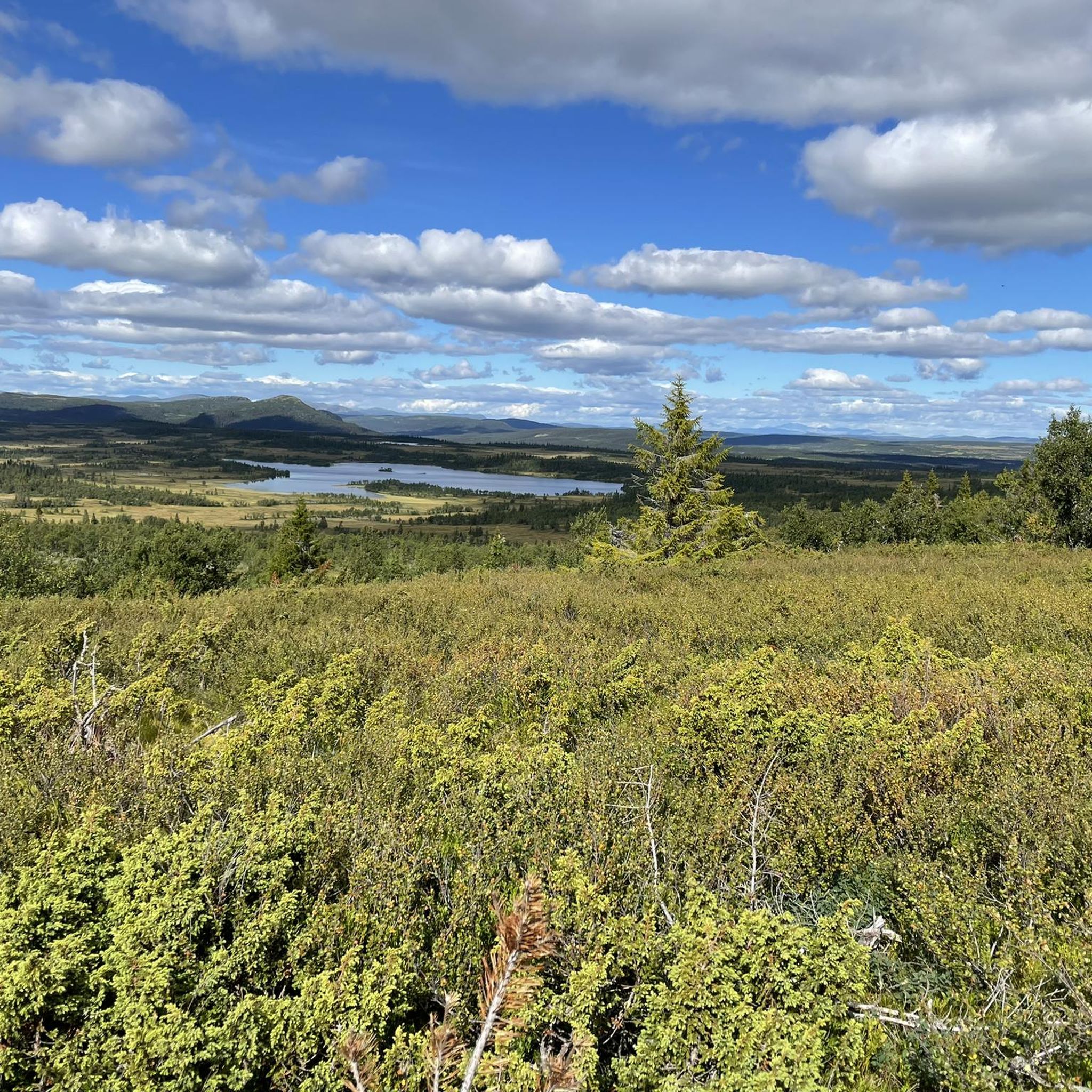
Hiking around Synnfjorden offers diverse and accessible mountain landscapes, situated 796 meters above sea level between Spåtind and Skjervungfjellet. The region features gentle yet open mountain terrain, surrounded by various peaks. This area is characterized by its accessible trails and panoramic views, providing options for different hiking preferences.
Best hiking trails around Synnfjorden
- The most popular hiking route is On the top of Skjervungfjellet, a 2.5 miles (4.0 km) trail that takes 1 hour 22 minutes to complete. This…
Last updated: May 14, 2026
5.0
(2)
16
hikers
3.99km
01:22
210m
210m
Easy hike. Great for any fitness level. Easily-accessible paths. Suitable for all skill levels.
5.0
(2)
8
hikers
5.90km
01:54
260m
260m
Easy hike. Great for any fitness level. Easily-accessible paths. Suitable for all skill levels.

Sign up for free
4.0
(1)
5
hikers
8.22km
02:37
340m
340m
Moderate hike. Good fitness required. Easily-accessible paths. Suitable for all skill levels.
15
hikers
7.77km
02:35
380m
380m
Moderate hike. Good fitness required. Easily-accessible paths. Suitable for all skill levels.
9
hikers
5.93km
01:50
200m
200m
Easy hike. Great for any fitness level. Easily-accessible paths. Suitable for all skill levels.
Get access to more routes and recommendations from other explorers.
Sign up for free
Already have an account?
Our route recommendations are based on thousands of hikes, rides, and runs completed by other people on komoot.
Start today with a free account
Your next adventure awaits.
Login or Signup
Popular around Synnfjorden
Tips from the Community

The summit of Skjervungfjellet is 1098 metres high and you can easily reach it on an easy and pleasant walk.
0
0
The path up to Skjervungfjellet runs through majestic landscapes and heather bushes.
0
0
The Svartkampen peak is 1168 metres high. From here you can enjoy a beautiful panoramic view.
0
0
Frequently Asked Questions
Are there easy hiking trails suitable for beginners in Synnfjorden?
Yes, Synnfjorden offers several easy trails perfect for beginners or those looking for a relaxed walk. For instance, the route On the top of Skjervungfjellet is an easy 4.0 km path that provides beautiful views towards Spåtind. Another accessible option is the Campsite Below Snuen loop from Gråberga, which is a 5.9 km trail exploring the area around the rounded Snuen mountain.
What kind of challenging hikes can I find in Synnfjorden?
While Synnfjorden is known for its gentle terrain, you can find moderately challenging hikes, especially those leading to higher peaks. The region features impressive peaks like Spåtind (1414 m) and Olavskampen (1312 m), which offer more strenuous ascents and rewarding panoramic views. There are 3 difficult routes available in the area for experienced hikers.
Are there family-friendly hiking options in Synnfjorden?
Synnfjorden's accessible mountain landscape and variety of easy trails make it suitable for families. Many routes are not overly steep and offer enjoyable experiences for all ages. The easy trails mentioned, such as those around Skjervungfjellet or Snuen, are good starting points for family outings.
Can I bring my dog on the hiking trails in Synnfjorden?
Generally, dogs are welcome on hiking trails in Norway, but it's important to keep them on a leash, especially during certain times of the year (April 1 to August 20) to protect wildlife and livestock. Always check local regulations or signage at trailheads for specific rules in the Synnfjorden area.
Are there any circular hiking routes in Synnfjorden?
Yes, circular routes are available, allowing you to experience varied terrain without retracing your steps. An example is the Campsite Below Snuen loop from Gråberga, which is an easy 5.9 km trail. Another option is the Skjervungfjellet trail – Skjervungfjellet loop from Synnfjorden, an easy 5.9 km loop.
When is the best time of year to go hiking in Synnfjorden?
Hiking in Synnfjorden is especially recommended during the summer and autumn months. These seasons offer the most favorable weather conditions, with trails generally clear of snow and vibrant natural colors, particularly in autumn.
What are some notable peaks or viewpoints to aim for during a hike?
Synnfjorden is surrounded by impressive peaks offering spectacular views. Spåtind (1414 m) is the highest and provides far-reaching panoramic vistas. Other notable peaks include Skjervungfjellet (1098 m), offering views towards Spåtind, and Snuen (1179 m), an easily accessible rounded mountain top. You can also aim for Svartkampen (1168 m) for elevated perspectives.
How many hiking trails are available in the Synnfjorden area?
There are over 20 hiking trails available around Synnfjorden, offering a diverse range of experiences from easy walks to more challenging ascents. This network provides options for various ability levels and preferences.
What do other hikers say about the trails in Synnfjorden?
The trails in Synnfjorden are highly rated by the komoot community, with an average score of 4.4 stars from over 60 reviews. Hikers often praise the accessible mountain terrain, the impressive peaks, and the open landscapes that define the area. Many appreciate the variety of options for different ability levels.
Is parking available at the trailheads in Synnfjorden?
Yes, many popular starting points for hikes in Synnfjorden, such as Strangsætra, Aasætra, Gråberga, and the Krokhølen area, typically offer parking facilities. It's always advisable to check specific trailhead information or local signage for parking availability and any potential fees.
How can I reach the hiking trails in Synnfjorden by public transport?
Public transport options directly to specific trailheads in the Synnfjorden mountain range may be limited. It is generally recommended to travel by car to access the various starting points. For detailed information on local bus services to the broader Synnfjellet region, it's best to consult local transport providers.
Can I find longer, more extensive hikes in Synnfjorden?
Yes, while there are many shorter options, Synnfjorden also offers opportunities for longer, more extensive hikes. You can combine trails or explore routes that traverse the Høgkampflæene plateaus and Høgkampvatnet lake, leading to peaks like Spåtind. The region's proximity to Langsua National Park also suggests possibilities for multi-day treks in lush, gentle terrain.
Most popular routes around Synnfjorden

Get inspired with the komoot mobile app


Explore more
Browse the best Hikes in other regions.
