The best road cycling routes in Piscataquis County
6
riders
5
rides
If you've ever tried to plan road cycling in Piscataquis County, you know how overwhelming the options can be. With so much expansive wilderness and so many lakes, it's tough to figure out which routes are genuinely worth your time and effort, and which are just filler. We get it, and we're here to cut through the noise.
Our komoot community has ridden, mapped, and reviewed these routes, so this guide is your curated shortlist of the ones that truly…
Last updated: May 10, 2026
1
riders
119km
11:47
1,370m
1,370m
The Park Tote Road from Togue Pond to South Branch Pond offers a deep dive into Baxter State Park's wild heart, a challenging 73.9-mile (118.9 km) gravel cycling route that…
1
riders
62.6km
02:40
530m
530m
The road cycling route from Greenville to Rockwood offers a truly picturesque journey through Maine's rugged Highlands, with continuous views of the expansive Moosehead Lake. You'll pedal through ancient forests…

1
riders
33.5km
02:46
350m
350m
The road cycling route from Greenville to Lily Bay State Park offers a truly scenic journey along the eastern shore of Moosehead Lake, Maine's largest lake. You'll navigate a moderate…
35.8km
04:22
410m
410m
The Grand Lake Matagamon to South Branch Pond via Park Tote Road offers a unique journey through Baxter State Park, winding through dense forests and along the East Branch of…
2
riders
39.5km
02:35
310m
310m
Moderate road ride. Good fitness required. Mostly well-paved surfaces and easy to ride.
Our route recommendations are based on thousands of hikes, rides, and runs completed by other people on komoot.
Start today with a free account
Your next adventure awaits.
Popular around Piscataquis County
Tips from the Community

Milo is a tiny town in Piscataquis County, Maine. Although it is small, there are places to grab a bite to eat, and rest and refuel here including: McLaughlins Family Restaurant, a local institution; Tradewinds Market, which has a Dunkin' Doughnuts; two different pizza places; and a couple gas stations/ convenience stores.
0
0
The Park Tote Road runs for 44 miles north-south on the western side of Baxter State Park in Maine. This well-graded, generally smooth road is open to cyclists and is an especially great place to gravel ride in the fall and admire the changing leaves. This particular section is the far northern segment running from the Trout Brook Farm Campground (west of the Grand Lake Matagamon) and the turn off for the South Branch Lake Trailhead and campground. Although Park Tote Road is doable on a road bike, wider tires (28-30mm+) are recommended, especially in the spring when the road can be rutted due to snow melt.
0
0
Grand Lake Matagamon is a massive freshwater lake northeast of Baxter State Park deep in the Maine Highlands. It's a popular place for fishing and other recreational activities.
0
0
The Park Tote Road runs for 44 miles north-south on the western side of Baxter State Park in Maine. This well-graded, generally smooth road is open to cyclists and is an especially great place to gravel ride in the fall and admire the changing leaves. Although it is doable on a road bike, wider tires (28-30mm+) are recommended, especially in the spring when the road can be rutted due to snow melt.
0
0

This is a really quiet and peaceful part of the park, and has a number of easy scenic trails. The Cranberry Pond Trail is itself makes for a nice short run and pairs well with other trails nearby. Here you get views south across Togue Pond, which is open for ice fishing in the winter.
0
0
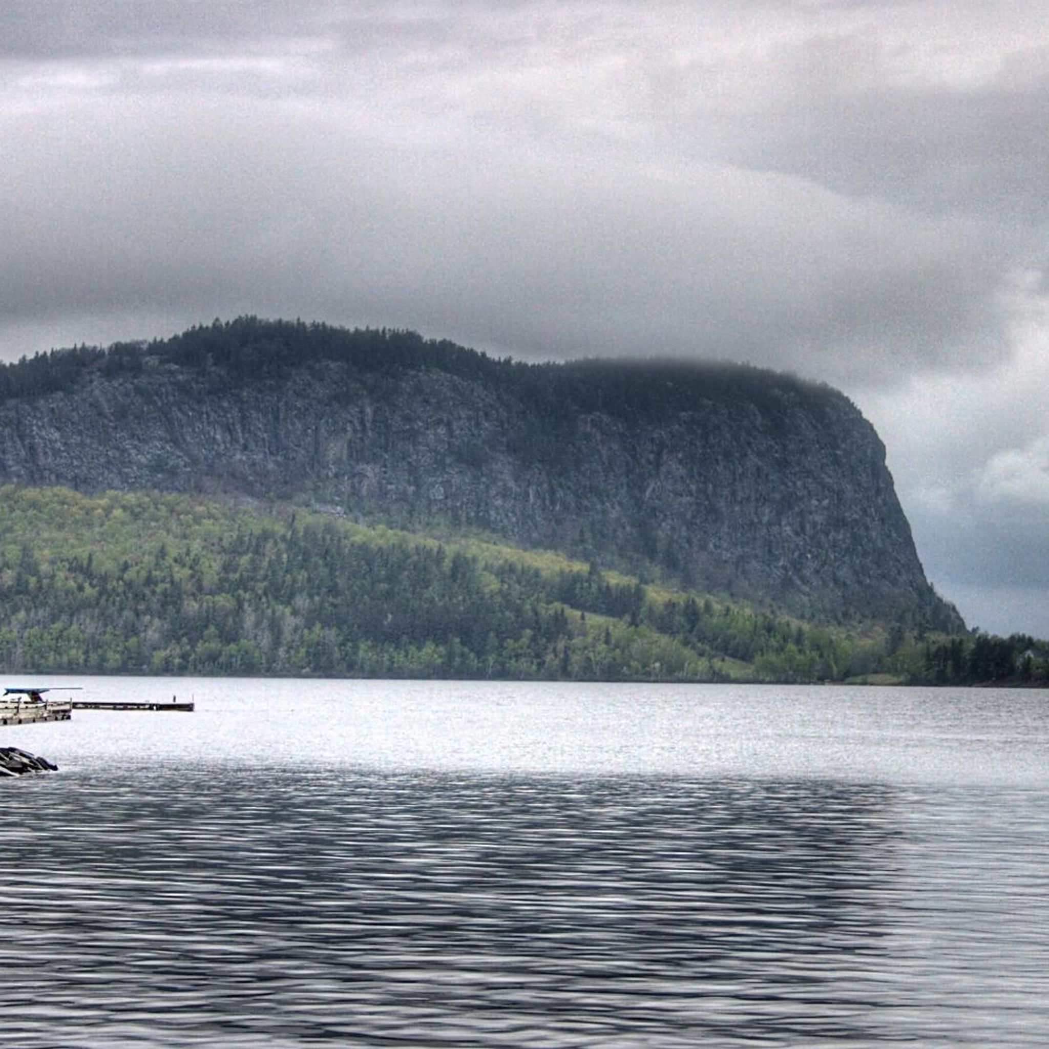
Rockwood is a small village on the western shore of Moosehead Lake. This is a nice place to stop on a ride from the larger town of Greenville. You can get fantastic views of the famous Mount Kineo from this tiny town. Don't forget to take a photo with the famous flying moose statue on your way out!
0
0
Greenville, Maine, is located on Moosehead Lake, which is the state's largest lake, at 40 miles long and 20 miles wide. This small town is in the heart of the Maine Highlands, and a great launching pad for all sorts of outdoor adventures from hiking to snowshoeing. Greenville is also home to the last steamboat in Maine, The Katahdin. You can take cruises on it around the lake and look out for moose, which are abundant on the shores of Moosehead Lake. There are several places to stay in Greenville as well as many local restaurants to grab a good meal after a long day out on the trails or water.
0
0

This 925-acre park includes a fine pebble beach with swimming, a playground, and miles of trails, with year-round camping available as well. The winter offers groomed cross-country ski trails with a nice view of the lake.
0
0
Frequently Asked Questions
How many road cycling routes are available in Piscataquis County?
Piscataquis County offers a selection of 5 road cycling routes, ranging from moderate to difficult, allowing cyclists to explore the region's diverse landscapes.
Are there any beginner-friendly road cycling routes in Piscataquis County?
While there are no routes specifically classified as 'easy' in the current selection, several 'moderate' routes like Greenville to Lily Bay State Park offer a good introduction to the area's terrain without extreme difficulty. These routes typically feature rolling hills and well-maintained surfaces.
Which routes are best for experienced road cyclists looking for a challenge?
Experienced cyclists seeking a significant challenge will appreciate the Park Tote Road from Togue Pond to South Branch Pond — Gravel. This difficult, 73.9-mile route includes substantial elevation changes and sections of gravel, providing an extensive adventure through natural parkland.
What are some popular moderate road cycling routes in the region?
For a moderate ride, consider the Greenville to Rockwood route, which spans 38.9 miles and connects two towns with scenic views. Another excellent option is Trestle Road Bridge – Milo loop from Milo, a 39.5-mile loop offering a balanced ride.
Are there any road cycling routes that offer scenic views of lakes or natural monuments?
Many routes in Piscataquis County provide stunning natural scenery. The Greenville to Lily Bay State Park route, for instance, leads through forested areas and along lake shores, offering picturesque views. You might also encounter highlights like Lily Bay State Park or Sandy Stream Pond near some routes.
What is the best time of year for road cycling in Piscataquis County?
The best time for road cycling in Piscataquis County is typically from late spring through early autumn (May to October). During these months, the weather is generally mild, and the vibrant foliage, especially in the fall, adds to the scenic beauty of the rides. Summers offer longer daylight hours, perfect for extended tours.
Are there any loop road cycling routes in Piscataquis County?
Yes, the Trestle Road Bridge – Milo loop from Milo is a notable loop route, covering 39.5 miles. Loop routes are convenient for starting and ending your ride in the same location, often providing varied scenery along the way.
What kind of terrain can I expect on road cycling routes in Piscataquis County?
Piscataquis County's road cycling routes feature a mix of terrain. You'll encounter paved roads, rolling hills, and some more challenging ascents. The region is characterized by dense forests and numerous lakes, with some routes, like the Park Tote Road, including sections of gravel, adding to the adventure.
Are there any specific attractions or landmarks I can visit near the road cycling routes?
Yes, the region is rich in natural beauty. Depending on your chosen route, you might be near significant natural monuments such as Mount Katahdin – Appalachian Trail Northern Terminus or The Hermitage Preserve. Many routes also pass by or near beautiful lakes like Rum Pond or Elbow Pond.
Are there any long-distance road cycling routes in Piscataquis County?
For those seeking a long-distance ride, the Park Tote Road from Togue Pond to South Branch Pond — Gravel is a substantial 73.9-mile route. It's classified as difficult and offers an immersive experience through the county's expansive natural areas.
Where can I find parking for road cycling routes in Piscataquis County?
Many routes in Piscataquis County originate or pass through towns like Greenville or Milo, where public parking is generally available. For routes within state parks or natural areas, designated parking lots are often provided, such as near South Branch Pond Trailhead & Campground or Lily Bay State Park.
Most popular routes in Piscataquis County
Most popular attractions in Piscataquis County

Get inspired with the komoot mobile app


Explore more
Browse the best Road cycling routes in other regions.
