Routes

Planner

Features

Updates

App

Login or Signup

Get the App

Login or Signup

Routes
Hikes
United States
Connecticut

Western Connecticut Planning Region

Routes
Hikes
United States
Connecticut

Western Connecticut Planning Region

The best walks and hikes in Western Connecticut Planning Region

4.8

(123)

1,712

hikers

206

hikes

Hiking in Western Connecticut Planning Region offers diverse landscapes, characterized by rolling hills, dense woodlands, and numerous rivers and lakes. The region features a mix of state parks, forests, and nature preserves, providing varied terrain for outdoor activities. Hikers can expect trails that wind through forested areas, alongside waterways, and occasionally offer views from elevated points. This area is defined by forested hills, river valleys, and state park trails.

Best hiking trails in Western Connecticut Planning Region

  • The most popular hiking route is Hemlock Hills and Pine Mountain Trail, a 7.9 miles (12.7 km) trail that takes 3 hours 35 minutes to complete. This route features varied terrain through forests and over hills.
  • Another top favourite among local hikers is Fairfield Hills Loop, an easy 2.4 miles (3.9 km) path. This trail offers a gentle walk through open fields and wooded areas.
  • Local hikers also love the Lillinonah Upper Half Loop, a 3.3 miles (5.3 km) trail leading through forested areas near Lake Lillinonah, often completed in about 1 hour 29 minutes.
  • Hiking in Western Connecticut Planning Region is defined by forested hills, river valleys, and state park trails. The network offers options for various ability levels, from easy strolls to more challenging moderate hikes.
  • The routes in Western Connecticut Planning Region are highly rated by the komoot community with an average score of 4.8 stars from over 100 reviews. More than 1600 hikers have used komoot to explore Western Connecticut Planning Region's varied terrain.

Last updated: July 8, 2026

5.0

(2)

11

hikers

#1.

Hemlock Hills and Pine Mountain Trail

12.7km

03:35

260m

280m

Embark on the Hemlock Hills and Pine Mountain Trail for a moderate hike spanning 7.9 miles (12.7 km), featuring a total elevation gain of 844 feet (257 metres). You can expect to complete this route in about 3 hours and 35 minutes. As you traverse the path, you will discover diverse mixed forests, including impressive hemlock stands, and encounter unique rock formations that show evidence of ancient glacial activity. Keep an eye out for the historic Ives Cabin Chimney Ruin, a distinctive landmark along the way.

Planning your visit is straightforward, with parking typically available at the Hemlock Hills trailhead. Be prepared for some challenging sections, particularly on the Yellow Trail on Pine Mountain, which involves strenuous uphill climbs over rocky slopes. You will also encounter multiple stream crossings, especially near the Pine Mountain entrance, so appropriate footwear is advisable for a comfortable experience.

This trail offers more than just a workout; it provides a journey through a rich natural environment. The route is notable for its varied terrain, from rocky singletrack and granite outcrops to swampy areas where you might spot marsh marigolds in bloom. Enjoy scenic views of Lake Windwing and the surrounding hills from various overlooks, making this a rewarding outdoor adventure within Bennett's Pond State Park.

Navigate with device

Send to Phone

Save

Moderate

15

hikers

3.88km

01:02

50m

50m

The Fairfield Hills Loop offers a serene escape, guiding you through a mix of paved and natural dirt paths that meander past open meadows bursting with goldenrod and milkweed, crucial for Monarch Butterflies. You'll also explore peaceful wooded sections and discover the unique native plants of the Newtown Fruit Trail, including blueberry and elderberry. This easy 2.4-mile (3.9 km) hike, with a gentle 150 feet (46 metres) of elevation gain, provides a refreshing outdoor experience that typically takes just over an hour to complete.

Planning your visit is straightforward, as the trail is meticulously maintained and accessible throughout the year, even in winter. Its well-lit paths make it a versatile option for daytime or evening strolls. The route is also welcoming to dogs, provided they are kept on a leash, making it a great choice for pet owners looking for a relaxing outing.

Beyond its natural beauty, the Fairfield Hills Loop carries a rich historical context, encircling the former Fairfield Hills Hospital campus. A particularly moving feature is the peach tree orchard memorial, adding a reflective layer to your journey. The trail's dedication to supporting pollinator habitats further enhances its ecological value, making it more than just a walk, but an experience rooted in community and nature.

Easy
guide_signup
Let us show you the way with the komoot mobile app
With a free komoot account, you can easily find, customize, and navigate endless outdoor adventures.

Sign up for free

12

hikers

The Lillinonah Upper Half Loop offers a delightful, easy hike through Paugussett State Forest, showcasing classic Old New England forests and intermittent views of Lake Lillinonah and the Housatonic River. This 3.3-mile (5.3 km) route, with 368 feet (112 metres) of elevation gain, takes about 1 hour and 29 minutes to complete, making it an ideal choice for a refreshing outing. You'll navigate a mix of forest floor, rocky sections, and dirt roads, encountering historical stone fences and dense stands of mountain laurel along the way.

To plan your trip, be aware that a portion of the trail near the Housatonic River is seasonally closed from December 15 to March 15 (or April 15) for bald eagle protection; always check current conditions. Parking is generally available near Echo Valley Road. It's also wise to wear orange during hunting season, as the trail passes through Paugussett State Forest where hunting is allowed.

This trail is part of a larger system that follows Lake Lillinonah, a body of water created by the Shepaug Dam. Keep an eye out for an active maple sugaring operation near Echo Valley Road, identifiable by blue sap collection tubes, adding a unique local touch to your hike. The area is also known for its diverse wildlife, including the nesting bald eagles, making it a great spot for nature observation.

Easy

5.0

(1)

6

hikers

The Saugatuck Falls and Hardwood Trail Loop offers a delightful journey through diverse ecosystems, from lush forests and wetlands to the scenic banks of the Saugatuck River. You'll discover the charming Saugatuck Falls and the unique 'Falls Hole,' a woodland pool, while traversing varied terrain that includes impressive rock formations and thick laurel stands. It's an easy 2.6-mile (4.2 km) hike with 268 feet (82 metres) of elevation gain, typically completed in about 1 hour and 10 minutes, making it an excellent choice for a rewarding, accessible outing.

This popular loop is generally open year-round, so you can enjoy its beauty in any season. While specific parking information isn't detailed, it's wise to arrive early, especially on weekends, to ensure you find a spot at the trailhead. Always check the Redding CT government website for any current advisories or regulations before heading out.

Beyond its natural beauty, the trail is notable for educational signage featuring nature quotes and environmental information, adding an inspiring element to your hike. You'll experience forests, wetlands, and riverine habitats all in one go, with geological features like the substantial rock formations and cliffs providing a glimpse into the area's natural history. The Hardwood Trail section also passes through an area that experienced a forest fire in the 1970s, showcasing ecological recovery.

Easy

6

hikers

The Wilton Town Forest Blue Trail offers a dynamic hiking experience through a varied landscape. You'll traverse packed earth, dirt paths, and surprisingly rocky sections, winding through a mix of deciduous hardwood forest and small, serene hemlock groves. Keep an eye out for the picturesque Sheep Falls in the park's northeast corner, a lovely natural feature that adds to the trail's charm. This 3.4-mile (5.5 km) route, despite its easy rating, presents 270 feet (82 metres) of elevation gain and takes about 1 hour and 31 minutes, making it a great option for those who enjoy a bit of ruggedness.

Planning your visit to the Wilton Town Forest Blue Trail is straightforward, as there are no permits or fees required. The trail is part of a larger network, and while this specific loop is considered easy, be prepared for sections with rooty singletrack and rock gardens, particularly on the Blue East portion. Parking is typically available at the trailhead, but arriving earlier in the day can help ensure a spot, especially on busy weekends. This trail is ideal for hikers looking for a diverse and engaging walk without committing to a full-day excursion.

Beyond its natural beauty, the Wilton Town Forest holds historical significance, with features like the

Easy

6

hikers

The Pootatuck State Forest Loop offers a tranquil escape into a landscape of rugged, wooded slopes and fascinating rock formations. As you hike, you'll traverse shaded paths, old charcoal-wagon roads, and wider fire roads, eventually reaching a stunning rock outcrop with panoramic views of Squantz Pond and Candlewood Lake. Keep an eye out for seasonal streams and waterfalls, especially after rain, adding to the picturesque scenery.

This moderate 4.1-mile (6.6 km) loop, with 666 feet (203 metres) of elevation gain, typically takes around 2 hours. While manageable for those with good fitness, be ready for some short, steep descents and sustained ascents. Sturdy shoes are recommended for the uneven and rocky terrain, ensuring a comfortable and safe experience on the Pootatuck State Forest trails.

Beyond the scenic overlooks, the Pootatuck State Forest is rich in history, with trails that include paths built by the Civilian Conservation Corps in the 1930s. The forest boasts a diverse ecosystem of oak, maple, and birch trees, and its name, an Algonquian term meaning "river of the falls," hints at the natural features you might encounter. It's a peaceful alternative to more crowded areas, perfect for wildlife spotting.

Moderate

5.0

(1)

5

hikers

5.35km

01:27

70m

70m

If you're seeking a straightforward and pleasant outdoor experience, the Green Loop is an excellent option for Green Loop hiking. This easy 3.3-mile (5.3 km) route, with a modest 222 feet (68 metres) of elevation gain, takes approximately 1 hour and 26 minutes to complete. It's ideal for a leisurely walk, offering a refreshing escape into nature without demanding too much effort.

Planning your visit to the Green Loop is simple; the trail is generally accessible, and you'll likely find parking at the trailhead. Consider going during off-peak hours or earlier in the morning to ensure a smooth start to your hike. The trail is suitable for most seasons, providing a consistent and enjoyable experience throughout the year.

The Green Loop offers a peaceful journey through a Rocky Forest Trail, where you can enjoy the natural surroundings and catch a View of the Stream. This circular hiking route is a great way to immerse yourself in the local environment, providing a gentle yet rewarding outdoor activity for individuals or families.

Easy

6

hikers

3.30km

00:56

70m

70m

The Birch Rocks Loop offers a delightful and varied hiking experience, winding through diverse ecosystems from hardwood forests to spruce and white pine plantations. You'll encounter naturally rocky sections and seasonal brooks, with the path eventually descending to offer peaceful views of Lake Lillinonah and the Housatonic River. A unique aspect is the visible evidence of a 2018 macroburst, with enormous uprooted trees adding a raw, natural character to the route.

This easy 2.0-mile (3.3 km) loop, with 219 feet (67 metres) of elevation gain, can be completed in about 55 minutes, making it ideal for a relatively quick outing. Dogs are permitted but must be kept on a leash. The trail maintains a sense of seclusion, offering a quiet escape, and the varied foliage makes it particularly appealing during the fall for vibrant colors.

Beyond its scenic beauty, the Birch Rocks Loop is notable for protecting over 175 acres of diverse habitats, supporting a wide array of flora and fauna, including at least 34 bird species. The preserve is a testament to decades of conservation efforts, ensuring this natural space remains protected and accessible for future generations to enjoy its unique blend of natural beauty and ecological significance.

Easy

5

hikers

The Godfrey and Sap Brook Trail Loop offers a delightful escape into nature, winding through the varied landscapes of Devil's Den Preserve. You will trek through dense wooded forests, past tranquil wetlands, and alongside a stream that occasionally boasts a seasonal waterfall. The highlight is undoubtedly Godfrey Pond, a serene 18th-century mill pond that adds a touch of historical charm to the natural beauty, making this easy 3.4-mile (5.5 km) hike a rewarding experience for all. With only 287 feet (87 metres) of elevation gain, it is a gentle journey that takes about 1 hour and 29 minutes.

Planning your visit to this popular loop means considering the best time to go; early mornings are ideal for securing parking at the trailhead, especially on busy days. While the trail is generally easy, some sections have rocky footing, so sturdy hiking shoes are a good idea to keep you comfortable. There are no permits required, and the trail is accessible year-round, offering different scenic views with each changing season.

This trail is nestled within the Lucius Pond Ordway Devil's Den Preserve, which is the largest continuous preserve in Connecticut's densely developed Fairfield County. It is a haven for biodiversity, home to over 500 types of trees and wildflowers, and a variety of wildlife including red fox and bobcat. The preserve's historical significance, with the old mill pond and sawmill remains, combined with its ecological importance as part of the Saugatuck River watershed, makes this loop more than just a walk in the woods; it is a journey through a vital natural and historical landmark.

Easy

5

hikers

The Blue to Green/Blue Loop offers a delightful journey through varied forest landscapes, transitioning from smoother green-graded paths to more rugged blue-graded sections. You'll encounter attractive woodlands, potentially passing by water features and rock outcroppings, with the Wooden Bridge in Trout Brook Valley State Park Reserve serving as a charming landmark. The trail provides a refreshing escape into nature, perfect for unwinding.

This easy hiking loop covers 2.8 miles (4.5 km) with a gentle 295 feet (90 metres) of elevation gain, typically completed in about 1 hour and 16 minutes. While generally accessible, some sections may feature uneven terrain with roots and rocks, so sturdy footwear is recommended. Always check local trail conditions before heading out, especially after rain, as parts of the trail can become wet or muddy.

This type of trail system, using color-coded difficulty, is common in many regions, offering a clear guide for hikers. The combination of green and blue sections on this loop provides a balanced experience, suitable for families and those looking for a moderate challenge without extreme difficulty. It's a great way to explore the natural beauty of Western Connecticut Planning Region.

Easy
Sign up for free to see 197 more hikes in Western Connecticut Planning Region.

Get access to more routes and recommendations from other explorers.

Sign up for free

Already have an account?

Our route recommendations are based on thousands of hikes, rides, and runs completed by other people on komoot.

Start today with a free account

Your next adventure awaits.

Login or Signup

Popular around Western Connecticut Planning Region
Hiking around Botsford

Hiking in Squantz Pond State Park

Hiking around Sail Harbor

Hiking around Sherman

Hiking in Birchbank Mountain Open Space

Hiking around East Village

Hiking around Glenville

Hiking around South Wilton

Hiking around Bogus Hill

Hiking around Bigelow Corners

Other adventures in Western Connecticut Planning Region

The Appalachian Trail — America's most iconic long-distance hike

Hiking Collection by

Jamie S.

Tips from the Community

Nicole Woods
February 1, 2025, Lake Windwing

An offshoot of the trails leads to a swing with a view of the lake! There are residences around the lake, and you can sometimes see the residents boating, fishing, or swimming.

0

0

Nicole Woods
February 1, 2025, Bennett's Pond

This pond is part of the headwaters of the Saugatuck River, ultimately providing drinking water to lower Fairfield County. The trail circles the entire pond. We were there in August, and saw some swans! But also lots of mosquitoes. And there wasn't really any good spot to rest for a picnic either. The trail around the pond is very narrow and the vegetation is dense around the trail, at least in the summer.

0

0

This is all that's left of a cabin built by Charles and Moss Ives in 1903 (Charles Ives was a well-known composer). Here is a picture of what the cabin originally looked like: https://vizettes.com/trailmaps/fcnemba-trailmaps/bennettspond/bp-images/Ives_Shanty.jpg You can see from the picture that the cabin had an incredible view down the mountain, which may have inspired Ives' work.

1

0

Pine Mountain viewpoint. Not the summit, but an excellent view nonetheless. We saw evidence of someone's firepit at the viewpoint, but it's likely NOT an authorized firepit. This is NOT a place to build a fire! The clearing for the viewpoint is wayy too close to the pines!

0

0

Matthew
February 16, 2024, Godfrey Pond

Godfrey Pond is a small body of water within Devil's Den Nature Preserve. A few different trails pass by the pond, but it is so heavily surrounded by trees that the views of the pond are spotty.

0

0

Once you hit the upper ridge of Pine Mountain, you start to get sporadic views through the trees. This is a great final rest point if you are still pushing uphill. On a clear day, you can see up to 5 rows of rolling hills in the distance.

0

0

Wilton Town Forest is Wilton's largest and best open space park and sits just north of Popes Pond. In its northeast corner is a lovely waterfall known as Sheep Falls. It has numerous walking and biking trails and is quite a rugged but popular recreation area.

0

0

Edwin
December 11, 2023, Lake Windwing

The Lake Windwing area has some nice trails that are fun in the summer and covered with snow in the winter. The lake itself is nice to visit while on a ride. There is a parking lot at the end of North Shore Drive to access the area.

0

0

Frequently Asked Questions

How many hiking trails are available in the Western Connecticut Planning Region?

The Western Connecticut Planning Region offers a wide variety of hiking experiences, with over 110 routes available. These trails cater to different skill levels, from easy strolls to more challenging moderate hikes.

What kind of hiking difficulty can I expect in Western Connecticut Planning Region?

The region features a diverse range of trails. You'll find a significant number of easy routes, with over 80 available, perfect for a relaxed outing. There are also around 30 moderate trails for those seeking a bit more challenge, and a few difficult options for experienced hikers.

Are there family-friendly hiking options in Western Connecticut Planning Region?

Yes, many trails in the Western Connecticut Planning Region are suitable for families. Easy, relatively flat paths are common, especially in state parks and nature preserves. For example, the Still River Greenway in Brookfield offers a gentle, accessible experience.

Can I bring my dog on the hiking trails in Western Connecticut Planning Region?

Many state parks and forests in the Western Connecticut Planning Region welcome dogs, typically requiring them to be on a leash. It's always a good idea to check specific park regulations before you go. Trails like the Mianus River State Park loop are popular choices for dog walkers.

Are there any circular hiking routes in the area?

Yes, the region has several excellent loop trails that bring you back to your starting point. A great example is the Loop Trail at Devil's Den Nature Preserve, which offers a moderate hike through varied terrain.

What natural features or landmarks can I see while hiking?

The Western Connecticut Planning Region is rich in natural beauty. Many trails wind alongside rivers and lakes, offering scenic views. You can explore areas with significant natural monuments like Parlor Rock Park, or visit beautiful lakes such as Squantz Pond State Park and Lake Mohegan Recreation Area.
Are there any trails that offer views of water?

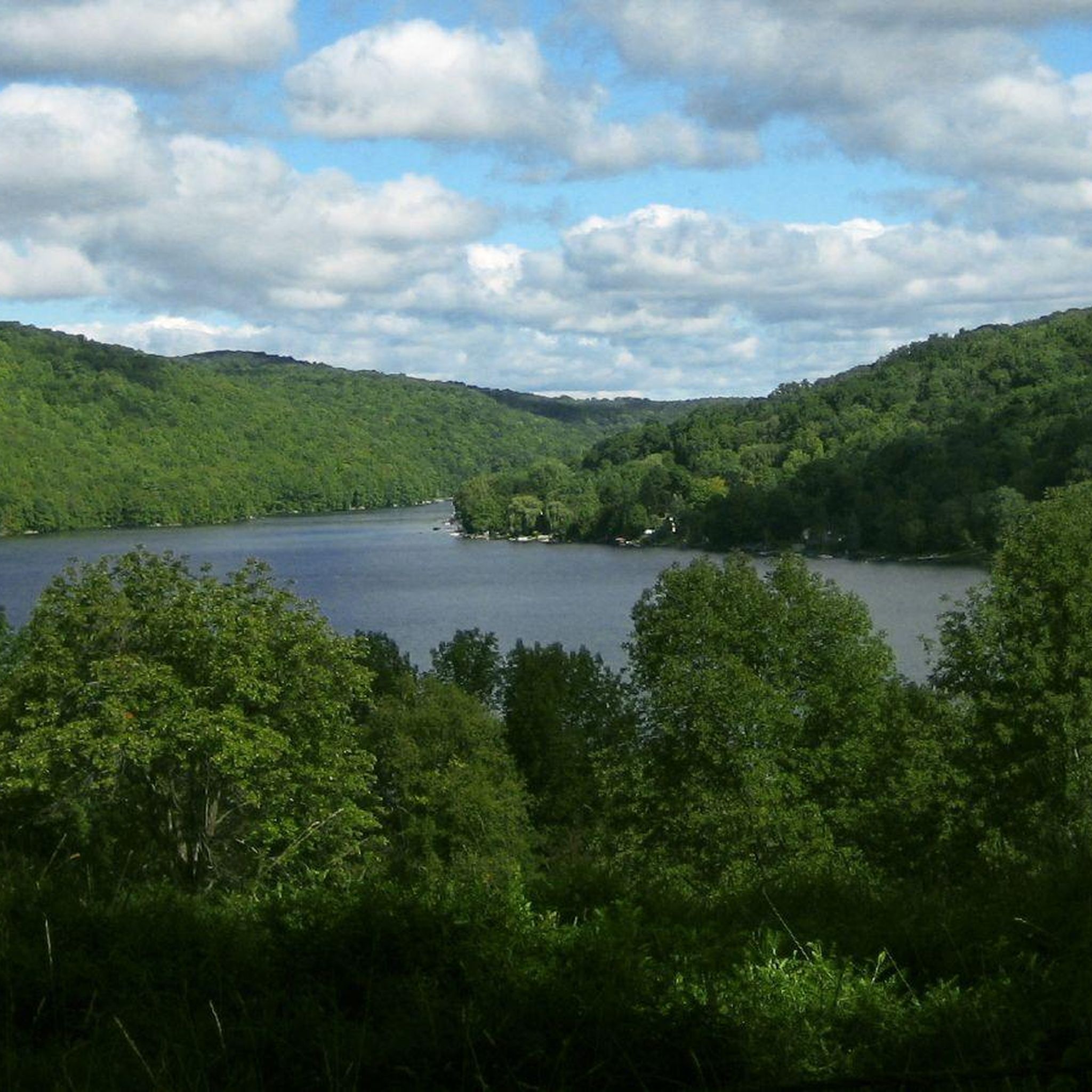
Absolutely. Many routes in the region feature water views. The Lillinonah Trail in Paugussett State Forest, for instance, follows the scenic Lake Lillinonah shoreline, providing beautiful waterside vistas throughout your hike.

What is the best time of year to go hiking in Western Connecticut Planning Region?

Spring and fall are particularly popular for hiking in Western Connecticut Planning Region due to comfortable temperatures and vibrant foliage. Spring brings blooming wildflowers, while autumn showcases stunning fall colors. Summer offers lush greenery, though some trails can be more humid. Winter hiking is also possible, especially on well-maintained paths, offering a different kind of serene beauty.

Are there any trails with good parking facilities?

Most state parks and nature preserves in the Western Connecticut Planning Region offer designated parking areas for trail access. For example, trails like the Bennett's Pond via Ives Trail Greenway loop typically have convenient parking at the state park.

What do other hikers enjoy most about the trails here?

The hiking trails in Western Connecticut Planning Region are highly regarded by the komoot community, with an average rating of 4.8 stars. Hikers frequently praise the region's quiet woodlands, well-marked paths, and the diverse scenery that includes rolling hills, dense forests, and picturesque waterways.

Are there any coastal hiking opportunities?

Yes, you can find coastal hiking experiences in the region. The Tod's Driftway loop in Greenwich Point Park offers a pleasant walk through a coastal park with views of the Long Island Sound.

Can I find trails near towns like Danbury or New Milford?

Yes, the Western Connecticut Planning Region includes areas near these towns. For example, the Thomas Mountain via Tarrywile Yellow Trail loop is located within Tarrywile State Park, which is easily accessible from Danbury. Similarly, trails near New Milford often provide access to the region's natural beauty.

Most popular routes in Western Connecticut Planning Region

Easy hikes in Western Connecticut Planning Region

Most popular attractions in Western Connecticut Planning Region

Places to see

Store rating

Get inspired with the komoot mobile app

With a free komoot account, you can easily find, customize, and navigate endless outdoor adventures.

or

Join komoot Now

Store rating

Didn’t find what you were looking for?

Check out more Hikes throughout Western Connecticut Planning Region below and find the perfect route in your destination.

DanburyBranchvilleGlenvilleLakes EastOld GreenwichStaplesTaylor CornersTokenekeMurrayPaugussett State ForestPootatuck State ForestSheltonNewtownBridgeportTrout Brook Valley State Park ReserveWooster Mountain State ParkPutnam Memorial State ParkCollis P. Huntington State ParkSquantz Pond State ParkNorwalkSeth Low Pierrepont State Park ReserveLong HillOronoqueBotsfordCandlewood Lake ClubDodgingtownGreenwichHawleyvilleMamanasco LakeLakes WestNew CanaanPlattsvilleRock RidgeSandy HookShermanSouth WiltonStratford DowntownCandlewood ShoresEast VillageGeorgetownNorotonOld HillIndian Well State ParkBall PondLordshipBethelBirchbank Mountain Open SpaceRedding CenterInglenookBigelow CornersTashuaNoroton HeightsKnollcrestIndian FieldSail HarborRoute 7 GatewayStamfordCos CobBrookfield CenterRidgefieldRiversideTopstoneStepneyWilton CenterStewart B. Mckinney National Wildlife Refuge Sheffield Island UnitColeytownLakeside WoodsFairfield UniversityCannondaleMill PlainGreens FarmsPoplar PlainsKellogg PointCandlewood KnollsRocky Glen State Park Scenic ReserveWestport VillageDarien DowntownWest MountainCompoCandlewood OrchardsMianus River State Park Scenic ReserveTrumbull CenterRidgeburySouthportSaugatuckBogus HillDaniels FarmWestonPemberwickByramCandlewood IsleDevils Den

Nearby adventure guides

Things to Do around Weston

background

Get ready to conquer new peaks

Sign up for Free

Explore
RoutesRoute plannerFeaturesHikesMTB TrailsRoad cycling routesBikepackingSitemap
Download the app
Follow Us on Socials

© komoot GmbH

Privacy Policy




