The best walks and hikes in Franklin County
1.0
(1)
30
hikers
12
hikes
Hiking in Franklin County, Arkansas, offers access to the diverse landscapes of the Ozark Mountains. The region is characterized by dense woodlands, river valleys, and rolling hills, providing varied terrain for outdoor exploration. Hikers can expect trails that traverse forests, lead to scenic overlooks, and follow waterways. This area provides opportunities for both gentle walks and more challenging ascents.
Best hiking trails in Franklin County
- The most popular hiking route is Ozark Highlands Trail: Indian Creek to Lick Branch,…
Last updated: August 18, 2026
2
hikers
7.68km
02:14
230m
170m
If you're seeking a hike that delivers on varied scenery and a good workout, the Ozark Highlands Trail: Indian Creek to Lick Branch is a solid choice. This moderate 4.8-mile…
1
hikers
3.13km
01:01
230m
10m
This section of the Ozark Highlands Trail offers a rewarding journey through rugged forestland to Hare Mountain, the highest point on the entire OHT. You'll hike through diverse hardwood and…

Sign up for free
40.2km
10:57
710m
420m
Hike the difficult 25.0-mile Pig Trail Scenic Byway through the Ozark National Forest, gaining 2318 feet with panoramic views.
527m
00:09
0m
30m
The Spy Rock Overlook Trail in Arkansas delivers stunning vistas of the Ozark National Forest with minimal effort. This easy 0.3-mile (0.5 km) hike takes you through a well-beaten path…
292km
85:35
7,470m
7,760m
The Ozark Highlands Trail offers a true wilderness experience, winding through a rugged, heavily forested landscape that feels far removed from civilization. This difficult 181.6-mile (292.2 km) hiking route, with…
1,000m
00:17
20m
20m
Embark on an easy hike through the Fern Gully Scenic Area Bushwhack, a route that offers a unique rainforest-like feel. You will discover impressive sandstone cliff faces and towering bluffs,…
1.55km
00:29
0m
160m
Hike the easy 1.0-mile Spirits Falls via Ozark Highlands Trail in Ozark National Forest, featuring waterfalls and bluffs.
101km
29:29
2,740m
2,640m
The Mill Creek OHV Trail Loop is a formidable journey through the Ozark National Forest, offering a deep dive into remote, rugged landscapes. While primarily an OHV system, the area…
5
hikers
24.0km
06:52
650m
650m
Hike the difficult 14.9-mile White Rock - Shores Lake Loop in Ozark National Forest, featuring waterfalls, bluffs, and panoramic mountain vi
10
hikers
Moderate hike. Great for any fitness level. Mostly accessible paths. Sure-footedness required.
Get access to more routes and recommendations from other explorers.
Sign up for free
Already have an account?
Our route recommendations are based on thousands of hikes, rides, and runs completed by other people on komoot.
Start today with a free account
Your next adventure awaits.
Login or Signup
Popular around Franklin County

Other adventures in Franklin County

Tips from the Community

Big Piney Creek winds through the heart of the Ozark National Forest, known for its clear mountain water. Designated a National Wild and Scenic River, it’s popular for canoeing, fishing, and swimming, with Class I–III rapids and year-round recreation. The creek flows for nearly 70 miles before joining the Arkansas River, passing through remote wilderness, historic bridges, and Forest Service campgrounds, including Long Pool and Haw Creek Falls.
0
0
This is a lovely campsite with two fire rings and plenty of level spots to pitch your tent. Situated along the beautiful Cedar Creek, there is a waterfall here that drops into an emerald green pool, perfect for a dip on a warm day. It's an ideal spot for an overnight stay, and an opportunity to explore more of this beautiful area while you're here.
0
0
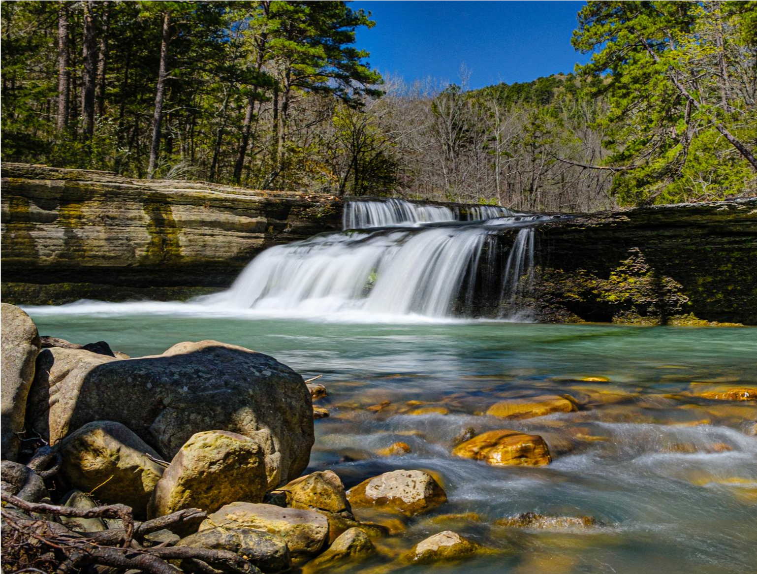
Bear Skull Falls, the largest of several along this stretch of the OHT, is a beautiful, multi-tiered waterfall over fantastic slot-like rock formations that end in a calm pool at its base. The falls tumble through a narrow ravine surrounded by mossy boulders and dense forest canopy. It's especially photogenic after rainfall. If you are from Arkansas and are familiar with Cedar Falls at Petit Jean State Park, you'll notice the striking similarity, but not quite as large. The short spur trail to reach the falls is well worth the side trip, perfect for a scenic break to capture some memorable photos
0
0
This trailhead is a popular access point for the Ozark Highlands Trail (OHT) for both day and long-distance hikers. There is a small parking lot and an information kiosk with a map and trail register, and a small campsite, with space for a few tents, along with a large fire ring. There is no restroom or drinking water; however, the trailhead sits along the creek of the same name, which is one of many reliable water sources in the area.
0
0
This spur trail runs roughly 1 ½ miles south to reach the Mulberry River, a popular spot for paddling with beautiful views. Byrd’s Adventure Center sits right along the river and offers tent sites, cabins, and amenities for hikers looking to rest or resupply, including warm showers, a convenience store, and a restaurant. This spur is the perfect exit or resupply point for thru-hikers navigating the OHT’s midsection.
0
0
Indian Creek is beautiful, cutting through a narrow gorge with clear water running over mossy rocks and pooling under the tall bluffs. After rain, it creates several small waterfalls, though it often dries up in summer. The creek bed is rough and uneven, so be mindful of your footing when crossing. There are a couple of nice tent sites here with fire rings, and if the weather is warm, the pools are a great place to take a dip and cool off.
0
0
Hare Mountain, part of a designated Special Interest Area, is the highest point along the OHT, rising to about 2,400 feet. There are several campsites here, with bear poles, fire rings, a picnic table and plenty of trees for hanging a hammock. There is a nearby well, and all sites have beautiful panoramic views of the Boston Mountains, especially during sunrise and sunset. It's worth the detour, even if you don't plan on staying overnight.
0
0
Fane Creek is clear and beautiful as it flows through this quiet forest stretch, with smooth rock, gentle cascades, and small pools. The crossing is usually manageable, though the flat rock can be slick after rain, so take care with footing. There are two or three excellent campsites just a few yards upstream, with stone chairs, fire rings, flat tent space, and easy access to water—perfect for a restful overnight, or a spot to take a few hours to rest and recharge.
0
0
Frequently Asked Questions
What kind of terrain can I expect on hiking trails in Franklin County?
Hiking in Franklin County, Arkansas, primarily takes you through the diverse landscapes of the Ozark Mountains. You'll encounter dense woodlands, rolling hills, and river valleys. Trails often traverse forests, lead to scenic overlooks, and follow waterways, offering a mix of natural environments.
How many hiking trails are available in Franklin County?
Komoot features over 10 hiking routes in Franklin County, offering a variety of options for outdoor enthusiasts. These trails range from easy strolls to more challenging, longer excursions.
Are there hiking options for all skill levels in Franklin County?
Yes, Franklin County provides trails for various abilities. You can find several easy routes, such as the Morgan Fields to Hare Mountain via Ozark Highlands Trail, which is 1.9 miles long. There are also moderate paths like the Ozark Highlands Trail: Indian Creek to Lick Branch, and more difficult, longer routes like the White Rock - Shores Lake Loop.
Are there any trails with waterfalls in Franklin County?
Yes, you can explore trails that lead to natural water features. The Spirits Falls via Ozark Highlands Trail is an easy 1.0-mile route that takes you to Spirits Falls, offering a refreshing natural highlight.
Can I find trails with scenic viewpoints in Franklin County?
Absolutely. Many trails in Franklin County offer rewarding views of the surrounding Ozark Mountains and river valleys. For example, the short Spy Rock Overlook Trail provides a great vantage point. Additionally, the White Rock Mountain Recreation Area is known for its scenic vistas.
Are there any circular or loop trails in Franklin County?
Yes, Franklin County offers several loop trails for those who prefer not to retrace their steps. Notable options include the challenging White Rock - Shores Lake Loop, the extensive Mill Creek OHV Trail Loop, and the White Rock Mountain Rim Trail loop.
What are the typical durations for hikes in Franklin County?
Hike durations vary significantly based on the trail's length and difficulty. Shorter, easy routes like Morgan Fields to Hare Mountain can be completed in under 2 hours. Moderate trails, such as Ozark Highlands Trail: Indian Creek to Lick Branch, typically take around 2-3 hours. Longer, more difficult routes like the White Rock - Shores Lake Loop can take 6-7 hours or more.
Are there family-friendly hiking options in Franklin County?
For families looking for easier walks, Franklin County has several suitable trails. The Morgan Fields to Hare Mountain via Ozark Highlands Trail is an easy 1.9-mile path, and the Fern Gully Scenic Area Bushwhack is a short, easy option, both great for a leisurely outing.
Are dogs allowed on hiking trails in Franklin County?
While komoot's data doesn't specify dog-friendliness for every trail, many state parks and natural areas in Arkansas generally allow dogs on trails, often requiring them to be on a leash. It's always best to check specific regulations for the park or trail you plan to visit beforehand.
What natural features are prominent along the trails in Franklin County?
The trails in Franklin County showcase the natural beauty of the Ozark Mountains, featuring dense hardwood forests, river valleys, and rolling hills. You'll often encounter creeks like Fane Creek and Spirits Creek, as well as diverse flora and fauna typical of the region.
Is there parking available at trailheads in Franklin County?
Most established trailheads and recreation areas in Franklin County, especially within state parks or designated natural areas, typically offer parking facilities. For specific routes, it's advisable to check the route details on komoot or local park websites for precise parking information.
What is the best time of year to hike in Franklin County?
The spring and fall seasons are generally ideal for hiking in Franklin County. Spring brings blooming wildflowers and mild temperatures, while fall offers vibrant foliage. Summer can be hot and humid, but shaded forest trails provide some relief. Winter hiking is also possible, with fewer crowds and unique frosty landscapes, though some trails might be slick.
Most popular routes in Franklin County
Most popular attractions in Franklin County

Get inspired with the komoot mobile app


Explore more
Browse the best Hikes in other regions.
