The best walks and hikes in Cambria County
35
hikers
24
hikes
Hiking in Cambria County explores the rolling hills of the Allegheny Plateau, a region characterized by dense forests and major river valleys. The landscape is shaped by features like the Allegheny Mountains and Laurel Ridge, offering varied terrain from moderate paths to more challenging routes. This area includes a network of trails that often follow historic railroad beds, providing a distinct backdrop for hiking. The Conemaugh Gorge, one of the deepest gorges east of the Mississippi River, also contributes to the region's diverse natural features.
Best hiking trails in Cambria County
- The most popular hiking route is Staple Bend Tunnel Trail, a 4.7 miles (7.5 km) trail that takes around 1 hour 58 minutes to complete. This route follows a historic railroad path through the Allegheny Portage Railroad National Historic Site.
- Another top favourite among local hikers is Clark Run Trail & Rager Mountain Trail loop — Charles F. Lewis Natural Area, a moderate 4.8 miles (7.7 km) path. The trail features varied terrain with an elevation gain of over 1,100 feet (338 m).
- Local hikers also love the Viewpoint of South Fork Dam via Path of the Flood Trail — Johnstown Flood National Memorial, a 4.4 miles (7.1 km) trail leading through the Johnstown Flood National Memorial, often completed in about 1 hour 53 minutes.
- Hiking in Cambria County is defined by forested hills, historic rail-trails, and paths along river valleys. The trail network offers routes for different ability levels, from easy walks in state parks to more challenging hikes along the Laurel Highlands.
- The guide includes highly-rated routes that showcase the best of the region's landscape. More than 30 hikers have used komoot to explore Cambria County's varied terrain.
Last updated: June 23, 2026
2
hikers
13.7km
03:45
160m
310m
Embark on a moderate hike along the Laurel Highlands Hiking Trail, covering 8.5 miles (13.7 km) with an elevation gain of 516 feet (157 metres). This segment, estimated to take about 3 hours and 45 minutes, offers a varied landscape. You will begin with an uphill climb to reach the ridge, transitioning into pleasant "ridge walking" with beautiful views. The terrain here is generally easier, featuring more dirt paths and fewer rocks. As you hike, you will pass through mixed deciduous forests, where ferns carpet the ground and white-tailed deer might be spotted before you reach the Decker Avenue Shelter. This route provides a balanced experience, combining moderate climbs with more level stretches.
Planning your visit is straightforward, as the trail is well-marked with yellow blazes every 100 feet and clear mile markers. Both the Route 271 and Decker Avenue shelter areas provide amenities like pit toilets, trash cans, and water pumps for your convenience. Remember that if you plan an overnight stay in shelters or tent sites, reservations are required. The trail is open year-round, making it suitable for winter activities such as snowshoeing or cross-country skiing, so you can enjoy it in any season.
This section of the Laurel Highlands Hiking Trail is part of a longer, well-established route within Laurel Ridge State Park. It is known for its distinct ridge walking experience, offering hikers a unique perspective of the surrounding natural environment. The trail's design ensures a consistent and enjoyable journey, making it a popular choice for those looking to explore the region's diverse ecosystems. You will find that this segment provides a great introduction to the wider trail system, showcasing its characteristic beauty and accessibility.
1
hikers
2.03km
00:32
10m
30m
Embark on the Laurel Ridge Shelter Trail for an easy 1.3 miles (2.0 km) hike, where you will gain a gentle 41 feet (12 metres) in elevation. This route takes about 32 minutes to complete, winding through beautiful deciduous forests. You can expect to see abundant mountain laurel, especially when it blooms, and vibrant spring wildflowers in early April, with stunning fall colors later in the year. Keep an eye out for interesting rock formations and scenic streams along the way.
Planning your visit is straightforward, as the trail is well-maintained and clearly marked with yellow blazes. You will find concrete mile markers along the path to help you track your progress. Parking is generally available at the Route 271 Shelter Area, which also offers convenient facilities for hikers. This makes it an ideal spot for a quick outdoor escape without much fuss.
This trail is an integral part of the much longer Laurel Highlands Hiking Trail, offering a taste of its natural beauty in a manageable segment. It provides a perfect opportunity to experience the region's unique ecosystem, whether you are looking for a short, refreshing walk or a starting point to explore more of the area's extensive trail network.

Sign up for free
7.07km
01:56
70m
180m
Discover the Stackhouse Park Trail, a true hidden gem offering a tranquil escape into nature within Johnstown, Pennsylvania. This easy hiking route guides you through lush, wooded areas, where you'll hear the sounds of rushing creeks and spot little waterfalls. The path winds through deep ravines, featuring natural canopies formed by overgrowth and charming footbridges, creating a picturesque journey that feels miles away from the urban bustle.
Planning your visit is straightforward, with the main entrance accessible from Luzerne Street. The park is very welcoming to families and dog owners, allowing leashed dogs on the trails. You'll find picnic areas and shaded seating, perfect for a break. While the 4.4-mile (7.1 km) trail with 224 feet (68 metres) of elevation gain can be completed in about 1 hour and 55 minutes, arriving earlier in the day is always a good idea to secure parking, especially on weekends.
What makes Stackhouse Park truly special is its untouched character; a historical deed prohibits construction or logging, preserving it as a miniature nature reserve. You can still see the legacy of the Civilian Conservation Corps, who built sturdy stone pavilions and miles of trails in the 1930s. These rustic structures, along with 26 designated fire pits, are still in use today, making the park a beloved community space for gatherings and events.
25.6km
06:46
200m
310m
The Path of the Flood Trail offers a truly unique hiking experience, blending natural beauty with a profound historical narrative. As you traverse this difficult 15.9-mile (25.6 km) route, which typically takes around 6 hours and 45 minutes to complete, you'll follow the exact path of the 1889 Johnstown Flood. Expect varied terrain, from crushed stone to packed earth, and enjoy views of lush woodlands, active rail lines, and the Little Conemaugh River, all while encountering historical markers that bring the past to life.
While the trail is generally considered flat, be ready for some sections with moderate to steep grades, especially around the historic Staple Bend Tunnel. The route is well-marked with numerous interpretive exhibits, making it an excellent choice for those who appreciate a hike with a strong educational component. Plan to allocate extra time to read the historical information along the way, which provides crucial context to the landscape.
This trail is not just a walk in the park; it's a journey through one of America's worst 19th-century catastrophes, claiming over 2,200 lives. The Path of the Flood Trail meticulously traces the flood's course, integrating landmarks like the 901-foot-long Staple Bend Tunnel, the nation's first railroad tunnel. Its historical and recreational value was recognized when it was named Pennsylvania's 2025 Trail of the Year, highlighting its significance within the region and beyond.
128km
37:00
2,990m
3,380m
Embark on the Laurel Highlands Hiking Trail, a challenging 79.5-mile (128.0 km) journey that demands approximately 37 hours of hiking. You will navigate diverse landscapes, from open hardwoods and ferns to dense hemlock and rhododendron thickets, gaining a significant 9805 feet (2988 metres) in elevation. This difficult route offers impressive rock formations, including giant boulders and grottos, especially within State Game Lands 111. Look for rewarding vistas, such as the Middle Fork Overlook, which provide expansive views off the mountain, particularly clear in winter.
The Laurel Highlands Hiking Trail is accessible year-round, offering a consistent experience regardless of the season. The route is meticulously maintained, marked by clear yellow blazes every 100 feet, making navigation straightforward. If you plan an overnight trip, remember that reservations are mandatory for staying at any of the eight designated shelter areas along the trail. Each shelter area provides Adirondack-style shelters, tent pads, comfort stations, fireplaces, and water sources for your convenience.
This linear trail connects the Conemaugh Gorge to Ohiopyle State Park, providing a significant long-distance hiking experience. It is a well-regarded path for those seeking a multi-day adventure through Pennsylvania's natural beauty. The trail's design ensures you are immersed in varied ecosystems, from lush forests to striking geological features. Consider this route if you are looking for a sustained challenge with ample opportunities to connect with nature.
3
hikers
7.53km
01:58
60m
60m
The Staple Bend Tunnel Trail offers a unique blend of easy hiking and fascinating history, making it one of the more popular trails in the region for a relaxed outing. You'll follow a flat, crushed limestone path through a verdant forest, often alongside the Little Conemaugh River, before reaching the impressive Staple Bend Tunnel. This route is perfect for those who appreciate a gentle 4.7-mile (7.5 km) hike with minimal effort, as it only has 183 feet (56 metres) of elevation gain.
Planning your visit is simple, with ample parking available at the trailhead. The trail is well-maintained and suitable for all ages, making it a great family-friendly activity. While the estimated time is just under 2 hours, you might want to allow extra time to read the interpretive panels and explore the tunnel. Remember to bring a headlamp if you intend to walk through the 901-foot tunnel, as it can be quite dark inside.
This easy trail holds significant historical importance as the site of the first railroad tunnel built in the United States, completed between 1831 and 1833. It was a crucial part of the Allegheny Portage Railroad, connecting canal systems across Pennsylvania. The route is part of the larger Path of the Flood Trail and is managed by the National Park Service, offering a tangible connection to early American engineering and transportation history.
2
hikers
26.8km
07:19
400m
400m
Embark on a challenging journey along the Laurel Highlands Hiking Trail, a difficult route spanning 16.7 miles (26.8 km) with an elevation gain of 1322 feet (403 metres). You will find yourself deep within pleasant hardwood forests, often accented by mountain laurel and rhododendrons, experiencing a true immersion in nature. Expect to spend around 7 hours and 18 minutes hiking this rewarding path, navigating through interesting geological formations and rock corridors.
Planning your visit to the Laurel Highlands Hiking Trail is straightforward, as the path is well-maintained and clearly marked with yellow blazes. While you can access the trail year-round, the best time for hiking is typically from mid-April through early November, when conditions are most favorable. If you plan an overnight stay in one of the shelter areas, remember that reservations are mandatory to secure your spot.
This trail stands out for its unique geological features, including numerous rock mazes and notable outcroppings like Beam Rocks, which add a distinctive character to your hike. As you progress, keep an eye out for occasional vistas that open up, offering views of the valleys and distant ridges that define the beauty of the Laurel Highlands region. The route provides a robust experience for hikers seeking both natural beauty and a physical test.
1
hikers
11.4km
03:00
100m
100m
The Honan Avenue Trail offers a delightful escape into nature, winding through a lively wooded corridor that feels miles away from the city. This moderate 7.1-mile (11.4 km) hike, with a gentle 313 feet (95 metres) of elevation gain, takes about 3 hours to complete. Along the way, you'll discover small waterfalls culminating in the impressive Hinckston Falls, and about a mile in, an active beaver dam. It's a fantastic route for wildlife spotting, with chances to see various birds, mammals, and even bald eagles.
Planning your visit is straightforward, as the trail is generally considered an easy walk with slight hills, making it suitable for all skill levels. While specific parking for Honan Avenue Trail isn't detailed, it connects easily from the River Walk Trail in Cambria City. Benches are available for rests, and nearby picnic pavilions offer a place to relax. Consider visiting in spring or fall for the best conditions and vibrant scenery.
This trail is notable for its transformation from a disused roadway into a vibrant recreational path, thanks to community efforts. It features educational interpretive signs about local wildlife and ecosystems, and serves as a vital link to other trails around the Hinckston Run Reservoir. The trail complex also includes the Laurel Highlands Veterans Memorial Bird Sanctuary, adding to its unique appeal and community value.
1
hikers
7.10km
01:53
70m
70m
The Path of the Flood Trail offers a unique journey through history and nature, winding alongside the Little Conemaugh River. You'll experience a mix of crushed stone, pavement, and packed earth underfoot, with lush woodlands providing a scenic backdrop. Keep an eye out for the active Norfolk Southern Railroad running parallel to the trail, adding an interesting dynamic to the natural setting.
This easy 4.4-mile (7.1 km) hike, with just 230 feet (70 metres) of elevation gain, is suitable for most fitness levels and takes approximately 1 hour and 52 minutes. Good walking shoes are always a smart choice, and remember to carry water, especially if you're hiking on warmer days. The trail is generally accessible, making it a great option for a relaxed outing.
The most compelling aspect of the Path of the Flood Trail is its deep connection to the 1889 Johnstown Flood, one of America's worst historical catastrophes. The route literally traces the path the floodwaters took, with interpretive signs along the way bringing the tragic events to life. You'll also encounter the historic Staple Bend Tunnel, the first railroad tunnel in the United States, adding another layer of historical significance to your hike.
4.05km
01:03
30m
30m
The Grandview Cemetery loop offers a distinctive hiking experience, blending a gentle outdoor walk with a journey through local history. You'll wander among mature trees and historical gravestones, encountering significant landmarks like the Grand Army of the Republic Memorial and the Morrell Circle. This easy 2.5-mile (4.1 km) route, with just 93 feet (28 metres) of elevation gain, provides a quiet, contemplative atmosphere, perfect for a leisurely stroll that takes about 1 hour and 3 minutes.
Planning your visit to this unique trail is simple, as parking is readily available within the cemetery grounds. The route is accessible and enjoyable throughout the year, though many find the spring and autumn months particularly scenic. It's an ideal choice for those seeking a peaceful walk without significant physical challenge, and it's a great option for families or anyone looking for an easy hike with historical context.
What truly sets the Grandview Cemetery loop apart is its historical significance, serving as the burial site for 777 unknown victims of the 1889 Flood. Walking here offers a direct connection to the past, with memorials and mausoleums telling stories of the region. It's a family-friendly trail that provides a unique blend of outdoor activity and historical exploration, making it a notable landmark in the area.
Get access to more routes and recommendations from other explorers.
Sign up for free
Already have an account?
Our route recommendations are based on thousands of hikes, rides, and runs completed by other people on komoot.
Start today with a free account
Your next adventure awaits.
Login or Signup








Tips from the Community

This shelter area located north of Route 31 is one of eight strategically placed along the Laurel Highlands Hiking Trail. Each shelter area has five Adirondack-style lean-to shelters, room for up to 25 tents, bathrooms, fire pits, and garbage cans. Overnight stays at shelter areas must be reserved ahead of time with Laurel Ridge State Park. There is a seasonal stream that runs through the south end of this shelter area near shelters #1 and #2 that can serve as a good water supply.
0
0
This shelter area just off Route 653 is one of eight strategically placed along the Laurel Highlands Hiking Trail. Each shelter area has five Adirondack-style lean-to shelters, room for up to 25 tents, bathrooms, fire pits, and garbage cans. Overnight stays at shelter areas must be reserved ahead of time with Laurel Ridge State Park. At this shelter area there is a water pump with untreated water in case you need to fill up your water supply.
0
0
This shelter area just off Route 271 is one of eight strategically placed along the Laurel Highlands Hiking Trail. Each shelter area has five Adirondack-style lean-to shelters, room for up to 25 tents, bathrooms, fire pits, and garbage cans. Overnight stays at shelter areas must be reserved ahead of time with Laurel Ridge State Park.
0
0
Tucked away along Jersey Hollow Road, this trailhead connects to the Laurel Highlands Hiking Trail around mile 11. There is a gravel parking lot here, and it connects to one of the quieter, less trafficked areas of the southern end of the trail. There is a kiosk with trail information and a registry box here for anyone starting the trail from this point.
0
0
The Youghiogheny River runs parallel to the Laurel Highlands Hiking Trail here around the southern terminus of the trail at Ohiopyle State Park. There are some great views and overlooks of the river along various points of the Laurel Highlands Hiking Trail, especially around miles 6 and 11, but the close-up view of the river near Ohiopyle makes for a great ending or start to the trail.
0
0
Seven Springs is a mountain ski resort with multi-use trails in the off-season. The Laurel Highlands Hiking Trail runs directly through the area and past Tahoe Lodge, with views of the nearby lake. For through hikers, this is a great spot to rest for a meal and take in some views of the highest point on the trail.
0
0
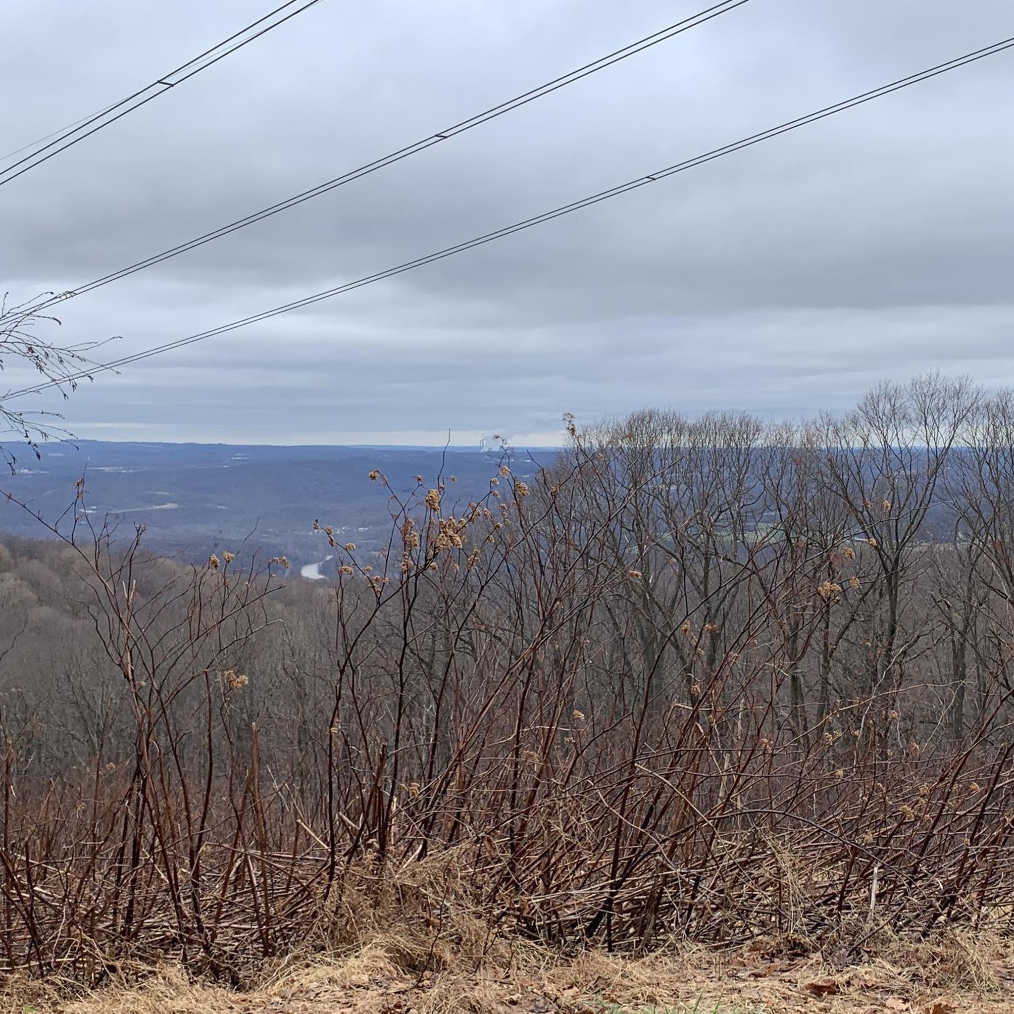
South of Middle Fork Road, this overlook gives you a nice panorama of Fayette County, Chestnut Ridge, and even the Pittsburgh skyline in the distance.
0
0

This 3.5-mile path, once an abandoned roadway, has been transformed into a community trail. Along the way, you'll find inviting benches for rest and interpretive signs that offer insights into the local environment.
0
0
Frequently Asked Questions
Are there any family-friendly hikes in Cambria County?
Yes, the region offers several easy walks perfect for a family outing. A great choice is the Grandview Cemetery loop, which is a relatively flat and short walk. Another excellent option is the Johnstown Greenway Trail, providing a simple and accessible path for all ages.
Can I bring my dog on the trails?
Many trails in Cambria County are dog-friendly, but policies can vary, especially within state parks and national historic sites. It's always best to keep your dog on a leash and check the specific regulations for the trail you plan to visit. For example, Prince Gallitzin State Park generally allows dogs on its trails, but they must be controlled at all times.
What is the Ghost Town Trail like for hiking?
The Ghost Town Trail is a renowned rail-trail with a crushed limestone surface, making for a relatively easy and smooth walk. It follows the path of former railroads through the Blacklick Creek valley, passing remnants of old coal-mining towns. A long but manageable section is the C & I Trail & Ghost Town Trail loop near Vintondale, which explores a significant portion of this historic route.
Are there any challenging hikes for experienced hikers?
Yes, for those seeking a more strenuous adventure, the Laurel Highlands offer significant challenges. The Laurel Highlands Hiking Trail section in Laurel Ridge State Park is a difficult, long-distance route with considerable elevation gain, perfect for a full-day challenge.
Can I find any circular or loop trails?
Absolutely. If you prefer to end your hike where you started without backtracking, the Johnstown Flood National Memorial loop is a short and historically interesting option. It provides a concise way to explore the area around the former South Fork Dam.
What is the historical significance of the trails in the Johnstown area?
Many trails commemorate the region's industrial and tragic history. The Path of the Flood Trail, for instance, follows the path of the devastating 1889 Johnstown Flood. You can explore part of this history on the hike to the Staple Bend Tunnel, which combines flood history with the legacy of the Allegheny Portage Railroad.
Are there any waterfall hikes in Cambria County?
While Cambria County is known more for its forests and rivers, you can find waterfalls in the broader region. Nearby Buttermilk Falls Park in New Florence features a beautiful waterfall accessible via an easy path with boardwalks. It's a short drive from many of the county's main hiking areas and offers a rewarding sight.
What kind of terrain should I expect on the trails?
The terrain varies significantly. You'll find flat, crushed-gravel rail-trails like the Ghost Town Trail, which are easy to walk. In contrast, trails in areas like the Charles F. Lewis Natural Area feature more rugged, natural surfaces with significant elevation changes, such as the moderate Clark Run Trail & Rager Mountain Trail loop.
What are some good hiking options in Prince Gallitzin State Park?
Prince Gallitzin State Park has over 35 miles of trails, many of which offer beautiful views of Glendale Lake. The trails range from easy lakeside strolls to more moderate forest hikes. While specific routes are numerous, exploring the trails around the lake's 26 miles of shoreline is a popular activity for visitors.
Do I need to pay for parking or trail access?
Most state parks and local trailheads in Cambria County, such as those for the Ghost Town Trail, offer free access and parking. However, national historic sites like the Allegheny Portage Railroad may have entrance fees for certain exhibits, though access to the trails themselves is often free. Always check the specific site's policy before you go.
What do other hikers enjoy about Cambria County?
The komoot community has explored over 18 trails in the area. Hikers often praise the unique blend of natural scenery and industrial history. The well-maintained rail-trails, the serene forests of the Allegheny Plateau, and the opportunity to walk through sites of historical importance are frequently mentioned as highlights.
Is it possible to reach the trails by public transport?
Reaching trailheads in Cambria County via public transportation is very difficult, as most are located in rural areas away from bus routes. Traveling by car is the most reliable way to access the region's hiking opportunities.
Most popular attractions in Cambria County

Get inspired with the komoot mobile app


Didn’t find what you were looking for?
Check out more Hikes throughout Cambria County below and find the perfect route in your destination.
Explore more
Browse the best Hikes in other regions.
