The best walks and hikes in Columbia County
8
hikes
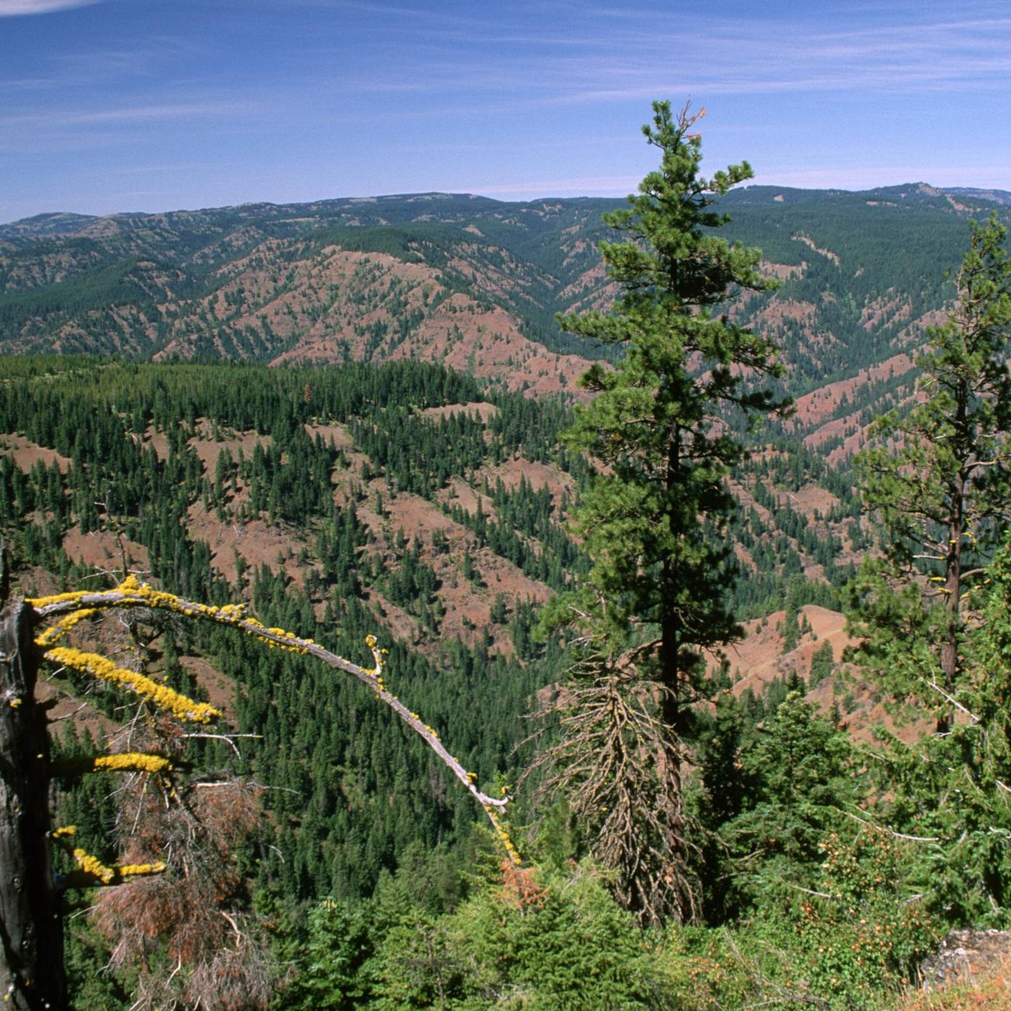
Hiking trails in Columbia County are concentrated within the Umatilla National Forest and the Wenaha-Tucannon Wilderness. The region is characterized by forested river valleys, high buttes, and challenging mountain trails. Many routes involve significant elevation gain, leading to expansive viewpoints over the surrounding landscape. The terrain includes dense forests, rugged ridgelines, and open areas.
Best hiking trails in Columbia County
- The most popular hiking route is Diamond Peak via Tucannon and Bear Creek Trails, a 19.2 miles (30.8 km)…
Last updated: May 28, 2026
7.23km
02:25
420m
210m
Moderate hike. Good fitness required. Easily-accessible paths. Suitable for all skill levels.
8.85km
02:53
400m
400m
Moderate hike. Good fitness required. Easily-accessible paths. Suitable for all skill levels.

Sign up for free
30.8km
09:16
950m
950m
Hard hike. Very good fitness required. Easily-accessible paths. Suitable for all skill levels.
26.7km
08:26
1,070m
1,070m
Hard hike. Very good fitness required. Easily-accessible paths. Suitable for all skill levels.
9.68km
02:44
210m
210m
Moderate hike. Good fitness required. Easily-accessible paths. Suitable for all skill levels.
20.3km
06:34
850m
850m
Hard hike. Very good fitness required. Easily-accessible paths. Suitable for all skill levels.
15.9km
05:15
760m
760m
Hard hike. Very good fitness required. Easily-accessible paths. Suitable for all skill levels.
16.2km
05:50
980m
980m
Hard hike. Very good fitness required. Easily-accessible paths. Suitable for all skill levels.
Our route recommendations are based on thousands of hikes, rides, and runs completed by other people on komoot.
Start today with a free account
Your next adventure awaits.
Login or Signup
Popular around Columbia County
Tips from the Community

If you want to access the summit of Round Butte, follow a subtle game trail here to the east to gain the ridge of mountain. You will slowly work your way up the rocky bald where you will find 360 views of the Wenaha-Tucannon Wilderness.
0
0
This section of trail is known for being quite overgrown and covered with blowdowns during certain seasons. If you are looking for a true adventure, wear shoes meant for water crossings, and be prepared for route finding. This is a truly wild section of wilderness trail.
0
0
At 5,656 feet, the highest of the Twin Buttes sits directly on the East Butte Creek Trail. There are open views looking east off of the butte into the Wenaha-Tucannon Wilderness and Blue Mountains.
0
0
Flowing through the Wenaha-Tucannon Wilderness, the long Wenaha River runs through a wide valley. The intersection of the Slick Ear Trail and Wenaha River Trail is in a wide open field offering great camping and fishing access right along the side of the water.
1
0
Teepee Trailhead is a common starting point for those looking to hike to Oregon Butte. This trailhead offers access to numerous trails, all of which gain access into the Wenaha-Tucannon Wilderness.
0
0
West Butte is a lesser visited viewpoint than the nearby Oregon Butte, but it still offers excellent views of the surrounding mountains. The Mount Misery Trail bypasses this small climb if you are looking to avoid extra vertical gain during your trek.
0
0
Standing at 6,387 feet, Oregon Butte is the highest point in southeast Washington and is an easy-to-reach ridge offering 360 views of Umatilla National Forest and the Blue Mountains. There is a lookout structure at the top accessible to trail users but can only be reached during the dry season.
0
0
Panjab Creek flows alongside Panjab Trail, which crosses the water on several occasions. This creek serves as a year-round water source to animals in the area as well as hikers using the trail.
0
0
Frequently Asked Questions
Are there any easy, family-friendly hikes in Columbia County?
Yes, for a short and accessible outing, the Fryxell Overlook loop from Connell is a great option. It's less than a mile long and can be completed in about 30 minutes, making it suitable for hikers of all ages and abilities.
What are some moderately challenging hikes available?
For a good workout without extreme difficulty, consider the Mount Misery Trail to Oregon Butte — Umatilla National Forest. This 5.5-mile (8.9 km) trail involves a steady ascent to a scenic lookout. Another moderate option is the Round Butte Trail — Wenaha-Tucannon Wilderness, which offers a rewarding experience through the wilderness.
I'm looking for a difficult, all-day hike. What do you recommend?
If you're seeking a strenuous challenge, the Diamond Peak via Tucannon River Trail — Umatilla National Forest is a demanding 19.2-mile (30.8 km) trek with over 3,100 feet (947 m) of elevation gain. It's a full-day commitment that rewards with a true wilderness experience.
Are there any long circular hikes in the area?
Yes, the Panjab Trail & Mount Misery Trail loop — Umatilla National Forest is a challenging loop that covers about 16.6 miles (26.7 km). It combines two distinct trails for a varied and immersive day of hiking.
What is the terrain like on the hiking trails in Columbia County?
The trails are primarily located within the Umatilla National Forest and Wenaha-Tucannon Wilderness. You can expect rugged paths that wind through forested river valleys and climb to high buttes. Many routes feature significant elevation changes, leading to expansive views.
Are dogs allowed on the hiking trails?
Most trails within the Umatilla National Forest and Wenaha-Tucannon Wilderness are dog-friendly, but they must be kept under control at all times. For longer, more remote trails like the Rattlesnake Trail & Panjab Trail loop, ensure your dog has the stamina and that you carry enough water for both of you.
How many hiking trails are featured in this Columbia County guide?
This guide highlights 8 curated hiking routes. They range from an easy sub-one-mile loop to difficult wilderness treks over 19 miles long, showcasing the diverse terrain the region has to offer.
Are there any trails that are particularly good for scenic views?
Many trails in the area lead to impressive viewpoints. The East Butte Creek Trail is a challenging hike that rewards with significant elevation gain and stunning vistas over the Wenaha-Tucannon Wilderness.
What kind of hiking should I expect in the Wenaha-Tucannon Wilderness?
Hiking in the Wenaha-Tucannon Wilderness typically involves remote and challenging trails. A route like the Slick Ear Trail is a good example, offering a nearly 10-mile (16 km) journey with considerable elevation gain through rugged, forested landscapes.
What should I know about parking at the trailheads?
Parking is generally available at the trailheads for routes in the Umatilla National Forest and Wenaha-Tucannon Wilderness. However, these are often remote areas, so parking can be limited, especially on weekends. It's always best to arrive early to secure a spot.

Get inspired with the komoot mobile app


Didn’t find what you were looking for?
Check out more Hikes throughout Columbia County below and find the perfect route in your destination.
Explore more
Browse the best Hikes in other regions.
