The best walks and hikes in Blount County
4.6
(161)
2,325
hikers
78
hikes
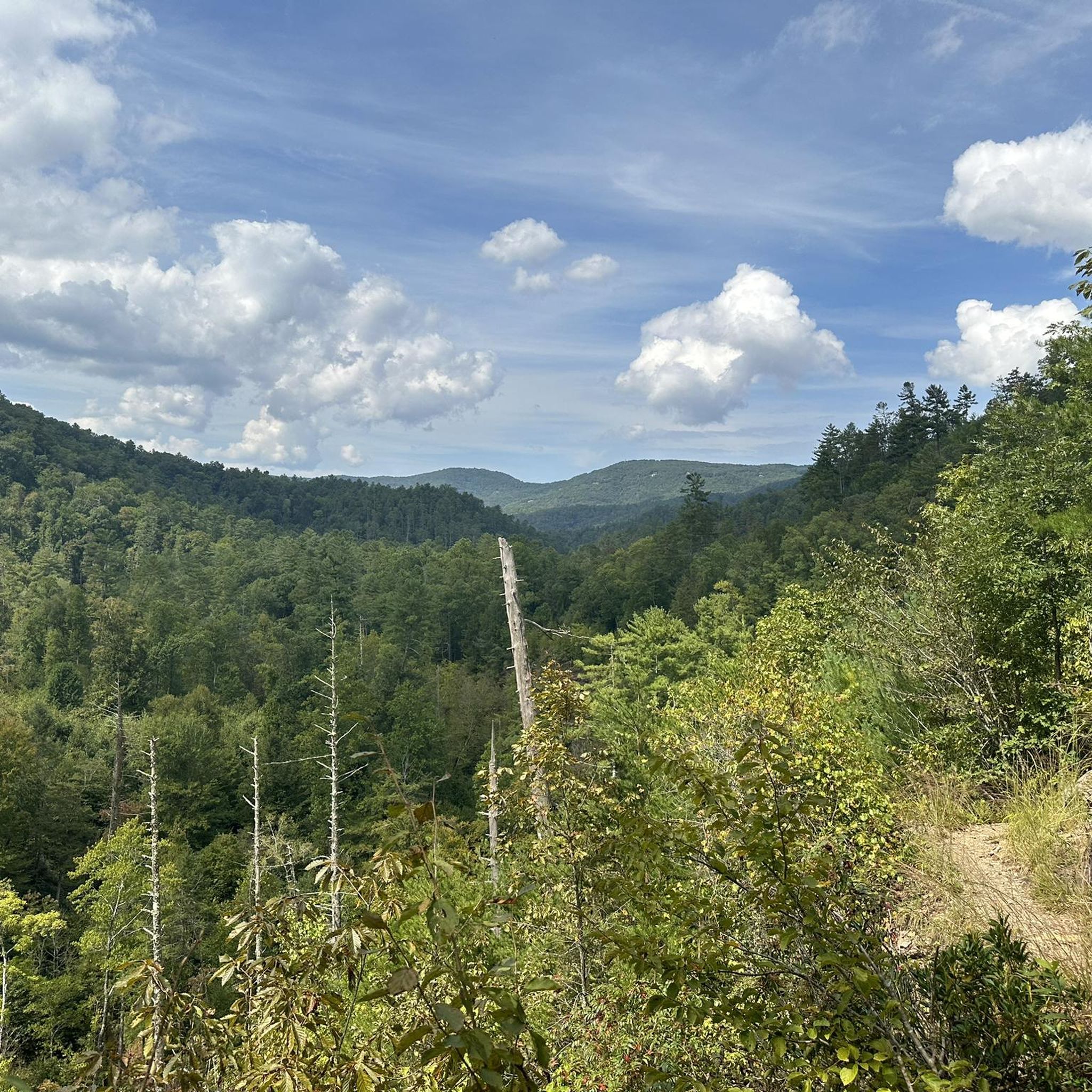
Hiking in Blount County, Tennessee, provides access to diverse landscapes, including the Great Smoky Mountains National Park. The region features rugged terrain, dense forests, and high peaks, with the Little River flowing through the county. The northern parts are characterized by the rolling hills of the Ridge-and-Valley Appalachians, offering varied natural environments for exploration. Numerous waterfalls and the scenic Cades Cove further define the area's natural environment.
Best hiking trails in Blount County
- The most popular hiking route is Abrams Falls Trail, a 5.0 miles (8.1 km) trail that takes 2 hours 7 minutes to complete. This moderate route leads to a 20-foot waterfall through a pine-oak forest.
- Another top favourite among local hikers is Maryville-Alcoa Greenway, an easy 3.7 miles (6.0 km) path. This paved trail winds through urban areas, suitable for walking and jogging.
- Local hikers also love the Abrams Falls and Rabbit Creek Loop, a 15.7 miles (25.2 km) trail leading through varied forest terrain, often completed in about 7 hours 22 minutes.
- Hiking in Blount County is defined by its access to the Great Smoky Mountains, numerous waterfalls, and the scenic Cades Cove. The network offers options for all ability levels, from easy walks to challenging mountain ascents.
- The routes in Blount County are highly rated by the komoot community with an average score of 4.7 stars from over 100 reviews. More than 1,700 hikers have used komoot to explore Blount County's varied terrain.
Last updated: August 18, 2026
4.9
(36)
459
hikers
8.07km
02:08
70m
70m
Embark on the Abrams Falls Trail, a moderate 5.0-mile (8.1 km) hike that guides you through varied forest landscapes in the Great Smoky Mountains National Park. You will gain 244 feet (74 metres) in elevation, with the entire route taking approximately 2 hours and 7 minutes to complete. As you follow the path, you'll experience a mix of pine-oak ridges and lush hemlock-rhododendron areas, all leading to the impressive Abrams Falls.
When planning your visit, consider starting your hike early in the morning, on a weekday, or during the off-season to avoid the busiest times, as this trail is very popular. Be aware that the pool at the base of Abrams Falls has strong currents and undertows, making it extremely dangerous; swimming or climbing near the waterfall is strongly discouraged for your safety. Sturdy hiking shoes are recommended to navigate the rocky sections and uneven terrain comfortably.
This route is particularly notable for Abrams Falls itself, a 20-foot high waterfall recognized as the most voluminous in the park, plunging into a large, deep pool. The trail offers picturesque streamside views along Abrams Creek, featuring clear pools and small cascades before you reach the main attraction. It provides a rewarding experience for those looking to explore the natural beauty and powerful water features of the Smokies.
5.0
(1)
8
hikers
25.2km
07:22
680m
680m
Embark on the Abrams Falls and Rabbit Creek Loop for a challenging hiking adventure through Great Smoky Mountains National Park. This difficult route spans 15.7 miles (25.2 km) and involves a significant elevation gain of 2220 feet (677 metres), typically requiring around 7 hours and 21 minutes to complete. You will experience diverse terrain, moving from dense pine-oak forests into areas thick with hemlock and rhododendron. The trail features unique "Indiana Jones" bridges over creeks and leads you to the powerful Abrams Falls, a 20-foot cascade known for its impressive water flow. Beyond the popular falls, the path becomes more rugged and less maintained, offering a true wilderness immersion.
When planning your hike, be aware that the section leading to Abrams Falls can become quite crowded, particularly during peak season and on weekends. To ensure you find parking and enjoy a more peaceful experience, it is advisable to start your journey early in the day. Be prepared for varied trail conditions throughout the loop, as some creek crossings may require wading if there has been recent heavy rainfall. Always check local park advisories before heading out to ensure optimal conditions for your visit.
This loop offers a unique blend of popular sights and secluded wilderness, making it a standout option for experienced hikers in the Great Smoky Mountains. While the initial segment to Abrams Falls is well-trafficked, the extended loop into Rabbit Creek provides a deeper, more solitary exploration of the park's natural beauty. It allows you to witness the iconic falls while also venturing into less-trodden paths, showcasing the park's diverse ecosystems from pine-oak to hemlock forests.

Sign up for free
5.0
(1)
9
hikers
19.7km
06:04
840m
620m
The Middle Prong, Lynn Camp, Miry Ridge, and Panther Creek Loop offers a challenging journey through the Great Smoky Mountains. You will hike 12.3 miles (19.7 km) with a significant elevation gain of 2756 feet (840 metres), requiring about 6 hours and 4 minutes to complete this difficult route. Expect dense forests, abundant rhododendron, and mountain laurel, creating a lush, immersive experience. The trail winds past beautiful waterfalls like Indian Flats Falls and numerous cascades along the Middle Prong Trail. This rugged terrain provides a true test for experienced hikers seeking a full-day adventure.
Before you set out, be aware that the numerous water crossings on Panther Creek can be hazardous, especially after heavy rains. Trekking poles are highly recommended for stability, particularly during these crossings and on the trail's rugged sections. Parking is available at the trailhead, so you can drive directly to the start of your hike. Always check current trail conditions and weather forecasts before your visit to ensure a safe and enjoyable experience. This difficult loop is best tackled by well-prepared hikers.
This loop offers a diverse and rugged journey through the Great Smoky Mountains National Park. Beyond the spring wildflowers and fall foliage, Miry Ridge provides wonderful winter views from a rocky outcrop. These vistas offer spectacular panoramas over the surrounding landscape, making the trail appealing across different seasons. The varied ecosystems you encounter highlight the rich biodiversity of the region.
10
hikers
6.02km
01:32
20m
30m
Explore the Maryville-Alcoa Greenway, an easy 3.7-mile (6.0 km) hiking route that offers a pleasant outdoor experience. You'll gain a gentle 57 feet (17 metres) in elevation, making it suitable for all skill levels. The trail follows the picturesque Pistol Creek, crossing it via numerous bridges, and winds through wooded areas and open meadows. Keep an eye out for the restored railroad trestle, which provides unique views high above the creek, adding a touch of history to your journey. This route typically takes about 1 hour and 32 minutes to complete at a steady pace.
To begin your hike, you can access the greenway from various points, with parking generally available at the parks it connects, such as Sandy Springs Park. The route is designed for accessibility, featuring convenient mile markers every quarter mile to help you track your progress. You'll find that the main stretches have few street crossings, and a dedicated pedestrian bridge safely guides you over Alcoa Highway, enhancing your peace of mind while you explore.
The Maryville-Alcoa Greenway is notable for its diverse scenery, transitioning smoothly between natural landscapes and urban parks. It's a family-friendly option where you might even spot farm animals in some sections, adding to its charm. The trail's design, including its paved surface and clear signage, makes it a welcoming path for anyone looking to enjoy a straightforward and enjoyable outdoor activity in the area.
9
hikers
26.9km
08:32
1,120m
1,170m
Embark on the Anthony Creek, Russell Field, Appalachian, and Bote Mountain Loop for a challenging 16.7 miles (26.9 km) hike. You will navigate varied terrain, from wide gravel paths to rocky single tracks, as you gain 3687 feet (1124 metres) in elevation. Expect to spend around 8 hours and 32 minutes immersed in old-growth forests and dense rhododendron stands. Along the way, you'll discover picturesque cascades beside Abrams Creek and may even catch glimpses of Cades Cove through the trees. Keep an eye out for the unique "Mountain Laurel tunnels" on sections like Bote Mountain and Russell Field Trails, leading to the open grassy areas of Russell Field itself. This difficult route offers a true test of endurance and a diverse natural experience.
Your journey begins at the Anthony Creek trailhead, conveniently situated at the Cades Cove picnic area. This location provides easy access, allowing you to bypass the often-heavy traffic of the main Cades Cove Loop. Plan your visit carefully, as this area is known for bear activity. Always take appropriate precautions, especially when near backcountry shelters such as Russell Field Shelter, to ensure a safe and enjoyable hike.
This loop stands out for its remarkable ecological diversity, transitioning through various forest types and open fields. You will encounter dense hemlock stands and the distinct rhododendron thickets that characterize the region. The trail offers a unique opportunity to experience the varied landscapes of Great Smoky Mountains National Park, from the serene beauty of Abrams Creek to the expansive views from Russell Field. It's a comprehensive exploration of the park's natural wonders.
4
hikers
4.55km
01:10
20m
20m
Embark on an easy hike through the Maryville College Woods Loop, a straightforward 2.8-mile (4.5 km) route that takes about 1 hour and 10 minutes to complete. You will experience a gentle elevation gain of just 62 feet (19 metres) as you wander through a diverse forest. Look for the charming wooden bridge that crosses a small stream, adding a picturesque touch to your journey. The path winds through a mix of pines, cedars, and magnolia trees, offering a pleasant and accessible outdoor experience for everyone.
This trail is easily accessible, making it a convenient choice for a quick outdoor escape. It is well-suited for various activities beyond hiking, such as trail running or a leisurely walk. The Maryville College Woods offers a network of interconnected paths, allowing you to explore different sections and extend your adventure if you wish. Consider visiting during daylight hours to fully appreciate the natural surroundings.
As you explore the woods, you will find yourself immersed in a diverse ecosystem. Keep an eye out for a unique section near the Ruby Tuesday Lodge, where English ivy, believed to be from the early 1900s, carpets the ground. The woods are also home to a variety of wildlife, including over 75 species of amphibians, reptiles, birds, and mammals, making it a great spot for nature observation.
4
hikers
9.78km
03:44
1,080m
40m
Rocky Top from Lead Cove Trailhead presents a demanding hike through the lush forests of the Great Smoky Mountains National Park. You will ascend 3528 feet (1075 metres) over 6.1 miles (9.8 km), a difficult journey that typically takes around 3 hours and 44 minutes. As you climb, you might catch glimpses of Thunderhead Ridge, but the true reward is the panoramic 360-degree views from Rocky Top Summit, showcasing the mountains of Tennessee and North Carolina.
Before you set out, be aware that the initial 1.8 miles are particularly steep, and after rain, you might encounter a water crossing that requires careful rock hopping. This trail becomes even more challenging in winter due to potential ice and snow, so always check conditions before your visit. The Lead Cove Trailhead is conveniently situated just before the scenic Cades Cove loop road, making it accessible for those exploring the area.
This route is known for its strenuous climb, which is not recommended for beginners, but it promises an iconic experience for seasoned hikers. From the summit, you can identify landmarks like Spence Field, Cades Cove, and even Mount LeConte, offering a unique perspective of the region's vast wilderness. Keep an eye out for wildflowers and local wildlife as you make your way through the diverse forest environment.
2
hikers
14.8km
05:05
1,120m
240m
Tackle the difficult Rocky Top via Anthony Creek Trail, a challenging 9.2-mile (14.8 km) hike that demands 3660 feet (1116 metres) of elevation gain. This route typically takes around 5 hours and 5 minutes to complete, leading you through lush hardwood forests along Anthony Creek. As you ascend, you will pass through diverse environments, encountering rhododendrons and mountain laurel, which add color in late spring and early summer. The ultimate reward is the 360-degree panoramic view from the Rocky Top Summit, where you can gaze upon Fontana Lake, Cades Cove, and other distant peaks. The final push involves steep and rocky sections as you join the Appalachian Trail.
Begin your adventure near the Cades Cove Picnic Area, where the trail officially starts. Be aware that the initial section of the route, following Anthony Creek, is also frequented by horse campers, so you might encounter muddy or uneven ground. This is a strenuous hike, so ensure you are in good physical condition before setting out. Plan your visit carefully, especially considering the estimated duration and the challenging nature of the ascent.
This route is nestled within the iconic Great Smoky Mountains National Park, offering a classic Appalachian experience. You will traverse varied terrain, from creek-side forests to higher elevations where the flora changes. The trail's connection to the Appalachian Trail near the summit adds to its allure, placing you on a segment of one of America's most famous long-distance paths. It is a notable ascent for those seeking significant elevation and expansive views in the region.
5.0
(1)
1
hikers
8.10km
02:17
210m
90m
Embark on a moderate hike to Abrams Falls, a powerful waterfall known for its immense water volume. This 5.0-mile (8.1 km) route takes you through diverse forest types, including pine-oak ridges and dense rhododendron thickets, offering chances to spot wildflowers and wildlife. You will follow Abrams Creek, enjoying the sound of flowing water, as the trail itself features unpaved, rocky sections and exposed tree roots. With an elevation gain of 681 feet (208 metres), you can expect to complete this journey in about 2 hours and 17 minutes. The highlight is the impressive Abrams Falls, where water cascades into a wide, deep plunge pool.
Planning your visit requires some foresight, as this trail is very popular, especially during peak season. You should anticipate potential crowds and limited parking availability at the trailhead. Restrooms are provided at the start of the route, but none are found along the trail itself. A critical safety reminder: swimming in the pool at the base of Abrams Falls is extremely dangerous due to strong currents and undertows. Always remain vigilant for black bears in the area during your hike.
This trail is a standout in Great Smoky Mountains National Park for its journey through varied ecosystems. As you hike, you will experience transitions from pine-oak ridges to dense rhododendron thickets, showcasing the park's rich biodiversity. The trail's path alongside Abrams Creek provides a continuous natural soundtrack, enhancing the immersive experience. The sheer volume of water at Abrams Falls makes it one of the most compelling natural features in the region, drawing many visitors to witness its power.
1
hikers
2.81km
00:52
140m
50m
Meigs Creek Cascade via Meigs Creek Trail offers an easy hiking experience through a vibrant Appalachian forest. You will cover 1.7 miles (2.8 km) with an elevation gain of 449 feet (137 metres), which typically takes about 52 minutes to complete. The highlight of your journey is the beautiful, multi-tiered Meigs Creek Cascade, an 18-foot waterfall nestled in a serene setting, providing a peaceful reward for your efforts.
To begin your hike, head to The Sinks, a popular roadside spot along Little River Road, where the trailhead is conveniently located. Remember that a Great Smoky Mountains National Park parking pass is required for your visit. Be prepared for numerous unbridged creek crossings along the route; after heavy rains, water levels can be high, so trekking poles and waterproof or water-friendly footwear are highly recommended to keep your feet dry.
This route stands out for its immersive forest environment and the adventure of navigating multiple creek crossings. You will find yourself surrounded by the characteristic lushness of the Great Smoky Mountains, with smaller cascades adding to the natural beauty as you progress. The trail provides a unique opportunity to experience the park's aquatic features up close, making it a memorable outing for those who enjoy a bit of splash and exploration.
Get access to more routes and recommendations from other explorers.
Sign up for free
Already have an account?
Our route recommendations are based on thousands of hikes, rides, and runs completed by other people on komoot.
Start today with a free account
Your next adventure awaits.
Login or Signup








Tips from the Community

Tucker Springs is a small spring by a large rock wall just off of the Maryville Greenbelt, a popular multi-use path. This is a nice place to pause on your ride, and it's easy to find because there is a historical marker sign.
0
0

Because the trailhead is so accessible to Cades Cove Loop it is very crowded on weekends. Not uncommon to see folks on the trail in thong sandals, no water, fast food bags (one of the most littered trails). It is a fun trail run with a rewarding cool swim below the falls on a weekday in Summer.
0
0

Indian Flats Falls is a group of four cascading falls. Nearly the entire Middle Prong Trail follows creeks and streams so many people turn around before even getting to the falls. This is one of the most secluded waterfalls in the Tremont area of the park.
1
0
Thunderhead Mountain is a 5,527-foot peak in Smoky Mountain National Park. There is about a mile of trail offering great viewpoints to the west of Thunderhead, but the mountain's actual summit is mostly blocked by brush and trees. Rocky Top, about half a mile west of Thunderhead on the Appalachian Trail, offers much more expansive views. The section of Appalachian Trail to the east of Thunderhead is an awesome, challenging section of trail. It traverses rooty, rocky, and overgrown portions of ridgeline on its way to Derrick Knob Shelter.
0
0
This bald spot on the ridge leading to Rocky Top and Thunderhead Mountain has an awesome overlook towards Fontana Dam and the southern part of the Great Smoky Mountains National Park. There is also a lot of mountain laurel and Catawba rhododendron out in the spring and summer months.
0
0
Rocky Top is a popular summit on this long ridge between Derrick Knob Shelter and Spence Field Shelter on the Appalachian Trail. This summit sits at 5,440 feet and is technically a subpeak of Thunderhead Mountain (just a little further east along the trail). Many say that this overlook provides the best views from this area of the park.
0
0
Reservations have to be made to stay at the shelter, as it is a very popular backpacking spot and a usual stop for AT thru-hikers. The shelter and field don't offer expansive views and are more so just peaceful forest areas on the ridge. The peaks to the east located on the Appalachian Trail offer the best lookouts.
0
0
Spence Field is a high meadow just under 5,000 feet on the Appalachian Trail in the Smoky Mountains. The field is at the intersection of Bote Mountain Trail, the Appalachian Trail, and a short spur trail to Spence Field Shelter. Bears frequent this area so make sure to follow LNT principles.
0
0
Frequently Asked Questions
How many hiking trails are available in Blount County?
Blount County offers a wide variety of hiking experiences, with over 50 trails recorded on komoot. These range from easy walks to challenging mountain ascents, catering to all skill levels.
What makes hiking in Blount County unique?
Hiking in Blount County is unique due to its direct access to the Great Smoky Mountains National Park, offering diverse landscapes from rugged peaks like Thunderhead Mountain to picturesque valleys like Cades Cove. The region is also rich in natural features such as numerous waterfalls and the scenic Little River.
Are there easy or family-friendly hiking trails in Blount County?
Yes, Blount County has several easy and family-friendly options. The Spruce Flats Falls trail is an easy 1.9-mile path to a scenic waterfall. The Maryville-Alcoa Greenway system also provides nearly 15 miles of paved, pet-friendly trails suitable for casual walks and families.
Where can I find more challenging hikes in Blount County?
For more challenging adventures, Blount County, particularly within the Great Smoky Mountains National Park, offers strenuous treks. Routes like Rocky Top via Anthony Creek Trail provide significant elevation gain and distance, leading to high peaks and rewarding views.
Are there hiking trails that feature waterfalls in Blount County?
Absolutely. Blount County is home to several stunning waterfalls accessible via hiking trails. Notable examples include Abrams Falls, a moderate 5-mile round trip, and Spruce Flats Falls. You can also explore Abrams Falls, Lynn Camp Cascades, and Spruce Flats Falls as individual highlights.
Can I find trails with scenic views in Blount County?
Yes, Blount County offers numerous trails with scenic views, especially within the Great Smoky Mountains National Park. Areas like Cades Cove provide picturesque valley views and wildlife spotting opportunities. High peaks such as Gregory Bald and Thunderhead Mountain also offer expansive vistas for those willing to undertake more strenuous hikes.
Are there loop trails available for hiking in Blount County?
Yes, Blount County features several loop trails. For instance, the Cerulean Knob Loop offers a challenging 12-mile experience, while the Rich Mountain Loop Trail is a moderate 8.6-mile option. There's also the Lead Cove Trail & Finley Cane Trail loop for a moderate 8-mile hike.
Are dogs allowed on hiking trails in Blount County?
While dogs are generally not permitted on most trails within the Great Smoky Mountains National Park, the Maryville-Alcoa Greenway system offers nearly 15 miles of paved, pet-friendly trails. Always check specific trail regulations before bringing your dog.
What are the parking options for hiking trails in Blount County?
Parking availability varies by trail. For trails within the Great Smoky Mountains National Park, designated parking areas are typically available at trailheads. It's advisable to arrive early, especially during peak seasons, as popular spots like Cades Cove can fill up quickly. Some areas may require a parking tag.
What is the best time of year to hike in Blount County?
The best time to hike in Blount County is generally spring, summer, and fall. Spring brings wildflowers, while summer offers lush greenery. Fall is particularly popular for its vibrant foliage. Winter hiking is possible but requires appropriate gear and caution due to potential snow and ice at higher elevations.
What other attractions can I explore near the hiking trails in Blount County?
Beyond hiking, Blount County offers various attractions. You can visit historical sites like the John Oliver Cabin in Cades Cove, or enjoy natural monuments such as the Rocky Top Summit and Spence Field, which offers stunning viewpoints. The Little River is also popular for tubing and fishing.
What do other hikers say about the trails in Blount County?
The trails in Blount County are highly rated by the komoot community, with an average score of 4.7 stars from over 100 reviews. Hikers often praise the diverse landscapes, the beauty of the waterfalls, and the variety of options available for all skill levels, from easy walks to challenging mountain ascents.
Most popular routes in Blount County
Most popular attractions in Blount County

Get inspired with the komoot mobile app


Didn’t find what you were looking for?
Check out more Hikes throughout Blount County below and find the perfect route in your destination.
Explore more
Browse the best Hikes in other regions.
