The best road cycling routes in Kenton County
4.6
(34)
1,415
riders
114
rides
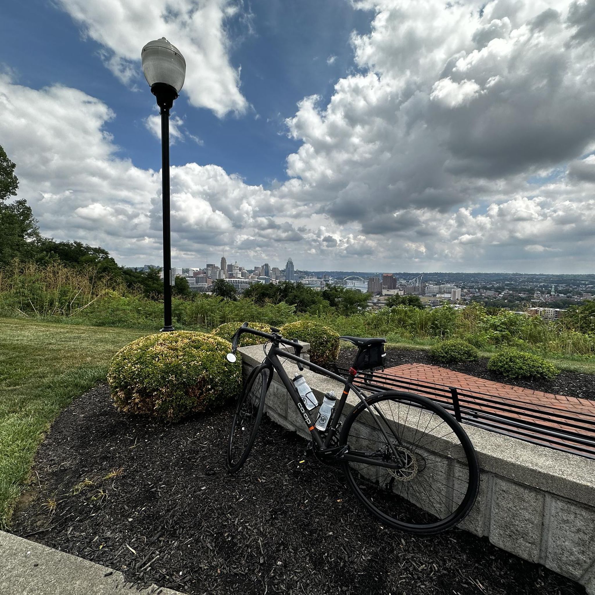
Road cycling routes in Kenton County traverse a diverse landscape characterized by significant hills and river valleys, particularly along the Ohio and Licking Rivers. This topography provides both challenging climbs and scenic descents for cyclists. The region features extensive wooded corridors and natural preserves, offering natural settings for exploration. Elevated points, such as those in Devou Park, provide panoramic views of the Ohio River and the Cincinnati skyline.
Best road cycling routes in Kenton County
- The most popular road cycling route is Ramblin' River and Fort Thomas Loop, a 31.8 miles (51.1 km) trail that takes 2 hours 42 minutes to complete. This difficult route offers river views and urban exploration.
- Another top favourite among local road cyclists is Devou Park to Rabbit Hash Loop, a difficult 71.1 miles (114.4 km) path. This route features significant climbs and scenic views, starting from Devou Park.
- Local road cyclists also love the Serpentine Wall – Cincinnati Flying Pig Statues loop from Covington, a 17.3 miles (27.9 km) trail leading through urban areas and along the river, often completed in about 1 hour 30 minutes.
- Road cycling in Kenton County is defined by hilly terrain, river valleys, and wooded corridors. The network offers options for various ability levels, from easy loops to challenging long-distance routes.
- The routes in Kenton County are highly rated by the komoot community with an average score of 4.5 stars from over 17 reviews. More than 1,400 road cyclists have used komoot to explore Kenton County's varied terrain.
Last updated: July 7, 2026
4.0
(2)
33
riders
51.1km
02:42
430m
430m
The Ramblin' River and Fort Thomas Loop offers a compelling mix of urban and natural landscapes, making it a standout road cycling route near Fort Thomas, Kentucky. You'll experience the unique blend of riverfront views along the Ohio River, forested sections, and the charm of urban areas, all while tackling the region's characteristic rolling hills. The route's diverse scenery and challenging terrain keep things interesting from start to finish.
This is a difficult 31.8-mile (51.1 km) ride with a substantial 1396 feet (425 metres) of elevation gain, typically taking around 2 hours and 42 minutes. It's designed for experienced cyclists who are comfortable with significant climbs and descents. While specific parking isn't listed, you'll find options in Fort Thomas or nearby Cincinnati; plan your start time to ensure you have ample daylight and avoid peak traffic.
What makes this route particularly appealing is its combination of physical challenge and varied visual rewards. Beyond the river views, you'll encounter local points of interest like the Fort Thomas Tower at Tower Park, adding a historical dimension to your ride. It's a highly-rated option within the broader network of cycling routes in the area, perfect for those seeking a demanding yet rewarding adventure on two wheels.
3
riders
114km
05:14
1,000m
1,000m
The Devou Park to Rabbit Hash Loop offers a truly memorable road cycling experience, blending demanding terrain with picturesque Northern Kentucky scenery. You'll navigate challenging rolling hills, especially near the Ohio River valley, and enjoy expansive river views as you traverse rural landscapes and farmland. The highlight for many is the historic Rabbit Hash village, a charming destination that feels like a step back in time, providing a unique backdrop to your ride.
This difficult 71.1-mile (114.4 km) loop demands very good fitness, with a significant 3289 feet (1002 metres) of elevation gain over an estimated 5 hours and 13 minutes. Be prepared for substantial climbs, particularly within Devou Park, and note that some sections might be unpaved. The Rabbit Hash General Store makes for an excellent mid-ride stop, offering a chance to refuel and soak in the historic atmosphere.
What sets this route apart is its combination of demanding topography and the unique cultural destination of Rabbit Hash. Many cyclists find the hills here tougher than those in nearby Cincinnati, making it a true test of endurance. Beyond the physical challenge, the route provides a diverse visual journey, from tree-lined sections to open countryside, culminating in the distinctive old buildings of Rabbit Hash Historic District.

Sign up for free
31
riders
51.7km
02:30
300m
300m
Moderate road ride. Good fitness required. Mostly well-paved surfaces and easy to ride.
11
riders
29.1km
01:34
370m
370m
If you're after a road cycling route that blends scenic beauty with a good workout, the Bircus Brewing Co. loop from Fort Mitchell delivers. This moderate 18.1 miles (29.1 km) ride features 1224 feet (373 metres) of elevation gain, taking about 1 hour and 33 minutes to complete. You'll enjoy picturesque views of the Ohio River and the Cincinnati skyline from elevated points, along with lush green landscapes as you traverse wooded corridors and natural preserves.
Planning your ride is straightforward, as the route is predominantly well-paved and suitable for road bikes. The Bircus Brewing Co. itself, located in Ludlow, Kentucky, serves as a unique destination, offering craft beer, food, and live circus performances. This makes it an ideal spot to refuel and relax before or after your ride.
This loop is a prime example of the varied terrain and scenic beauty that Kenton County cycling routes are known for. It's a rewarding experience for cyclists seeking a moderate challenge with diverse views, showcasing why Northern Kentucky cycling routes are popular among the community.
13
riders
43.7km
02:01
380m
380m
This moderate road bike loop from Cincinnati offers a fantastic way to experience the region's varied terrain, taking you through green hills and scenic river valleys. You'll find yourself pedaling through diverse wooded landscapes, enjoying a mix of flatter stretches and rewarding climbs. It's a great option for cyclists seeking a solid workout and picturesque views without venturing too far from the city.
To tackle this 27.2 miles (43.7 km) route with its 1261 feet (384 metres) of elevation gain, plan for about 2 hours and 1 minutes of riding. Starting directly from Cincinnati, the route is convenient for city dwellers. The best season for road biking in Cincinnati is generally spring or fall, when temperatures are mild and the scenery is vibrant.
While the Little Miami Scenic Trail is often highlighted as a premier option for road cycling near Cincinnati, this loop provides a different experience with its notable elevation changes. It's an excellent choice if you're looking for challenging road bike routes in Cincinnati that move beyond the flatter, dedicated bike paths, offering a more dynamic ride through the area's natural topography.
12
riders
54.3km
02:43
590m
590m
Embark on a road cycling adventure that takes you from the quiet streets of Park Hills, Kentucky, across the Ohio River, and into the vibrant heart of Cincinnati. This route offers a captivating blend of urban landscapes, stunning riverfront vistas, and the delightful surprise of spotting the city's iconic Flying Pig Statues. You'll experience the dynamic energy of downtown, pedal along the scenic Ohio River Trail, and navigate through varied terrain that keeps the ride engaging.
This moderate road cycling loop covers 33.7 miles (54.3 km) with a total elevation gain of 1938 feet (591 metres), typically completed in about 2 hours and 43 minutes. Be ready for a mix of flat stretches and challenging climbs as you explore the diverse topography of the region. Starting from Park Hills, it's wise to plan your route carefully and ensure you're prepared for the elevation changes that characterize road cycling in the Cincinnati area.
The Flying Pig Statues are a unique cultural landmark, commemorating Cincinnati's historical nickname as "Porkopolis" and adding a whimsical touch to your ride. This loop provides an excellent opportunity to combine a good workout with sightseeing, offering a comprehensive tour of the area's natural beauty and urban charm. It's a fantastic way to discover hidden gems and popular viewpoints, making it a memorable experience for any road cyclist.
10
riders
If you're seeking a road cycling adventure that blends urban charm with stunning river vistas, the Purple People Bridge – Cincinnati Flying Pig Statues loop is a fantastic choice. This moderate 34.0-mile (54.7 km) route, featuring 1452 feet (443 metres) of elevation gain and taking about 2 hours and 39 minutes, guides you across the iconic Purple People Bridge with its panoramic views of the Ohio River and both city skylines. You'll also encounter the whimsical Flying Pig Statues, a unique artistic tribute to Cincinnati's heritage, adding a playful element to your ride.
Plan your start from Lakeside Park, where you'll find good access to the route. The Purple People Bridge is a dedicated path for cyclists and pedestrians, ensuring a safe and enjoyable crossing. Be aware that the Cincinnati-side approach to the bridge reopened on June 8, 2026, so access is now fully restored. This ride requires good fitness, but the well-paved surfaces make for a smooth journey.
The Purple People Bridge itself is a marvel of engineering and history, originally a railroad bridge from 1872, now repurposed as the longest pedestrian bridge of its kind in the United States. It's a vital link in the regional cycling network, connecting to the Ohio River Trail and the larger CROWN system. The Flying Pig Statues, initially numbering over 400, are a testament to Cincinnati's past as a major pork processing center, making this loop a ride through local history and art.
16
riders
The Cincinnati Flying Pig Statues – Kroger Hills loop offers a dynamic road cycling experience, blending the city's quirky urban art with the peaceful natural beauty of its outskirts. You'll pedal through bustling city streets, spotting the iconic Flying Pig Statues that celebrate Cincinnati's heritage, before transitioning to the quieter, greener landscapes surrounding Kroger Hills. Expect a journey that shifts from cultural exploration to scenic river views along paved sections, possibly incorporating the Little Miami Scenic Trail, where old-growth forests and restored prairies provide a serene backdrop.
This moderate 64.0-mile (103.0 km) route, with 1990 feet (607 metres) of elevation gain, typically takes around 4 hours and 50 minutes to complete. Starting from the Columbia Sussex area, it's a custom-planned adventure, so be sure to map your exact course. Given the significant elevation changes in the Cincinnati area, this route is best suited for cyclists comfortable with sustained climbs and varying terrain. Consider cycling in spring or fall for the most pleasant seasonal conditions.
What makes this route truly stand out is its ability to combine the cultural significance of Cincinnati's "Porkopolis" past, embodied by the Flying Pig Statues, with the diverse natural environment of the Kroger Hills area. It's a testament to the city's unique character, offering a challenging yet rewarding ride that showcases both urban landmarks and the tranquil beauty of the Miami River. This loop is ideal for those seeking a personalized cycling adventure that goes beyond a single, pre-defined trail.
5.0
(1)
8
riders
54.1km
02:38
640m
640m
Moderate road ride. Good fitness required. Mostly well-paved surfaces and easy to ride.
5
riders
60.4km
03:06
670m
670m
Moderate road ride. Good fitness required. Some segments of this route may be unpaved and difficult to ride.
Get access to more routes and recommendations from other explorers.
Sign up for free
Already have an account?
Our route recommendations are based on thousands of hikes, rides, and runs completed by other people on komoot.
Start today with a free account
Your next adventure awaits.
Login or Signup
Popular around Kenton County

Road Cycling Routes around Bromley
Road Cycling Routes around Covington

Road Cycling Routes around Fort Mitchell

Road Cycling Routes around Fort Wright

Road Cycling Routes around Park Hills

Road Cycling Routes around Villa Hills

Road Cycling Routes around Crescent Springs

Road Cycling Routes around Lakeside Park

Road Cycling Routes around Ludlow
Road Cycling Routes around Kenton Vale
Other adventures in Kenton County

Tips from the Community

Lots of hills! But stop mid run at Coffee emporium before you run back to your car!
0
0


The view of the surrounding river from the Taylor-Southgate Bridge is particularly wonderful at sunset.
0
0

This public landing is along the Ohio River Trail is a nice spot to stop for a quick dip or to just enjoy the views over the water. It is also near the National Steamboat Monument and the Great American Ball Park.
0
0
Bircus Brewing Co. is a brewery located in Ludlow, Kentucky, just across the Ohio River from Cincinnati. This unique spot combines craft beer and good food with live circus performances, creating a one-of-a-kind entertainment experience. Visitors can enjoy a rotating selection of beers brewed on-site, including IPAs, lagers, and seasonal creations, while watching acts like aerial silks, juggling, and acrobatics. The brewery is housed in a historic building, and is a popular spot for locals and visitors alike.
1
0
Geier Pond is a scenic, small water pond that is a little hard to see from the road. Sometimes, however, you might see ducks, birds, and other creatures nearby. It is located off of Kugler Mill Road, which is a pretty, quite road to ride along.
0
0

Ault Park is the city's fourth-largest park and was established in 1911 through the generous land donation by Levi Addison Ault and his wife, Ida May Ault. This spot is the heart of Ault Park. There is a Italian Renaissance-style Pavilion, constructed in 1930 with a large fountain in front of it. This elegant structure serves as a popular venue for weddings, dances, and private events, and provides visitors with panoramic views of the surrounding Little Miami River valley. Adjacent to the pavilion are the park's gardens, which feature the renowned Adopt-A-Plot program initiated in 1980, where volunteers maintain individual garden plots, contributing to the park's vibrant floral displays.
0
0
Frequently Asked Questions
What kind of terrain can I expect on road cycling routes in Kenton County?
Kenton County's road cycling routes are characterized by significant hills and river valleys, particularly along the Ohio and Licking Rivers. This topography provides both challenging climbs and scenic descents, with extensive wooded corridors and natural preserves offering a diverse landscape for exploration.
Are there road cycling routes suitable for beginners in Kenton County?
Yes, Kenton County offers a selection of easier routes. For instance, the Serpentine Wall – Cincinnati Flying Pig Statues loop from Covington is an easy 17.3-mile ride through urban areas and along the river. Another option is the Eden Park – Mirror Lake loop from Cincinnati, which is also rated as easy.
Where can I find challenging road cycling routes with significant elevation gains?
For experienced cyclists seeking a challenge, Kenton County delivers with its hilly terrain. The Devou Park to Rabbit Hash Loop is a difficult 71.1-mile route known for its significant climbs and scenic views, starting from Devou Park. Another difficult option is the Ramblin' River and Fort Thomas Loop, spanning 31.8 miles with notable elevation.
Are there any circular road cycling routes in Kenton County?
Many of the road cycling routes in Kenton County are designed as loops, allowing you to start and end at the same point. Examples include the Serpentine Wall – Cincinnati Flying Pig Statues loop from Covington and the Roadbike loop from Fort Mitchell, offering convenient circular journeys.
What are some scenic highlights or viewpoints along the road cycling routes?
Road cycling in Kenton County offers numerous scenic views, especially of the Ohio River and the Cincinnati skyline from elevated points like Devou Park. Routes often traverse wooded corridors and natural preserves, providing lush greenery. The Ramblin' River and Fort Thomas Loop specifically offers river views, while the Devou Park to Rabbit Hash Loop is praised for its scenic vistas.
Are there any attractions or points of interest near the road cycling routes?
Yes, several points of interest are accessible. You can find places like Bircus Brewing Co., which is near the Bircus Brewing Co. loop from Park Hills. Other natural attractions include the Incinerator Trail, Riverfront Commons, and Licking River Greenway, which are part of the broader network of trails and green spaces in the area.
What do other road cyclists say about the routes in Kenton County?
The road cycling routes in Kenton County are highly rated by the komoot community, with an average score of 4.5 stars from over 17 reviews. Cyclists often praise the varied terrain, from challenging hills to scenic river views, and the extensive network of routes that cater to different ability levels.
Are there any long-distance road cycling routes available?
For those looking for longer rides, Kenton County offers routes that extend for significant distances. The Devou Park to Rabbit Hash Loop is a substantial 71.1-mile route, providing a full day's adventure with plenty of climbs and scenic rewards.
Can I access road cycling routes using public transport?
While specific public transport access points for every route vary, many routes start or pass through urban centers like Covington and Cincinnati, which generally have public transport options. It's advisable to check local transit schedules and bike-on-bus policies for specific starting points.
Are there any road cycling routes that pass by cafes or pubs?
Yes, some routes integrate well with local amenities. For example, the Bircus Brewing Co. loop from Park Hills starts near Bircus Brewing Co., offering a convenient stop for refreshments before or after your ride. Routes passing through urban areas like Covington and Cincinnati also provide access to various cafes and eateries.
What is the best time of year for road cycling in Kenton County?
The spring and fall seasons are particularly popular for road cycling in Kenton County. The weather is generally milder, and the natural landscapes, especially the wooded areas, offer striking views. Ridge-top views at places like Morning View Heritage Area are particularly beautiful during these times.
How many road cycling routes are available in Kenton County?
Kenton County features over 100 road cycling routes, catering to a wide range of abilities. This includes approximately 24 easy routes, 79 moderate routes, and 8 difficult routes, ensuring options for every cyclist.
Most popular routes in Kenton County
Most popular attractions in Kenton County

Get inspired with the komoot mobile app


Didn’t find what you were looking for?
Check out more Road cycling routes throughout Kenton County below and find the perfect route in your destination.
Explore more
Browse the best Road cycling routes in other regions.
