The best walks and hikes in Pickaway County
4.3
(16)
205
hikers
18
hikes
Hikes in Pickaway County lead through a landscape shaped by glaciers, characterized by rolling woodlands, prairies, and river valleys. The terrain is generally gentle, with trails following creek beds, circling lakes, and crossing through wetlands. This makes the region accessible for various hiking abilities.
Best hiking trails in Pickaway County
- The most popular hiking route is Hargus Lake loop from A W Marion State Park, a 3.9 mile (6.3 km) trail that takes about 1 hour 40 minutes to complete. This easy path offers a full circuit of the lake within A.W. Marion State Park.
- Another top favourite among local hiking enthusiasts is Kokomo Wetlands Trail to Sugar Maple Trail loop — Slate Run Metro Park, a moderate 5.0 mile (8.0 km) path. The route combines wetland sections with forested trails inside Slate Run Metro Park.
- Local hiking enthusiasts also love the Covered Bridge Trail to Buzzard's Roost Lake — Slate Run Metro Park, a 2.0 mile (3.3 km) trail leading through woodlands, often completed in about 50 minutes.
- Hiking in Pickaway County is defined by lakeside paths, gentle woodland trails, and routes through prairies and wetlands. The network of trails provides options for different ability levels, from short, easy walks to longer, moderate hikes.
- The routes in Pickaway County are highly rated by the komoot community with an average score of 4.1 stars from more than 10 reviews. More than 150 hikers have used komoot to explore Pickaway County's varied terrain.
Last updated: November 7, 2026
4.0
(3)
20
hikers
6.34km
01:40
50m
50m
Embark on an easy hike around Hargus Lake, a 3.9-mile (6.3 km) loop that offers constant water views. You will gain 166 feet (50 metres) in elevation, taking about 1 hour and 39 minutes to complete. The path winds through pleasant shaded wooded areas, providing a refreshing experience. While generally flat, expect a few gentle hills and roots underfoot, adding a touch of variety to your walk.
This trail is open all year, so you can enjoy its scenery in any season. Parking is readily available at A.W. Marion State Park, making access straightforward. If you plan to bring your furry friend, leashed dogs are welcome to join you on this adventure.
Located within A.W. Marion State Park, this route is known for its opportunities to observe local wildlife. Keep an eye out for wood ducks and great blue herons near the water's edge. The trail's gentle nature makes it an accessible outdoor experience for hikers of all levels.
5.0
(1)
8
hikers
10.7km
02:51
110m
90m

3
hikers
3.30km
00:51
10m
10m
The REI River Trail offers a delightful escape into nature, tracing the banks of the Scioto River through mature forests. You'll navigate a gentle dirt path, occasionally transitioning to grassy sections, with the river almost constantly in view. Look out for scenic bluffs and the impressive giant sycamore tree along this winding route. It's an easy 2.1-mile (3.3 km) hike with just 41 feet (12 metres) of elevation gain, making it a perfect family-friendly option that takes around 50 minutes to complete.
Planning your visit is straightforward, as the trail is located within Scioto Grove Metro Park, offering ample parking and facilities like public restrooms and a water fountain. While generally accessible, be mindful that the trail can become quite muddy after heavy rain due to its low-lying terrain. For those interested in an extended adventure, free backpacking campsites are available, though registration is required.
Beyond the scenic riverside walk, the REI River Trail connects to other routes like the Mingo Trail, allowing for longer hikes if you desire. A notable feature at the trail's end is a charming swinging bridge crossing Grant Run. The surrounding park also boasts additional amenities such as 3D archery courses and a fire tower, providing diverse activities for a full day out.
3
hikers
2.76km
00:45
40m
30m
The Five Oaks Trail offers a peaceful, hikers-only journey through diverse landscapes, from dense oak forests to open meadows. You'll experience the unique sensation of walking under lush oak canopies that form natural tunnels, then emerge to expansive views of Julian's apple orchards and the distant Cuyamaca and Laguna Mountains. This easy 1.7-mile (2.8 km) route with just 115 feet (35 metres) of elevation gain is a perfect quick escape, taking only about 44 minutes.
To plan your visit, consider heading out in the fall when the black oaks put on a spectacular display of deep amber and faded orange leaves. The trail is located in the Volcan Mountain Wilderness Preserve near Julian, California. It's a great option for beginners and families, offering a gentle incline and a chance to connect with nature without a strenuous effort.
What makes this trail stand out is its intimate connection with nature, offering a tranquil alternative to busier routes. It's named for the five (or more) species of oak trees in the area, providing a unique opportunity to observe diverse canopies. The artistic Hubbell Gateway marks the trail's beginning, adding a distinctive cultural touch to this scenic path.
1
hikers
4.39km
01:07
10m
10m
4.23km
01:05
10m
30m
8
hikers
4.35km
01:09
40m
40m
5.0
(1)
7
hikers
8.04km
02:05
50m
50m
5
hikers
3.29km
00:51
20m
20m
21
hikers
3.60km
00:55
10m
10m
Easy hike. Easily walkable paths.
Get access to more routes and recommendations from other explorers.
Already have an account?
Our route recommendations are based on thousands of hikes, rides, and runs completed by other people on komoot.
Start today with a free account
Your next adventure awaits.




Tips from the Community

A. W. Marion State Park is a 310-acre public park that plays host to the 145-acre Hargus Lake. There are a number of hiking trails, campgrounds, and recreational facilities throughout the park. There are also a few different trailheads, so you can start your hike from a few different spots.
0
0

This small area within Walnut Woods Metro Park is filled with towering pines and sweetgum trees along a semi-paved path. Pets are allowed on this trail.
0
0
REI River Trail offers views of the dense woodlands and of the river along which it runs, the Scioto River. Dogs are allowed on this trail and the path is made of hard-packed dirt.
0
0
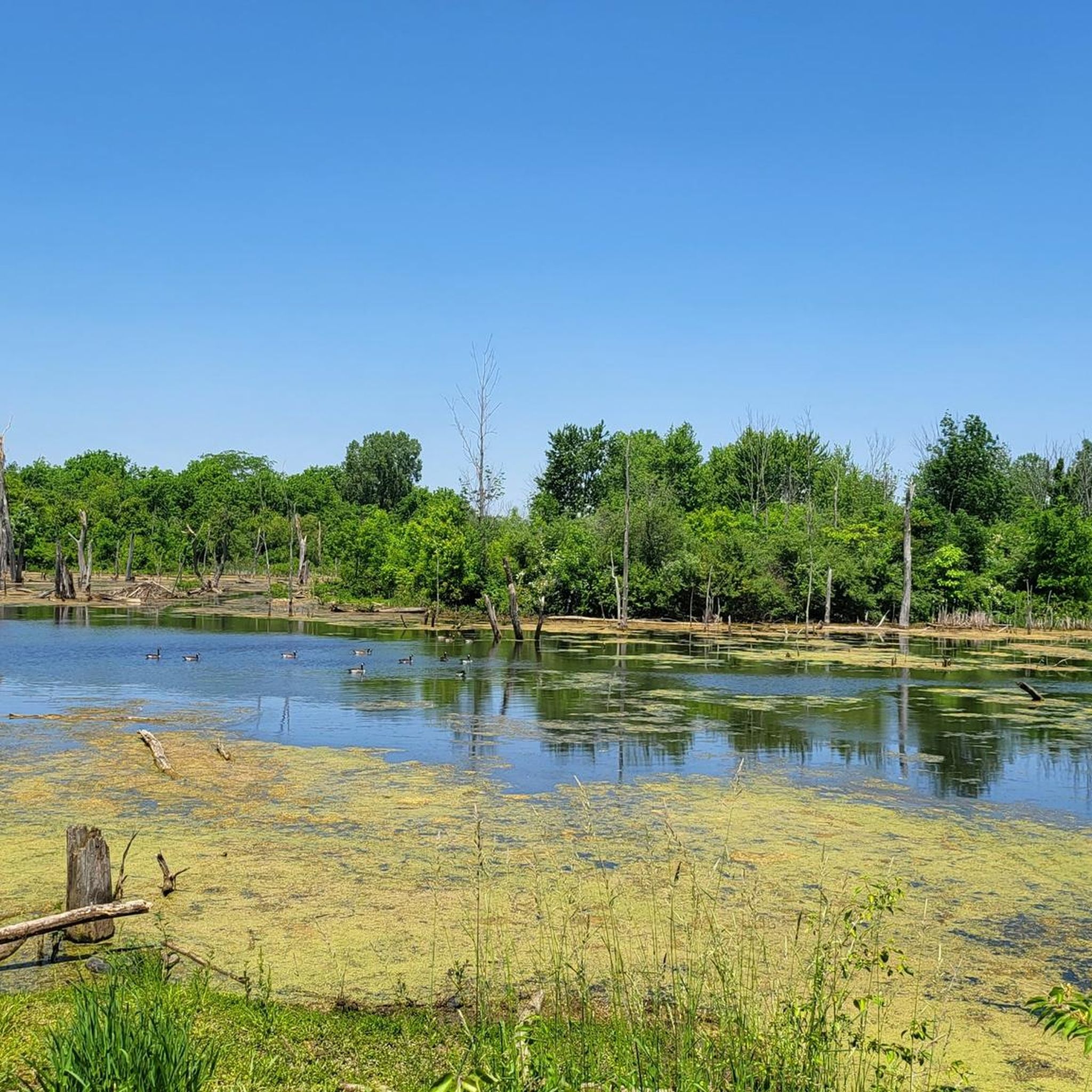
This wetlands observation deck is a stop on the Kokomo Wetland Trail through Slate Run Metro Park. This deck offers views of the wetlands, opportunities for birding, and an overhead view of species that live in the shallow waters.
0
0
Natural Play Areas are unique spots that exist in various Metro Parks throughout the Columbus area. These areas allow for off-trail exploration and experiences. In this Natural Play Area in Slate Run Metro Park, hikers can play in the creek and flip logs throughout the forest in this specially designated spot.
0
0
Slate Run Living Historical Farm aims to educate and offer experiences about what life was like on a crop and livestock farm in the 1880s. The land of this historical farm was acquired by the Metro Parks system in the 1970s, including the farmhouse that was built in 1856 and the barn that was built in 1881.
0
0
Slate Run River is a tributary to the Scioto River. The creek bed is comprised of slate, giving the river its name. Many small waterfalls can be found along this creek. The creek sometimes runs dry because it is mostly fed by rainfall.
0
0
This wooden covered bridge was built for $378 in 1885 to cross Brannon's Fork near Young Hickory in Muskingum County. This 56-foot bridge was moved to the area of Big Run in 1967 and then eventually disassembled and moved to its current location in Slate Run Metro Park in 1998.
0
0
Frequently Asked Questions
Are dogs allowed on the hiking trails in Pickaway County?
Yes, many parks in the area are dog-friendly, but policies can vary. For example, A.W. Marion State Park has a designated dog swimming beach. It's always best to keep your dog on a leash and check the specific park's regulations before you go. The Sweetgum Trail to Buckeye Trail loop — Walnut Woods Metro Park is a great long walk to take with your leashed canine companion.
What are some good, easy hikes for families?
Pickaway County has several family-friendly options. Metzger Preserve features a half-mile Storybook Trail, which is perfect for young children. For a slightly longer but still easy walk with historical interest, the Covered Bridge Trail to Buzzard's Roost Lake — Slate Run Metro Park is a great choice, leading to a historic covered bridge.
Where can I find circular or loop trails?
Most of the popular trails in the region are loops, which makes planning your hike simple. You can find loops of varying lengths, from the short REI River Trail loop from Utzinger Bog Preserve which is about 2 miles, to longer moderate circuits like the 5-mile REI River Trail to Mingo Trail loop — Scioto Grove Metro Park.
Are there any trails with waterfalls in Pickaway County?
The landscape in Pickaway County is primarily defined by gentle hills, wetlands, and rivers, so large waterfalls are not a common feature. While you won't find significant waterfalls, you will find scenic trails along creeks and rivers, such as the path along Slate Run Creek on the Five Oaks Trail loop — Slate Run Creek.
What do other hikers think of the trails in Pickaway County?
The trails in this area are well-regarded by the komoot community, earning an average rating of over 4 stars. Hikers often praise the well-maintained paths, the peaceful woodlands, and the variety of scenery, from lakeside views at Hargus Lake to the wetlands of Slate Run Metro Park.
Where are the best spots for birdwatching?
Calamus Swamp is an excellent location for birdwatching. This 19-acre Audubon preserve features a boardwalk that encircles a kettle hole wetland, providing great viewing opportunities, especially during migration seasons. The wetland trails in Slate Run Metro Park, such as the Kokomo Wetlands Trail, also offer observation decks and are prime habitats for various bird species.
Are the trails suitable for trail running?
Yes, many of the trails are well-suited for running. The terrain is generally not too technical, with gentle hills and packed earth paths. The Slate Run Creek – Blackburn/Wesner Bridge loop from Walnut offers a nearly 5-mile route with moderate elevation changes that provides a good challenge for trail runners.
Do I need to pay for parking or entry at the parks?
Most of the hiking trails in Pickaway County, including those in the Metro Parks and State Parks like A.W. Marion, are free to access. Parking is also typically free at designated trailheads and park entrances, making it an accessible and affordable way to get outdoors.
What kind of terrain should I expect on the trails?
The terrain is a product of glaciation, so you'll mostly encounter rolling woodlands, gentle hills, and flat prairie or wetland areas. Trails often follow river valleys or lake shores. While most routes are easy to moderate, some paths in places like Slate Run Metro Park can include steeper ravines and more rugged sections.
Are there any paved trails for walking or biking?
Yes, the Pickaway Trail is part of the 'Rails to Trails' initiative and offers paved sections perfect for a smooth walk, run, or bike ride through woodlands and past farmland. The Roundtown Trail in Circleville is another option, providing a 1.5-mile paved path for a community bike ride or stroll.
Can I see any historical sites while hiking?
Absolutely. Canal Park features the Towpath Trail, which follows a historic section of the Ohio-Erie Canal. In Slate Run Metro Park, you can hike to the historic Blackburn Covered Bridge, originally built in 1885. For ancient history, Cross Mound Park contains a unique cross-shaped earthwork.
What are some popular places for hiking in Pickaway County?
Beyond the specific trails, several parks are local favorites for hiking. A.W. Marion State Park is very popular for its lakeside loop. Slate Run Metro Park is highly regarded for its extensive and varied trail network. For a unique experience, many visitors enjoy the trails at Cantwell Cliffs, known for its rugged terrain and rock shelter, which is just a short drive from the county.
Most popular attractions in Pickaway County

Get inspired with the komoot mobile app


Didn’t find what you were looking for?
Check out more Hikes throughout Pickaway County below and find the perfect route in your destination.
Explore more
Browse the best Hikes in other regions.
