The best walks and hikes in Rappahannock County
4.7
(511)
5,427
hikers
55
hikes
Hiking trails in Rappahannock County are characterized by their proximity to Shenandoah National Park and the Blue Ridge Mountains, offering diverse landscapes. The region features cascading waterfalls, wooded hollows, and picturesque mountain views. The Rappahannock River Valley National Wildlife Refuge provides varied ecosystems, including grasslands, forests, and marshlands, along the Rappahannock River. Elevation changes are common, ranging from gentle river walks to more challenging mountain ascents.
Best hiking trails in Rappahannock County
- The most popular hiking route is Overall Run…
Last updated: October 11, 2026
4.8
(4)
36
hikers
7.90km
02:23
260m
290m
The Sugarloaf Loop in Shenandoah National Park offers a delightful escape into a "big forest feel," winding through diverse terrain of compacted dirt, roots, and stones. You'll experience stream crossings…
5.0
(2)
24
hikers
21.0km
06:45
670m
1,180m
Embark on the Little Devils Stairs and Keyser Run Loop, a challenging hike that takes you through varied terrain in Shenandoah National Park. You will navigate steep ascents and rock…

5.0
(3)
22
hikers
9.25km
03:14
520m
510m
The Buck Hollow and Buck Ridge Trail Loop is a challenging 5.7-mile (9.3 km) hike in Shenandoah National Park, featuring 1690 feet (515 metres) of elevation gain over about 3…
3.5
(2)
21
hikers
2.70km
00:56
190m
60m
If you're looking for a hike that packs a punch without demanding an entire day, the Compton Peak Trail delivers. This 1.7-mile (2.7 km) route, rated easy, offers a diverse…
5
hikers
10.4km
03:10
340m
330m
The Hazel River and White Rocks Trail Loop offers a journey through diverse landscapes within Shenandoah National Park, from old-growth forests to a picturesque gorge. You'll encounter the multi-tiered Hazel…
4
hikers
9.87km
03:17
450m
460m
The Big Devils Stairs and Bluff Trail Loop offers a captivating journey through Shenandoah National Park's dramatic landscapes. You'll traverse varied terrain, from serene wooded paths on the Bluff Trail…
4
hikers
1.64km
00:34
140m
10m
The Compton West Peak via Appalachian Trail offers a delightful, short journey through a mixed hardwood forest to stunning panoramic views. You'll navigate some rocky sections as you ascend to…
3
hikers
9.60km
03:13
470m
470m
Embark on the Broad Hollow and Pine Hill Gap Trail, a moderate hike spanning 6.0 miles (9.6 km) with a significant elevation gain of 1539 feet (469 metres). You can…
2
hikers
7.48km
02:16
350m
110m
You can enjoy impressive views on the North and South Marshall via Appalachian Trail, a moderate hiking route that covers 4.6 miles (7.5 km). This out-and-back journey involves a steady…
2
hikers
9.40km
02:45
270m
280m
Embark on a moderate hike along the Appalachian Trail: Beahms Gap to Elkwallow Wayside, a 5.8-mile (9.4 km) section that takes you through a lush forest, often described as a…
Get access to more routes and recommendations from other explorers.
Already have an account?
Our route recommendations are based on thousands of hikes, rides, and runs completed by other people on komoot.
Start today with a free account
Your next adventure awaits.




Tips from the Community

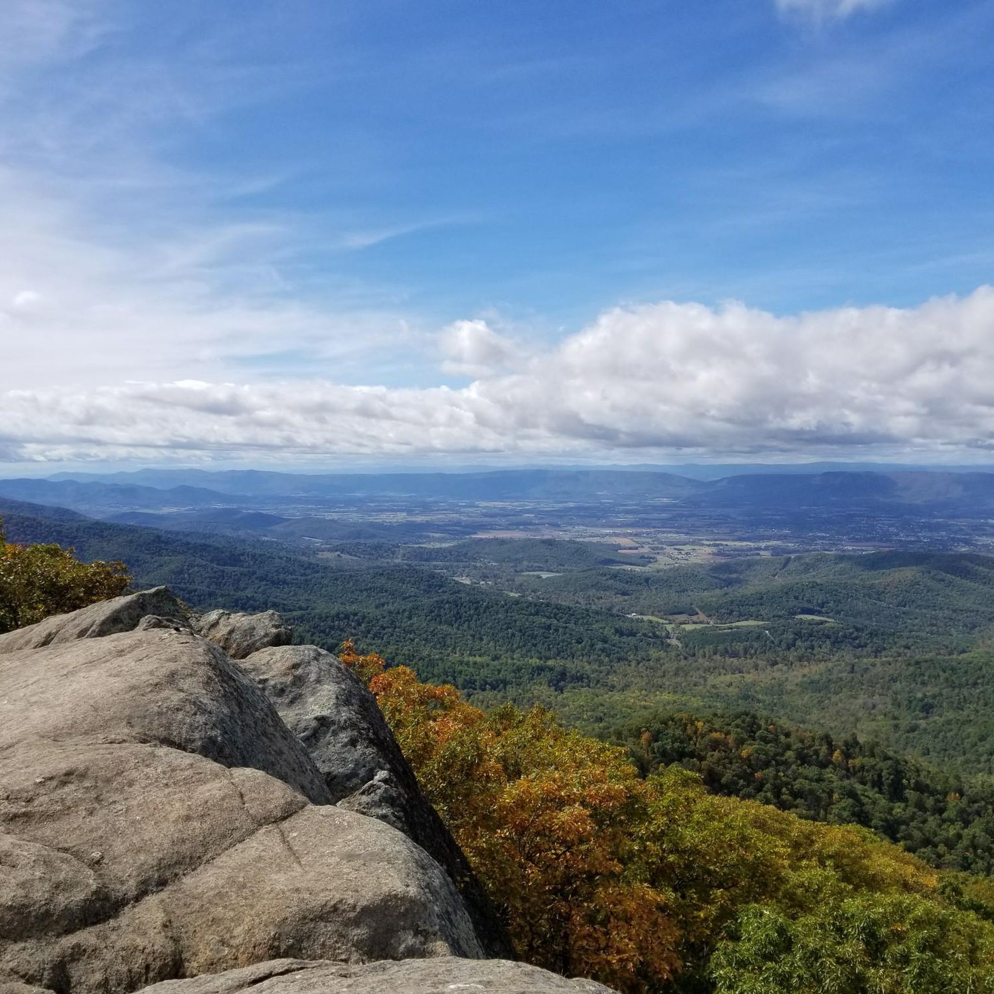
Nice viewpoint along the Appalachian Trail. It's a great place to take a break during the hike to sit on the rocks and enjoy the wonderful vista.
0
0

Mount Marshall viewpoint sits just a few meters from Skyline Drive. From the road you can easily go to take a look at sweeping and peaceful views of the beautiful Nantahala National Forest.
0
0

At an elevation of 2,355 ft (717 m), this viewpoint faces east toward Compton Peak. The Bolton Branch of the Burgess River runs through the hollow in front of you.
0
0

This is the longest overlook in the area, stretching nearly a quarter mile. To the north, you'll be greeted with breathtaking views of Gimlet Ridge, Allegheny Mountains, and Mathews Arm.
0
0

Compton Gap Trailhead is actually situated at Compton Gap and is on the National Register of Historic Places. The views from Compton Gap are great, but if you decide to hike up to Compton Peak, you are in for an even greater treat.
0
0

Compton Peak is found on a short detour off the Appalachian Trail, via the Compton Peak West Trail, only a few hundred feet up. There is a great clearing and lookout point, and it is worth the detour for hikers to peek out of the green tunnel over the trees. For day hikers, it is a 2.4-mile round-trip hike from the nearest trailhead, with an elevation gain of 800 feet. It is recommended to bring a reward snack to eat here while overlooking the Shenandoah Mountains.
0
0

The most peaceful vantage point on Skyline Drive. My favorite.
0
0

Buried in this cemetery are the descendants of those who lived in this area until the federal state decided to create a park.
1
0
Frequently Asked Questions
How many hiking trails are available in Rappahannock County?
Rappahannock County offers a diverse selection of over 40 hiking trails. These routes cater to various skill levels, from easy strolls to more challenging mountain ascents, with 7 easy, 21 moderate, and 14 difficult trails recorded.
What do other hikers enjoy most about the trails in Rappahannock County?
The hiking trails in Rappahannock County are highly rated by the komoot community, with an average score of 4.7 stars from over 240 reviews. Hikers frequently praise the region's diverse landscapes, including its proximity to Shenandoah National Park, stunning Blue Ridge Mountain views, and the tranquil wooded hollows.
Are there any easy hiking trails suitable for families or beginners?
Yes, Rappahannock County has several easy trails. For a gentle walk, consider the Compton Gap Trailhead – Compton Peak loop, which is an easy 3.5 km (2.2 miles) route. The Rappahannock County Park also offers nature walks along the Rush River, perfect for less strenuous outings.
Can I find trails with waterfalls in Rappahannock County?
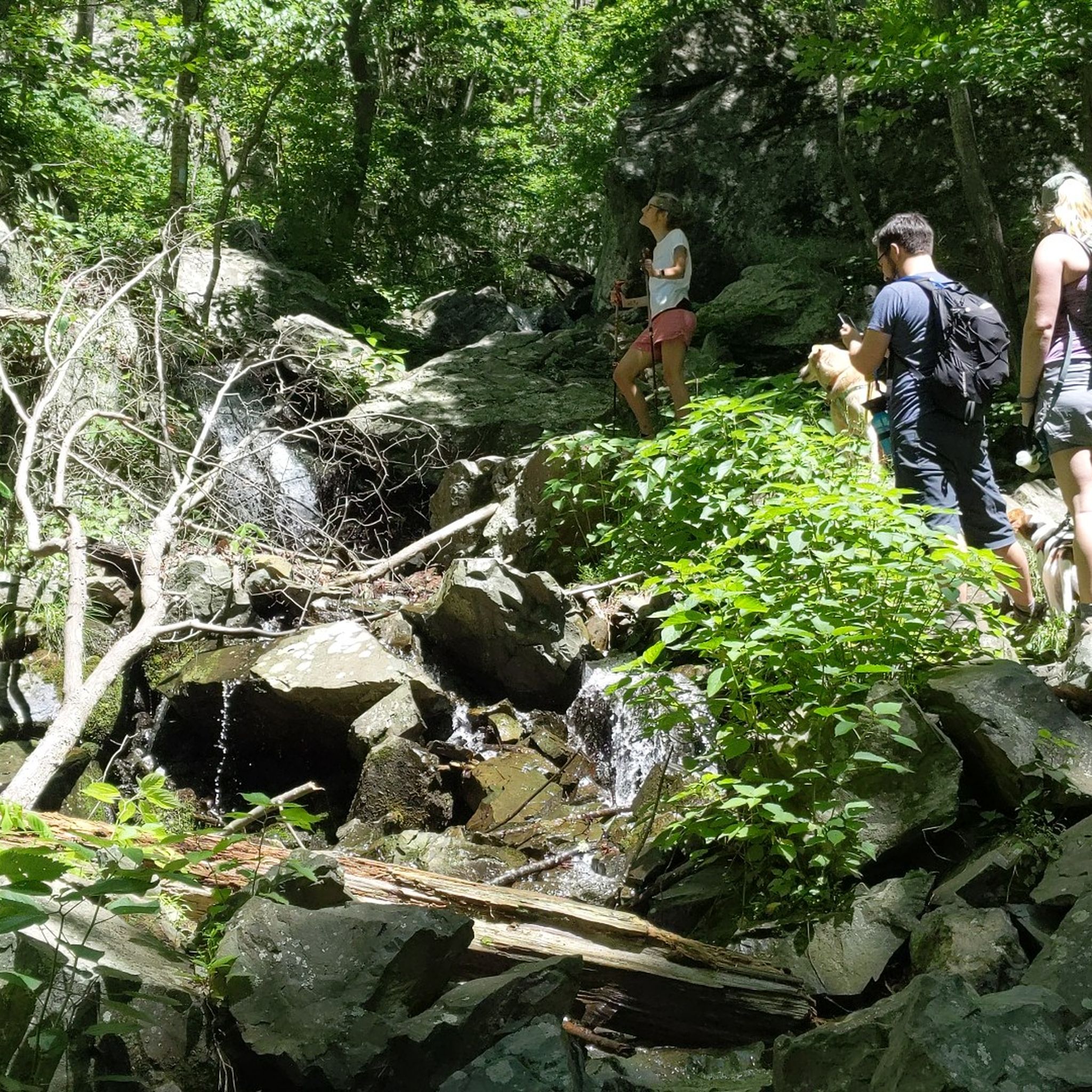
Yes, the region is known for its cascading waterfalls. A prominent trail featuring a significant waterfall is the Overall Run Falls via Traces Trail loop — Shenandoah National Park. This moderate 11.2 km (7.0 miles) route is a local favorite for its natural beauty.
Are there any challenging hikes for experienced trekkers?
For those seeking a more challenging experience, Rappahannock County offers several difficult routes. The Bolen Cemetery via Little Devils Stairs Trail loop — Shenandoah National Park is a difficult 17.9 km (11.1 miles) trail that leads through varied forest landscapes and requires good fitness.
What kind of natural features and landmarks can I expect to see along the trails?
Rappahannock County's trails offer a variety of natural features and landmarks. You can explore the rugged terrain and scenic gorge of the Little Devils Stairs Trail, or visit historical sites like Bolen Cemetery. Many trails also provide stunning viewpoints such as Mount Marshall Overlook and Hogback Overlook, offering panoramic views of the Blue Ridge Mountains and valleys.
Are there any loop trails available for hiking?
Yes, many trails in Rappahannock County are designed as loops, offering a complete scenic experience. Examples include the Little Devils Stairs Trail loop — Shenandoah National Park and the Mary's Rock Overlook – Marys Rock loop from Sperryville. These loops allow you to start and end at the same point, making logistics easier.
What is the best time of year to go hiking in Rappahannock County?
The best time to hike in Rappahannock County depends on your preferences. Spring brings blooming wildflowers like Mountain Laurel and Eastern Redbud. Fall is particularly popular for its vibrant fall foliage, offering spectacular views across the Blue Ridge Mountains. Summer provides lush greenery, while winter can offer serene, quiet trails, though some higher elevation routes may require appropriate gear.
Are dogs allowed on the hiking trails in Rappahannock County?
Many trails within Rappahannock County and the adjacent Shenandoah National Park are dog-friendly, but it's essential to check specific trail regulations before heading out. Generally, dogs must be kept on a leash. Always ensure your dog is well-behaved and that you clean up after them to preserve the natural environment for all visitors.
Are there any permit requirements for hiking in Rappahannock County?
While many local trails in Rappahannock County do not require permits, some trails within Shenandoah National Park, which borders the county, may have entrance fees or specific regulations. It's advisable to check the official Shenandoah National Park website for any current permit or fee requirements before your visit, especially for backcountry camping or specific activities.
Where can I find trails with good viewpoints?
Rappahannock County, with its Blue Ridge Mountain backdrop, offers numerous trails with excellent viewpoints. The North Marshall via Appalachian Trail — Shenandoah National Park provides superb views of the valley. Other notable overlooks include Mount Marshall Overlook and Hogback Overlook, both offering expansive vistas.
Are there opportunities for wildlife viewing while hiking?
Yes, Rappahannock County's diverse ecosystems support a variety of wildlife. The Rappahannock River Valley National Wildlife Refuge, in particular, is an excellent spot for wildlife viewing, with habitats supporting migratory and breeding birds, as well as various reptiles and amphibians. Hikers might also encounter black bears, bald eagles, and Eastern Box Turtles throughout the region's forests and river valleys.
Most popular routes in Rappahannock County
Most popular attractions in Rappahannock County

Get inspired with the komoot mobile app


Didn’t find what you were looking for?
Check out more Hikes throughout Rappahannock County below and find the perfect route in your destination.
Explore more
Browse the best Hikes in other regions.
