The best walks and hikes in Sagadahoc County
4.9
(25)
310
hikers
25
hikes
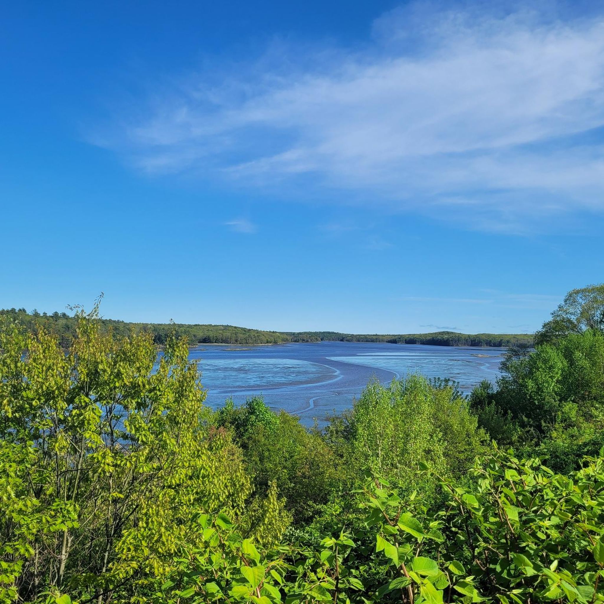
Hiking trails in Sagadahoc County traverse a varied landscape featuring the Kennebec River, sandy beaches, rocky cliffs, and lush woodlands. The region is defined by its extensive waterfronts, including salt marshes, tidal rivers, and inlets that support diverse ecosystems. Trails often wind through coastal forests and offer views of the river estuary and surrounding waterways. The terrain generally includes gentle elevations, with most routes suitable for easy to moderate activity.
Best hiking trails in Sagadahoc County
- The most popular hiking route is Gamble Trail & Kennebec River Lookout Trail loop — Berry Woods Preserve — Georgetown, a 2.5 miles (4.0 km) trail that takes 1 hour 5 minutes to complete. This easy loop explores the Berry Woods Preserve, offering views of the Kennebec River.
- Another top favourite among local hikers is Blue & Green Trail loop — Hamilton Audubon Sanctuary — West Bath, an easy 2.5 miles (4.0 km) path. This route winds through the Hamilton Audubon Sanctuary, providing a tranquil experience with minimal elevation gain.
- Local hikers also love the Whiskeag Trail, Narrows Trail & Overlook Trail loop — Thorne Head Preserve — Bath, a 1.5 miles (2.4 km) trail leading through Thorne Head Preserve, often completed in about 38 minutes. This loop offers views of the Kennebec River estuary.
- Hiking in Sagadahoc County is defined by coastal paths, river views, and dense woodlands, with trails often connecting to adjacent conservation lands. The network offers options for easy to moderate skill levels, catering to various preferences.
- The routes in Sagadahoc County are highly rated by the komoot community with an average score of 4.8 stars from over 15 reviews. More than 200 hikers have used komoot to explore Sagadahoc County's varied terrain.
Last updated: October 11, 2026
3
hikers
5.63km
01:28
40m
40m
The Cathance River East and Ravine Trail offers a surprisingly remote feel, winding through diverse landscapes that belie its proximity to busy areas. You'll traverse fields and quiet forests, catching glimpses of the Cathance River, sometimes flat, sometimes with exciting rapids. Don't miss the unique almost-circular heath with its boardwalks and the small quarries filled with dark water, where mica might even sparkle under your feet. This 3.5-mile (5.6 km) route, with its 127 feet (39 metres) of elevation gain, is an easy hike that feels like a true escape, taking about 1 hour and 27 minutes.
Parking is available at Top of the Tide Park, making for straightforward access. The trail is generally easy, but be aware that natural surfaces with roots and rocks can add a moderate challenge in spots, so wear appropriate footwear. It's a great option for a quick nature fix, but remember that dogs are generally not allowed in this part of the Cathance River Nature Preserve.
This trail system is part of the 230-acre Cathance River Nature Preserve, a significant ecological area. The Cathance River itself flows into the ecologically important Merrymeeting Bay, supporting a rich diversity of migratory birds and over 60 species of fish. The preserve also features vernal pools and freshwater tidal marsh habitats, making it a crucial spot for local wildlife and offering educational opportunities through the CREA Ecology Center.
2
hikers
3.13km
00:51
50m
40m
Embark on the easy Merritt Mountain Trail for a peaceful hike through diverse woods. This route covers 1.9 miles (3.1 km) with a gentle elevation gain of 162 feet (49 metres), taking about 51 minutes to complete. As you walk, you'll experience a quiet atmosphere and the chance to see golden light filtering through the trees. Keep an eye out for birdwatching opportunities and enjoy the harbor views that open up from the high, open ledges near Merritt Mountain.
Planning your visit to the Merritt Mountain Trail is straightforward. The trail system is well-marked, offering clear directions and even QR codes on signs for easy navigation. You will find picnic tables at scenic points along the way, perfect for a short break or a snack. Be aware that the natural path can become damp with scattered puddles or mud, particularly after rain, so it's wise to wear appropriate footwear for your hike.
This trail offers a serene escape into nature, providing a chance to unwind and observe local wildlife. The gradual unfolding of harbor views as you ascend adds a unique element to the experience. It's a great option if you are looking for a short, accessible outdoor activity that combines natural beauty with ease of navigation.

1
hikers
8.17km
02:04
10m
10m
Embark on the Topsham MTB Trail for a moderate hike through sun-dappled, quiet woods, offering serene views of Topsham Ponds and open meadows. This 5.1-mile (8.2 km) route features generally easy, smooth paths, though you will encounter some sections with roots and sandy soil. You can expect to gain a gentle 31 feet (10 metres) in elevation over approximately 2 hours and 3 minutes. As you hike, you will discover peaceful ravine trails that wind alongside narrow streams with sandy banks, providing a tranquil experience.
Planning your visit to the Topsham MTB Trail is straightforward, as it is part of the larger Topsham Ponds Trails network which forms a clear loop. You will find parking generally available at various trailheads located within the Topsham Ponds area. This specific route is well-maintained, ensuring a pleasant hiking experience. While the broader Topsham system offers more rugged options, this trail provides an accessible and enjoyable outing for many.
The Topsham MTB Trail is a highlight within the Topsham Ponds Trails network, known for its blend of natural beauty and accessibility. It stands out for its well-maintained paths and the opportunity to experience diverse landscapes, from open meadows to quiet ravines. This route offers a great way to explore the natural features of the area, making it a notable choice for a relaxing outdoor adventure.
2.82km
00:44
20m
20m
The Mile Beach and Little River Trail Loop offers a refreshing coastal experience, blending the expansive views of a sandy beach with the serene atmosphere of a riverside path. This easy 1.8-mile (2.8 km) hiking route, with a gentle 57 feet (17 metres) of elevation gain, is perfect for a quick outing, taking only about 43 minutes to complete. You'll enjoy the fresh ocean air and the peaceful sounds of the Little River, making it an ideal choice for a relaxing walk.
Planning your visit is straightforward, as the trail is easily accessible within Reid State Park. Parking is available, though it's wise to arrive early during busy times to ensure a spot. This loop is suitable for all ages and is a great option for a casual stroll at any time of day, offering a convenient escape into nature without requiring extensive planning or gear.
This trail stands out as a family-friendly option in Sagadahoc County, providing a taste of Maine's beautiful coastline and riverine ecosystems. While short, it offers a diverse natural setting, from the open beach to the more sheltered riverbanks. It's a fantastic way to experience the local environment and is often considered one of the popular trails for those seeking an easy, scenic outdoor activity.
1.73km
00:27
10m
10m
Embark on an easy hike along the Highland and Cathance River Trail Loop, a pleasant 1.1-mile (1.7 km) path that takes just about 26 minutes to complete. You'll experience a gentle elevation gain of only 25 feet (8 metres) as you wander through diverse woodlands, featuring towering hemlocks and sturdy oak trees. The route offers charming glimpses of the Cathance River, transitioning from lively rapids to calm, reflective waters. Keep an eye out for the impressive fifteen-foot waterfall at Head of Tide Park, a highlight of your journey.
When planning your visit, remember that dogs are generally not permitted within the Cathance River Nature Preserve itself, so it's best to leave your furry friends at home for this particular adventure. Parking is usually available at designated areas for the preserve, making access straightforward. This short loop is ideal for a quick outdoor escape, perfect for a morning stroll or an afternoon break.
This trail is nestled within the Cathance River Nature Preserve, an area known for its natural beauty and ecological significance. As you hike, you might spot local wildlife such as deer and beaver, adding to the immersive experience. The varied landscape, from dense forests to river views, makes this an excellent choice for anyone looking to connect with nature without committing to a long or strenuous outing.
3.34km
00:50
0m
0m
Enjoy an easy hike along Popham Beach, a route that stretches for 2.1 miles (3.3 km) with a minimal elevation gain of just 2 feet (0 metres). This pleasant walk takes about 50 minutes, offering you expansive views of the Atlantic Ocean. As you stroll along the vast sandy shore, you can spot distant islands like Seguin, Fox, and Wood dotting the horizon. The flat terrain makes it accessible for nearly everyone, providing a relaxing coastal experience.
If you plan to walk out to Fox Island, remember to check the tide schedules beforehand; this unique opportunity is entirely dependent on low tide conditions. During warmer months, it's a good idea to be prepared for insects to ensure your comfort throughout your visit. The trail is generally open year-round, but always consider local weather conditions for the best experience. Parking is available at the state park, making access straightforward for most visitors.
What makes Popham Beach particularly special is its dynamic coastline, which changes with the tides. A unique highlight is the chance to walk to Fox Island at low tide, when a temporary land bridge appears from beneath the waves. This allows you to explore the ocean floor and the island itself, offering a different perspective of the coastal environment. It's a distinctive feature that sets this beach apart from many others in the region.
723m
00:11
10m
0m
The Androscoggin Riverwalk offers a charming and accessible escape into nature and history, winding along the scenic river between Brunswick and Topsham. You'll enjoy diverse views of the majestic Androscoggin River, historic mills, and the hydroelectric dam, with pleasant overlooks and even small "pocket beaches" along the way. The trail is predominantly flat and paved, making it an easy 0.4-mile (0.7 km) hike with only 17 feet (5 metres) of elevation gain, perfect for a quick 11-minute stroll.
This trail is incredibly user-friendly, suitable for all ages and fitness levels, and even wheelchair accessible in many parts. It's a great option for family-friendly hiking, and your leashed dog is welcome too, with waste bag dispensers provided. The path is plowed and sanded in winter, ensuring year-round enjoyment, so you can plan your visit any time of year to experience its seasonal beauty.
One of the standout features is the historic Androscoggin Swinging Bridge, a cable suspension bridge built in 1892 by the same company that constructed the Brooklyn Bridge. Crossing it offers unique views and a slight bounce, adding to the adventure. The trail also connects to the larger East Coast Greenway, providing historical context through informational signs along the route and making it a notable part of the region's trail network.
10
hikers
4.04km
01:06
60m
60m
The Gamble and Kennebec River Lookout Loop offers a delightful escape into nature, winding through the Berry Woods Preserve in Georgetown, Maine. You'll wander through peaceful oak-pine woodlands before reaching the star attraction: a spectacular ledge outcrop on the Kennebec River Lookout Trail. This viewpoint provides expansive, open views up and down the Kennebec River, making the easy effort incredibly rewarding.
This family-friendly hiking route covers 2.5 miles (4.0 km) with a gentle 188 feet (57 metres) of elevation gain, typically taking just over an hour. The trails are well-marked and mostly level, with only two short inclines, making it an ideal choice for beginners or those seeking a relaxed outing. Parking is available at the trailhead, and no permits or fees are required, so you can easily plan your visit.
Beyond the stunning river views, the Berry Woods Preserve itself is a significant natural area, encompassing 377 acres with extensive shoreline along the Kennebec River, Robinhood Cove, and Wilson Pond. It also connects to an additional 1,300 acres of conserved lands, including Maine Audubon's Josephine Newman Sanctuary, contributing to a rich and diverse natural environment. This makes the Gamble and Kennebec River Lookout Loop a great way to experience the region's natural beauty.
5.0
(1)
7
hikers
4.03km
01:02
20m
20m
The Hamilton Blue and Green Trail Loop offers a serene escape into nature within the Hamilton Audubon Sanctuary. This easy 2.5-mile (4.0 km) hiking route guides you through peaceful woodlands, providing a gentle experience with minimal elevation gain of just 63 feet (19 metres). It's a perfect choice for those seeking a quiet walk, birdwatching opportunities, and a chance to immerse themselves in natural surroundings without strenuous effort. You can expect to complete the loop in about 1 hour and 2 minutes.
Planning your visit to this accessible trail is straightforward. Located in West Bath, Maine, the trailhead is easy to find, and parking is typically available. This loop is particularly family-friendly and suitable for beginners, offering a relaxed pace through the sanctuary. Consider visiting in the spring or fall for the most comfortable weather and active wildlife viewing.
As part of the Hamilton Audubon Sanctuary, this trail is dedicated to preserving natural habitats and offering a tranquil environment for both wildlife and visitors. It's an excellent example of how local conservation efforts provide accessible green spaces for the community, making it a notable spot for nature lovers in Sagadahoc County.
5
hikers
2.36km
00:38
30m
30m
Embark on an easy hike along the Ridgerunner Trail, a pleasant 1.5 miles (2.4 km) route that takes approximately 38 minutes to complete. You will experience a gentle elevation gain of just 97 feet (30 metres) as you explore the natural beauty of Thorne Head Preserve. Keep an eye out for the Overlook Trail section, which promises scenic views of the surrounding area and offers a rewarding visual landmark during your walk. This trail provides a straightforward outdoor experience for hikers of all levels.
Accessing the Ridgerunner Trail is convenient, with ample parking available directly at the Thorne Head Preserve Trailhead. You can plan your visit without concerns about specific warnings regarding snow conditions, road closures, or the need for permits, making it an accessible option for most visitors. Always remember to check local conditions before you head out to ensure a smooth and enjoyable trip.
The Ridgerunner Trail is a key part of the larger network within Thorne Head Preserve, connecting seamlessly with other routes like the Whiskeag Trail and Narrows Trail. This interconnectedness allows you to extend your adventure and discover varied scenery within the preserve if you wish. It offers a great opportunity to explore the diverse natural environment and unique features that make this area special.
Get access to more routes and recommendations from other explorers.
Already have an account?
Our route recommendations are based on thousands of hikes, rides, and runs completed by other people on komoot.
Start today with a free account
Your next adventure awaits.



Tips from the Community

Top of the Tide Park, also known as Head of Tide Park, is a scenic spot in Topsham, Maine, along the Cathance River. The park features trails, picnic areas, and a viewing area for a stunning fifteen-foot waterfall. Located at the site of an old mill dam, it offers access to both upstream and tidal portions of the river for activities like kayaking. The park also provides toilet facilities and parking, making it a convenient and beautiful location for outdoor recreation.
0
0
Mile Beach in Reid State Park, Georgetown, Maine, is a scenic, sandy beach that offers a classic New England coastal experience. As the name indicates, the beach spans a mile and its southern end it marked by a rocky promontory known as Todd's Point, which provides stunning ocean views.
0
0
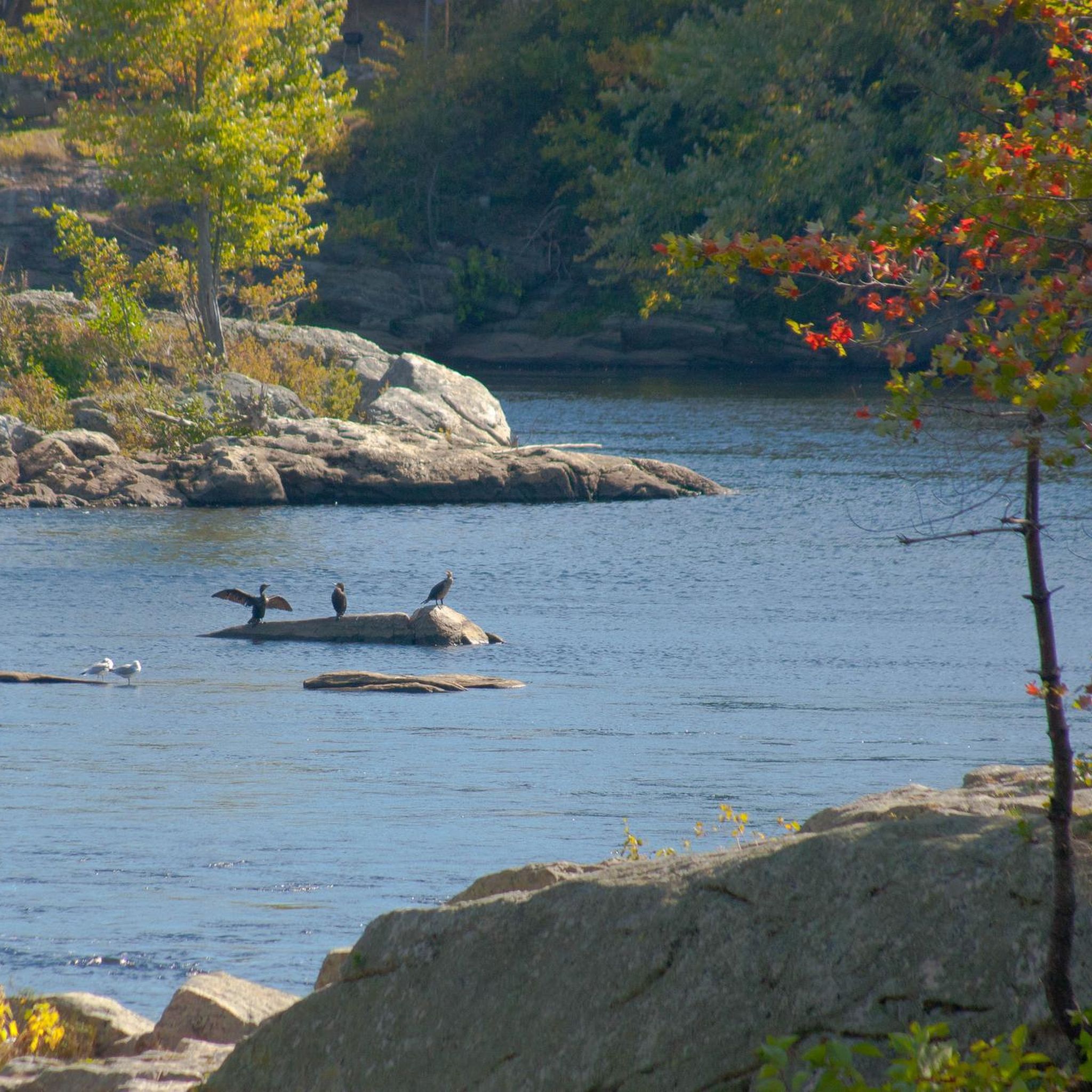
Kennebec River Lookout Trail is a short (.33 miles one way) extension trail off of the main Gamble Trail and Gamble Loop Trail to a viewpoint of the Kennebec River. This is a lovely spot where you get nice views over the river to Lamb and Marr Islands.
0
0
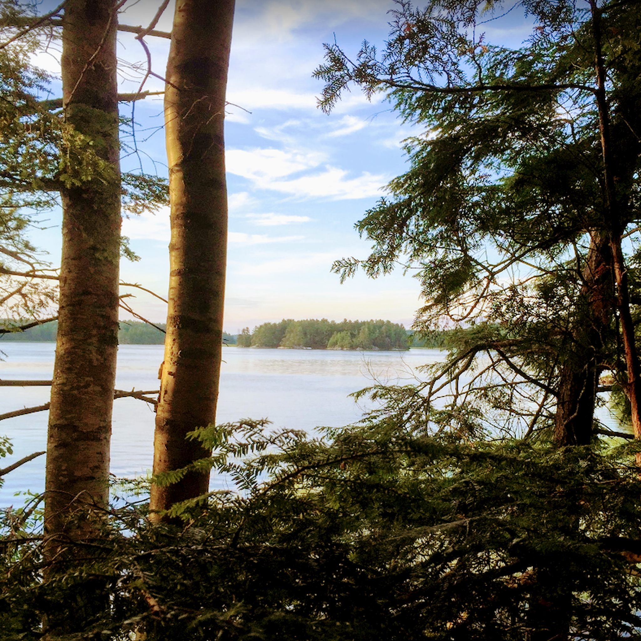
The 377-acre Berry Woods Preserve is part of a larger network of conserved lands totaling over 2,000 acres, which includes Reid State Park and Maine Audubon’s Josephine Newman Sanctuary, spanning across Georgetown Island. The preserve offers a small trail system with generally easy, level terrain, perfect for hiking and bird-watching, and snowshoeing, and cross-country skiing in the winter. Trails meander through oak-pine forests from the shores of the Kennebec River to Robinhood Cove, passing by notable features like an old mica mine and natural blowdowns. Visitors are encouraged to follow preserve policies, including day use only, foot traffic only, staying on trails to protect the ecosystem, and carrying out all litter. Pets, fires, smoking, and camping are not permitted.
0
0
The Whiskeag Trail connects the conserved lands at Sewall Woods and Thorne Head Preserve to the YMCA, McMann Athletic Complex, Bath Middle School, and Oak Grove Cemetery in Bath, Maine. Named after an Abenaki word meaning "a creek that runs nearly dry at low tides," the trail follows Whiskeag Creek, which flows into the Kennebec River. The surrounding wetlands and waterways are crucial for flood control, erosion reduction, pollutant filtration, and wildlife habitat. The area supports a diverse range of species, including birds like Blue-winged Teal, Great Blue Heron, Bald Eagle, and Egret, as well as terrestrial animals like beaver, wild turkey, and coyote. Public use of the trail is free from dawn to dusk.
0
0
The Narrows Trail skirts around the edge of the peninsula and connects with many other trails in the preserve. This popular trail takes you through rocky pine forests with great views through the trees of the water.
0
0
Thorne Head Preserve is a 96-acre property managed by the Kennebec Estuary Land Trust, located at the confluence of Whiskeag Creek and the Kennebec River near Bath, Maine. The preserve features an extensive trail system, offering stunning views of the estuary, Lines Island, and surrounding waterways. The trails vary in difficulty, from the short and accessible Overlook Trail to longer, challenging routes like 5.1-mile Whiskeag Trail. Dogs are welcome on the trails if leashed and well-mannered. Open daily from dawn to dusk, Thorne Head Preserve is free to the public.
1
0
The Blue Trail is one of the most popular trails here. It is a loop that follows the peninsula’s eastern shore, providing great views at Back Cove Point. The Yellow Trail weaves through the heart of the sanctuary connecting the northern and southern side of the Blue Trail. You can also link up with the Green Trail at the eastern end of the Blue Trail which adds an additional mile and a quarter loop around the eastern peninsula of the Hamilton Audubon Sanctuary.
0
0
Frequently Asked Questions
What kind of terrain can I expect on hiking trails in Sagadahoc County?
Sagadahoc County's hiking trails feature a diverse landscape, including coastal paths, river views, and dense woodlands. You'll encounter sandy beaches, rocky cliffs, salt marshes, and tidal rivers. The terrain generally includes gentle elevations, with most routes suitable for easy to moderate activity.
Are there many easy hiking trails available in Sagadahoc County?
Yes, Sagadahoc County offers a wide selection of easy hiking trails. Out of the 20 routes available, 17 are classified as easy, making it a great destination for casual strolls and less strenuous walks. An example is the Blue & Green Trail loop at Hamilton Audubon Sanctuary, which provides a tranquil experience with minimal elevation gain.
Can I find family-friendly hiking options in Sagadahoc County?
Many trails in Sagadahoc County are suitable for families, offering easily accessible paths and generally gentle terrain. Preserves like Berry Woods Preserve, with its small trail system and level ground, are ideal for outings with children. The Gamble Trail & Kennebec River Lookout Trail loop is an easy option that explores this preserve.
Are there any dog-friendly trails in Sagadahoc County?
Many of Sagadahoc County's preserves and trails welcome dogs, though it's always best to check specific preserve rules regarding leashes. The region's natural settings, with woodlands and coastal paths, provide excellent opportunities for walks with your canine companion.
What are some notable natural features or landmarks to see while hiking?
Sagadahoc County's trails often lead to stunning natural features and landmarks. You can explore the Kennebec River estuary, observe diverse ecosystems in salt marshes, or visit coastal areas like Popham Beach State Park. The Fort Baldwin, Fort Popham, & Popham Beach loop offers historical sites alongside scenic coastal views. You might also spot highlights like the Whiskeag Trail or Berry Woods Preserve.
Are there any circular hiking routes in Sagadahoc County?
Yes, many trails in Sagadahoc County are designed as loops, offering convenient circular routes. For example, the Whiskeag Trail, Narrows Trail & Overlook Trail loop in Thorne Head Preserve is a popular circular option, providing views of the Kennebec River estuary.
What do other hikers enjoy most about hiking in Sagadahoc County?
The hiking experiences in Sagadahoc County are highly rated by the komoot community, with an average score of 4.8 stars from over 15 reviews. Reviewers often praise the quiet woodlands, scenic river views, and well-marked paths that make exploration enjoyable for all skill levels.
Are there any longer or more challenging hikes in the area?
While most trails are easy, Sagadahoc County does offer some moderate options for those seeking a bit more challenge. The Highland Trail & Cathance River Trail loop in Topsham is a moderate route, covering nearly 6 miles. Another moderate option is the Whiskeag Trail loop, which is over 5.7 miles long.
What is the best time of year to go hiking in Sagadahoc County?
Sagadahoc County offers picturesque settings year-round. Spring and fall provide comfortable temperatures and vibrant foliage, while summer allows for combining hikes with beach activities. Winter offers opportunities for snowshoeing and cross-country skiing on trails like those in Berry Woods Preserve.
Are there any trails that lead to lighthouses or coastal viewpoints?
Yes, Sagadahoc County features trails that offer stunning coastal views and access to lighthouses. The Squirrel Point Lighthouse & Bald Head Trail at Bald Head Preserve is an excellent choice for a hike that includes a lighthouse and scenic coastal vistas.
Where can I find trails that explore Audubon Sanctuaries?
Sagadahoc County is home to several Audubon Sanctuaries with accessible trails. The Geology Trail, Rocky End Trail, & Horseshoe Trail loop is located within the Josephine Newman Audubon Sanctuary, offering coastal forests and rocky shorelines perfect for birdwatching.
Are there any trails that offer views of the Cathance River?
Yes, you can find trails that provide views of the Cathance River. The Highland Trail & Cathance River Trail loop in Topsham protects shoreline along the Cathance River and offers views of rolling fields and stone walls.
Most popular routes in Sagadahoc County
Most popular attractions in Sagadahoc County

Get inspired with the komoot mobile app


Didn’t find what you were looking for?
Check out more Hikes throughout Sagadahoc County below and find the perfect route in your destination.
Explore more
Browse the best Hikes in other regions.
