The best walks and hikes in Sussex County
4.7
(92)
1,229
hikers
117
hikes
Hiking trails in Sussex County traverse a diverse landscape in northern New Jersey, characterized by the Kittatinny Mountains, extensive forests, wetlands, and numerous lakes. The region features varied terrain, including challenging mountain climbs and more accessible paths. Significant portions of the Appalachian Trail run through the county, alongside several state parks and natural preserves. This topography offers a range of outdoor experiences for hikers.
Best hiking trails in Sussex County
- The most popular hiking route is Stairway to Heaven Trail, a 3.7 miles (6.0 km) trail that takes 2 hours 17 minutes to complete. This moderate route features significant elevation gain and scenic views.
- Another top favourite among local hikers is Monument Trail Loop, an easy 3.7 miles (6.0 km) path. This trail offers views around the High Point Monument.
- Local hikers also love the Wawayanda Lake Loop, a 5.6 miles (9.0 km) trail leading through Wawayanda State Park, often completed in about 2 hours 22 minutes.
- Hiking in Sussex County is defined by sections of the Appalachian Trail, the Kittatinny Mountains, and numerous state parks like High Point and Allamuchy. The network offers options for various ability levels, from easy lakeside strolls to more challenging mountain ascents.
- The routes in Sussex County are highly rated by the komoot community with an average score of 4.7 stars from around 50 reviews. More than 900 hikers have used komoot to explore Sussex County's varied terrain.
Last updated: September 27, 2026
4.9
(9)
123
hikers
6.00km
02:17
500m
240m
The Stairway to Heaven Trail offers a memorable journey through varied landscapes, starting with flat sections and boardwalks that wind through marshes and forests. Soon, the route transforms into a strenuous climb up Wawayanda Mountain, characterized by a large boulder field and distinctive rock slab steps that give the trail its name. The effort is richly rewarded with the expansive, panoramic views from Pinwheel Vista Lookout, showcasing the Vernon Valley and distant mountain ranges.
Planning your visit to this popular New Jersey trail means considering its accessibility year-round, though starting early is advisable, especially on peak days, to secure parking and enjoy a less crowded experience. The trail is dog-friendly, making it a great option for hiking with your canine companion. Be sure to wear good hiking shoes and consider bringing trekking poles to navigate the steep, rocky sections effectively.
This well-known 1.3-mile section of the Appalachian Trail is celebrated for its unique
5.0
(2)
36
hikers
5.96km
01:39
100m
90m
Embark on the Monument Trail Loop for an easy hike through High Point State Park. This route guides you through varied landscapes, from rocky sections to tranquil, shady forests. You will cover 3.7 miles (6.0 km) with a gentle elevation gain of 342 feet (104 metres), making it accessible for most hikers. Along the way, you can enjoy views of Lake Marcia and catch glimpses of the impressive High Point Monument. Expect to complete this loop in about 1 hour and 38 minutes, offering a pleasant outdoor escape.
Accessing the Monument Trail Loop is straightforward, with convenient parking available close to the monument. If you plan to bring your canine friend, leashed dogs are welcome on the trail. Keep in mind that the High Point Monument itself operates seasonally; check local listings if you wish to climb its 291 steps for expanded vistas. This trail is suitable for a morning or afternoon outing.
This loop offers a unique opportunity to experience New Jersey's highest point. As you hike, you can take in panoramic views that stretch across the Delaware River Valley and beyond. The area is also home to towering white cedars and various native songbirds, adding to the natural appeal of your journey. It is a great way to explore the diverse ecosystems of the park.

5.0
(1)
20
hikers
9.02km
02:22
70m
70m
The Wawayanda Lake Loop offers a delightful moderate hike, winding 5.6 miles (9.0 km) around the scenic Wawayanda Lake with a gentle 229 feet (70 metres) of elevation gain, typically taking about 2 hours and 21 minutes. You'll experience a varied path, from moderately rocky sections to old woods roads and boardwalks through the Wawayanda Swamp Natural Area. The thick, shady forests are a highlight, especially when rhododendrons and mountain laurel are in bloom, providing continuous lake views and a refreshing escape.
Planning your visit to Wawayanda State Park means arriving early, particularly on summer weekends, as the park can get busy and reach capacity. The trail is well-marked with orange blazes, but keep an eye out at junctions. While no specific permits are usually required for hiking, it's always wise to check the park's official site for any entrance fees or seasonal operating hours before you go.
Beyond the beautiful lake, the area is rich in natural and historical features. You might spot wildlife like red-shouldered hawks or great blue herons, and the forests boast Atlantic white cedar swamps and mixed oak-hardwood trees. Keep an eye out for the historic Wawayanda Furnace, a remnant from 1846 when iron ore was mined here, adding a touch of industrial history to your natural exploration.
14
hikers
10.9km
03:44
370m
370m
Embark on the Buttermilk Falls, Crater Lake, and Hemlock Pond Loop, a moderate hike that takes you through diverse landscapes. You will experience a challenging climb alongside Buttermilk Falls, New Jersey's tallest waterfall, before reaching the tranquil waters of Crater Lake. The route covers 6.7 miles (10.9 km) with an elevation gain of 1213 feet (370 metres), typically taking around 3 hours and 44 minutes to complete.
When planning your visit, be aware that access to the trailhead for this loop is closed during the winter months. Make sure to check local conditions and plan your trip for warmer seasons to fully enjoy the trail. This will ensure you can access all parts of the route without unexpected closures.
This trail offers more than just waterfalls and lakes; you will also wander through peaceful hemlock groves surrounding Hemlock Pond. Along the way, you can enjoy expansive views of the Kittatinny Mountains from various vista points. A segment of the renowned Appalachian Trail is also incorporated into this rewarding journey.
4.5
(2)
14
hikers
7.70km
02:15
200m
200m
Embark on the Normanook Tower Loop, a moderate hiking route that spans 4.8 miles (7.7 km) and climbs 656 feet (200 metres). You can expect to complete this journey in about 2 hours and 14 minutes. As you hike, you'll pass through lush sections filled with wildflowers and ferns, then emerge into clearings that offer views towards Pennsylvania. The trail's highlight is the historic Normanook Fire Tower, standing tall along the Kittatinny Ridge. From its vantage point, you can take in wide views of the surrounding lakes, hills, and valleys.
Planning your trip is straightforward for this loop. You'll find parking readily available at the trailhead, and there are no fees required to access the trails. While the path is generally well-marked, some parts can be steep and rocky, so wearing sturdy hiking shoes is a good idea. Near the tower, you'll discover an open grassy area with a picnic table, perfect for a break or a packed lunch.
The Normanook Fire Tower is a significant feature of this trail, offering a historical touch to your outdoor experience. It stands at 1,509 feet along the Kittatinny Ridge, providing a unique perspective of the landscape. This area is known for its diverse natural environment, making the trail a great way to explore the local flora and varied terrain. The route offers a rewarding outdoor experience within Stokes State Forest.
5.0
(1)
10
hikers
3.04km
00:46
0m
10m
Embark on an easy hike along the Pochuck Boardwalk on the Appalachian Trail, a unique route that guides you through sensitive wetlands. This 1.9-mile (3.0 km) path is mostly a wooden boardwalk, offering an exceptionally flat surface with a minimal elevation gain of just 16 feet (5 metres). You can expect to complete this scenic journey in about 46 minutes. As you traverse the boardwalk, you will find yourself surrounded by the natural beauty of the Pochuck and Wawayanda Mountains. A highlight of your walk will be crossing the impressive 146-foot suspension bridge over Pochuck Creek, providing excellent views of the marshy landscape below.
This easy trail is a popular choice for a leisurely stroll, making it ideal for families and those looking for a gentle outdoor experience. You can bring your dog along, as the route is suitable for dog-walking. Accessing the trailhead is straightforward, with parking generally available nearby, ensuring a convenient start to your hike. Consider visiting during milder weather to fully appreciate the open wetland environment.
The Pochuck Boardwalk is particularly notable for its nearly mile-long wooden structure, specifically designed to protect the sensitive wetland ecosystem it crosses. Keep an eye out for diverse wildlife during your visit, including turtles, snakes, frogs, and various bird species that thrive in this marshy habitat. This section of the Appalachian Trail offers a unique opportunity to experience a significant natural area with minimal impact, making it a cherished local gem.
6
hikers
6.71km
01:52
140m
100m
The Silver Mine Loop offers an easy hiking experience through the scenic woods of Stokes State Forest. You will find a peaceful atmosphere as you follow wooded paths, with some sections potentially feeling a bit rugged. Keep an eye out for the charming streams that wind through the forest, adding to the picturesque scenery. This route covers 4.2 miles (6.7 km) with an elevation gain of 454 feet (139 metres), and you can expect to complete it in about 1 hour and 52 minutes. It's a straightforward and enjoyable way to immerse yourself in nature.
Planning your visit to the Silver Mine Loop is generally simple, as the trail is easily accessible. You should find parking readily available at the trailhead, making it convenient to start your hike. There are no specific warnings about road closures, permits, or fees mentioned for this location, so you can focus on enjoying your time outdoors. While the trail is enjoyable year-round, conditions can change with the seasons, so always check the local weather forecast before you head out.
This loop provides a wonderful opportunity to explore the natural beauty of Stokes State Forest. The diverse landscape, featuring both wooded paths and varied terrain, makes for an engaging hike. It's a great option if you are looking for a tranquil escape into nature without needing extensive preparation. The presence of the Streams of Stokes State Forest adds a unique and picturesque element to your journey through this peaceful woodland.
5
hikers
2.23km
00:35
20m
20m
The Maple Grange Park Loop offers a delightful and accessible journey through varied landscapes, perfect for a quick nature fix. You'll find yourself moving between open fields and shaded woods, with smooth, partially paved surfaces underfoot. A standout feature is the historic Vernon Boardwalk, a segment of the Appalachian Trail, where you can enjoy peaceful views of green wetlands and learn about the trail's history from informative placards.
Planning your visit is simple, as parking is readily available at Maple Grange Park. The park itself is well-equipped with picnic tables and playgrounds, making it an excellent destination for families. This easy 1.4-mile (2.2 km) hike, with only 50 feet (15 metres) of elevation gain, takes about 35 minutes, making it a great option for a relaxed outing any time of year.
What makes this trail particularly special is its connection to the Appalachian Trail via the Vernon Boardwalk, offering a unique blend of local park amenities and a piece of a legendary long-distance route. The trail's family-friendly nature and accessibility, including wheelchair-friendly sections, ensure that almost everyone can enjoy the diverse scenery and observe local flora and fauna.
5.0
(2)
6
hikers
16.9km
05:19
690m
500m
This difficult 10.5 miles (16.9 km) hike along the Appalachian Trail takes you through the diverse landscapes of the Wallkill and Vernon Valleys. You will experience wetlands, dense hardwood and evergreen forests, and even pass an active cattle pasture. The route involves a significant elevation gain of 2248 feet (685 metres), making it a challenging journey that typically takes around 5 hours and 18 minutes to complete. A highlight is the famous Pochuck Boardwalk, which includes a 110-foot wooden suspension bridge over Pochuck Creek, offering a unique walking experience. Expect varied ecosystems, from boggy sections requiring puncheons to shaded woodland paths.
Prepare for varied terrain on this route; while some sections are relatively flat, the overall difficulty comes from the elevation changes and diverse ground conditions. Be ready for boggy sections, especially in wetlands, where puncheons are in place to help keep your feet dry. Always check local conditions before you head out, as weather can impact trail accessibility and ground firmness. Plan your visit to allow ample time for the full duration, especially if you want to take breaks to enjoy the scenery.
This section of the Appalachian Trail is known for its ecological diversity and the unique engineering of the Pochuck Boardwalk. Beyond the boardwalk, a blue-blazed side trail leads to Pinwheel Vista Lookout, providing expansive views of the Vernon Valley and the surrounding mountains. The trail offers a chance to see different natural habitats and is a popular choice for those seeking a demanding yet rewarding outdoor experience in the region.
5
hikers
17.3km
04:55
400m
350m
Embark on the Culver Tower Loop, a moderate hiking route that takes you through the diverse and often rugged terrain of Stokes State Forest. This 10.7-mile (17.3 km) journey involves a climb of 1311 feet (400 metres), offering a rewarding workout. As you hike, you'll encounter rocky sections and enjoy the changing scenery, with the historic Culver Fire Tower serving as a prominent landmark and a key visual anchor for the experience.
Plan for a hike lasting around 4 hours and 54 minutes to comfortably complete the loop. The trailhead provides convenient amenities, including ample parking and clean restrooms, making it an easy starting point for your adventure. Be ready for varied ground underfoot, especially on descents along the Tower Trail, where careful footing is advised. The route is generally well-marked, ensuring a smooth and enjoyable experience.
The highlight of the Culver Tower Loop is undoubtedly the Culver Fire Tower itself, which offers expansive 360-degree panoramic views across New Jersey, Pennsylvania, and New York. Even from the base of the tower, you can take in excellent westward vistas. The trail also integrates with sections of the famous Appalachian Trail, adding a layer of historical and natural significance to your hike through this serene forest environment.
Get access to more routes and recommendations from other explorers.
Already have an account?
Our route recommendations are based on thousands of hikes, rides, and runs completed by other people on komoot.
Start today with a free account
Your next adventure awaits.
Popular around Sussex County







Tips from the Community

Buttermilk Falls is the tallest waterfall in New Jersey. If you want to park your bike at the bottom of the falls, you can climb up to the top and to take in the vistas from the viewing platform.
1
0

Relatively short hike with somewhat steep segments at the end. Wear proper shoes as surface is rocky and uneven.
0
0

Discover the enchanting Stokes State Forest, where forested mountains, pristine streams, and the awe-inspiring Sunrise Mountain offer a haven for nature enthusiasts. Whether seeking tranquility or outdoor adventure, Stokes has it all! Explore over 63 miles of trails leading to landmarks like the Appalachian Trail, Tillman's Ravine, and Stepping Stones Falls.
0
0
Stony Lake in Stokes State Forest beckons with its scenic charm and recreational opportunities. Annually stocked with trout by the Division of Fish and Wildlife, it provides a haven for anglers. As the seasons change, indulge in the unique experience of ice fishing, adding an extra layer of adventure to your visit.
0
0

Right next to a parking area, this beautiful lake is in the heart of the park and is an ideal starting point for your adventure. From here, you can join many different trails (most are multiuse) that are perfect for exploring the area or simply circling the lake.
1
0
Discover the enchanting Stokes State Forest, where forested mountains, pristine streams, and the awe-inspiring Sunrise Mountain offer a haven for nature enthusiasts. Whether seeking tranquility or outdoor adventure, Stokes has it all! Explore over 63 miles of trails leading to landmarks like the Appalachian Trail, Tillman's Ravine, and Stepping Stones Falls.
0
0
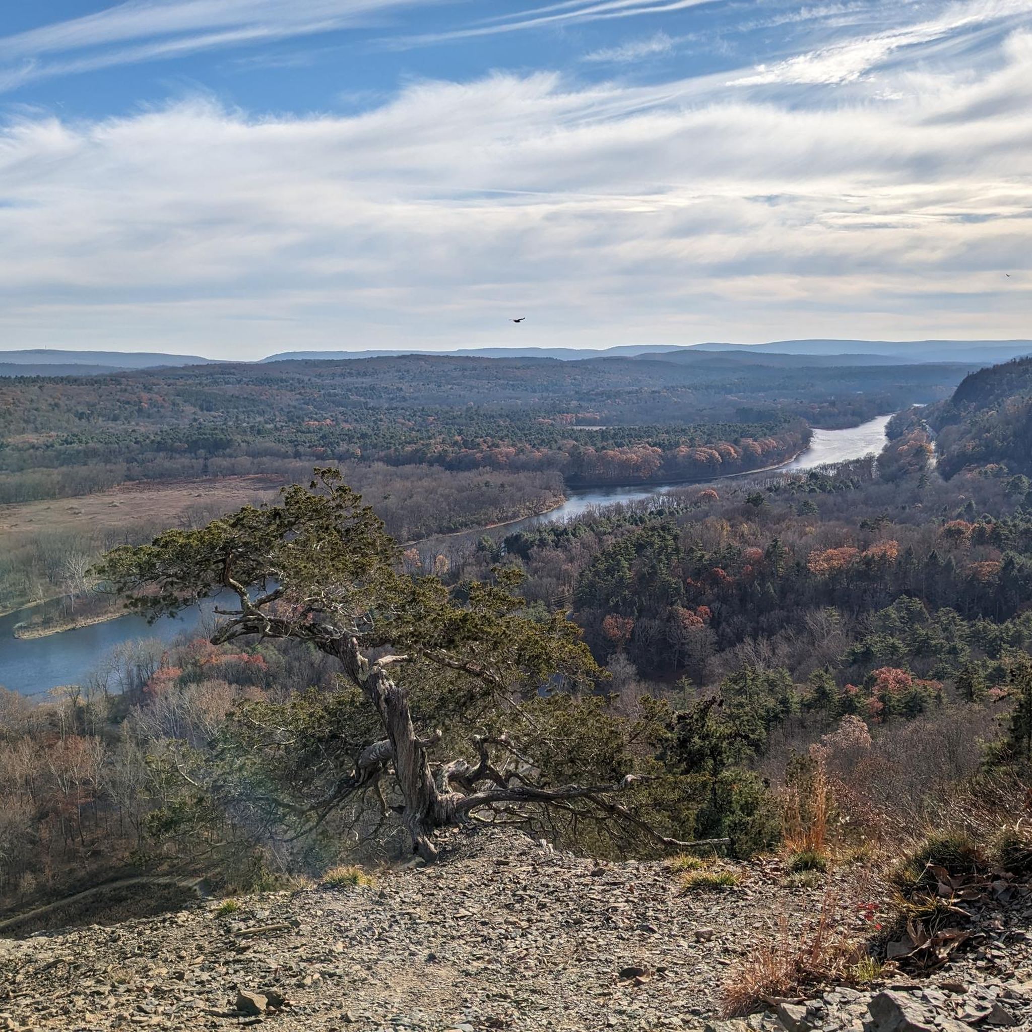
Running along the New Jersey and Pennsylvania border, Kittatinny Mountain is a unique part of the Great Appalachian Valley, offering fantastic, panoramic views.
0
0

Crater Lake is a former glacial lake. An approximately 2.5 km long hiking trail leads around the lake. The 'Skyline Drive', a tar road, ends at a parking lot by the lake. Hemlock Pond is nearby and a longer circular hike is possible on the Blue Mountain Lake Trail. The Appalachian National Scenic Trail passes Crater Lake. https://www.nps.gov/dewa/planyourvisit/crater-lake-trail.htm
1
0
Frequently Asked Questions
How many hiking trails are available in Sussex County?
Sussex County offers a wide variety of hiking experiences, with over 80 routes documented on komoot. These range from easy strolls to more challenging ascents, ensuring options for all skill levels.
What types of terrain can I expect on hikes in Sussex County?
The terrain in Sussex County is incredibly diverse, encompassing the rugged Kittatinny Mountains, dense forests, serene wetlands, and numerous lakes. You'll find everything from challenging mountain climbs with significant elevation changes, particularly along sections of the Appalachian Trail, to flatter, accessible paths like those found in Kittatinny Valley State Park or along the Paulinskill Valley Trail.
What do other hikers say about the trails in Sussex County?
The hiking routes in Sussex County are highly rated by the komoot community, with an average score of 4.7 stars from nearly 50 reviews. Over 700 hikers have used komoot to explore the varied terrain, often praising the scenic views, well-maintained paths, and the diverse natural beauty of the region.
Are there any family-friendly hiking options in Sussex County?
Yes, Sussex County has many family-friendly trails. For an easy and scenic walk, consider the Jefferson Lake Loop – Allamuchy Mountain State Park, which offers beautiful views around the lake. Another great option is the Crater Lake and Hemlock Pond loop — Delaware Water Gap National Recreation Area, an easy 3.3-mile path perfect for a leisurely outing.
Can I bring my dog on the trails in Sussex County?
Many parks and trails in Sussex County are dog-friendly, though it's always best to check specific park regulations before you go. Generally, trails in state parks like Allamuchy Mountain State Park and Stokes State Forest welcome leashed dogs. The flat, multi-use Andover to Waterloo via Sussex Branch Trail is a good option for walking with your canine companion.
Are there any trails with waterfalls in Sussex County?
Yes, Sussex County is home to beautiful waterfalls. A popular route that features a stunning waterfall is the Buttermilk Falls to Appalachian Trail — Delaware Water Gap National Recreation Area. This trail leads you directly to Buttermilk Falls, one of New Jersey's tallest waterfalls.
Where can I find scenic viewpoints or panoramic vistas?
For breathtaking panoramic views, head to High Point State Park, the highest point in New Jersey. From the monument, you can see across three states: New Jersey, New York, and Pennsylvania. Another excellent option is the Sunrise Mountain Loop – Stokes State Forest, which offers spectacular vistas, especially during sunrise or sunset.
Are there any circular hiking routes in Sussex County?
Yes, many trails in Sussex County are designed as loops, offering a varied experience without retracing your steps. Examples include the Allamuchy Loop – Allamuchy Mountain State Park, a moderate 6.3-mile trail, and the Kittatinny Valley State Park loop, which is a moderate 4.7-mile route.
What are some notable natural features or landmarks to look out for?
Sussex County is rich in natural beauty. Besides Buttermilk Falls, you can explore Stokes State Forest, known for its diverse ecosystems, or visit Kittatinny Mountain for its impressive summit. The Sussex Branch Trail itself is a historic landmark, following an old railway line.
Are there opportunities for wildlife spotting on the trails?
Absolutely. Parks like Kittatinny Valley State Park and Blair Creek Nature Preserve are excellent for wildlife observation. You might spot whitetail deer, wild turkeys, and a variety of bird species. The Paulinskill Valley Trail is particularly noted by birdwatchers for its diverse avian population, with over 100 different species recorded.
What is the best time of year to go hiking in Sussex County?
Spring and fall are generally considered the best times for hiking in Sussex County. Spring brings wildflowers and lush greenery, while fall offers spectacular foliage. Summer can be pleasant, but be prepared for warmer temperatures and potential humidity. Winter hiking is also possible, especially on flatter trails, but requires appropriate gear for snow and ice.
Are there any longer, more challenging hikes for experienced hikers?
For experienced hikers seeking a challenge, sections of the Appalachian Trail that traverse Sussex County offer significant elevation changes and rugged terrain. The Blue Mountain Loop – Stokes State Forest is a moderate 9.5-mile route with notable climbs, and the Waterloo Village via Highland Trail — Allamuchy State Park is a longer, moderate 10-mile hike with substantial elevation gain.
Most popular routes in Sussex County
Most popular attractions in Sussex County

Get inspired with the komoot mobile app


Didn’t find what you were looking for?
Check out more Hikes throughout Sussex County below and find the perfect route in your destination.
Explore more
Browse the best Hikes in other regions.
