The best walks and hikes in Wallowa County
5.0
(4)
215
hikers
33
hikes
If you've ever tried planning hiking in Wallowa County, you know how quickly the sheer number of options can feel overwhelming. How do you pick the truly spectacular routes from the merely good, or even worse, the filler? It's tough to tell the highlights from the trails that just aren't worth the effort when you're looking at a map.
That's where we come in. Our komoot community has explored, mapped, and reviewed countless trails here, so we've done the legwork to bring you a curated shortlist of the hikes genuinely worth your time and effort. We promise to save you the guesswork and point you straight to the routes that deliver.
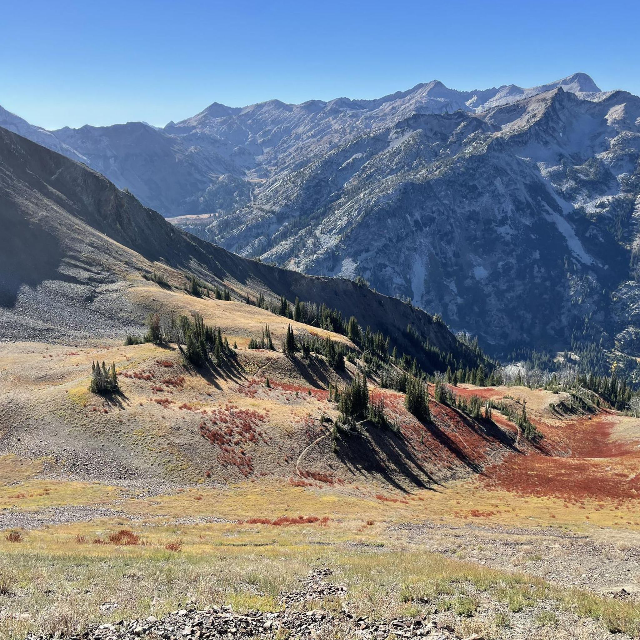
Wallowa County, often called the "Alps of Oregon," is defined by its dramatic granite peaks, pristine alpine lakes, and deep river gorges, particularly within the vast Eagle Cap Wilderness. You'll find everything from gentle riverside strolls to demanding multi-day alpine expeditions. While many trails are accessible for much of the year, the higher elevation routes, especially those leading to alpine lakes, are typically best from late spring through early fall once the snow has melted.
If you only do one hike, we'd point you to the challenging but incredibly rewarding Ice Lake Trail to Matterhorn Peak, a 11.6 miles (18.7 km) route that delivers classic Wallowa alpine scenery. For a more accessible, family-friendly win, the easy Iwetemlaykin Heritage Trail at 1.8 miles (2.9 km) offers stunning views without the big climb. Dive in and discover why more than 200 hikers have already used komoot to explore this incredible region.
Last updated: May 10, 2026
10
hikers
18.7km
07:38
1,560m
580m
The Ice Lake Trail to Matterhorn Peak is a truly epic hike through the heart of Oregon's Eagle Cap Wilderness, offering a journey from lush river valleys to high alpine splendor. You'll navigate through dense forests, past roaring waterfalls, and alongside the West Fork Wallowa River before reaching the pristine, deep blue waters of Ice Lake. From there, the route becomes a rugged ascent to the summit of Matterhorn Peak, where you're rewarded with expansive, breathtaking views across the Wallowa Mountains.
This is a difficult 11.6-mile (18.7 km) hike with a significant 5114 feet (1559 metres) of elevation gain, typically requiring around 7 hours and 38 minutes to complete. The trail to Matterhorn Peak is especially challenging, involving steep, loose rock and some scrambling. While possible as a very long day hike for the fittest, many choose to backpack for two to three days to fully experience the area. Remember to check weather conditions before heading out, as there's no cell service.
Often considered one of the "7 wonders of Oregon," this trail is a popular destination for backpackers and climbers alike, leading to the second-highest peak in the Eagle Cap Wilderness. It's a prime example of the region's rugged beauty, attracting visitors who appreciate its challenging terrain and stunning natural features. The best time to visit is generally between June and October, but expect company on summer weekends.
6
hikers
24.4km
07:14
1,020m
190m
The Lakes Basin Loop offers a demanding yet incredibly rewarding journey into the Wallowa Mountains, perfect for those who love a true wilderness challenge. This difficult hiking route covers 15.2 miles (24.4 km) with a significant 3342 feet (1019 metres) of elevation gain, typically requiring about 7 hours and 13 minutes to complete. You'll navigate varied terrain, from the initial West Fork Wallowa Trail to the high-alpine beauty of lakes like Sunshine Lake and Douglas Lake, making it an ideal choice for experienced hikers seeking a full day of adventure.
Planning your trip means starting early from the Wallowa Lake Trailhead to make the most of the day and secure parking. Always check with the local forest service for any current permit requirements, especially if you're considering an overnight stay in the Eagle Cap Wilderness. Given the trail's length and the remote mountain environment, carry ample water and be ready for unpredictable weather changes, even in the warmer months.
This particular Lakes Basin Loop is situated in Oregon's stunning Eagle Cap Wilderness, an area renowned for its rugged beauty and pristine alpine environments. Unlike other

Sign up for free
3
hikers
38.5km
11:47
1,400m
1,410m
The Polaris Pass Loop offers an intense and visually stunning journey through Oregon's Eagle Cap Wilderness. You'll traverse lush green meadows framed by jagged granite peaks, connect with high alpine lakes like Rogers Lake, and climb aggressively through shale and scree. The highlight is Polaris Pass itself, which rewards your efforts with expansive vistas of the Eagle Cap to Glacier Peak ridge and the distant Lakes Basin, making this a truly memorable experience for those who love rugged mountain scenery.
Planning your visit to this difficult 23.9-mile (38.5 km) hiking loop, which involves 4598 feet (1401 metres) of elevation gain and takes around 11 hours and 47 minutes, is crucial. The best time to tackle the Polaris Pass Loop is generally between July and September, when the trails are clear of snow. Be ready for steep ascents, particularly on the west side of Polaris Pass, and be mindful of loose rock and potential trail obstructions.
What sets the Polaris Pass Loop apart is its combination of demanding terrain and unparalleled scenic rewards, offering hikers serious bragging rights. The geological makeup of the pass, with its slate and limestone formations, adds another layer of interest to the dramatic landscape. This route is often integrated into longer backpacking trips, connecting to other iconic areas like Frazier Lake, and is considered one of the best, albeit most challenging, hikes in the Wallowas.
4.0
(1)
4
hikers
2.91km
00:47
50m
20m
The Iwetemlaykin Heritage Trail is a delightful, easy 1.8-mile (2.9 km) hike that takes around 47 minutes to complete, with a gentle 164 feet (50 metres) of elevation gain. You'll wander along meadow paths, often graveled, circling the peaceful Knight's Pond and following a running stream. The trail offers continuous, spectacular views of the Wallowa Mountains, and in spring, you're treated to an explosive display of wildflowers.
Planning your visit is straightforward; the trail is open year-round during daylight hours, and you'll find vault toilets and cell service at the main trailhead. While dogs are welcome on leash, bicycles are not permitted out of respect for the sacred land. Due to limited shade, it's a good idea to plan your hike for the morning or evening on warmer days.
This trail holds significant cultural importance, as its name, "Iwetemlaykin," is Nez Perce for "at the edge of the lake," marking it as part of the ancestral homeland of the Nez Perce Tribe. Interpretive signs along the path provide insights into the area's history and the experiences of tribal members, adding a profound layer to your scenic walk.
2
hikers
42.9km
12:47
1,290m
1,290m
The Wallowa River Loop Trail plunges you deep into the heart of Oregon's Eagle Cap Wilderness, often called the "Alps of Oregon," where glacier-carved valleys meet immense granite peaks. You'll traverse diverse terrain, from lush riparian zones along the East Fork Wallowa River to high alpine passes, with the highlight being the series of pristine alpine lakes like Ice Lake and the particularly stunning Glacier Lake. Expect a true backcountry experience with breathtaking vistas at every turn.
This difficult multi-day hike covers 26.7 miles (42.9 km) and involves a substantial 4223 feet (1287 metres) of elevation gain, typically requiring around 12 hours and 46 minutes of hiking time. The most common starting point is the Wallowa Lake Trailhead, easily accessible near the town of Joseph. Remember to pick up your free, self-issued wilderness permit at the trailhead before you begin, and be prepared for potentially snow-covered sections even into early summer.
Beyond the physical challenge, the Wallowa River Loop Trail offers a chance to connect with the rich cultural history of the Nez Perce tribe, who consider these mountains sacred ancestral lands. Keep an eye out for diverse wildlife, including mountain goats and bighorn sheep, as you navigate past iconic peaks like Sacajawea Peak. This trail is a demanding yet incredibly rewarding journey for experienced hikers seeking an unforgettable wilderness adventure.
2
hikers
8.52km
02:57
750m
20m
The Chimney Lake via Bowman Trail offers a truly immersive experience into the heart of the Eagle Cap Wilderness, guiding you through varied terrain to a stunning alpine lake. You'll navigate a moderate 5.3-mile (8.5 km) path that climbs a substantial 2465 feet (751 metres) over approximately 2 hours and 57 minutes, starting with a steep, rocky ascent through shaded forest. The route gradually opens up to reveal breathtaking views of the Wallowa Mountains and Twin Peaks, eventually leading you past the scenic Laverty Lakes and into the vibrant meadows of Brownie Basin before reaching the tranquil waters of Chimney Lake.
Planning your trip means aiming for the sweet spot between mid-July and September, when the trail is typically clear of snow and most accessible. The Bowman Trailhead provides essential amenities like an outhouse and picnic area, making for a convenient starting point. Remember to bring a water filter, as while sources are available, treatment is necessary for safe hydration on this rewarding journey.
This trail is a primary gateway into the vast Eagle Cap Wilderness, renowned for its diverse ecosystems and abundant wildlife, including elk, deer, and pikas. Chimney Lake itself is a popular spot for both day hikers and campers, offering excellent fishing opportunities for brook trout. Beyond the lake, you can even extend your adventure to Hobo Lake for even more unreal views of the north central Eagle Cap wilderness peaks, making it a perfect base for longer explorations.
1
hikers
2.63km
00:54
140m
140m
The Lower Falls and West Fork Wallowa Spur Loop offers a delightful, easy hike through diverse Wallowa Mountains scenery. You'll wander through shady sub-alpine forests that transition into open meadows, all while enjoying fantastic views of Wallowa Lake and Joseph Mountain. The highlight is a short spur trail to BC Falls, a charming waterfall, making this 1.6-mile (2.6 km) route with 455 feet (139 metres) of elevation gain a rewarding experience that takes about 53 minutes.
This beginner-friendly loop starts at the popular Wallowa Lake Trailhead, which serves as a gateway to the larger Eagle Cap Wilderness. While the loop itself doesn't require a permit, be aware that a free, self-issued wilderness permit is necessary if you plan to venture further into the wilderness area. Parking can be busy during peak times, so arriving early is recommended, especially during the summer months when wildflowers are in full bloom.
This trail is one of the best loop trails in the Wallowa Mountains for those seeking an accessible taste of the region's natural beauty. It provides an excellent introduction to the area's craggy mountains and winding rivers without the strenuous commitment of longer wilderness treks. The route also showcases interesting geological formations and is a great option for a family-friendly outing.
2
hikers
31.2km
09:07
810m
810m
The Lakes Basin via East Fork Lostine Trail is your express ticket to some of the most spectacular scenery in the Wallowa Mountains. This difficult 19.4-mile (31.2 km) hike, with 2671 feet (814 metres) of elevation gain and an estimated duration of 9 hours and 6 minutes, takes you through a magnificent glacial meadow with continuous views of the towering Eagle Cap peak. You'll pass serene spots like Douglas Lake and Sunshine Lake before reaching the highly photogenic Mirror Lake, known for its stunning reflections.
Accessing the East Fork Lostine Trailhead requires an early start, especially during the busy mid-June to September hiking season, as parking fills up quickly. If you're planning an overnight trip into the Eagle Cap Wilderness, remember that permits are required. Always pack plenty of water and be ready for potential river crossings, as the trail sometimes requires fording the East Fork Lostine River.
This route is celebrated as the shortest and quickest entry point into the popular Lakes Basin, making it one of the most sought-after Wallowa Mountains Lakes Basin trails. Its extensive meadows and access to iconic alpine lakes like Mirror Lake make it a gateway to further exploration, connecting to other trails and offering numerous options for adventurers seeking the heart of Oregon's wilderness.
5.98km
01:54
400m
10m
The Bonny Lakes via Tenderfoot Wagon Road trail offers a beautiful journey into the Eagle Cap Wilderness, leading you through diverse terrain to the stunning Bonny Lakes basin. You'll start on an old wagon road, now a singletrack trail, passing through forested sections and areas recovering from a wildfire, now bursting with wildflowers. Expect rocky terrain and basalt outcroppings before a steep push to the two picturesque Bonny Lakes, which often reflect the surrounding peaks like Aneroid Mountain. The basin itself is celebrated for its beauty and abundant wildflowers, making it a top choice in the Wallowas.
This moderate 3.7-mile (6.0 km) hike involves 1321 feet (403 metres) of elevation gain, taking roughly 1 hour and 54 minutes. Be aware that the Forest Road 100 leading to the Tenderfoot Trailhead is known for being very rocky, bumpy, and narrow, so plan your vehicle choice accordingly. The prime season for experiencing the trail's vibrant wildflower displays is typically from July through mid-October.
What sets this trail apart is its ability to offer a more serene and peaceful hiking experience compared to other popular areas within the Lakes Basin. The Tenderfoot Trailhead sits at a higher elevation, providing a shortcut into the mountains with less initial climbing. Beyond the stunning scenery and geological features like columnar basalt, you might spot wildlife such as pikas and monarch butterflies, and the lakes serve as an excellent base for further exploration into the wilderness.
10.8km
05:41
1,420m
10m
The Sacajawea Peak Trail is a demanding yet incredibly rewarding hike, offering some of the most spectacular high-alpine scenery in the Bridger Range. You'll journey from lush forests through open meadows, ascending into a dramatic glacial cirque with massive limestone formations. The final push to Sacajawea Peak, the highest point in the range, is a rocky climb that culminates in truly expansive 360-degree views of the surrounding mountains and valleys.
This difficult 6.7-mile (10.8 km) route involves a significant 4666 feet (1422 metres) of elevation gain, typically taking around 5 hours and 41 minutes. Access is usually via Fairy Lake Road, which can be rough but is often passable for 2WD vehicles when dry. Plan your visit between June and October to avoid persistent snowfields, ensuring the best hiking conditions.
Beyond the stunning vistas, the trail is notable for its geological features, including abundant invertebrate fossils visible along the path. It's also one of the best places to spot mountain goats in their natural habitat near the summit. This popular trail offers accessible high-elevation views, making it a classic for those seeking a challenging and memorable experience.
Get access to more routes and recommendations from other explorers.
Sign up for free
Already have an account?
Our route recommendations are based on thousands of hikes, rides, and runs completed by other people on komoot.
Start today with a free account
Your next adventure awaits.
Login or Signup

Tips from the Community

To reach Glacier Lake from the north, you'll have to climb Glacier Pass, a 1,000 foot (333m) climb from Moccasin Lake over just under two miles. The trail is easy to follow and has decent, if rocky, footing.
0
0
Mirror Lake is one of the most popular destinations in the Wallowa Mountains, so don't be surprised when you find a lot of people camping along its shores. Most maps show a camping symbol on the northwest corner of the lake; this is where people will likely head to set up camp (it's where we went in the dark!). If you are willing to hike further to the east, you'll find some great locations (try crossing the creek on the east side - really great camps up on the granite!). Be sure to pitch your tent at least 100 feet from the lakes or wetlands - you will be asked to move by the rangers if you set up too close.
0
0
Another stunning lake with plentiful campsites. Less popular than nearby Horseshoe, Mirror or Moccasin Lakes as this one is further in from the trailheads.
0
0
This little lake, just a ten minute walk from the junction at Mirror Lake, offers up beautiful campsites with views of Eagle Cap and the Matterhorn as well as gorgeous meadows and a lot less traffic than the popular lake just to the south.
0
0
This popular trailhead is one of the easiest ways to access the wonders of the Wallowas' Lakes Basin. A Northwest Forest Pass is required to park here (you may pay the $5.00/daily fee with check or cash in a drop box if you don't have a pass). A vault toilet and primitive camping is available.
0
0
This gorgeous little spot on the East Fork of the Lostine River, nestled on the edge of a meadow, is a wonderful backcountry campsite. Easy water access, flat tent spots and views towards Eagle Cap are your reward. A good place to stop on your entrance hike if you got a late start.
0
0
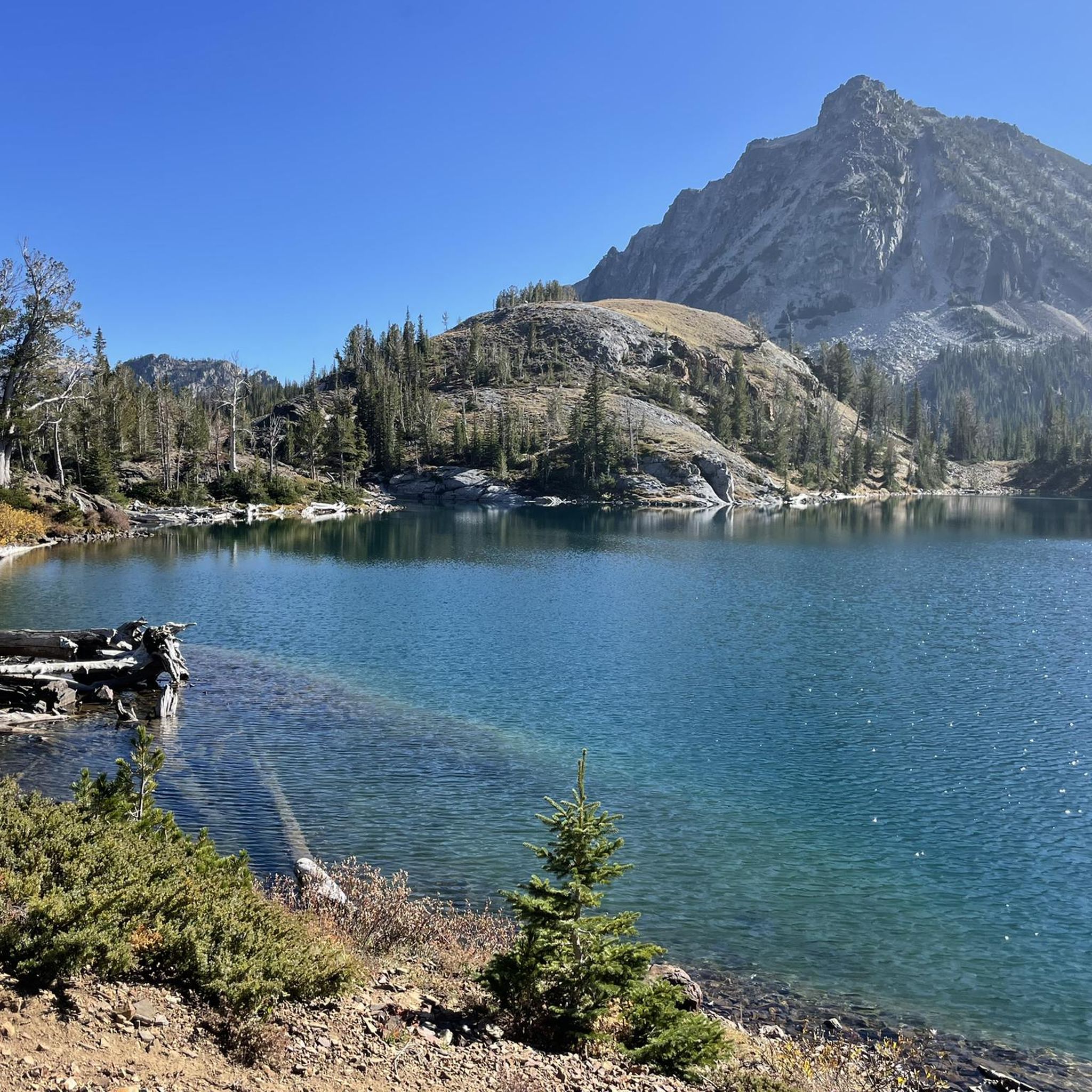
We were stunned to realize that there is a small, sandy beach on the west end of the lake. Mountain bluebirds fill the shrubs nearby. An excellent place to enjoy the mountain sun and the tropical blue colors of Ice Lake.
0
0
The trail to the summit of the Matterhorn is fairly well defined even as a user trail. Accessing this summit is one of the easier options in the area and provides sweeping views of the surrounding peaks.
0
0
Frequently Asked Questions
Are there many family-friendly hikes in Wallowa County?
Yes, the area offers several options suitable for families. While many trails involve significant climbs, you can find gentler paths. The Wallowa River Hydroplant — Eagle Cap Wilderness trail is a moderate, shorter walk that follows the river. For a very easy, accessible path, the Iwetemlaykin Heritage Trail near Joseph is a great choice for all ages.
Can I bring my dog on the hiking trails?
Dogs are generally welcome on trails in the Wallowa-Whitman National Forest and the Eagle Cap Wilderness, but they must be under your control. Regulations often require dogs to be on a leash, especially in busy areas, near trailheads, and around lakes to protect wildlife and the experience of other hikers. Always carry waste bags and pack out everything.
What are some good options for a long day hike or backpacking trip?
The Wallowas are ideal for multi-day trips. For a substantial day hike or the start of a longer journey, consider the Frazier Lake — Eagle Cap Wilderness route. It's a challenging trek that rewards with classic alpine scenery. Many trails, like those starting from the Wallowa Lake Trailhead, serve as gateways to the extensive network within the Eagle Cap Wilderness, leading to numerous lakes perfect for overnight stays.
What is the best time of year to hike in the Wallowas?
The prime hiking season is typically from July through September. During these months, the high-elevation trails are mostly snow-free, and the weather is generally stable. Wildflowers are often at their peak in July and early August. Snow can linger in the high country well into June, and early snowfalls can occur in October, so always check current conditions before you go.
Are there any hikes that feature waterfalls?
While the region is more famous for its alpine lakes, you can find waterfalls on some trails. The Chief Joseph Trail is well-known for its waterfall. Additionally, many routes that follow river valleys, such as the Echo Lake via Hurricane Creek Trail — Eagle Cap Wilderness, feature cascades and rushing water, especially during the spring and early summer snowmelt.
Where can I find hikes starting near Wallowa Lake?
Wallowa Lake is a major hub for hiking. The Wallowa Lake Trailhead, located at the south end of the lake, is the starting point for many iconic trails into the Eagle Cap Wilderness, including the West Fork Wallowa River Trail which leads towards the Lakes Basin. You can also access the trails on Mount Howard via the Wallowa Lake Tramway for stunning panoramic views.
What do other hikers say about the trails in Wallowa County?
The trails in this region are highly regarded by the komoot community. Hikers frequently praise the spectacular alpine scenery, the pristine lakes, and the vastness of the Eagle Cap Wilderness. The well-maintained trail system and the sense of true wilderness are common themes in reviews.
How many hiking trails are there in Wallowa County?
There are over 20 designated hiking routes in Wallowa County on komoot, ranging from easy nature walks to challenging multi-day backpacking expeditions. This network covers the diverse landscapes of the region, from the Wenaha-Tucannon Wilderness to the heart of the Wallowa Mountains.
Do I need a permit to hike in the Eagle Cap Wilderness?
Yes, a Wilderness Permit is required for both day and overnight use in the Eagle Cap Wilderness. These are free and self-issued at the trailhead kiosks. The permit helps the Forest Service monitor visitor use and manage the wilderness area. Always fill one out before starting your hike.
What are some challenging hikes that lead to a lake?
The area specializes in strenuous but rewarding hikes to alpine lakes. For a tough climb to a beautiful, less-visited lake, the trail to Francis Lake — Eagle Cap Wilderness is an excellent choice. It involves significant elevation gain and distance, making it a serious undertaking for experienced hikers.
Are there any good hikes in the area that aren't in the Eagle Cap Wilderness?
Yes, there are great options outside of the main Eagle Cap area. The Elk Flats Trail — Wenaha-Tucannon Wilderness offers a different perspective on the region's rugged beauty. This moderate trail explores the canyons and grasslands characteristic of the northern part of the county.
What should I know about parking at the trailheads?
Parking is available at most major trailheads, such as the popular Wallowa Lake Trailhead and Hurricane Creek Trailhead. However, these lots can fill up very quickly, especially on weekends during the peak summer season. It's best to arrive early to secure a spot. A Northwest Forest Pass or equivalent day-use fee is often required for parking.
Most popular routes in Wallowa County
Most popular attractions in Wallowa County

Get inspired with the komoot mobile app


Didn’t find what you were looking for?
Check out more Hikes throughout Wallowa County below and find the perfect route in your destination.
Explore more
Browse the best Hikes in other regions.
