The best cycling routes around Morské oko
5.0
(7)
94
riders
4
rides
Touring cycling around Morské oko offers routes through the Vihorlat Mountains, a region characterized by its volcanic origin and varied terrain. The area features the largest non-karst lake in Slovakia, surrounded by ancient primeval beech forests, a UNESCO World Heritage Site. These landscapes provide a mix of paved and unpaved roads, with significant elevation changes. The region's natural features create a challenging environment for touring cyclists.
Best touring cycling routes around Morské oko
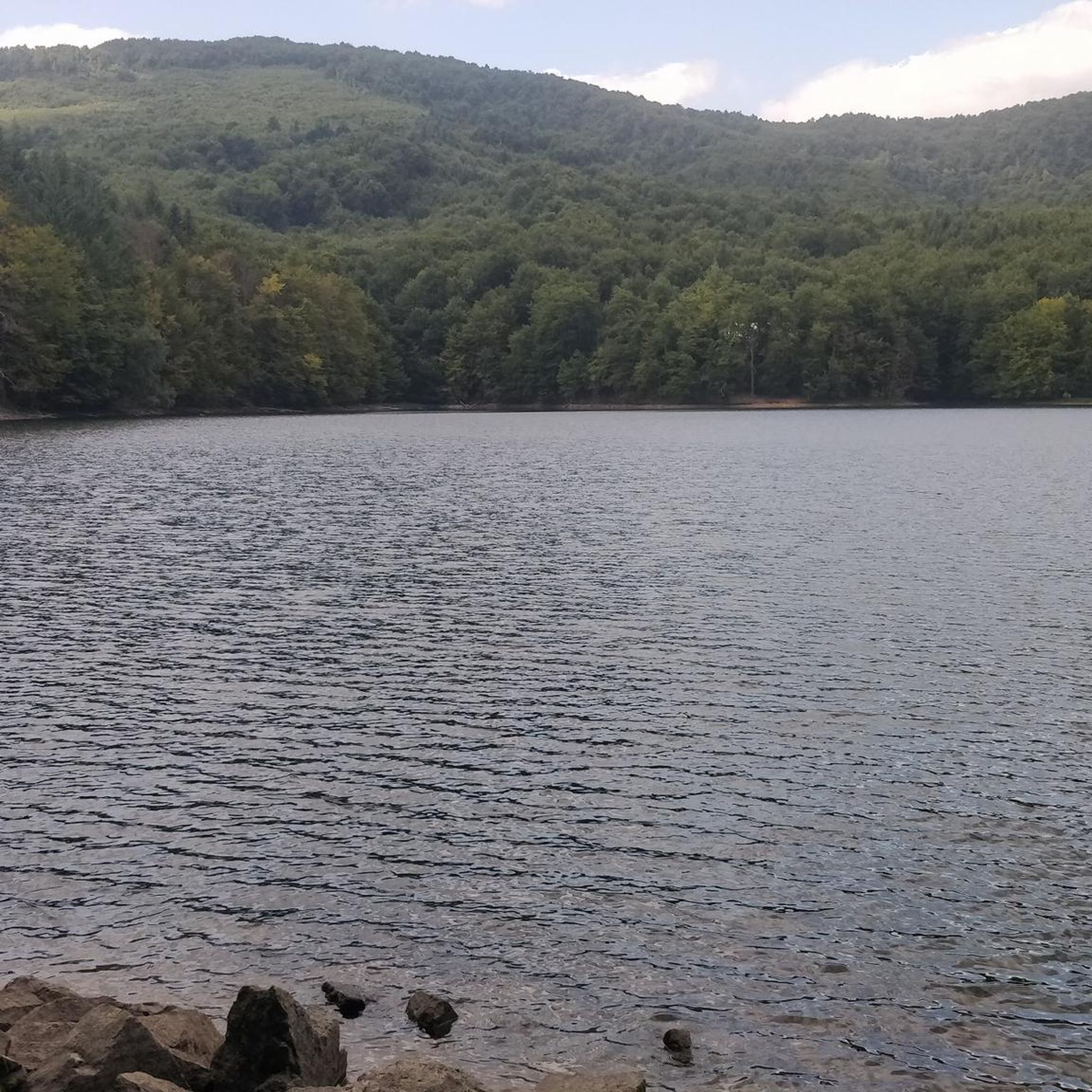
- The most popular touring cycling route is Morské Oko loop from Morské oko, a 13.7 miles (22.1 km) trail that takes 1 hour 38 minutes to complete. This difficult route circles the lake, offering views of the surrounding forests.
- Another top favourite among local touring cyclists is Morské oko – Tri tably loop from Remetské Hámre, a difficult 24.4 miles (39.2 km) path. This route traverses the Vihorlat Mountains, featuring significant elevation gain through forested landscapes.
- Local touring cyclists also love the Poloniny Dark Sky Park – River Crossing loop from Snina, a 18.7 miles (30.0 km) trail leading through the Poloniny Dark Sky Park and across rivers, often completed in about 2 hours 3 minutes.
- Touring cycling around Morské oko is defined by volcanic mountains, primeval beech forests, and varied terrain. The network offers options for experienced cyclists seeking challenging routes.
- The routes in Morské oko are highly rated by the komoot community with an average score of 5.0 stars from over 3 reviews. More than 70 touring cyclists have used komoot to explore Morské oko's varied terrain.
Last updated: October 5, 2026
7
riders
22.1km
01:39
490m
490m
Hard bike ride. Very good fitness required. Mostly paved surfaces. Suitable for all skill levels.
9
riders
39.9km
03:02
880m
880m
Hard bike ride. Very good fitness required. Mostly paved surfaces. Suitable for all skill levels.

6
riders
30.1km
02:04
480m
480m
Hard bike ride. Very good fitness required. Mostly paved surfaces. Suitable for all skill levels.
5.0
(1)
5
riders
65.5km
04:30
820m
820m
Hard bike ride. Very good fitness required. Mostly paved surfaces. Suitable for all skill levels.
5.0
(3)
39
riders
55.6km
03:35
730m
730m
Hard bike ride. Very good fitness required. Mostly paved surfaces. Suitable for all skill levels.
Our route recommendations are based on thousands of hikes, rides, and runs completed by other people on komoot.
Start today with a free account
Your next adventure awaits.
Popular around Morské oko
Tips from the Community

More information and photos: https://pl.wikipedia.org/wiki/Prze%C5%82%C4%99cz_nad_Roztokami_G%C3%B3rnymi https://mapa-turystyczna.pl/node/przelecz-nad-roztokami#49.14426/22.33040/14 https://goryaktywnie.pl/przelecz-nad-roztokami https://odtur.pl/atrakcje/cisna-przelecz-nad-roztokami-gornymi-55250.html
2
0


The Greek Catholic wooden church in the village of Kalná Roztoka was built in 1750. It is dedicated to the feast of the Nativity of the venerable and famous prophet of the Lord, the forerunner and baptist John. The wooden temple in Klaná Roztok was built in log style. The temple consists of a sanctuary, nave and vestibule. The vestibule has a tower with a dome and a three-armed cross. The shrine has a three-armed cross on its roof. The temple tower and the temple roof are covered with wooden shingles. This temple is unique in that its wooden walls are plastered inside and out and painted with lime in an attempt to protect the temple from adverse weather.
0
0

Border crossing between Poland and Slovakia
0
0

Approximately 200-300 m of asphalt exit to the Slovak side. Then a road paved with flat stones begins
0
0

The cycle path ends before Snina. Here you can cross the river
0
0
Ruské (until 1927 Slovak Ruská; Hungarian Zemplénoroszi - until 1907 Oroszruszka)[1] is a former village in Okres Snina (Prešovský kraj) and today a cadastral municipality of Stakčín in eastern Slovakia. It is located in the Bukovské vrchy Mountains below the main Carpathian ridge in the source area of the Cirocha River and near the state border with Poland. The former town center lies at an altitude of 486 m above sea level, the distance to Snina is about 26 kilometers. The Pľaša National Nature Reserve extends to the east of the town,[2] the cadastral municipality as such lies entirely in the Poloniny National Park. The end of the town came with the construction of the Starina reservoir on the Cirocha further downstream in the 1980s. Although it was far from the flooded area, an extensive drinking water protection area meant that all villages in the upper Cirocha valley, including Ruské, had to be evacuated. In 1986, the displaced village was incorporated into Stakčín. Today, only the municipal cemetery, the military cemetery from the First World War, a chapel on the site of the demolished church from 1789 and three houses stand on the site of the former village. A stone road from 1861, the so-called Porta Rusica, leads to the Ruské sedlo saddle on the border with Poland.[5]
0
0
Porta Rusica stone road On the cadastral area of the former village of Ruské, in the area of the Starina reservoir, there is the Porta Rusica stone road, which has been declared a cultural monument. This road was built between 1861 and 1865 and originally led from Michalowiece through the Russian border crossing Sattel to the Polish town of Baligród, from where it probably continued to Lviv. The Porta Rusica stone road thus connected Hungary with Lesser Poland. It is the only road that has survived from this period in the territory of Slovakia. The Porta Rusica stone road is still preserved today on a section with a length of 4 km, with 16 bends and a height of 247 m. On the Polish side, it is only a short section, about 200 m long. Porta Rusica is also part of the tourist border crossing with Poland - Osadné - Balnica.
0
0
Frequently Asked Questions
What is the general difficulty level for touring cycling routes around Morské oko?
The touring cycling routes listed in this guide are generally considered difficult, featuring significant elevation changes and varied terrain. For example, the Morské Oko loop from Morské oko covers 22.1 km with nearly 500 meters of ascent. While the wider region offers options for various skill levels, the specific routes highlighted here are best suited for experienced cyclists.
Are there any circular touring cycling routes around Morské oko?
Yes, many of the touring cycling routes around Morské oko are designed as loops. For instance, you can explore the Morské Oko loop from Morské oko, which circles the lake, or the more challenging Morské oko – Tri tably loop from Remetské Hámre, traversing the Vihorlat Mountains.
What kind of landscapes can I expect to see while touring cycling in the Morské oko region?
The Morské oko region, nestled in the Vihorlat Mountains, offers diverse landscapes. You'll cycle through ancient primeval beech forests, a UNESCO World Heritage Site, and experience terrain shaped by volcanic activity. Expect a mix of paved and unpaved roads, with breathtaking views of the largest non-karst lake in Slovakia and the surrounding mountainous scenery.
What are some notable viewpoints or attractions along the touring cycling routes?
While cycling, you'll encounter stunning natural beauty. The lake itself, Morské oko, is a central attraction. For panoramic views, consider a hike to Sninský Kameň, a prominent rock formation in the Vihorlat Hills, which offers vistas of the forests and the Eastern Slovakian Lowland. The Poloniny Dark Sky Park – River Crossing loop from Snina also offers unique scenery through the Dark Sky Park.
Is it possible to cycle with dogs on the touring routes around Morské oko?
The suitability for cycling with dogs depends on the specific route and your dog's fitness. Given that all listed touring cycling routes are classified as difficult with significant elevation changes and varied terrain, they might be challenging for some dogs. Always ensure your dog is capable of the distance and terrain, and respect local regulations regarding pets in protected areas.
What is the best time of year for touring cycling around Morské oko?
The best time for touring cycling around Morské oko is typically during the warmer months, from late spring to early autumn (May to October). During this period, the weather is generally more stable, and the primeval beech forests are in full bloom or displaying autumn colors. Always check local weather conditions before heading out, as mountain weather can change rapidly.
Are there any cafes or places to rest near the touring cycling routes?
While the region is known for its natural, untouched character, there are limited facilities directly on the more remote routes. It's advisable to plan your stops in nearby towns like Snina or Remetské Hámre, which serve as starting points for some tours, such as the Morské Oko loop from Snina. Always carry sufficient water and snacks, especially on longer rides.
What should I pack for a touring cycling trip in Morské oko?
Given the difficult nature of the routes and the mountainous terrain, it's essential to pack appropriately. We recommend carrying plenty of water, energy-rich snacks, a repair kit for your bike, appropriate cycling attire for varying weather conditions, a first-aid kit, and a fully charged phone. Navigation tools like komoot are also highly recommended, as some areas can be remote.
What do other touring cyclists enjoy most about touring cycling in Morské oko?
The area is highly rated by the komoot community, with an average score of 5.0 stars. Reviewers often praise the stunning natural beauty, the challenge of the mountainous terrain, and the immersive experience of cycling through the ancient primeval beech forests. The sense of adventure and the quiet, unspoiled nature are frequently highlighted.
Are there options for public transport to reach the touring cycling routes?
Access to the Morské oko region is primarily via road. While specific public transport options directly to trailheads might be limited, towns like Snina and Remetské Hámre, which are starting points for routes such as the River Crossing – Stariná Reservoir loop from Snina, may have bus connections. It's best to check local transport schedules in advance if you plan to use public transport.
Can I find parking facilities near the starting points of the cycling routes?
Parking facilities are generally available in the towns and villages that serve as common starting points for the touring cycling routes, such as Snina or Remetské Hámre. When planning your trip, it's advisable to research specific parking options for your chosen trailhead, especially during peak season, to ensure a smooth start to your ride.
Are there any restrictions on activities at Morské oko lake itself?
Yes, Morské oko is a national nature reserve with the highest level of protection. Due to its ecological significance, activities such as boating, swimming, and fishing are strictly prohibited in the lake itself. Cyclists can enjoy the scenic views of the lake from the surrounding trails, but direct interaction with the water is restricted to preserve its natural state.
Most popular routes around Morské oko

Get inspired with the komoot mobile app


