The best running trails around Etang De Gabriau
4.0
(3)
67
runners
21
runs
Jogging around Etang De Gabriau offers routes through a landscape characterized by numerous ponds and lakes, interspersed with woodlands and nature reserves. The terrain is generally flat, with minimal elevation changes, making it suitable for various running abilities. This region, part of the Brenne Regional Natural Park, provides a tranquil setting for outdoor activity.
Best jogging routes around Etang De Gabriau
- The most popular jogging route is Étang des Maléteries – Bois de Nouzières loop from Île des Soudelles,…
Last updated: May 22, 2026
5.0
(1)
4
runners
Hard run. Very good fitness required. Mostly paved surfaces. Suitable for all skill levels.
5.0
(1)
2
runners
9.82km
01:06
30m
30m
Moderate run. Good fitness required. Mostly paved surfaces. Suitable for all skill levels.

Sign up for free
5
runners
9.55km
00:59
40m
40m
Moderate run. Good fitness required. Mostly paved surfaces. Suitable for all skill levels.
3
runners
12.0km
01:19
30m
30m
Moderate run. Good fitness required. Mostly paved surfaces. Suitable for all skill levels.
1
runners
Moderate run. Good fitness required. Mostly paved surfaces. Suitable for all skill levels.
Get access to more routes and recommendations from other explorers.
Sign up for free
Already have an account?
Our route recommendations are based on thousands of hikes, rides, and runs completed by other people on komoot.
Start today with a free account
Your next adventure awaits.
Login or Signup
Tips from the Community

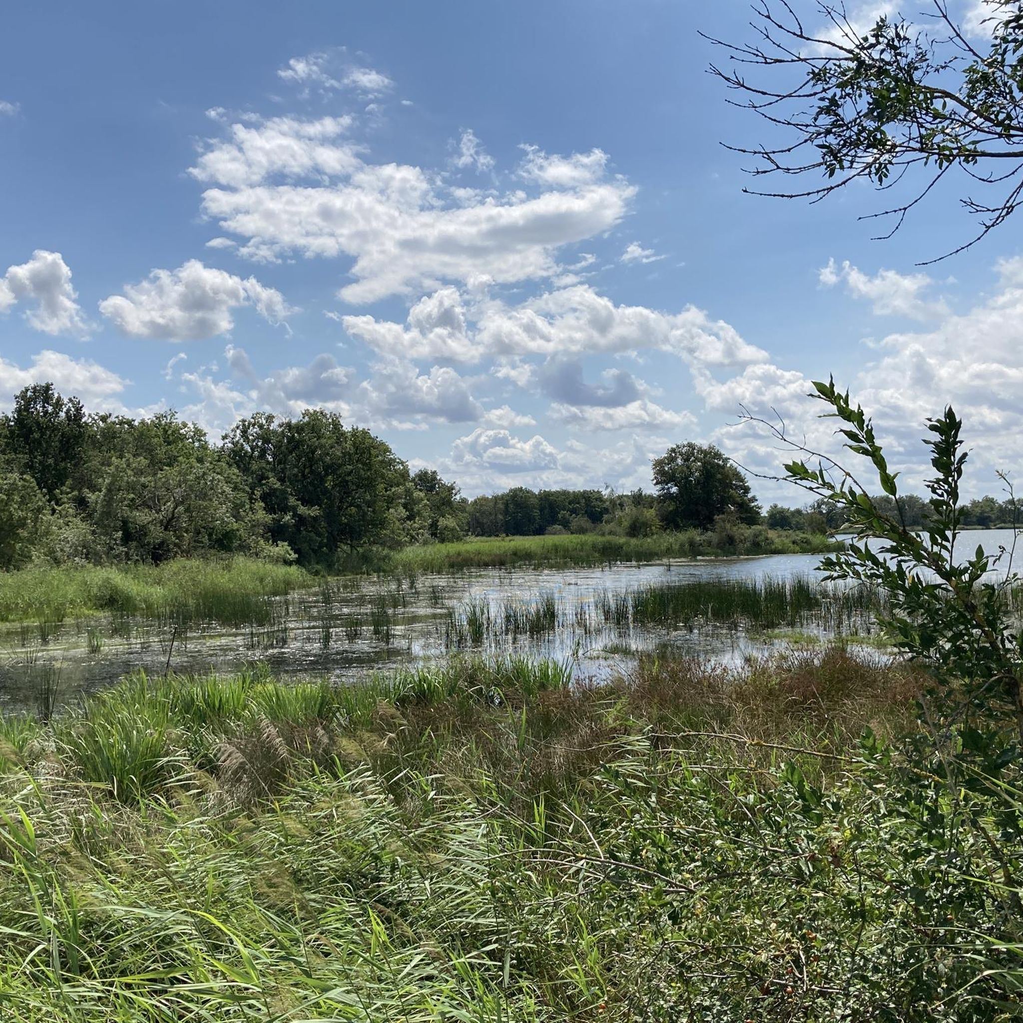
This park is known for its 3,000 ponds, 267 species of birds, 100,000 pond turtles, 1,600 plant species including wild orchids and thousands of insects and animals. The Brenne Regional Natural Park attracts thousands of visitors each year in search of a calm, natural and authentic setting.
0
0

A unique experience of running on this pond in the heart of the Regional Natural Park of Brenne - the country of 1000 ponds.
2
0
Frequently Asked Questions
How many running routes are available around Etang De Gabriau?
There are over 20 running routes available for jogging around Etang De Gabriau, offering a variety of distances and experiences within the Brenne Regional Natural Park.
Are there easy running paths suitable for beginners in Etang De Gabriau?
While there are no routes specifically classified as 'easy', the terrain around Etang De Gabriau is generally flat with minimal elevation changes. Many of the moderate routes, such as the Étang de Rochefort loop from Île des Soudelles (6.1 miles), are well-suited for runners of varying abilities, including beginners looking for a gentle challenge.
What options are there for longer distance running trails?
For those seeking longer distances, the Étang des Maléteries – Bois de Nouzières loop from Île des Soudelles is a challenging 10.5-mile (16.9 km) trail. Another good option is the Le Blizon loop, which covers approximately 8.6 miles (13.9 km) through the Terres et Étangs de Brenne Nature Reserve.
Are dogs allowed on the jogging paths around Etang De Gabriau?
Yes, dogs are generally welcome on the jogging paths in the Brenne Regional Natural Park, including those around Etang De Gabriau. However, it's always recommended to keep them on a leash, especially in nature reserve areas, to protect local wildlife and ensure a pleasant experience for all users.
Are there any circular running loops available?
Many of the routes in the area are circular loops, perfect for a continuous run. Examples include the popular Étang de Rochefort loop from Île des Soudelles and the Running loop from Lingé, both offering scenic circuits.
What kind of scenery can I expect while running in this region?
The region is characterized by a tranquil landscape of numerous ponds and lakes, interspersed with woodlands and nature reserves. You can expect peaceful views of water bodies, diverse birdlife, and lush forest paths, typical of the Brenne Regional Natural Park.
What do other runners enjoy most about jogging in Etang De Gabriau?
The area is highly rated by the komoot community, with an average score of 4.0 stars. Runners often praise the tranquil setting, the flat terrain suitable for various abilities, and the beautiful natural scenery of lakes and woodlands that define the Brenne Regional Natural Park.
Is public transport available to access the running trails?
Public transport options directly to the trailheads around Etang De Gabriau are limited. It is generally recommended to access the area by car, which allows for more flexibility in reaching various starting points for the routes.
Are there any challenging running routes for experienced runners?
Yes, for experienced runners seeking a challenge, the Étang des Maléteries – Bois de Nouzières loop from Île des Soudelles is classified as difficult. This 10.5-mile route offers a substantial distance through woodlands and past lakes, providing a good test of endurance.
What is the best season for running around Etang De Gabriau?
Spring and autumn are often considered ideal for running in the region, with milder temperatures and beautiful natural colors. Summer can also be pleasant, especially in the mornings or evenings, though some paths might be more exposed to the sun. Winter offers a different, quieter beauty, but trails might be damp.
Are there any running routes that pass through nature reserves?
Yes, several routes traverse or are adjacent to nature reserves. For example, the Running loop from Réserve naturelle de Chérine is a moderate 7.4-mile (11.9 km) route that takes you through this significant natural area, offering opportunities for wildlife spotting.
Are the running paths suitable for families with children?
Given the generally flat terrain and moderate difficulty of many routes, several paths are suitable for families. Shorter, well-maintained sections of routes like the Étang de Rochefort loop can be enjoyed by families looking for a pleasant outdoor activity, though supervision is always recommended.
Most popular routes around Etang De Gabriau

Get inspired with the komoot mobile app


Explore more
Browse the best Running Trails & Routes in other regions.
