The best cycling routes around Lac De Calacuccia
4.8
(107)
1,344
riders
15
rides
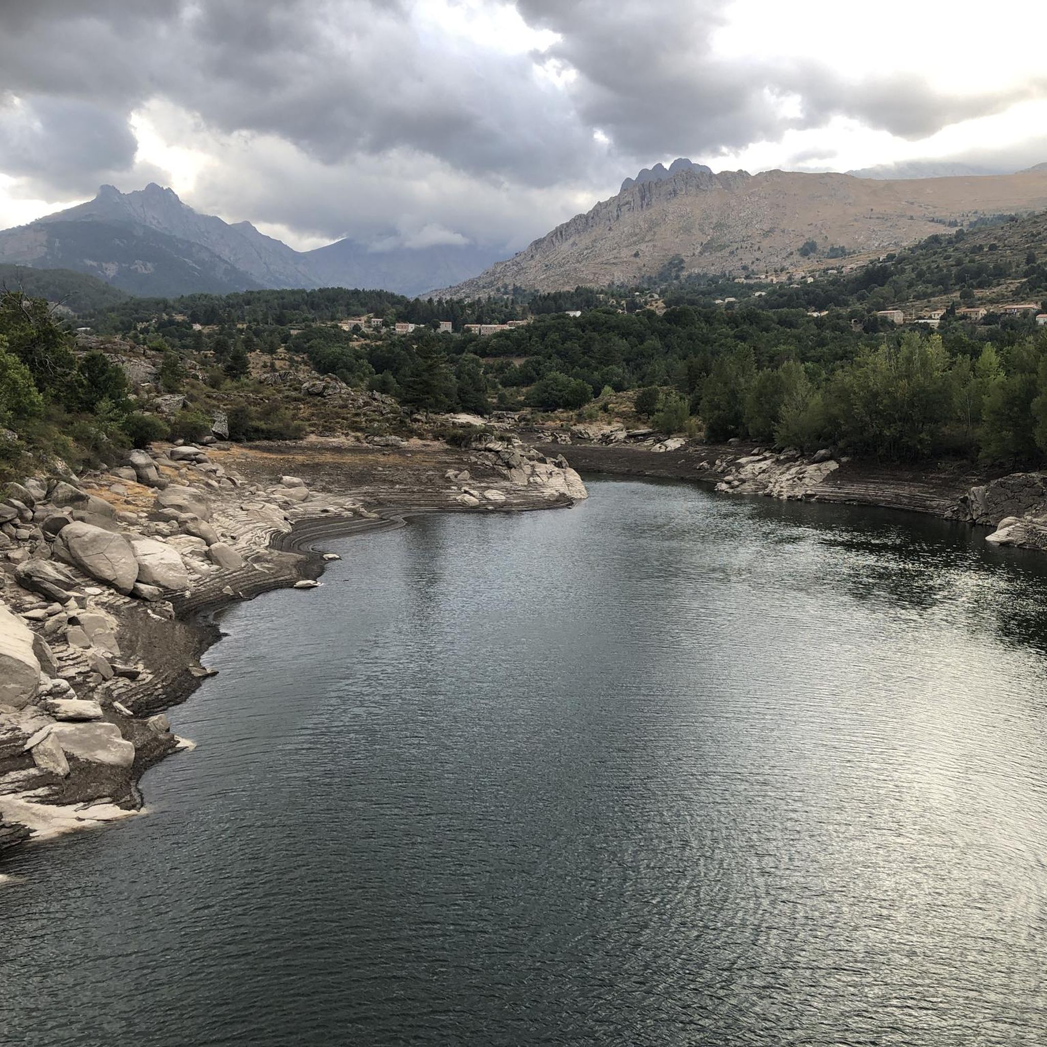
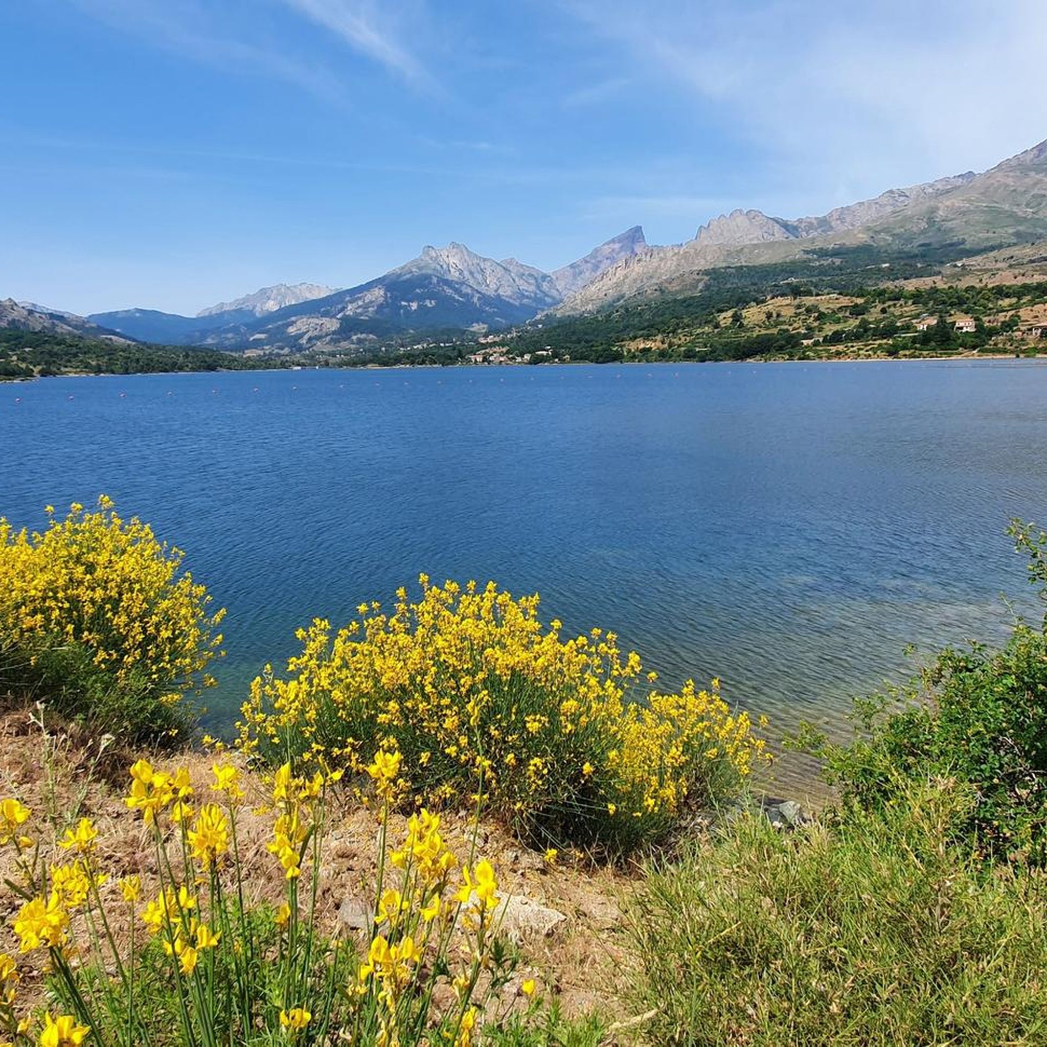
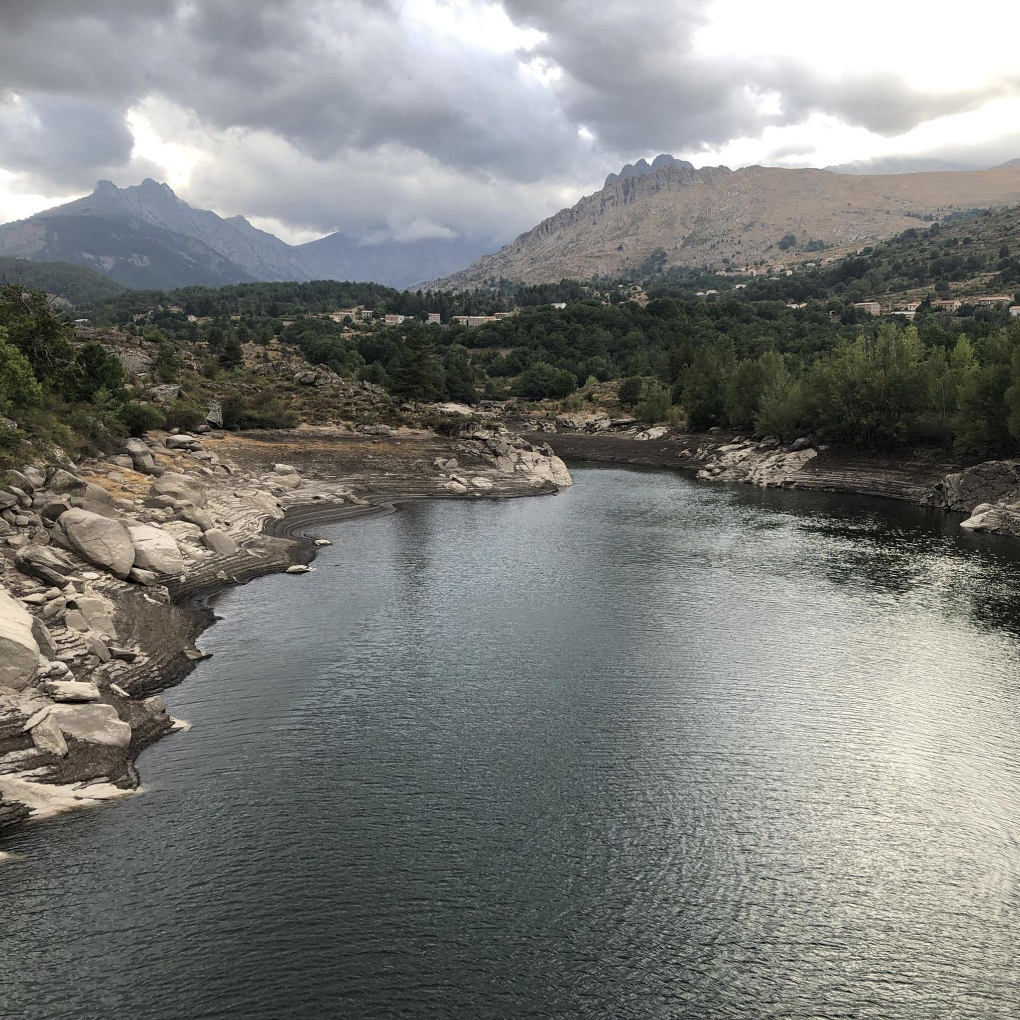
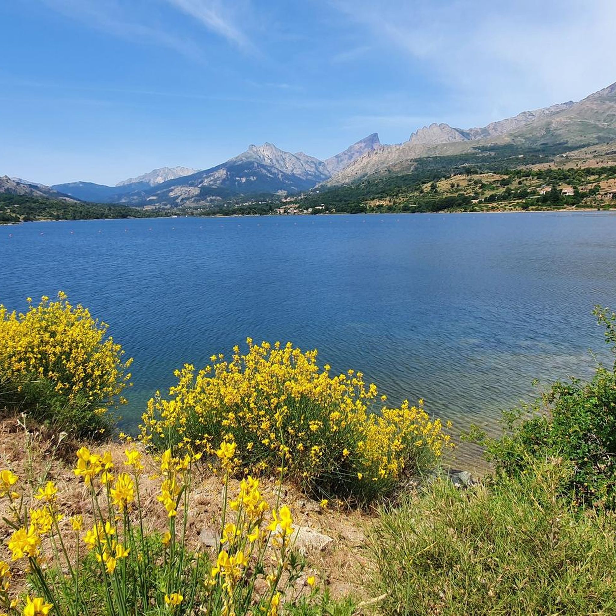
Touring cycling routes around Lac de Calacuccia are situated in Corsica's mountainous Niolu region, at an altitude of approximately 800 meters. The artificial lake, formed by damming the Golo river, is a central feature within the rugged landscape of the Parc naturel régional de Corse. The region is characterized by formidable mountainous terrain, including peaks like Monte Cinto, and the dramatic Scala di Santa Regina Gorge, offering diverse and challenging cycling conditions. Deep forests and valleys complement the rocky peaks,…
Last updated: June 28, 2026
4.7
(18)
146
riders
56.6km
03:58
1,120m
1,120m
Hard bike ride. Very good fitness required. Mostly paved surfaces. Suitable for all skill levels.
5.0
(2)
29
riders
29.7km
02:30
730m
730m
Hard bike ride. Very good fitness required. Mostly paved surfaces. Suitable for all skill levels.

Sign up for free
5.0
(2)
26
riders
18.6km
01:19
330m
330m
Moderate bike ride. Good fitness required. Mostly paved surfaces. Suitable for all skill levels.
5.0
(2)
8
riders
9.38km
00:37
140m
140m
Easy bike ride. Great for any fitness level. Mostly paved surfaces. Suitable for all skill levels.
4.0
(5)
42
riders
17.7km
01:13
320m
320m
Moderate bike ride. Good fitness required. Mostly paved surfaces. Suitable for all skill levels.
Get access to more routes and recommendations from other explorers.
Sign up for free
Already have an account?
Our route recommendations are based on thousands of hikes, rides, and runs completed by other people on komoot.
Start today with a free account
Your next adventure awaits.
Login or Signup

Tips from the Community

wonderful and very beautiful here
3
0


very pretty here, very pretty
3
0

Be careful, contrary to the recommended route, there is a locked barrier at the bottom of the path. The rest of the route could only have been driven in an off-road vehicle, which added several kilometers and meters of elevation, with the result that we had to stop early due to time constraints. So please plan about 4 hours more if you are setting off from the campsite.
0
0


Built in 1968, the Calacuccia Dam retains water from the Golo River. Its lake is shared between the communes of Calacuccia and Casamaccioli in the Niolo region.
0
0
Frequently Asked Questions
How many touring cycling routes are available around Lac de Calacuccia?
There are 17 touring cycling routes available around Lac de Calacuccia, offering a variety of experiences for different skill levels.
What are the difficulty levels of touring cycling routes in the Lac de Calacuccia area?
The routes around Lac de Calacuccia cater to various abilities. You'll find 2 easy routes, 6 moderate routes, and 9 difficult routes, ensuring options for beginners to experienced cyclists.
Are there any easy touring cycling routes suitable for beginners around Lac de Calacuccia?
Yes, there are easy routes available. For a gentle introduction to the area, consider the Ponte Altu – Calacuccia loop from Casamaccioli, which is 11.7 km long and takes approximately 44 minutes to complete.
Can I find circular touring cycling routes around Lac de Calacuccia?
Many routes in the area are designed as loops. For example, the Calacuccia – Calacuccia Dam loop from Calacuccia offers a 10.4 km circular path around the lake, typically completed in about 42 minutes.
What are some of the most scenic viewpoints or natural features to see along the touring cycling routes?
The region is rich in dramatic landscapes. You'll encounter the formidable Niolu Mountain Range, the serene Lac de Calacuccia itself, and the spectacular Scala di Santa Regina Gorge, which offers panoramic views. Majestic peaks like Monte Cinto and Paglia Orba also dominate the skyline.
What is the best time of year to go touring cycling around Lac de Calacuccia?
Given its mountainous terrain and altitude, the warmer months, typically from late spring to early autumn, are ideal for touring cycling around Lac de Calacuccia. This avoids the winter snows and offers more pleasant temperatures for exploring.
Are there any routes that pass through the dramatic Scala di Santa Regina Gorge?
Yes, the The Steps of Santa Regina – Corte loop from Calacuccia is a challenging 54.8 km route that traverses the dramatic Scala di Santa Regina Gorge, offering an unforgettable experience with its austere and deep gorges.
What do other touring cyclists say about the routes in Lac de Calacuccia?
The area is highly rated by the komoot community, with an average score of 4.5 stars from over 90 reviews. Cyclists often praise the diverse terrain, from the serene lake views to the challenging mountain passes, and the overall natural beauty of the Niolu region.
Are there any moderate touring cycling routes for those looking for a balanced challenge?
Absolutely. A popular moderate option is the Ponte Altu – Albertacce loop from Casamaccioli. This 18.6 km path leads through the mountainous landscapes of the Niolu region, providing scenic views without being overly strenuous.
Is parking available near the touring cycling trailheads in Lac de Calacuccia?
Yes, the region's focus on outdoor activities means that parking is generally available near trailheads and key attractions, making it convenient for cyclists to access the routes.
Are there any touring cycling routes that offer views of the Golo River?
The Golo River is a significant natural element of the area, feeding Lac de Calacuccia and carving features like the Scala di Santa Regina Gorge. Routes that follow the lake or traverse the gorge, such as the The Steps of Santa Regina – Corte loop from Calacuccia, will offer views of this important waterway.
Are there any longer touring cycling routes for more ambitious cyclists?
For ambitious cyclists, the The Steps of Santa Regina – Corte loop from Calacuccia is a difficult 54.8 km route that takes nearly 4 hours to complete, offering a substantial challenge and extensive exploration of the region.
Most popular routes around Lac De Calacuccia

Get inspired with the komoot mobile app


Explore more
Browse the best Cycling routes in other regions.
