The best walks and hikes around Bassin De Réaltor
4.5
(398)
2,866
hikers
179
hikes
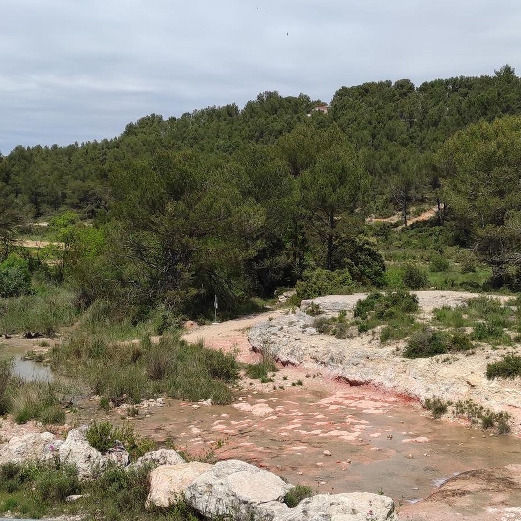
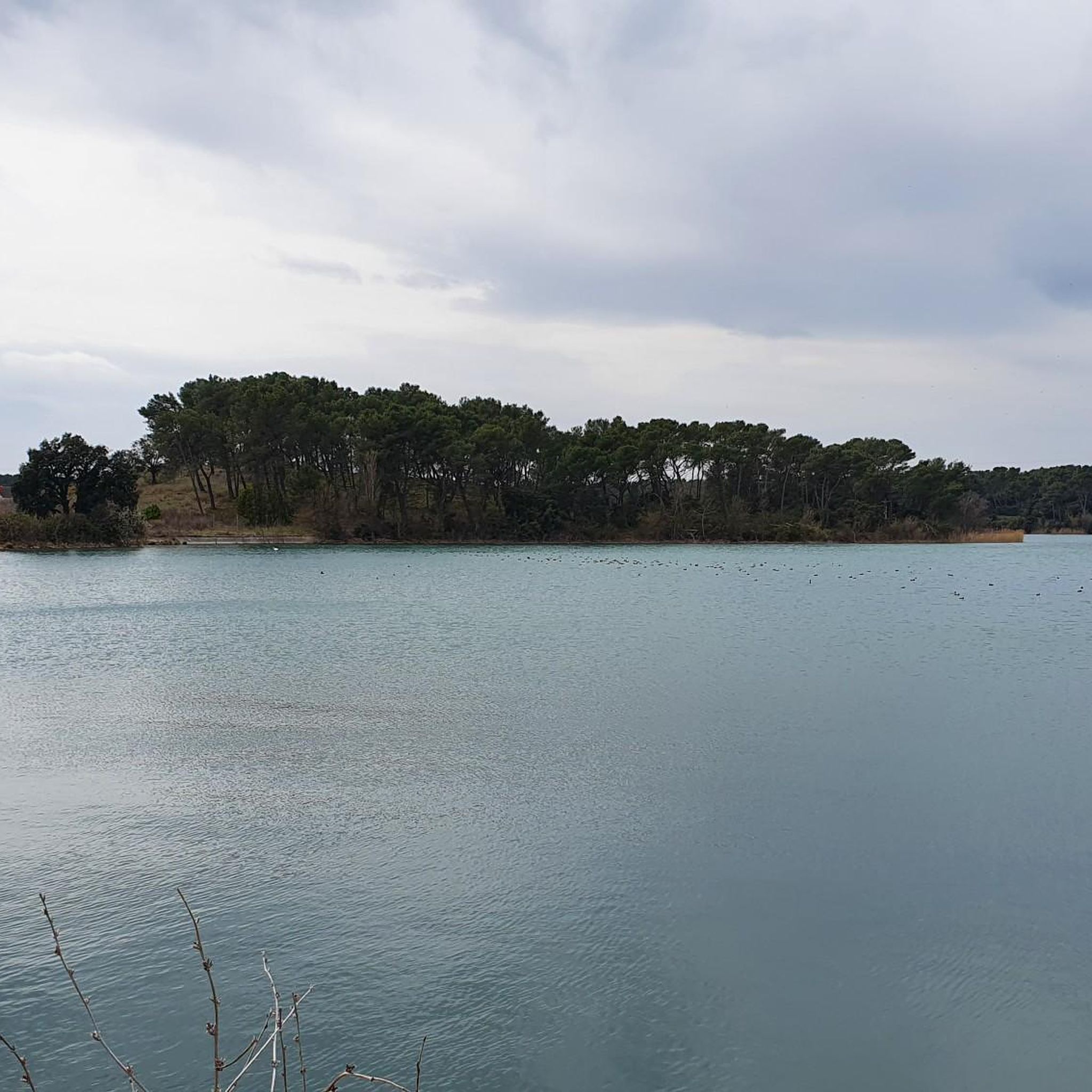
Hiking around Bassin De Réaltor features an artificial lake, surrounded by the low hills of the Arbois plateau. The terrain includes Provençal garrigue, pine trees, and green oaks, offering varied landscapes for outdoor activities. This region provides views of the surrounding hills and a humid environment contrasting with typical Provençal shrubland. The area is recognized for its biological value, serving as a refuge and nesting ground for numerous bird species.
Best hiking trails around Bassin De Réaltor
- The most popular hiking route is Réaltor Dam – Réaltor Basin loop from Domaine du Réaltor, a 6.3 miles (10.1 km) trail that takes 2 hours 38 minutes to complete, looping around the basin with views of the surrounding hills.
- Another top favourite among local hikers is Under the bamboo – Réaltor Reservoir loop from Aix-en-Provence TGV, a moderate 5.8 miles (9.3 km) path traversing varied Provençal landscapes.
- Local hikers also love the Under the bamboo – Réaltor Reservoir loop from Domaine de l'Arbois, a 3.0 miles (4.8 km) trail leading through garrigue and forest, often completed in about 1 hour 16 minutes.
- Hiking around Bassin De Réaltor is defined by its artificial lake, garrigue, and forests, set within low hills. The network offers options for easy, moderate, and some more challenging routes, catering to different ability levels.
- The routes in Bassin De Réaltor are highly rated by the komoot community with an average score of 4.5 stars from over 330 reviews. More than 2500 hikers have used komoot to explore Bassin De Réaltor's varied terrain.
Last updated: July 9, 2026
3.0
(4)
10
hikers
10.1km
02:39
80m
80m
Moderate hike. Good fitness required. Easily-accessible paths. Suitable for all skill levels.
5.0
(1)
14
hikers
8.95km
02:23
100m
100m
Moderate hike. Good fitness required. Easily-accessible paths. Suitable for all skill levels.

Sign up for free
3.5
(2)
6
hikers
Easy hike. Great for any fitness level. Easily-accessible paths. Suitable for all skill levels.
5.0
(5)
33
hikers
8.75km
02:23
130m
130m
Moderate hike. Good fitness required. Easily-accessible paths. Suitable for all skill levels.
5.0
(1)
10
hikers
Moderate hike. Good fitness required. Easily-accessible paths. Suitable for all skill levels.
Get access to more routes and recommendations from other explorers.
Sign up for free
Already have an account?
Our route recommendations are based on thousands of hikes, rides, and runs completed by other people on komoot.
Start today with a free account
Your next adventure awaits.
Login or Signup

Tips from the Community

Drive the scenic roads above Rognac and enjoy stunning views of the Étang de Berre. As you reach the heights, the vast expanse of this lagoon stretches out before you, framed by rolling hills and distant mountains. The shimmering waters reflect the sunlight, creating a breathtaking panorama that is well worth the climb. Don’t forget to pause and admire the scenery before heading back down, enjoying the coastal breeze.
0
0

This reservoir was created during the construction of the Marseille canal in the 19th century to supply the city. It is a beautiful nature reserve in the heart of the hills of the Arbois plateau. The site is a very rich ornithological reserve, and you can observe many species such as coots, swans, cormorants and egrets.
1
0

I did part of this route. The views are magnificent and the route very pleasant. Everything is spoiled by the fly-tipping and the shanty town set up near the TGV station. Unacceptable in a departmental park where signs order us not to throw away our papers!
2
0

Planted on the banks of the Réaltor basin, these bamboos create a tunnel through which you can speed along. In places, however, the vegetation allows you to glimpse the body of water.
1
0

Magnificent panorama with easy gravel access
1
0
Beautiful trail with great views
1
0

A small, easily accessible natural setting, surrounded by pretty trails and pleasant tracks, both for walking and mountain biking or gravel bikes. The Réaltor basin offers a beautiful diversity in terms of bird life: coots, grebes, swans, cormorants, egrets... and more during migration periods. Note that the banks on the north-east side (Calas side) are open to the public, but the south-west part (TGV station side), belonging to the Société des Eaux de Marseille, is fenced and inaccessible.
1
0

Very pleasant passages in the forest
0
1
Frequently Asked Questions
How many hiking trails are available around Bassin De Réaltor?
There are over 175 hiking trails around Bassin De Réaltor. These routes cater to various fitness levels, with 76 easy, 92 moderate, and 7 difficult options.
What is the best time of year to go hiking around Bassin De Réaltor?
The mild climate allows for hiking throughout the year. Spring (March to June) offers vibrant flora and greenery, while autumn provides warm colors and a peaceful atmosphere. Even in winter, clear views can be enjoyed. During summer, it's best to hike in the mornings to avoid the heat.
What kind of terrain can I expect on the trails around Bassin De Réaltor?
The trails traverse diverse landscapes, including garrigue, forests, and low hills of the Plateau de l'Arbois. You'll experience varied Provençal countryside views, with moderate elevation changes, making for enjoyable walks.
What do other hikers say about the trails around Bassin De Réaltor?
The area is highly rated by the komoot community, with an average score of 4.4 stars from over 330 reviews. More than 2500 hikers have explored Bassin De Réaltor using komoot, often praising the varied scenery and well-maintained paths.
Are there easy hiking trails suitable for beginners or families?
Yes, Bassin De Réaltor offers many easy trails, with 76 routes specifically graded as easy. These paths are suitable for short excursions, family outings, and hikers of all abilities. An example is the Under the bamboo – Réaltor Reservoir loop from Domaine de l'Arbois, which is 4.8 km long.
Are there any circular hiking routes around Bassin De Réaltor?
Yes, many popular routes around Bassin De Réaltor are circular. For instance, the Réaltor Dam – Réaltor Basin loop from Domaine du Réaltor is a 10.1 km loop that offers views of the surrounding hills.
Can I bring my dog on the hiking trails?
While the region is generally welcoming to outdoor activities, it's always recommended to check specific trail regulations regarding dogs. Given the area's importance for wildlife, especially birds, keeping dogs on a leash is advisable to protect the natural environment.
What kind of wildlife can I observe while hiking?
Bassin De Réaltor is a significant refuge for wildlife, particularly birds. It serves as an important resting and wintering ground for migratory birds like diving ducks. You might also spot local nesting species such as the Eurasian bittern or European roller. The area also boasts diverse entomological fauna, including a wide array of dragonflies and damselflies.
Are there any viewpoints or landmarks along the trails?
The trails offer expansive views of the Provençal countryside and the surrounding low hills. The basin itself is a preserved natural environment, and while bathing is prohibited, it provides a tranquil setting. The artificial lake, created in the 19th century, is a notable feature of the landscape.
What are the typical distances and durations for hikes in the area?
Hikes around Bassin De Réaltor typically range from approximately 4.77 km to 15.1 km. Durations vary depending on the route and your pace; for example, the Under the bamboo – Réaltor Reservoir loop from Aix-en-Provence TGV is 9.3 km and takes around 2 hours 28 minutes.
Is there public transport access to Bassin De Réaltor for hikers?
Some routes, like the Under the bamboo – Réaltor Reservoir loop from Aix-en-Provence TGV, indicate starting points accessible from transport hubs, suggesting public transport options might be available to reach the general vicinity. However, specific bus routes or train connections directly to trailheads should be verified with local transport authorities.
Are there facilities like cafes or accommodation near the hiking trails?
The region around Bassin De Réaltor is close to towns like Cabriès and Aix-en-Provence, which offer various amenities including cafes, restaurants, and accommodation options. While direct facilities on the trails might be limited, you'll find services in nearby communities.
Most popular routes around Bassin De Réaltor

Get inspired with the komoot mobile app


Explore more
Browse the best Hikes in other regions.
