The best walks and hikes around Lac de Cleuson
4.6
(2155)
18,576
hikers
326
hikes
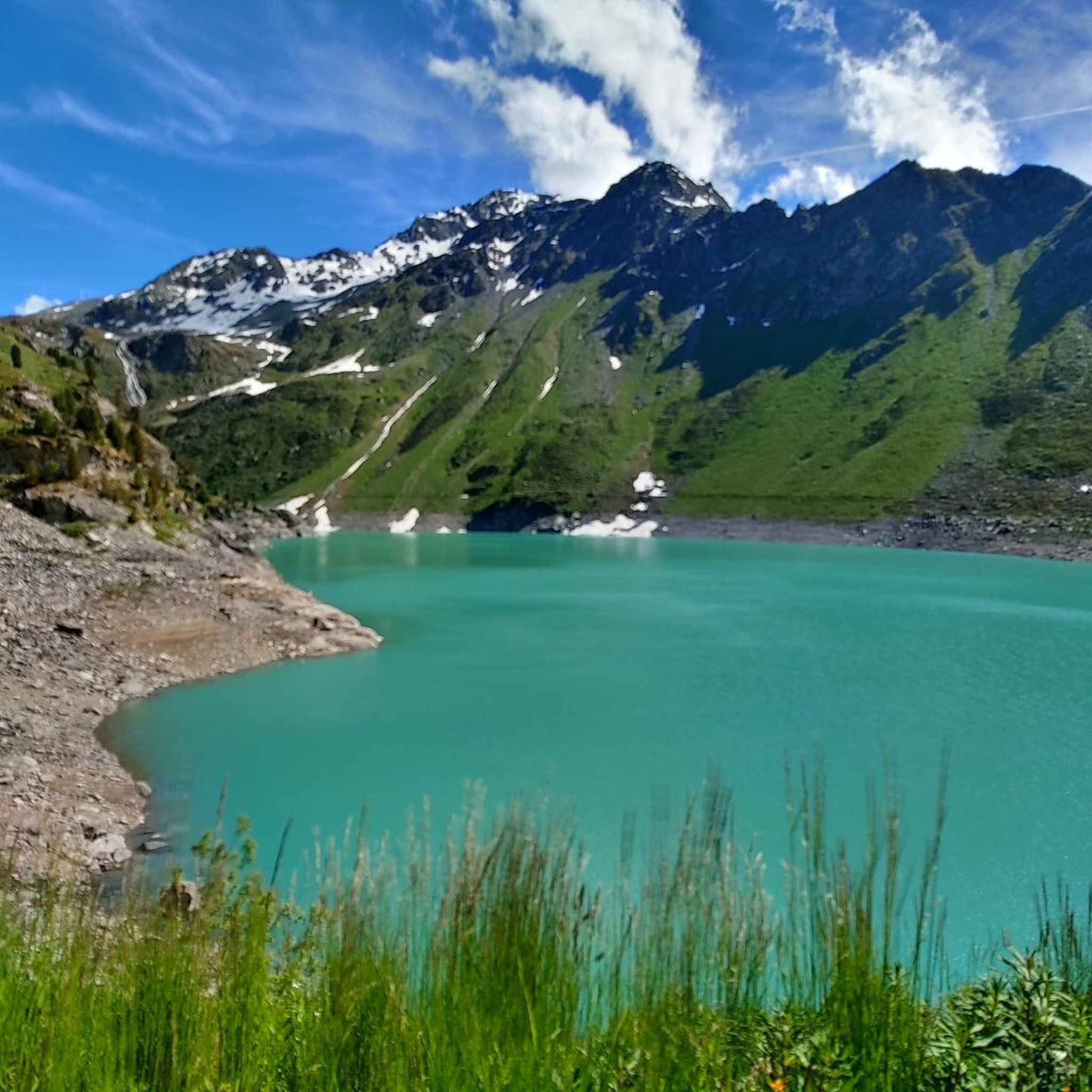
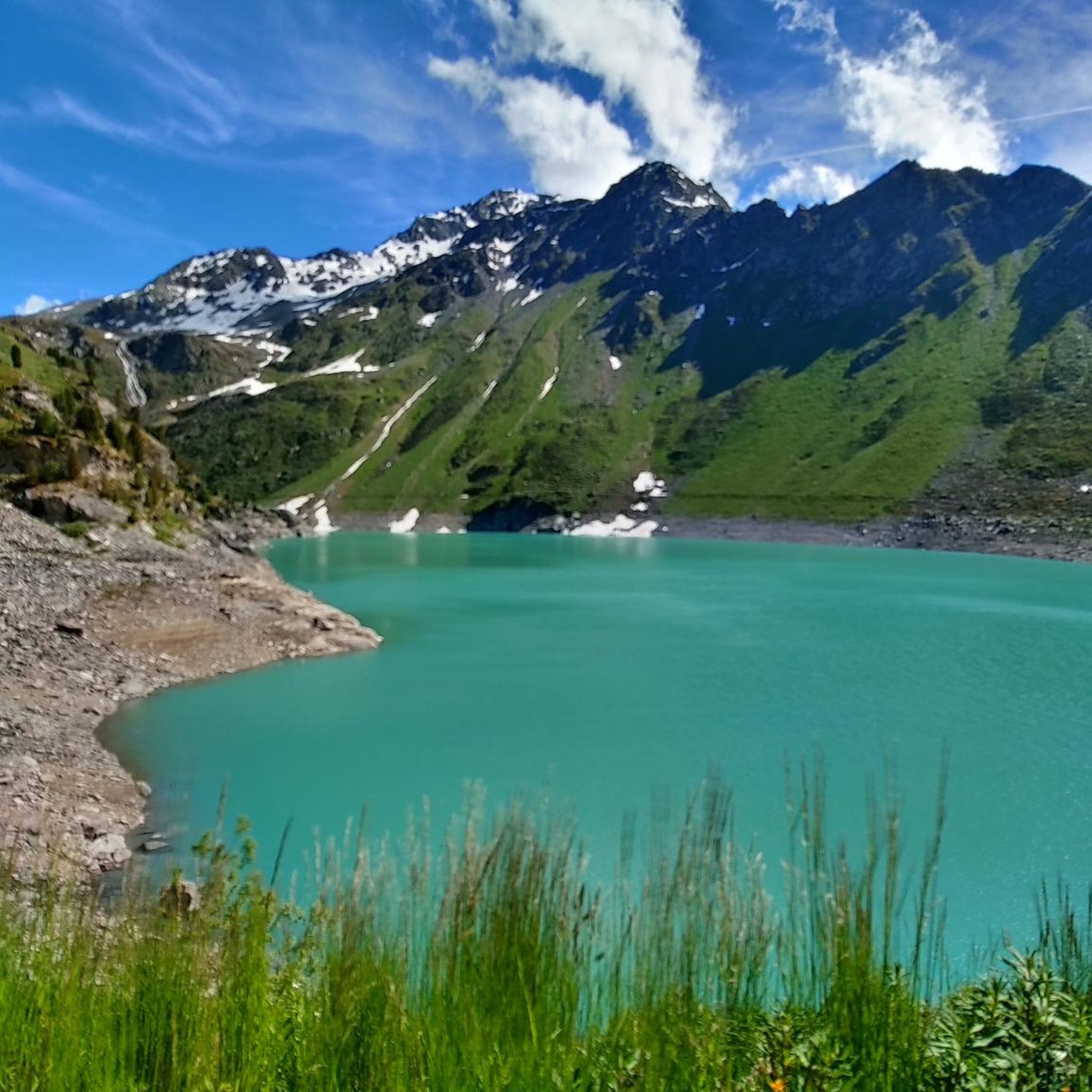
Hiking around Lac de Cleuson offers diverse trails within the Valais region of Switzerland, characterized by its striking turquoise glacial lake. The area is set against the backdrop of the Pennine Alps, featuring prominent peaks and expansive views of the Rhone Valley. Hikers encounter varied terrain, including lush alpine meadows, forests, and landscapes shaped by glacial meltwaters. The region's elevation, with the lake at approximately 2,186 meters, provides a high-alpine experience.
Best hiking trails around Lac de Cleuson
- The most popular hiking route is Loop of Lac de Cleuson and Refuge de Saint-Laurent, a 4.8 miles (7.8 km) trail that takes 2 hours 35 minutes to complete. This moderate route offers alternating views of cliffs, meadows, and the lake.
- Another top favourite among local hikers is Mont Fort from Lac de Cleuson in a loop, a difficult 14.3 miles (23.0 km) path. This challenging route ascends through alpine terrain, providing panoramic views of the surrounding peaks.
- Local hikers also love the Lac de Cleuson – Lake Cleuson loop from Barrage de Cleuson, a 4.0 miles (6.4 km) trail leading through the immediate lake surroundings, often completed in about 2 hours 7 minutes.
- Hiking around Lac de Cleuson is defined by its brilliant turquoise waters, panoramic alpine scenery, and glacial landscapes. The network offers options for different ability levels, from moderate lakeside loops to difficult high-alpine ascents.
- The routes in Lac de Cleuson are highly rated by the komoot community with an average score of 4.6 stars from more than 1700 reviews. More than 16000 hikers have used komoot to explore Lac de Cleuson's varied terrain.
Last updated: October 10, 2026
4.8
(9)
52
hikers
7.76km
02:36
310m
300m
Moderate hike. Good fitness required. Mostly accessible paths. Sure-footedness required.
3
hikers
23.0km
09:52
1,510m
1,510m
Hard hike. Very good fitness required. Sure-footedness, sturdy shoes and alpine experience required.

4.7
(7)
84
hikers
Moderate hike. Good fitness required. Easily-accessible paths. Suitable for all skill levels.
5.0
(1)
15
hikers
6.31km
02:05
240m
240m
Moderate hike. Good fitness required. Mostly accessible paths. Sure-footedness required.
4.8
(12)
109
hikers
8.53km
02:55
410m
410m
Moderate hike. Good fitness required. Mostly accessible paths. Sure-footedness required.
Get access to more routes and recommendations from other explorers.
Already have an account?
Our route recommendations are based on thousands of hikes, rides, and runs completed by other people on komoot.
Start today with a free account
Your next adventure awaits.
Tips from the Community


The cowbell game (Carillon de cloches) is one of the most popular interactive stations on the Eringer adventure trail on Alp Tortin above Siviez. It playfully conveys the deep-rooted tradition of the Valais alpine economy. What awaits you at the carillon Bell chords: At the station, a series of real Swiss cowbells of different sizes are hung side by side. Each bell produces its own unique, unmistakable tone due to its individual size and forging shape. Make music yourself: Children and adults can get active with the help of mallets and strike up their own melodies on the bells. It works like a wooden carillon (xylophone) in XXL format, right in the middle of nature. The learning effect: The post clearly explains that the powerful bells are far more than just tradition for the Eringer cows. They serve as an "acoustic GPS" for the alpine farmers in the mountains to quickly find lost animals in fog or difficult terrain.
0
0

Very friendly staff. Good food. Very clean. But this comes at a price.
1
0

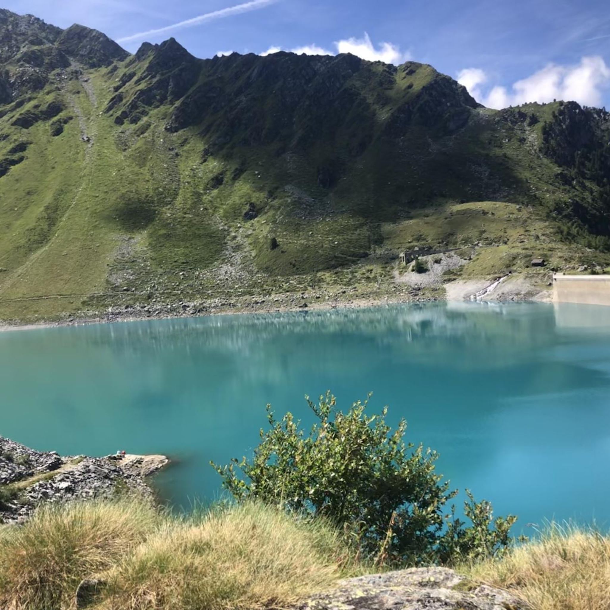
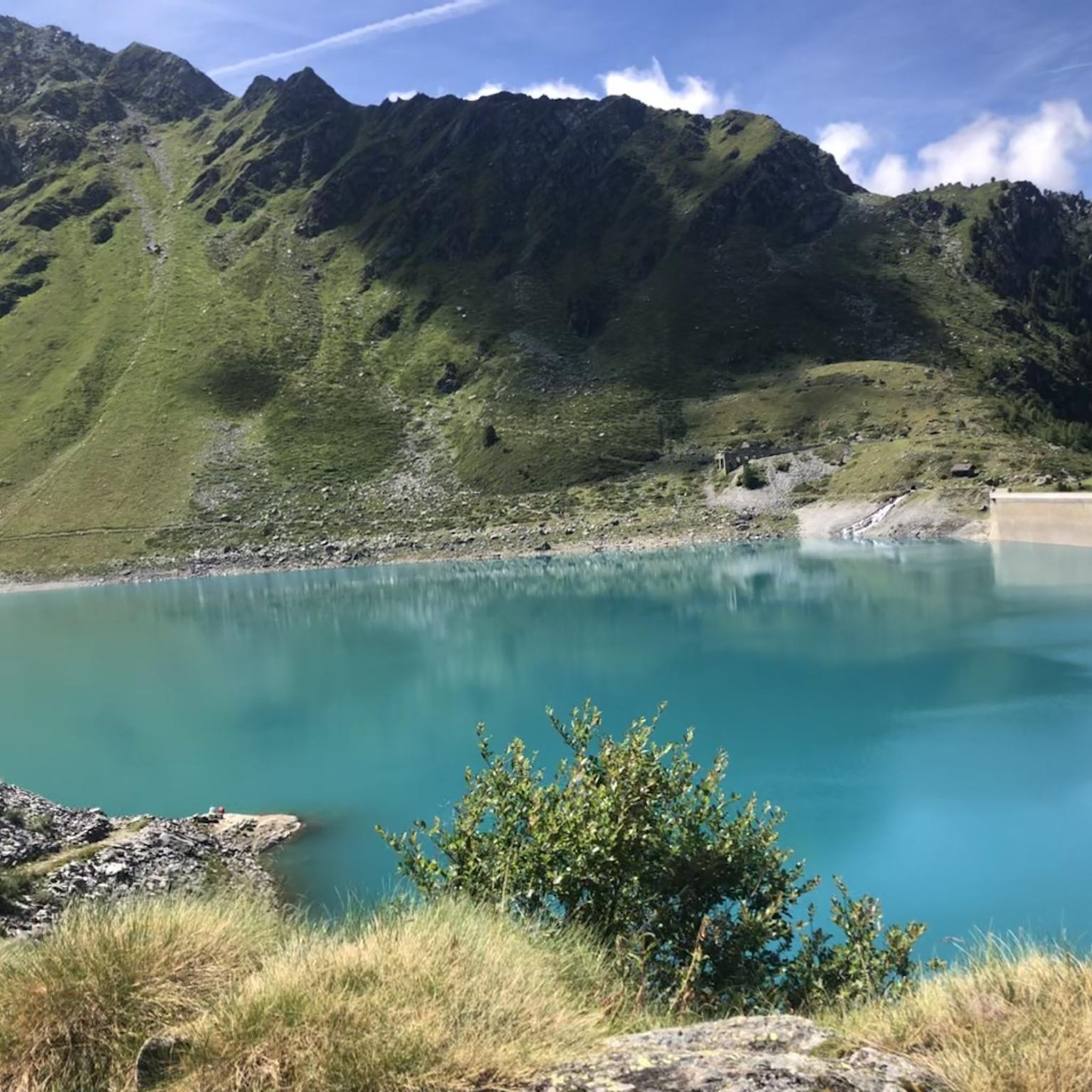
The Cleuson Dam rises with its pronounced curves, creating a stunning backdrop to the Alpine landscape. As you reach the top, take the time to admire the turquoise waters held back by the imposing dam structure, which contrasts beautifully with the rugged mountainous surroundings. The view over the Val de Nendaz is simply spectacular and the effort of the climb is well worth it.
0
0

shaped by nature itself, the water meanders in small streams of translucent water with silver sand at the bottom
0
0


A wild and isolated mountain lake, hidden in the shadow of Mont Fort. The lake is filled with deep, turquoise waters, filled with meltwater from the surrounding rocky peaks - it's going to be cold, so I don't recommend diving there!
0
1
The Saint-Laurent Mountain Cabin is located near Lake Cleuson, at an altitude of 2,500 meters. The refuge offers local cuisine and drinks prepared on site, to satisfy the appetites of hungry hikers and climbers, while providing accommodation for adventurers undertaking longer journeys. As is the case with most cabins in the Alps, reservations are recommended, especially during peak periods, so be sure to contact them in advance. For more details, go to their website at https://www.nendaz.ch/fr/P75758/cabane-de-montagne-saint-laurent.
2
0
Frequently Asked Questions
What kind of hiking trails can I expect around Lac de Cleuson?
The Lac de Cleuson area offers a wide variety of hiking trails, from easy, family-friendly strolls through forests and meadows to challenging high-alpine routes. You'll find paths that hug the turquoise lake, ascend to panoramic viewpoints of the Pennine Alps, and explore glacial landscapes. There are over 340 routes available, with 60 easy, 194 moderate, and 86 difficult options.
Are there any family-friendly hiking options near Lac de Cleuson?
Yes, the region is well-suited for families. A popular and gentle path is the ascent from Siviez to Lac de Cleuson, which winds through forests and across small streams, typically taking about two hours. These trails are generally less strenuous and allow for enjoyment of the natural surroundings at a relaxed pace.
What are the most scenic natural features to look out for while hiking?
The most striking feature is the brilliant turquoise water of Lac de Cleuson itself, which provides a stunning contrast against the alpine backdrop. Hikers are also treated to panoramic views of the surrounding Pennine Alps, including prominent peaks like Mont Fort and Bec des Étagnes, and expansive vistas of the Rhone Valley. The area also boasts lush meadows with vibrant wildflowers in summer and landscapes shaped by glacial meltwaters.
What interesting landmarks or attractions can I visit along the trails?
You can explore the impressive Cleuson Dam (Barrage de Cleuson), an 87-meter high structure built between 1946 and 1951. Near the dam, the charming Chapel St. Barthélémy offers a serene spot. Another unique experience is hiking along the historic Bisse du Chervé, an ancient irrigation channel featuring suspended wooden walkways and constant views of the lake below.
Are there any circular hiking routes around Lac de Cleuson?
Yes, there are several excellent circular routes. A popular moderate option is the Loop of Lac de Cleuson and Refuge de Saint-Laurent, which offers alternating views of cliffs, meadows, and the lake. Another well-liked loop is the Lac de Cleuson – Lake Cleuson loop from Barrage de Cleuson, which takes you through the immediate lake surroundings.
What is the best time of year to go hiking in the Lac de Cleuson region?
The best time for outdoor activities, including hiking, is generally during the summer months when temperatures are pleasant and wildflowers are abundant. Autumn also offers beautiful foliage and typically fewer crowds, making it another excellent season to visit.
What do other hikers enjoy most about the trails around Lac de Cleuson?
The area is highly rated by the komoot community, with an average score of 4.6 stars from over 1700 reviews. Hikers frequently praise the brilliant turquoise waters of the lake, the panoramic views of the Pennine Alps, and the diverse terrain that caters to various skill levels. Many also appreciate the well-maintained paths and the overall high-alpine experience.
Are there any challenging high-alpine routes for experienced hikers?
Absolutely. For experienced hikers, the region offers challenging high-alpine routes. One such option is the Lac de Cleuson to Grand Désert Loop, a demanding 10-kilometer trail that ascends to the glacial lake of Grand Désert at over 2,600 meters, featuring very rocky terrain. Another difficult route is Mont Fort from Lac de Cleuson in a loop, which provides extensive panoramic views.
Can I reach the hiking trails around Lac de Cleuson by public transport?
While specific public transport details for direct access to all trailheads are not provided, the region is situated above the mountain village of Siviez near Nendaz, which often serves as a starting point for many routes. It's advisable to check local bus schedules or cable car services from Nendaz or other nearby towns to Siviez for the most convenient access.
Is there parking available near the hiking trailheads?
Yes, parking is generally available at key access points for the hiking trails, such as near the Cleuson Dam (Barrage de Cleuson) or in the village of Siviez. These locations serve as common starting points for many routes around the lake.
Are there any trails that offer views of other lakes besides Lac de Cleuson?
Yes, some routes extend beyond the immediate vicinity of Lac de Cleuson to offer views of other bodies of water. For instance, the challenging Lac de Cleuson to Grand Désert Loop leads to the glacial lake of Grand Désert at higher elevations. Additionally, some routes in the broader area, like the La Gouille – View of Lac de Tseuzier loop from Les Puisses, provide vistas of Lac de Tseuzier.
What is the elevation of Lac de Cleuson and how does it affect hiking?
Lac de Cleuson is situated at approximately 2,186 meters (7,172 feet) above sea level. This elevated location means hikers experience a high-alpine environment, characterized by stunning panoramic views, cooler temperatures, and potentially more exposed terrain. Trails often involve significant ascents and descents, contributing to the challenging nature of some routes.
Most popular routes around Lac de Cleuson

Get inspired with the komoot mobile app


