The best cycling routes around Aghnamoira
4.6
(39)
968
riders
82
rides
Touring cycling around Aghnamoira offers diverse landscapes, from the volcanic terrain of Slieve Gullion to the scenic shores of Carlingford Lough. The region features prominent natural landmarks such as the Mourne Mountains and Slieve Foye, providing varied elevations and picturesque backdrops. Areas like Kilbroney Park offer dedicated trails through forests with views over the lough.
Best touring cycling routes around Aghnamoira
- The most popular touring cycling route is Route 7 - The Rostrevor Route, a 17.4 miles (28.1 km)…
Last updated: June 27, 2026
5.0
(1)
6
riders
28.1km
01:52
460m
460m
Embark on Route 7 - The Rostrevor Route for a challenging touring cycling experience through the scenic Mourne AONB. This difficult route spans 17.4 miles (28.1 km) and demands a…
1
riders
70.2km
04:50
1,080m
1,080m
Hard bike ride. Very good fitness required. Mostly paved surfaces. Suitable for all skill levels.

Sign up for free
2
riders
52.6km
03:06
350m
350m
Cycle the moderate 32.7-mile Newry Canal Way Loop, enjoying canal views, rolling hills, and charming villages like Scarva.
1
riders
42.6km
02:45
470m
480m
Cycle the difficult 26.5-mile Kilbroney Park loop from Warrenpoint, gaining 1556 feet with panoramic views of Carlingford Lough.
19.6km
01:15
210m
210m
Moderate bike ride. Good fitness required. Mostly paved surfaces. Suitable for all skill levels.
Get access to more routes and recommendations from other explorers.
Sign up for free
Already have an account?
Our route recommendations are based on thousands of hikes, rides, and runs completed by other people on komoot.
Start today with a free account
Your next adventure awaits.
Login or Signup

Tips from the Community

Between the rustling trees along the Newry Canal Towpath, you'll encounter the tranquil ruin of a lock keeper's cottage. Once, this was the proud and bustling heart of the waterway, where the lock keeper stood ready day and night to operate the heavy wooden canal gates for passing barges. Today, only the robust stone walls remain, slowly being reclaimed by nature.
6
0
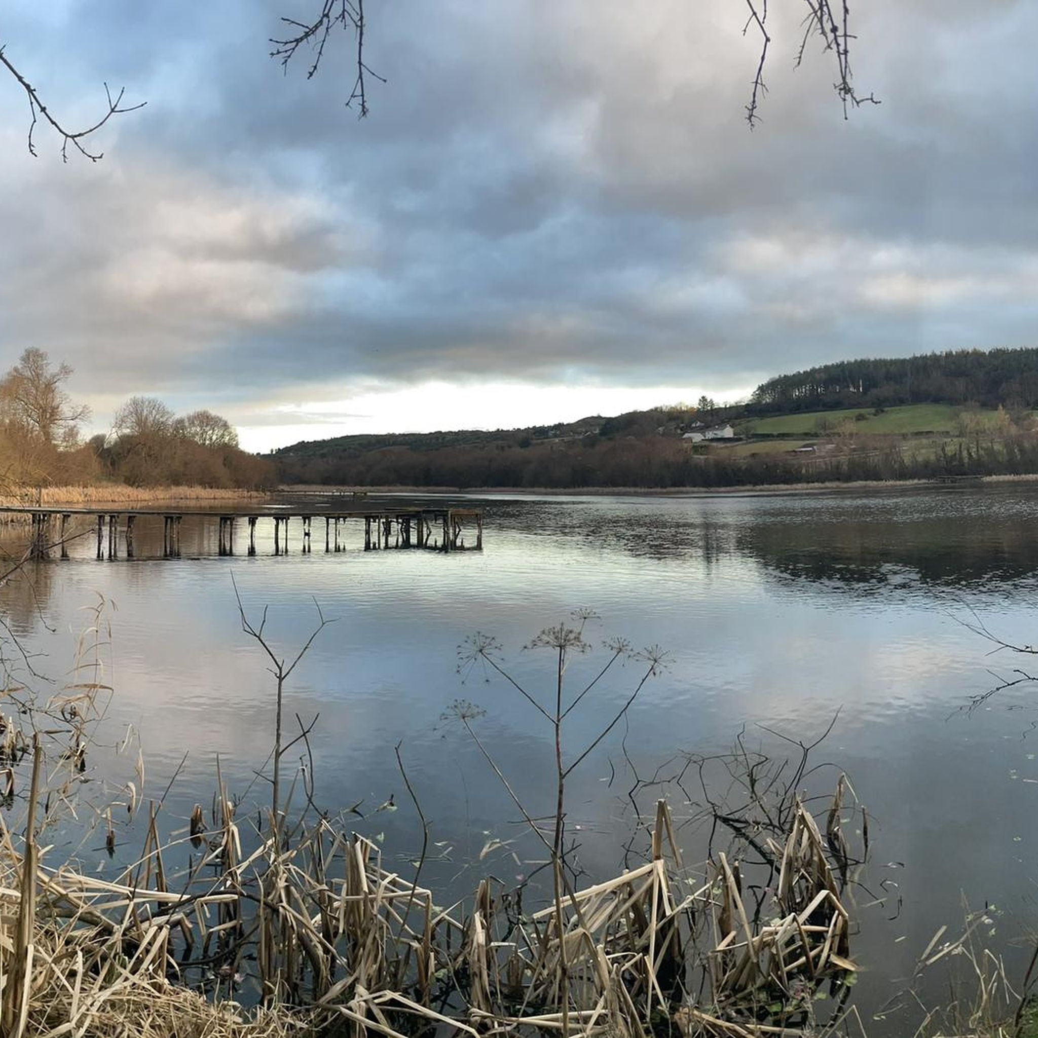
Quiet canal section south of Poyntzpass, where the towpath runs tightly along the narrow water. The bank is lightly overgrown with low trees and hedges, giving the stretch an intimate, green impression. The water is mostly still, forming a straight line through the open agricultural landscape. An even, traffic-free segment ideal for quiet miles on the towpath.
5
0
The Newry Canal Towpath is a 32-kilometer-long, almost entirely traffic-free green corridor connecting the towns of Portadown and Newry. It follows the towpath of the oldest canal in the British Isles, opened in 1742 to transport coal from County Tyrone to the sea. The Newry Canal Towpath offers an unparalleled cycling experience through the tranquil heart of County Armagh and County Down. This historic route, part of the National Cycle Network Route 9, takes you along a flat and largely asphalted path past fourteen monumental locks and characteristic lock-keeper's cottages. As you follow the waterway, you'll traverse a varied landscape of dense forests and open meadows, passing through welcoming villages like Scarva and Poyntzpass along the way. The path is a haven for wildlife; keep an eye out for kingfishers, swans, and otters that inhabit the reed beds. Whether you cycle the full 32 kilometers or explore just a section, the combination of industrial history and natural beauty makes this one of the absolute gems of Irish cycling routes.
5
0

Added to the collection: komoot.com/de-de/collection/3600632/-naturdenkmaeler-besondere-baeume-und-weitere-schaetze-der-natur
0
0

Hollie Berrie is a good place for refreshments on the route at Scarva
0
1

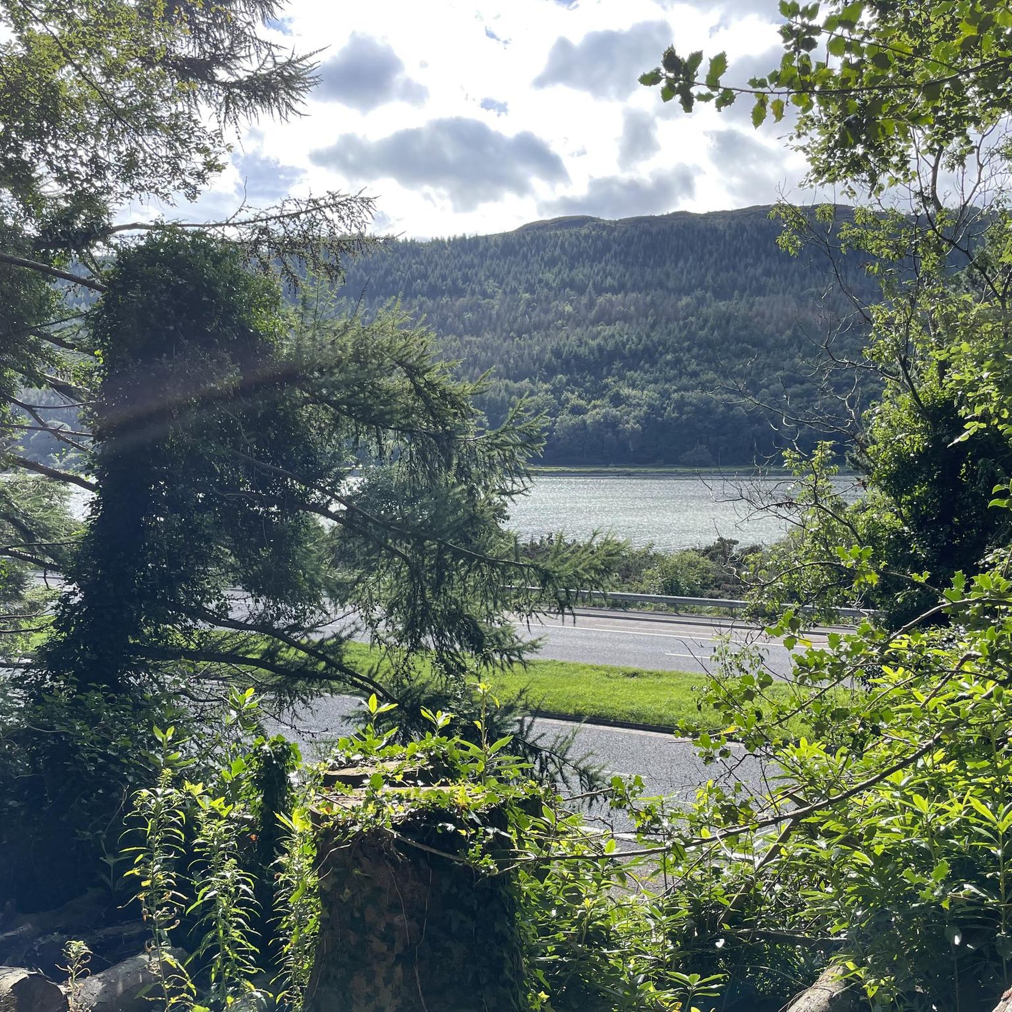
The route winds gently uphill, offering small clearings through which you can catch a glimpse of the valley and the sparkling water in the distance. The air here is wonderfully fresh and filled with the surrounding forests. During the climb you can feel the peace of the forest, accompanied only by the hum of the tires on the asphalt and the chirping of the birds. Once you reach the top, you are rewarded with a magnificent panorama.
0
0
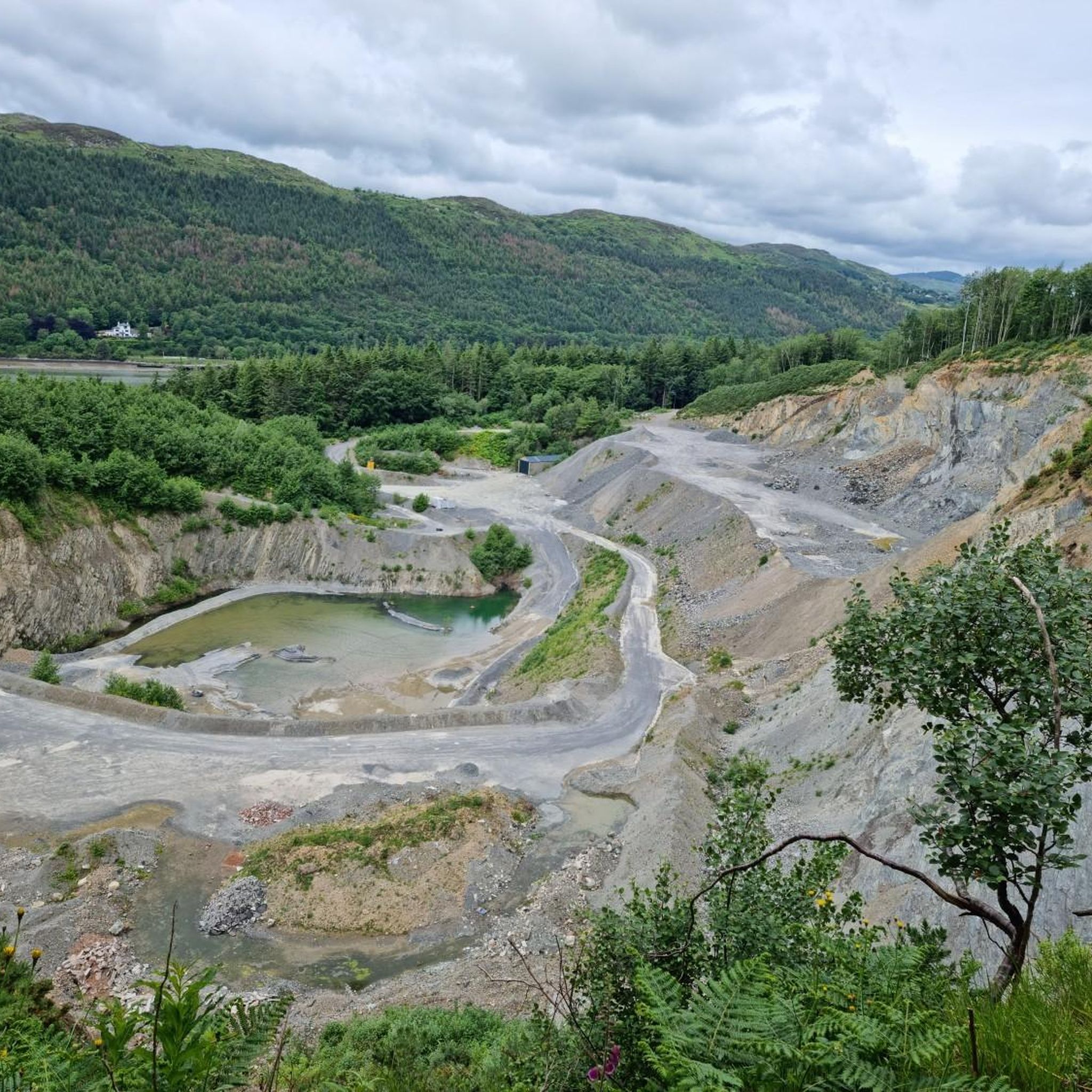
This impressive tree, which has stood here for centuries, is a testament to the region's rich natural history. The paths leading there lead through dense forest and offer a pleasant ride away from traffic. However, some sections are slippery in wet weather, so care should be taken. A particular highlight is the proximity to the Cloughmore Stone, a huge boulder that was transported here during the last Ice Age.
1
0
The well-signposted mountain bike trails take you through dense forests and offer breathtaking views of Carlingford Lough and the Mourne Mountains. The descent from the Cloughmore Stone, a huge boulder that was transported here during the last ice age, is a particular highlight. However, some sections are technical and require a certain level of riding technique. The trails can become slippery in wet weather, so caution is advised. Another plus point is the proximity to the charming village of Rostrevor, where you can relax in one of the cafes after the tour.
3
0
Frequently Asked Questions
How many touring cycling routes are available in Aghnamoira?
Aghnamoira offers a wide selection of touring cycling routes, with over 80 options to explore. These range from easy paths to more challenging rides, catering to various skill levels.
What makes touring cycling in Aghnamoira unique?
Touring cycling in Aghnamoira is unique due to its dramatic volcanic landscapes, ancient historical sites, and well-maintained parks. Riders can experience everything from the challenging ascents of Slieve Gullion to scenic routes offering breathtaking views of Carlingford Lough and the Mourne Mountains.
What do other touring cyclists say about the routes in Aghnamoira?
The touring cycling routes in Aghnamoira are highly rated by the komoot community, with an average score of 4.5 stars from over 30 reviews. Cyclists often praise the diverse terrain, stunning lough views, and the variety of trails available for different abilities.
Are there routes suitable for beginners or families in Aghnamoira?
Yes, Aghnamoira offers several routes suitable for beginners and families. While many routes feature significant elevation, there are 6 easy and 35 moderate routes available. For a relatively flat experience, consider sections of the Newry Canal, such as the Newry to Jerrettspass loop on the Newry Canal Path, which is a moderate 19.6 km ride.
What are some challenging touring cycling routes in Aghnamoira?
For experienced touring cyclists seeking a challenge, Aghnamoira has 47 difficult routes. Notable options include Ring of Gullion loop from Newry, a demanding 70.2 km path exploring the volcanic terrain with over 1000 meters of elevation gain, and Route 7 - The Rostrevor Route, a 28.1 km route with significant climbs and panoramic views.
Are there any circular touring cycling routes in Aghnamoira?
Many of the touring cycling routes in Aghnamoira are designed as loops, allowing you to start and finish at the same point. Examples include the Newry Canal Way Loop, a 52.6 km moderate ride, and the more challenging Kilbroney Park loop from Warrenpoint, which covers 42.6 km.
What natural landmarks can I see while touring cycling in Aghnamoira?
Aghnamoira is rich in natural landmarks. You can cycle past the impressive Cloughmore Stone, a massive erratic boulder in Kilbroney Park, or enjoy views of Slieve Gullion Summit, an extinct volcano. The region also offers stunning vistas of Carlingford Lough and the Mourne Mountains.
Are there any historical sites to explore along the routes?
Yes, Aghnamoira boasts significant historical sites. The summit of Slieve Gullion hosts the highest Passage Tomb in the British Isles. Additionally, you can find Bronze Age stone boxes at the North Cairn of Slieve Gullion, near Calliagh Beara's Lough.
Is Kilbroney Park suitable for touring cyclists?
Kilbroney Park is a popular hub for outdoor activities. While it's known for its mountain bike trails, touring cyclists can enjoy the scenic roads and paths within and around the park, offering spectacular views of Carlingford Lough and the Mourne Mountains. Some sections, particularly descents from areas like the Cloughmore Stone, can be technical and require caution, especially in wet conditions.
Are there cafes or places to stop for refreshments along the routes?
Yes, several routes pass through or near charming villages and towns where you can find cafes and pubs. Rostrevor, for instance, is close to Kilbroney Park and offers relaxing breaks at local cafes after a ride. Newry, a starting point for several routes, also provides ample amenities.
What are the parking options for touring cyclists in Aghnamoira?
Parking is generally available at key starting points for routes, such as Kilbroney Park and in towns like Newry and Warrenpoint. Specific parking information for individual routes can often be found on their respective komoot tour pages.
What should I consider regarding weather conditions when planning a touring cycling trip?
Aghnamoira's weather can be variable. It's advisable to check the forecast before heading out, as conditions can change rapidly, especially in mountainous areas like Slieve Gullion. Some trails, particularly in Kilbroney Park, can become slippery when wet. Layered clothing and waterproof gear are recommended.
Most popular attractions around Aghnamoira

Get inspired with the komoot mobile app


Explore more
Browse the best Cycling routes in other regions.
