The best road cycling routes around Glebe
3.5
(2)
202
riders
14
rides
Road cycling around Glebe, specifically within the Ring of Gullion, offers routes through an Area of Outstanding Natural Beauty. The terrain is characterized by rolling hills, dense forests, and tranquil waterways, set within an ancient ring dyke formed by volcanic activity. Cyclists can experience varied landscapes, from peaceful lakeside roads around Camlough Lake to routes with expansive views.
Best road cycling routes around Glebe
- The most popular road cycling route is View of Dundalk Bay – Basecamp Coffee loop from…
Last updated: September 3, 2026
3.5
(2)
36
riders
28.2km
01:11
160m
160m
Easy road ride. Great for any fitness level. Mostly well-paved surfaces and easy to ride.
26
riders
54.7km
02:28
590m
590m
Moderate road ride. Good fitness required. Mostly well-paved surfaces and easy to ride.

Sign up for free
20
riders
81.8km
03:25
380m
380m
Moderate road ride. Good fitness required. Some segments of this route may be unpaved and difficult to ride.
16
riders
47.3km
02:02
370m
370m
Moderate road ride. Good fitness required. Mostly well-paved surfaces and easy to ride.
11
riders
55.4km
02:31
560m
570m
Moderate road ride. Good fitness required. Mostly well-paved surfaces and easy to ride.
Get access to more routes and recommendations from other explorers.
Sign up for free
Already have an account?
Our route recommendations are based on thousands of hikes, rides, and runs completed by other people on komoot.
Start today with a free account
Your next adventure awaits.
Login or Signup
Popular around Glebe

Tips from the Community

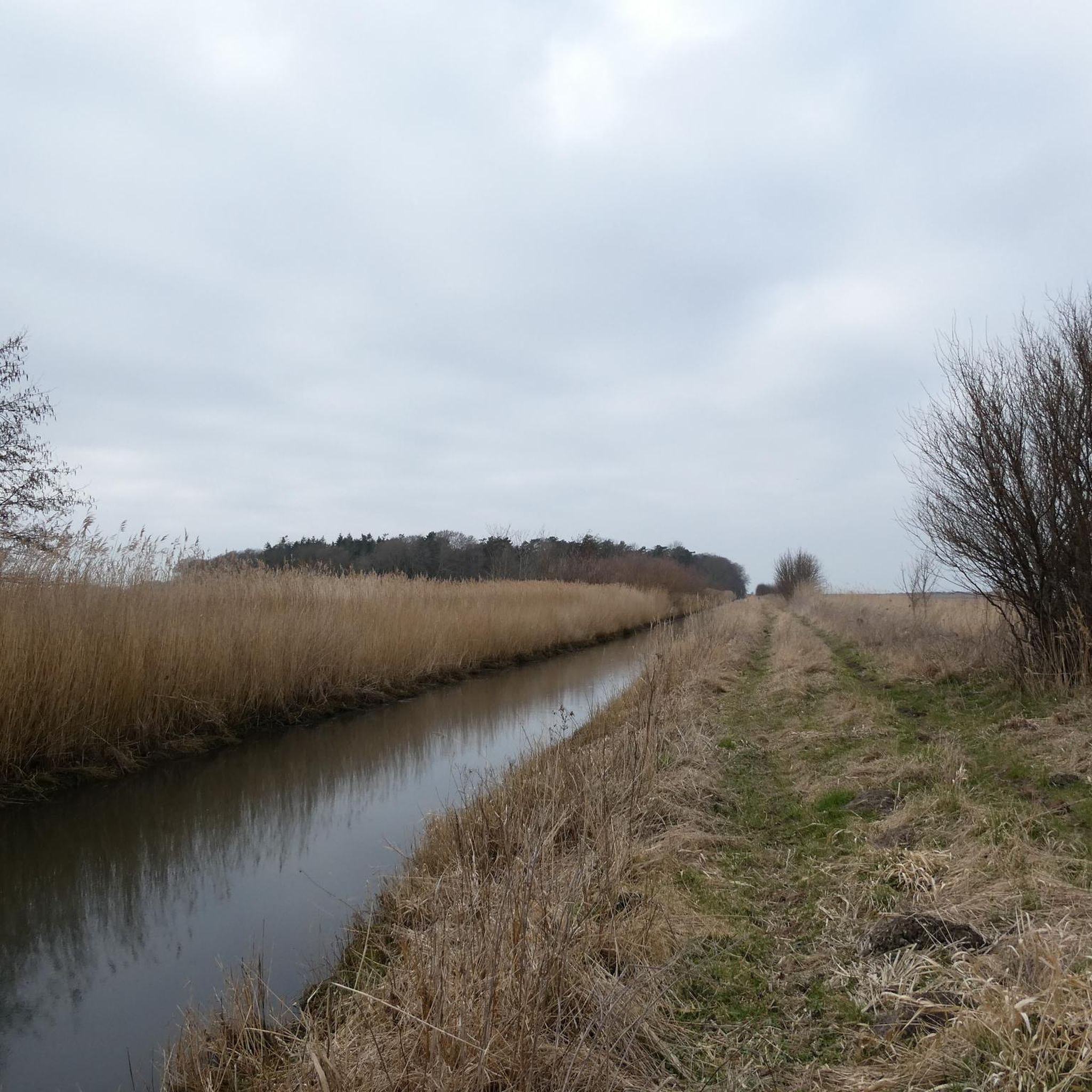
Cashel Crossroads is a rural junction located in the townland of Cashel (An Caiseal) within the Ring of Gullion hills in South Armagh, roughly 2.5 km west-south-west of Mullaghbawn and 2.5 km north-north-west of Silverbridge. The intersection connects Cashel Road with Lough Road and Planting Road, and it is known locally for traditional outdoor céilí and crossroads dance events
0
0


chance to see statue of Newry born , first manager of Celtic F.C.
0
0

Upon entering the village of Castlebellingham, you are welcomed by the impressive gatehouse of Bellingham Castle. This robust, castle-like structure with its battlements and characteristic arched gateway forms the historic entrance to the extensive Bellingham family estate. The castle itself, dating back to the 17th century, breathes the atmosphere of the Irish nobility.
7
1

The highest bar in County Louth along the Táin Way. A traditional Irish pub that offers a cozy interior with a warming fire and excellent food. A favourite amongst locals and hikers!
0
0

The Táin Way is a 40 kilometre (25 mi) circular hiking trail that starts and ends in Carlingford. Named after the ancient Irish epic "Táin Bó Cúailnge", the route winds through the Cooley Peninsula, offering a mix of coastal views, forest paths, and mountain tracks. Typically completed over two days, the trail includes a total ascent of about 1,025 meters and is marked with yellow arrows on a black background. Along the way, hikers encounter historical sites like Bronze Age cairns and enjoy panoramic vistas of Carlingford Lough and the Mourne Mountains. Alternative trailheads are available at Omeath and Ravensdale, providing flexibility for different starting points. Please note that dogs are not permitted on farmland sections of the trail.
1
0

gravel paths and a tarmac road up the middle, also has public toilets
0
0

The setting is done with great attention to detail, and it almost feels like a quick picnic in the mountains when you sit down at the rustic tables and look into the distance. The patterned cups and saucers give the place a cozy touch and make the whole thing that little bit more special. The view of the surrounding hills and the relaxed atmosphere invite you to take a short break - perfect for resting your legs and just taking a breather. The coffee house is not only friendly to cyclists, but even offers bike rental for the Ring of Gullion. Handy if you need an extra boost for the next stage! The surroundings are green and spacious, a nice mix of Irish idyll and relaxed hospitality. The owners seem to take the attention to detail seriously, which is reflected in the little things like the decorative elements and the cozy atmosphere.
1
0
Frequently Asked Questions
What kind of terrain can I expect on road cycling routes around Glebe?
Road cycling routes around Glebe, situated within the Ring of Gullion, feature a diverse landscape. You'll encounter rolling hills, dense forests, and tranquil waterways. The region is characterized by an ancient ring dyke, offering varied elevations and scenic views, from peaceful lakeside roads to expansive vistas across the countryside.
Are there road cycling routes suitable for beginners in Glebe?
Yes, Glebe offers routes suitable for various skill levels. For beginners, there are easy routes available. An excellent option is the View of Dundalk Bay – Basecamp Coffee loop from Jonesborough, which is 27.9 km long and offers beautiful views without significant elevation challenges.
What are some notable natural features or landmarks to see while cycling in Glebe?
The Ring of Gullion is rich in natural beauty and historical sites. Cyclists can enjoy views of Camlough Lake, which is often part of scenic routes. Other significant natural features include the Slieve Gullion Summit and the North Cairn of Slieve Gullion and Calliagh Beara's Lough. Historical sites like the Killevy Churches Ruins are also accessible, for example, on the Killevy Churches Ruins loop from Camlough Lake.
How long are the road cycling routes in Glebe?
The road cycling routes in Glebe vary in length. You can find shorter routes like the View of Dundalk Bay – Basecamp Coffee loop from Jonesborough at 27.9 km, or longer, more challenging rides such as the Strandfield Coffee Shop – Roodstown Castle loop from Saint Brigid Shrine, which extends to 83.5 km.
Are there any circular road cycling routes in the Glebe area?
Yes, many of the road cycling routes around Glebe are designed as loops, allowing you to start and finish in the same location. Examples include the Ring of Gullion Cycle Tours – Newry Ship Canal Fountain loop from Silverbridge and the Killeavy Wood Road – Killevy Churches Ruins loop from Jonesborough.
What do other cyclists say about road cycling in Glebe?
The road cycling routes in Glebe are highly rated by the komoot community, with an average score of 3.5 stars from 2 reviews. Cyclists appreciate the varied terrain, from rolling hills to tranquil waterways, and the opportunity to explore an Area of Outstanding Natural Beauty.
What is the best time of year to go road cycling in Glebe?
The Ring of Gullion, where Glebe is located, offers beautiful scenery year-round. However, for optimal road cycling conditions, late spring to early autumn (May to September) generally provides milder weather and longer daylight hours, making for a more comfortable and enjoyable experience.
Are there any historical sites along the road cycling routes in Glebe?
Yes, the region is rich in history. You can cycle past ancient sites like the Killevy Churches, which date back to the 6th century. The Killevy Churches Ruins loop from Camlough Lake is one route that incorporates these historical landmarks.
Can I find cafes or places to stop for refreshments along the routes?
While specific cafes directly on every route are not listed, routes like the View of Dundalk Bay – Basecamp Coffee loop from Jonesborough and the Strandfield Coffee Shop – Roodstown Castle loop from Saint Brigid Shrine are named after coffee shops, suggesting opportunities for refreshments at their start or end points, or nearby. It's advisable to check local amenities in towns along your chosen route.
What is the overall difficulty level of road cycling in Glebe?
The road cycling routes in Glebe primarily range from easy to moderate difficulty. There are 2 easy routes and 11 moderate routes, making it accessible for a wide range of cyclists. The terrain includes rolling hills, so some routes will involve climbs, but there are no routes classified as difficult.
Are there any routes that offer views of the Newry Ship Canal?
Yes, the Ring of Gullion Cycle Tours – Newry Ship Canal Fountain loop from Silverbridge is a moderate 56.4 km route that explores the Ring of Gullion area and passes by the Newry Ship Canal, offering scenic views of this historic waterway.
What kind of wildlife might I encounter while cycling in the Ring of Gullion?
The Ring of Gullion is an Area of Outstanding Natural Beauty with rich wildlife habitats, including heath, bog, and woodland. While cycling, you might spot various bird species, small mammals, and diverse plant life characteristic of Northern Ireland's rural landscapes.
Most popular routes around Glebe
Most popular attractions around Glebe

Get inspired with the komoot mobile app


Explore more
Browse the best Road cycling routes in other regions.
